
Human Geography PowerPoint PPT Presentation
1 / 12
Title: Human Geography
1
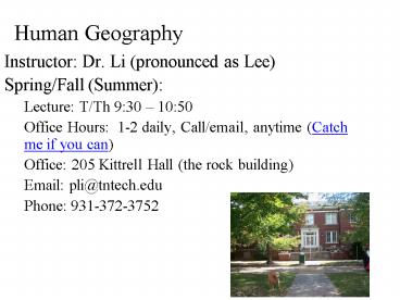
Human Geography
- Instructor Dr. Li (pronounced as Lee)
- Spring/Fall (Summer)
- Lecture T/Th 930 1050
- Office Hours 1-2 daily, Call/email, anytime
(Catch me if you can) - Office 205 Kittrell Hall (the rock building)
- Email pli_at_tntech.edu
- Phone 931-372-3752
2
Grading Scale http//iweb.tntech.edu/pli/fellmann
_fall08.html)A 85B 75C 65D
55F online Quizzes After each chapter, you have 7
days to complete your chapter quiz.And your
homework comes from Human Geography in Action
Activity..Your Textbook Find from bookstore
or .
3
(No Transcript)
4
Chapter One
- Introduction Some Background Basics
- The content of area has both physical and
cultural aspects, and geography is always
concerned with understanding both (fig 1.1)
5
Evolution of the Discipline
- Geography - Spatial Science, description of the
earth or more precisely, the study of spatial
variation, of how and why physical and cultural
items differ from place to place. (figure 1.1) - Ancient Period
- Greek scientist Eratosthenes over 2200 year ago-
geo, graphein about physical earth and
activities of people. - Strabo defined geography as describing the
several parts of the inhabited world and to write
the assessment of the countries of . - Herodotus described Persian war using cultural
traits such as people, lands, economies, and
customs. - Ptolemy - measured and devised grids (meridian
and parallel), mapped world using 360o. Errors
made Columbus think he reached Asia (figure 1.2) - Non-Western Contribution
- Chinese Map of the world, Img
- Middle Ages - Muslim geographer Idrisi, ordered
by Roger II, to collect all known geographical
info to show true world, with assistances from
many scholars. It took 15 years to finish the map
on a silver disc (80 in diameter, 300 lbs), lost
to looters in 1160, the map is survived by
Rogers Book containing a world map, 71 part
maps, and 70 sectional itinerary maps.
6
Geography and Human Geography
- Geography subfields are not divisive but are
interrelated - Focus of Geography
- Areal variation on the earths surface,
- Focus on Spatial systems
- Regional Geography, such as South Asia, or Corn
Belt - Human Geography and Physical Geography
- Subfields of Human Geography (figure 1.3)
7
What can you do as a geographer?
- Link to the Association of American Geographers.
- Aerial Photo Interpreter
- Cartographer
- Climatologist
- GIS specialist
- Environmental Manager
- CIA/FBI
- Planner...
- Average Salary from department of Earth
Sciences.(from 5/hr to million/yr)
8
Core Geographic Concepts
- Location, Direction and Distance
- Size and Scale
- Physical and Cultural Attributes
- The Changing Attributes of Place
- The Structure Content of Place
- Density
- Dispersion
- Pattern
- Place Similarity and Regions
- The Characteristics of Regions
- Types of Regions
9
Basic Geographic Concepts - 1
- Location, Direction, and Distance
- Absolute/Relative absolute location, referred as
mathematical location. relative location
expresses spatial interconnection and
interdependence. (fig 1.4, 1.5) - Direction - absolute and relative
- Distance - absolution and relative (fig 1.8)
- Site/Situation (fig 1.6 and 1.7)
- Psychological transformation
10
Basic Geographic Concepts - 2
- Size and Scale - fig 1.9
- Physical and Cultural Attributes
- climate, soil, water, terrain (Natural
landscape). help shape how people live, but human
modify env. (fig 1.10) Cultural landscape (fig
1.11) - The Changing Attributes of Place (fig 1.11 and
1.12) - Interrelations between Places, accessibility -
distance isolated places, connectivity
11
Basic Geographic Concepts (cont.)
- The Structured Content of Place
- Density, relatively
- Dispersion, clustered/agglomerated,
dispersed/scattered - Pattern (fig 1.14,1.15)
- Place Similarity and Regions
- The Characteristics of Regions-location,spatial
extent, boundaries (fig 1.16, 1.17) - Types of Regions- formal, functional and
perceptual (fig 1.18, 1.19) - Formal region uniformity in one or limited
combination of physical or cultural features.
E.g. county, state, country borders - Functional (nodal) region defined by the
interactions and connections that give it a
dynamic, organizational basis, shown in core and
peripheral relationship between center and
margins - Perceptual regions reflect feelings and images,
such as vernacular region shows the way people
view space, assign their loyalties and interpret
their world. Little Italy, Chinatown..
12
Maps
- Map Scale Projection (Fig 1.20 and Appendix A)
- The Globe Grid
- How Maps Show Data, general maps/thematic maps
(fig 1.22, 1.23)/Cartogram (1.24), intent in map
message and biases of its author, intentionally
false information (fig 1.25) - Geographic Information Systems (GIS)
- Mental Maps (1.27 and 1.28)
Systems, Maps, and Model Model a simplified
abstraction of reality, structured to clarify
causal relationships. Maps are a kind of
model. Model building is the technique social
(natural) scientists to simplify complex
situations, to eliminate (as does the map, or
google earth) unimportant details, and to isolate
for special study and analysis the role of one or
more interacting elements in a total system.
Recommended
