
Yield Mapping Systems PowerPoint PPT Presentation
1 / 76
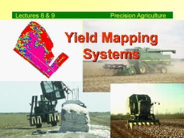
Title: Yield Mapping Systems
1
Yield Mapping Systems
2
Yield Mapping Functions
- Measure mass harvested within a known area
- Record mass and crop attributes (moisture, et
al.) by position - Record operator observations of field conditions
3
Potato Yield Variability
Courtesy Harvestmaster Inc.
4
(No Transcript)
5
Status of Yield Mapping
- Commercial
- Grain
- Potatoes
- Cotton
- Belt harvested vegetables
- Tomatoes
- Grapes
- Research Dev.
- Peanuts
- Forage
- Tree fruit
6
Yield Mapping System Components
7
Yield Mapping Components
- Positioning system
- Operator console/data logger
- Forward travel sensor
- Mass flow sensors
- Harvest indicator
8
Yield Mapping Components
- Positioning system differentially corrected GPS
receiver - The GPS receiver is the primary difference
between yield mapping and monitoring.
9
Deere Starfire GPS Receiver
10
Yield Mapping Components
- Positioning system
- Operator console/data logger
11
Ag Leader Console/Data logger
12
Yield Mapping Components
- Positioning system
- Operator console/data logger
- Forward Travel Sensor
13
Forward Travel Sensing
- Wheel rotation
- inexpensive
- high error in wet conditions
14
Forward Travel Sensing
- Wheel rotation
- Radar
- accurate under many conditions
- moderate cost
15
Forward Travel Sensing
- Wheel rotation
- Radar
- GPS indicated travel distance
- no additional cost
- inaccurate for slow moving harvesters (GPS
velocity resolution 0.05 m/s)
16
Yield Mapping Components
- Positioning system
- Operator console/data logger
- Forward Travel Sensor
- Mass Flow Sensors
- crop
- moisture
17
Mass Flow Sensor Types
- Grain
- impact, weighing, optical, radio frequency
- Cotton
- optical, weighing (research)
- Vegetables, Root crops
- weighing
18
Measures mass by motion of impact plate with
grain striking.
John Deere Grain Impact Sensor
19
Ag Leader Impact Sensor
Measures mass from strain caused by impact of
grain
20
Ag Leader Cotton Flow Sensor
21
Ag Leader Moisture Sensor
22
Harvestmaster Weighing Sensors
23
Idler Wheel Load Cells
24
Installed Idler Wheel
25
Yield Mapping Components
- Positioning system
- Operator console/data logger
- Forward Travel Sensor
- Mass Flow Sensors
- Harvesting Indicator
26
Harvesting Indicator
- Indicates when machine is actually harvesting and
not just traveling in field - Often based on position of gathering parts of
harvester - Controls recording of data
27
Header down in recording position
28
Yield Calculations
- Measure mass harvested over a period of time
- Measure the distance traveled during that same
period - Determine area from distance and effective
harvest width (set by operator - Yield mass/area
29
W
Z
D
Yield Mass / W D
W-indicated width, Z-actual harvest width
30
Harvester Dynamics
- Time between actual harvest and mass flow
measurement must be corrected for accurate maps - Delay values depend on harvester
31
Grain Flow Delay
32
Procedures for Accurate Yield Mapping
33
Yield Mapping Operations
- Enter information needed before harvest
- field names
- yield unit test weights
- varieties
- flags
34
Yield Mapping Operations
- Set up customers, field names, flags in advance
- Calibrate the system
35
Calibration Procedures
- Select appropriate harvest width
- Calibrate speed sensor (ground or radar)
- Weigh loads of at least 1500 kg.
- Case/Ag Leader Grain- multiple flows
- Deere Grain/Ag Leader Cotton - single flow rate
36
Yield Mapping Operations
- Set up customers, field names, flags in advance
- Calibrate the system
- Alternate passes of mapping and non-mapping
combines
37
(No Transcript)
38
(No Transcript)
39
Yield Mapping Operations
- Set up customers, field names, flags in advance
- Calibrate the system
- Alternate passes of mapping and non-mapping
combines - Dont record data over harvested areas
40
Yield Mapping Operations
- Avoid partial cutting width situations.
41
Differences between indicated and actual harvest
width result in erroneous yield estimates.
42
Yield Mapping Operations
- Avoid partial cutting width situations.
- Raise header to disable data recording when
traveling in field.
43
(No Transcript)
44
Yield Map Creation
45
Yield Map Creation and Use
- Data transfer
- Mapping Software
- Filtering Data
- Legend Selection
- Map Interpretation
46
Data Transfer
- PCMCIA memory cards manually carried to computer
today - Future simultaneous wire-less transmission?
47
Yield Mapping Software
- Vendor-supplied mapping software -
visualization, filtering, export, archive - GIS - import data, filtering, analysis
48
Mapping Software
- Downloads files from PC card
- Creates field summaries of area harvested and
total mass - Displays yield data as points or surface
- Filtering based on min/max limits
- Exports data in ASCII format
49
Export Formats
- Format differs for each manufacturer and crop
type - Two general forms
- basic - position, yield, flags
- advanced - all recorded information
50
Ag Leader Grain Basic Format
Latitude -97.1464 Longitude
31.03174 Yield (bu/ac) 123.4 Moisture 13.6 Ser
ial No. 971125 Field Id F123A Load
Id L12 Grain Corn
51
JDmap Grain Export Format
Longitude Latitude Flow (lbs/sec) Time (GPS
sec) Cycles Distance (in) Swath (in) Moisture
() Status Pass
Serial No. Field Id Load Id Grain
52
JDmap Export File Example
-96.197128,29.593638,1.90,25968064,
1,57,288,0.00,1,1,4596, "F1 Buckmaster A","L1
", "Rice (Long)","Jefferson"
53
GIS Software
- Provides visualization capability like the
manufacturers software - Provides additional filtering and analysis
capability
54
Filtering to Remove Inaccurate Yield Data
55
Data filtering and correction
- Reject values beyond upper and lower threshold
limits - Realignment of non-parallel GPS values
- Shift in time to correct lag
- Delete overlaps and partial width data
56
Operator error
GPS error
57
(No Transcript)
58
Map with bad data due to operator errors
59
After filtering
Before filtering
60
Yield layer creation
- Automatic creation in manufacturers software
- Manual entry of exported yield files in GIS
packages - Automated entry of exported yield files in some
GIS programs
61
Legend Selection
- Number of classes
- Selection of class limits
- Colors
62
Legend Selection
- Number of classes
- Visual filtering process to reduce the amount of
information - Humans have difficulty recognizing more than 10
different classes - 4-6 is optimum
63
Legend Selection
- Selection of class limits
- Software has default methods, but these are
generally not optimum - Select limits that have meaning for management
64
Legend Selection
- Colors
- Rainbow selection best for viewing differences
- Two color shading shows transitions
65
Point vs. Contour
- Point maps show details and allow for human
interpretation - Contour maps show primary trends
66
Point Map
67
Grid map with yields averaged in each cell
68
Yield Map Interpretation
69
Yield maps are ...
intensive field description
70
Exported yield files is 11 Mbytes.
71
Yield maps are ...
- intensive field description
- information rich but difficult to interpret
- useless without supporting knowledge of the field
72
(No Transcript)
73
Yield maps are ...
- generating many questions
- confounded with actual yield variability and both
system and operator errors
74
Yield map interpretation
- Must start at the beginning of the growing season
- tillage
- seedling emergence
- weed problems
- insect problems
75
Yield map interpretation
- Must start at the beginning of the growing season
- Incorporate available information
- soil survey
- aerial photos
- past management
76
Yield map interpretation
- Must start at the beginning of the growing season
- Incorporate available information
- Conduct diagnostic surveys
- soil sampling
Recommended
