
Public Presentation PowerPoint PPT Presentation
1 / 59
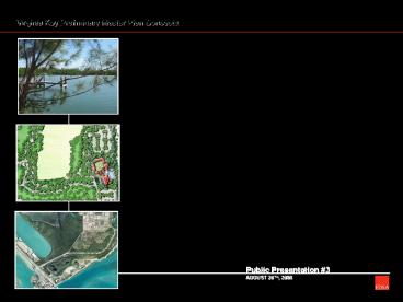
Title: Public Presentation
1
Public Presentation 3 AUGUST 26TH, 2008
Virginia Key Preliminary Master Plan Concepts
2
Presentation Outline
3
Goals and Objectives
4
The Process
- PROJECT SCOPING
- DATA COLLECTION AND REVIEW
- SITE INVENTORY AND ANALYSIS
- STAKEHOLDER INTERVIEW PROCESS
- PUBLIC MEETING 1 SITE INVENTORY AND ANALYSIS
- PUBLIC MEETING 2 COMMUNITY WORKSHOP
- PRELIMINARY CONCEPTUAL LAND USE PLANNING AND
DESIGN - PUBLIC MEETING 3 PRELIMINARY MASTER PLANNING
- FINAL MASTER PLANNING
- COMMISSION AND ADVISORY BOARD PRESENTATION/MEETING
- FINAL DOCUMENTATION
5
Site Inventory and Analysis Public Meeting 1
6
Site Inventory and Analysis Public Meeting 1
FEEDBACK RECEIVED ON WEBSITE
7
Improvement vs. No Improvement Areas
8
Community Workshop Public Meeting 2
9
Community Workshop Public Meeting 2
THE DOTS EXERCISE
10
Community Workshop Public Meeting 2
11
Community Workshop Public Meeting 2
SUMMARY OF COMMENTS 1. Preserve and enhance
natural environment 2. Low-impact mixed
use 3. Multi-use and multi-purpose recreation
trails through out island 4. Ensure safety
(concern about wake in lagoon) 5. Sustainable
and environmentally friendly practices
12
Marina and Market Study Recap
- Options
- Program/planning focus on outdoor recreation
waterfront access (beaches, windsurfing, boating,
etc.) - Activating uses include Virginia Key Beach
amenities, outdoor recreation facilities (could
include soccer, baseball, swimming/driving, crew,
environmental trails, etc.), new restaurants, and
public marina
13
Marina and Market Study Recap
- Issues
- Multiple ownership and long-term lease agreements
complicate coordinated planning and decisions - Significant wetlands conservation areas,
institutional uses along Causeway, and sewage
treatment plant limit development options - Ongoing presence of sewage treatment plant
- Restriction on Virginia Key residential
development requires off-site market support
14
Marina Study Recap
- Existing Facilities (with public access) in
Biscayne Bay area (as of May 2007) - 14 wetslip facilities with approx. 2,550 slips
- 8 drystack facilities with approx. 2,300 racks
- 100 occupancy wait list at all facilities
Approx. 11,435 boats (26 ft.) registered in
Miami-Dade County in 2007 - Plan for boats 25 to 45 in drystack 35 up to
70 in wetslips
15
Marina Study Recap
- Opportunities
- Moorings, addl. wetslips, passive boating in
Marine Stadium Lagoon (canoes, kayaks, etc.) - Clean Marina Program Best Mgmt. Practices for
- Stormwater runoff
- Solid fish waste disposal
- Fuel/oil spill prevention contingency plan
- Public marina staff education
- Constraints
- Permitting (Biscayne Bay Aquatic Preserve)
- Navigation Depths (for bigger boats)
16
Basin Area Users
- Basin Area Tenants Meeting
- Multiple users of Lagoon- Public Domain
- Safety issue created by conflicting uses (i.e.
motorized and non-motorized vessels) - Perceived lack of policing and proper programming
- Proper management, scheduling, multiple users
possible
17
Existing Roadway Lane Geometry
18
Existing Transportation Facilities
19
Existing Operational Characteristics
20
Existing (2006) Daily Traffic Volumes
N
Rickenbacker Causeway
VIRGINIA KEY
Arthur Lamb Jr. Rd
Dr
Beach
Virginia
Legend
Traffic Count Station
21
Traffic Summary
- Completed comprehensive review of
- Roadway geometry
- Transportation related infrastructure
- Current traffic conditions
- Key observations
- Weekend traffic on Virginia Key 18 higher than
weekday - Weekend traffic on Virginia Key 42 higher than
adjacent roadway link to the east - Existing roadway has available capacity to
accommodate additional development
22
Traffic Summary
- Next steps
- Analyze traffic impacts associated with potential
development on Virginia Key - Evaluate the need for new signalized
intersections - Review access management throughout the study
area - Promote benefits of
- Improved toll operations (options being
considered by Miami-Dade County including
Sun-Pass/Easy Pass system) - Coordinated event planning
23
Ownership Map
24
Land Use Summary
25
Preliminary Land Use Plan
- Environmental Education Trails and National Parks
Service Center
2. Bill Sadowski Aquatic Preserve
3. North Point Public Recreation
4. Public Boat Ramp
5. Shrimpers Lagoon
6. Public Beach
7. Coastal Hardwood Hammock
8. Public Recreation Regional Park
9. Virginia Key Beach Park Trust Lands Historic
Park Rejuvenation
10. DERM Restoration Wetlands with Educational
Boardwalks
11. Maritime Activities and Educational Center
(Aquatic Center, Miami Rowing Club, Dragon
Boating, Swim Gym, etc.)
12. Revitalized Basin Area Properties
13. Improved Fishing Pier Gateway Statement
26
Vehicular Circulation Diagram
27
Pedestrian Circulation Diagram
28
Detail Areas Key Plan
1. ECOLOGICAL PRESERVE EDUCATION
- Bill Sadowski Critical Wildlife Area
Visitors/Parks Service Center - Biscayne Bay
Aquatic Preserve Ecological Research Center -
Tour boats to Biscayne Bay National Park -
Limited Interpretive (low-impact) boardwalk trails
2. NORTH POINT RECREATION
- Low-impact Public Recreation - Youth Programs
(eco camping/outward bound/confidence course/play
fields) - Environmental Education Center and
Dormitories - Mountain Biking Trails and BMX
Course - Preservation and Educational Trails
3. IMPROVED PUBLIC BEACH, BOAT RAMP AND HARDWOOD
HAMMOCK AREA
- - Improved Public Recreation Areas
- - Boat Ramp Option
- New Trails and Educational Demonstration Gardens
- Preserve and improve Coastal Hardwood Hammock
ecosystem and trails
29
Detail Areas Key Plan
4. PUBLIC RECREATION REGIONAL PARK
- Regional-scale sports fields
- Major and minor league baseball and softball
- Soccer
- Track and Field and Football
- Multi-purpose fields
- Training Facilities with Dormitories and Wellness
and Fitness Center - Others (basketball, volleyball, tennis, etc.)
- Opportunity to bring in regional and
international sports competitions
30
Detail Areas Key Plan
5. REVITALIZED BASIN AREA PROPERTIES
- Maritime Activities and Educational Campus -
Improved Aquatic Center and Rowing Club-
Existing Mast Academy - Marine Village -
Anchor waterfront promenade with public
events/gathering space - Consolidated
(small-scale) retail (marine- related) and
restaurant service - Farmers/fish market -
Fishing fleet display
6. IMPROVED FISHING PIER AND ENTRY TO VIRGINIA KEY
- Option to provide under bridge connection to
Marina side of Key - Clean up area and provide
multi-use spaces for fishing, passive and active
recreation - Provide enhanced hardscape areas and
site furnishing such as benches, lighting, etc. -
Option to create entry statement using vertical
banner poles and lights
31
Detail Areas Key Plan
32
Bill Sadowski Critical Wildlife Area
Environmental Education Trails and Parks Service
Center
1. Miami skyline viewing area
2. Bill Sadowski Critical Wildlife Area Parks
Service and Visitor Center (to be located on
spoils)
4. Public waterfront promenade and service access
drive
3. Elevated boardwalks
33
Waterfront Promenade Conceptual Section
34
Waterfront Promenade Conceptual Section
35
Bill Sadowski Critical Wildlife Area
Environmental Education Trails and Parks Service
Center
A. Biscayne Bay Preserve tour boat
D. Elevated boardwalk
E. Shade pavilion and wildlife watch tower
B. Gravel parking lot
C. Park Service and Visitor Center
5. Basin Area Properties Multi-use public
entertainment and recreation area
36
Detail Areas Key Plan
37
North Point Option 1
1. FAA Tower
10. Park Ranger Station and public facilities
2. Water and Sewage Treatment Plant
11. Open field area with ½ mile jogging/walking
trail
12. Environmental Education Center and
dormitories
3. Existing Mangrove/Wetland Area (DERM
Restoration Area)
4. Eco-Campgrounds (52 Sites)
13. Beach
14. Parking with bio-swale (total number of
parking 250 spaces)
5. Boardwalks to water (Environmental Education
and City of Miami views)
15. Playground
6. Confidence course
16. Viewing pavilion/public restrooms
7. Community meeting rooms
8. BMX course
9. Park management and maintenance
38
North Point Option 2
11. Open field area
1. FAA Tower
12. Environmental Education Center and dormitories
2. Water and Sewage Treatment Plant
3. Existing Mangrove/Wetland Area (DERM
Restoration Area)
13. Multi-use parks building (i.e. cafeteria,
bike/equipment rentals, etc) with lake and
boardwalk
4. Eco-Campgrounds (84 Sites)
5. Boardwalks to water (Environmental Education
and City of Miami views)
14. Beach
15. Beach volleyball courts
6. Mountain biking trails (approximately 2.5
miles total)
16. Parking with bio-swale (total number of
parking 250 spaces)
7. Viewing pavilion/public restrooms
17. Boat ramp
8. BMX course
9. Park management and maintenance
10. Park Ranger Station and public facilities
39
Detail Areas Key Plan
40
Shrimpers Lagoon, Public Beach, and Coastal
Hammock Restoration
BOAT RAMP WITH MULTIPLE FINGER PIERS
1. Miami Dade Sewage Treatment Plant
9. Public facilities/beach pavilion
2. Boat ramp (final location to be determined)
BOAT TRAILER PARKING
10. Playground/tot lot
11. Beach volleyball courts
BIOSWALES AND RAIN GARDENS TO COLLECT AND FILTER
RUNOFF
3. Boat-trailer parking (100 trailer spaces 70
parking spaces)
4. Preserved and enhanced ecosystem
12. Coastal Hammock Restoration Area
opportunity to enhance and create gardens and
environmental education signage
5. Trail system with intermittent shade pavilions
6. Shrimpers Lagoon (passive boating, canoe,
kayaks)
13. Arthur J. Lamb Road
7. Public beach
8. Enhanced parking lots (115 spaces)
41
Detail Areas Key Plan
42
Public Recreation Regional Park Plan Option 1
1. Existing mangrove area
12. Training facilities and dormitories
Total Number of Parking Spaces 1,268 Spaces (/-
1,000 Spaces with 1-Story Structured Parking)
2. Baseball field (2)
13. Potential groundwater treatment plant
3. Training island (1)
4. Minor/Little League baseball field (2)
14. Open play area
5. Teeball field (4)
15. Main entry
6. Batting cages (7 bays)
16. Track and field
7. Softball field (4)
17. Soccer field (6)
8. Secondary entrance area
18. Snack vendors and other facilities
(restrooms, etc.)
9. Tennis court (10)
10. Central loop/open field
11. Wellness Center and classrooms
43
Public Recreation Regional Park Plan Option 2
1. Existing mangrove area
9. Training facilities and dormitories
TOTAL NUMBER OF PARKING SPACES 2,660 SPACES
2. Baseball field (4)
10. Potential groundwater treatment plant
3. Softball field (4)
11. Open play area
4. Batting cages (7 bays)
12. Main entry area and roundabout
5. Primary entrance drive and surface parking
13. Track and field
14. Soccer field (8)
6. Tennis courts (10)
15. Snack vendors and other facilities
(restrooms, etc.)
7. Central public gathering node and gardens
8. Wellness center and classrooms
16. Multi-story parking garage with green roofs
44
Conceptual Sections Interior Roadway Circulation
45
Detail Areas Key Plan
46
Basin Area Properties
47
Existing Basin Area Properties
RICKENBACKER MARINA
MAST ACADEMY
MIAMI ROWING CLUB AND SWIM GYM
MIAMI MARINE STADIUM PARKING
RUSTY PELICAN RESTAURANT
DRY-STACK BOAT STORAGE
N
48
Basin Area Properties
1. City Marina (282 wet slips) and boat side-tie
2. Rusty Pelican restaurant with dedicated
public gathering plaza
3. Public waterfront promenade
Right of Way
49
Waterfront Promenade Conceptual Section
50
Waterfront Promenade Conceptual Section
51
Basin Area Properties
4. Two-way access road with parallel parking and
drop-off
19. Multi-use pedestrian and biking trail
11. Dry-stack boat storage (700 boats)
20. MAST Academy
12. Marine-related small scale retail (41,000
sq. ft)
5. Temporary vendor kiosk (i.e. weekend market)
21. Hobie Beach
6. Harbor master, marina facilities and
operations building
13. Miami Marine Stadium performance venue
22. Pedestrian bridge over Rickenbacker Causeway
14. Aquatic Center public pools (Olympic size)
7. Shade pavilion/facilities building
15. Aquatic Center (Miami Rowing Club, Dragon
Boat Club, Swim Gym, and public swimming pools)
8. Mooring field and marina buoy delineation
9. 5-Story parking garage (600 spaces)
16. Public waterfront park and gardens
10. Rickenbacker Causeway
17. Two-way access road
18. 4-5 Story parking garage (1250 spaces)
Right of Way
52
Conceptual Sections Interior Roadway Circulation
53
Conceptual Sections Interior Roadway Circulation
54
Lagoon Basin
1500m
START
500m
1000m
2000m
600
Rowing and dragon boat racing course
Multi-use Programmable Area Swimming, Canoeing,
Rowing Practice, Water Sports etc.
Marina and Mooring Fields
55
Lagoon Basin
Existing Proposed Marina Wet Slips
200 282 (82) Dry-stack Boat Storage 650 700
(50) Side tie - 4,163 Moorings - 35
buoys APPROXIMATE LAGOON TOTAL AREA 176
ACRES APPROXIMATE AREA FOR MARINA AND MOORINGS
(IN LAGOON) 38 ACRES (lt21 OF TOTAL LAGOON
AREA)
56
Detail Areas Key Plan
57
Renovated Fishing Pier
1. Rickenbacker Causeway
2. Renovated and improved fishing pier
3. Under-bridge connection
4. Waterfront overlook
58
Next Steps
http//www.miamigov.com/planning/
59
(No Transcript)
Recommended
