
PWGSC Geomatics PowerPoint PPT Presentation
1 / 12
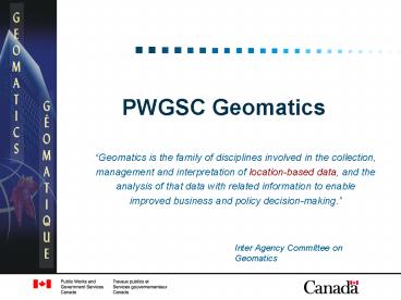
Title: PWGSC Geomatics
1
PWGSC Geomatics
- Geomatics is the family of disciplines involved
in the collection, management and interpretation
of location-based data, and the analysis of that
data with related information to enable improved
business and policy decision-making.
Inter Agency Committee on Geomatics
2
Role
- Provide common services, as per Treasury Boards
Common Services Policy - 7.14.2 Geographical Information Systems (GIS)
- 7.14.3 Surveys of land or real property / land
information management - 7.14.4 Hydrographic Survey
- Provide geomatics-based business solutions to
PWGSC and other departments and agencies - Stewardship of PWGSC land information and spatial
data assets - Geomatics Community Coordinator for Real Property
and its associated community of practice
(endorsed by IACG).
3
Geomatics Community Coordinator for Real Property
- PWGSC Geomatics Community Coordinator for Real
Property - Issue
- There currently exists no framework within the
federal government for the effective management
of spatial and land information as it relates to
real property management - Role
- PWGSC will play the lead role in guiding and
implementing the CGDI in a way that serves the
needs of the federal real property community - Mobilize teams and networks and task out work to
be performed - All activities of the GCC will be validated
through the collaboration of the real property
geomatics stakeholder community (community of
practice)
4
Geomatics CoP for Real Property
- Priorities identified through CoP
- Access to National Standardized Cadastral Data
- Why we are here
- Land Information Management Framework (LIMF)
- Purpose
- To provide guidance to individuals charged with
the responsibilities of land information
stewardship
5
Land Information Management Framework
- Managing Land Information
- Mandated by federal legislation
- Subject of international commitments by Canadian
Government - Directed through TBS and departmental policies
- Basis of PWGSC Geomatics services
6
Land Information Management Framework
- LIMF Objectives
- To understand the management of land information
in the federal context - To promote timely information sharing
- To promote knowledge transfer for
decision-makers, asset managers, and those
responsible for program delivery - To provide guidance to key and contributory real
property practitioners - To outline procedures necessary for effective
management of land information - To develop nationally consistent services
7
Land Information Management Framework
- The LIMF proposes the creation of
- A departmental Land Registry
- A Land Information Management System
- Policies, Directives, and Procedures
- Standards and Levels of Service
- Guidelines and Best Practices
- Performance Indicators and Measurement
8
Land Information Management Framework
- LIMF Benefits
- Will permit PWGSC to sustain, maintain, and
report upon federal land holdings in a more
efficient, complete, and economical manner - Will allow PWGSC to share this ability with other
custodians of federal real property
9
Land Information Management Framework
- Whats been done
- Review PWGSC and external capabilities (SWOT
analysis) - Review International LIMF context, and Canadian
legislation, policies, and SIGs - Research contextual references for LIMF
- Outline proposed content of LIMF
- Draft Framework document for PWGSC
- LR database
- LOI template
10
Land Information Management Framework
- Next steps
- Comprehensive communications campaign
- Alignment with Geomatics CoP for RP activities
and priorities - Senior management endorsement
11
- Treat the Earth well it was not given to you
by your parents, it was loaned to you by your
children. We do not inherit the Earth from our
ancestors we borrow it from our children." - Ancient Indian Proverb
12
- Julie Leese
- Director, Geomatics
- Public Works and Government
- Services Canada
- (819) 956-7231
- Julie.Leese_at_pwgsc.gc.ca
Recommended
