
14TH FTW PowerPoint PPT Presentation
1 / 70
Title: 14TH FTW
1
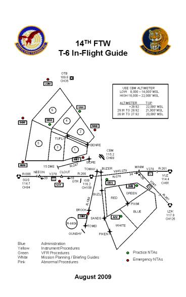
14TH FTW T-6 In-Flight Guide
OTB 109.8 CH35
22M
USE CBM ALTIMETER LOW 8,000 14,000
MSL HIGH 16,000 22,000 MSL ALTIMETER
TOP gt29.92 22,000
MSL 29.91 TO 28.92 21,000 MSL 28.91 TO
27.92 20,000 MSL
5A4
6
4
M44
04M
M40
2
TUPLI
5
BENRE
3
1
CBM 115.2 CH99
M83
SIDRE
R-247
06M
15 DME
MINIM
R-261
BUZER
V278
TOMAK
V245-278
NEEON
CLOUT
82
24
R-266
V278
R-086
VUZ 114.4 CH91
R-078
18
30
30
88
SQS 114.7 CH94
IGB 116.2 CH109
GTR
UBS
V245
STF
54
3M8
GREEN
BUZLI
RED
R-301
R-189
PIKMI
BROOK
LDK 117.8 CH125
BLUE
20M
SANDS
AIV
R-4404
WHITE
TOMEI
GUNSHY
PIKEN
Blue Administration Yellow Instrument
Procedures Green VFR Procedures White Mission
Planning / Briefing Guides Pink Abnormal
Procedures
August 2009
2
(No Transcript)
3
(No Transcript)
4
(No Transcript)
5
iii
6
INDEX
PAGE MISSION PLAN / BRIEF
WHITE Pre-Mission Briefing Guide 25 T-6 ORM
Checklist 26 BASH Plan / CRM
27-28 Contact Briefing Guide 29 C4201/02
Initial Solo Checklist 30-31 Solo Student
Briefing Guide 32 Formation Briefing
Guide 33 Instrument/Nav Briefing Guide
34 Low Level Briefing Guide 35 Nav Flt
Planning Checklist 36-38 Strange Field
Checklist 39 Flyover / Static Display
Checklist 40 Orientation Flight Briefing
Guide 41 AFTO 781 Procedures
42 Training Rules 43-44 ABNORMAL
PROCEDURES PINK Radar Out Procedures
45-46 Radio Failure Procedures
47-48 Emergency Procedures
49 Physiological / Hot Brakes Proc
50 Recall / Area Hold / RW Closure
51 Search Rescue / On Scene CC
52 Impounding Proc / Reportable
53 Caution/Warning Panel 54 Electrical
Failure 55 AHRS Failure
56 Diversion 57 Diversion
Fields 58 Bingo Fuels CBM to Alternate
59 Blank 60 OPS LIMITS/TAB DATA
WHITE Ops Limits 61 Crosswind Tab Data
62
PAGE COVER
WHITE AIRFIELD DIAGRAM i ADMIN
BLUE List of Effective Pages ii In-Flight
Guide Changes iii Index iv Phone Numbers
v Freqs / GPS Flight
Plans 1 T-6 Flying Status 2-3 Rwy
Change Proc / ITS 4 Restrictions
5 Restrictions / Sunfish Proc 6 INSTRUMENT
PROC YELLOW West Profiles 7 East Profiles
8 South Profiles
9 HI
-TIDE 10 Firebird Night 11 Phoenix Night
12 Local CBM Holding Fixes 13 Local
Canned Flight Plans 14 Standard Clearances
15-16 VFR PROC GREEN NTAs
17 Sunfish Rwy 13R 18 Sunfish Rwy 31L
19 Gunshy Rwy 13 20 Gunshy Rwy 31 21 Pickens
3 Rec / Sunfish 2 Rec 22 Golden Triangle Rwy
18 23 Golden Triangle Rwy 36 24
iv
7
v
8
FREQUENCIES / GPS FLIGHT PLANS
1
9
2
10
T-6 FLYING STATUS (cont)
STATUS / CATEGORY 7. SLOTS a. Minimum ceiling
and visibility 300 / 1. b. Plan recovery
to land within designated landing window.
c. Plan all approaches to a full stop.
Coordinate radar delays, multiple
approaches and cross-country / out and
backs through SUP to the SOF. 8. RECALL a.
Coordinate launches with the SOF. b.
Conditions necessitate an orderly recovery
flow. c. See page 51 for airspeeds and
procedures. d. The SOF will coordinate with
RAPCON to recover all aircraft in the
desired order (i.e. student solo
first). e. All aircrew request recovery from
area or outlying fix. Expect delays and
exercise good radio discipline.
9. AREA HOLD a. Stop all
launches. b. Airborne aircraft not in the
pattern follow guidance on page
51. 10. STANDBY a. No local aircraft
airborne. b. All local flying is suspended
for an indefinite period of time until
conditions improve to support a better
status. 11. GUNSHY a. Minimum ceiling and
visibility 2500 / 3. OPERATIONS b. Six
aircraft maximum in pattern. c. Must be able
to maintain VFR after canceling IFR when
entering Gunshy, and able to maintain VFR until
receiving IFR when leaving. ALTERNATES
Alternate fuels are only included on ATIS if they
differ from the standard fuel requirements in
the In-Flight Guide (IFG). When alternate fuels
differ from the IFG due to icing or other
factors, the SOF will direct ATC personnel to
include alternate fuels in the ATIS
message. NOTE The SOF may include additional
remarks and / or impose additional restrictions
to any flying status.
3
11
RUNWAY CHANGE PROCEDURES / ITS
RUNWAY CHANGE PROCEDURES PRIOR TO RUNWAY
CHANGE 15 MIN ------ Solos with less than 600
directed to FULL STOP. 10 MIN ------ Aircraft
with less than 500 (300 if GTR is open) FULL
STOP or depart the pattern. 05 MIN ------ No
RADAR entries to VFR pattern. No pitchouts
except for FULL STOPS. No high key. 00 MIN
------ Sunfish directs aircraft in pattern to
climb and maintain 2200 MSL. Depart pattern on
the turn to downwind and execute VFR re-entry
procedures for new runway. NOTE TIMES ARE FOR
MISSION PLANNING ONLY. ACCOMPLISH ONLY
WHEN DIRECTED BY THE RSU / TOWER.
INDEX OF THERMAL STRESS (ITS) RESTRICTIONS CAUTIO
N ZONE 1. IP accomplishes exterior inspection
on spare aircraft. 2. Solo students may
accomplish a second exterior inspection if
physically fit. Consider waiting in the
line shack if spare aircraft is not ready. 3.
Limit ground ops to 90 minutes (time outside
air-conditioned environment). 4. Avoid exercise
four hours prior to takeoff. DANGER ZONE (In
addition to CAUTION restrictions) 1. Ground
operations limited to 45 minutes (time outside
air-conditioned environment). 2. Maximum of one
spare (two exterior inspections) on initial dual
sorties under DANGER, no spare on subsequent dual
sorties. 3. Solo students are authorized only
one exterior inspection per sortie. 4. Wait in
the line shack if spare aircraft is not ready. 5.
Minimum recovery time between flights is two
hours (landing time to next takeoff time) if BOTH
landing and takeoff are under ITS DANGER. Note
Does not apply to C4201/C4202 sorties (initial
solo). NOTE Be alert for symptoms of heat
stress and drink plenty of caffeine-free
liquids. WIND CHILL RESTRICTIONS CAUTION
ZONE 1. Ground ops limited to 30 minutes (time
outside heated environment). NOTE When wind
chill exceeds -20 F, flights require OG/CC
approval. Be alert for symptoms of hypothermia.
4
12
RESTRICTIONS
This table helps the pilot determine the
minimum systems required for takeoff at locations
other than home station. Missions originating
from the home base will not normally launch with
a known malfunction other than as described in
Note 3. T-6 GO / NO-GO RESTRICTIONS (Excluding
FCFs)
5
13
RESTRICTIONS / SUNFISH PROCEDURES
T-6 FORMATION RESTRICTIONS
MAXIMUM X-WIND
WEATHER
TAKEOFF
Highest of Circling Mins or PWC or 500/1 ½ No
Ice / Snow or Standing Water
15 Knots
Wing Takeoff
25 Knots
Interval Takeoff
1500/3
15 Knots
Highest of 500/1 ½ or PWC No Ice / Snow
or Standing Water
Wing Approach / Wing Landing
- No rolling takeoffs
- Minimum runway width is 150 for formation wing
takeoff or landing (does not - apply to Interval takeoff)
- - No formation Touch-and-Gos
- - No formation low approaches lt 100 AGL (lt 300
AGL for chase aircraft)
SUNFISH PROCEDURES (If TO/LDG on center
runway) TAXI OUT (13C) Monitor CH 2 (Sunfish)
approaching Taxiway L until across Rwy 13R. A
traffic light located on the opposite side of
runway is available for minimum communications.
After receiving a green light, pilots will
visually clear final before crossing the active
runway. AFTER LANDING (31C) Hold short of the
VFR Hold Line, north end of the inside runway.
Monitor CH 2 (Sunfish) and await clearance to
cross from Sunfish. Once clear of 31L switch to
CH 1 (Ground Control) and taxi to park. TIRE
WEAR CRITERIA Tires will be changed when any
tire limit criteria is reached. The aircraft
commander may request a tire change before
reaching the criteria listed below when
anticipating heavy tire usage. As a guide do not
plan to accept an aircraft with MAIN GEAR
Local Red cord visible OB/XC Main Gear gt 3
cords visible NOSE GEAR (any sortie) Worn to
bottom of tread groove
6
14
WEST PROFILES
OTB 109.8 CH35
RADAR REQUIRED
CENTER RADIAL/DME 1 CBM/275/17 2 CBM/310/16 3
CBM/276/26 4 CBM/309/26 5 CBM/277/36 6
CBM/309/35
USE CBM ALTIMETER LOW 8,000 14,000
MSL HIGH 16,000 22,000 MSL ALTIMETER
TOP gt29.92 22,000
MSL 29.91 TO 28.92 21,000 MSL 28.91 TO
27.92 20,000 MSL
R-293
TUPLI
BENRE
3
CBM 115.2 CH99
290
220
SQS 114.7 CH94
SIDRE
175
CBM R-247
330
V278
IGB 116.2 CH109
R-266
R-086
88
18
NEEON
CLOUT
30
VFR PATTERN DEPARTURE PROCEDURES RUNWAY 31L
FLY RUNWAY HEADING REMAINING AT OR BELOW 700
MSL. ABEAM ALERT RAMP, TURN LEFT HEADING 220
(290 FOR BENGAL OR TUPELO PROFILES). WHEN CLEAR
OF INSIDE DOWNWIND BEGIN CLIMB. PASSING 4 DME
AND 3000 MSL, PROCEED WITH ASSIGNED
PROFILE. RUNWAY 13R FLY RUNWAY HEADING
REMAINING AT OR BELOW 700 MSL. ABEAM DEPARTURE
END OF 13C BEGIN CLIMB. CROSSING HWY 45 TURN
RIGHT HEADING 175. PASSING 4 DME AND 3000 MSL,
TURN RIGHT HEADING 330 AND PROCEED WITH ASSIGNED
PROFILE. NOTE WHEN TOWER CONTROLS THE INSIDE
RUNWAY AND THE STATUS IS LESS THAN RESTRICTED
OVERHEAD, FLY THE WEST POINT ONE DEPARTURE AND
PROCEED WITH ASSIGNED PROFILE OR ATC
INSTRUCTIONS. OTHERWISE, FLY THE VFR PATTERN
DEPARTURE PROCEDURE GROUNDTRACK. WEST
PROFILES BENGAL PROCEED DIRECT BENRE
(CBM/293/9), DIRECT TUPLI (CBM/293/20). CLIMB
AND MAINTAIN 15,000 MSL (7000 MSL FOR LOW
TRANSITION). BE AT OR ABOVE 5000 MSL BY BENRE,
AND REMAIN AT OR BELOW 7000 MSL UNTIL REACHING
BENRE. UPON REACHING 15,000 MSL (7000 MSL LOW
TRANSITION) PROCEED DIRECT TO ASSIGNED AREA.
CLIMB / DESCEND ONCE ESTABLISHED WITHIN AREA
BOUNDARIES. TUPELO PROCEED DIRECT BENRE
(CBM/293/9), DIRECT TUPLI (CBM/293/20). CLIMB
AND MAINTAIN 5000 MSL. BE AT 5000 MSL BY
BENRE. AT TUPLI PROCEED DIRECT TO TUPELO (OTB).
GREENWOOD PROCEED DIRECT SIDRE (CBM/247/9),
DIRECT CLOUT (CBM/247/24) . CLIMB AND MAINTAIN
10,000 MSL. BE AT OR ABOVE 5000 MSL BY SIDRE.
AT CLOUT, JOIN V-278 TO SIDON (SQS), THEN DIRECT
GWO (GREENWOOD). SR-137 INTERCEPT CBM R-247
(IGB R-275) OUTBOUND. CLIMB AND MAINTAIN 4000
MSL. AT 15 DME PROCEED DIRECT TO POINT A
(IGB/271/22). GTR INTERCEPT CBM R-247 (IGB
R-275) OUTBOUND TO 15 DME. CLIMB AND MAINTAIN
4000 MSL. EXPECT RADAR VECTORS PRIOR TO 15 DME.
7
15
EAST PROFILES
RADAR REQUIRED
CBM 115.2 CH99
VR-1014 POINT A
220
175
150
MINIM
150
15 DME
R-261
V278
82
24
R-078
V245-278
VUZ 114.4 CH91
30
IGB 116.2 CH109
V245
54
R-301
LDK 117.8 CH125
VFR PATTERN DEPARTURE PROCEDURES RUNWAY 31L
FLY RUNWAY HEADING REMAINING AT OR BELOW 700 MSL
UNTIL TURNING. ABEAM ALERT RAMP, TURN LEFT
HEADING 220. WHEN CLEAR OF INSIDE DOWNWIND
BEGIN CLIMB. PASSING 4 DME AND 3000 MSL, TURN
LEFT 150 AND PROCEED WITH ASSIGNED
PROFILE. RUNWAY 13R FLY RUNWAY HEADING
REMAINING AT OR BELOW 700 MSL. ABEAM DEPARTURE
END OF 13C BEGIN CLIMB. CROSSING HWY 45 TURN
RIGHT HEADING 175. PASSING 4 DME AND 3000 MSL,
TURN LEFT HDG 150 AND PROCEED WITH ASSIGNED
PROFILE. NOTE WHEN TOWER CONTROLS THE INSIDE
RUNWAY AND THE STATUS IS LESS THAN RESTRICTED
OVERHEAD, FLY THE WEST POINT ONE DEPARTURE AND
PROCEED WITH ASSIGNED PROFILE OR ATC
INSTRUCTIONS. OTHERWISE, FLY THE VFR PATTERN
DEPARTURE PROCEDURE GROUNDTRACK. . EAST
PROFILES TUSCALOOSA TRACK HEADING 150 TO IGB
R-078, THEN TURN LEFT DIRECT MINIM. CLIMB AND
MAINTAIN 6000 MSL. BE AT 6000 MSL BY IGB R-078.
AT MINIM INTERCEPT V-245 TO LDK
(CRIMSON). CATRN TRACK HEADING 150 TO IGB
R-078, THEN TURN LEFT DIRECT MINIM. CLIMB AND
MAINTAIN 10,000 MSL. BE AT OR ABOVE 6000 MSL
BY IGB R-078. AT MINIM PROCEED DIRECT TO CATRN
(LDK005016). VULCAN INTERCEPT IGB R-078, THEN
TURN LEFT DIRECT MINIM, DIRECT VUZ (VULCAN).
CLIMB AND MAINTAIN 9000 MSL. BE AT OR ABOVE
6000 MSL BY IGB R-078. VR-1014 INTERCEPT
V-278 EASTBOUND. CLIMB AND MAINTAIN 4000 MSL.
AT 15 DME PROCEED DIRECT TO POINT A.
8
16
SOUTH PROFILES
CBM 115.2 CH99
RADAR REQUIRED
USE CBM ALTIMETER LOW 8,000 14,000
MSL HIGH 16,000 22,000 MSL ALTIMETER
TOP gt29.92 22,000
MSL 29.91 TO 28.92 21,000 MSL 28.91 TO
27.92 20,000 MSL
220
CENTER RADIAL/DME RED CBM/156/23 GREEN
CBM/135/26 WHITE CBM/165/35 BLUE CBM/140/36
175
IGB 116.2 CH109
150
220
BUZER
TOMAK
GREEN
BUZLI
RED
R-189
PIKMI
BLUE
SANDS
BROOK
LDK 117.8 CH125
WHITE
MACON 1300
R-4404
PIKEN
TOMEI
GUNSHY
VFR PATTERN DEPARTURE PROCEDURES RUNWAY 31L
FLY RUNWAY HEADING REMAINING AT OR BELOW 700 MSL
UNTIL TURNING. ABEAM ALERT RAMP, TURN LEFT
HEADING 220. WHEN CLEAR OF INSIDE DOWNWIND
BEGIN CLIMB. PASSING 4 DME AND 3000 MSL, TURN
LEFT 150 AND PROCEED WITH ASSIGNED
PROFILE. RUNWAY 13R FLY RUNWAY HEADING
REMAINING AT OR BELOW 700 MSL. ABEAM DEPARTURE
END OF 13C BEGIN CLIMB. CROSSING HWY 45 TURN
RIGHT HEADING 175. PASSING 4 DME AND 3000 MSL,
TURN RIGHT HEADINGG 220 AND PROCEED WITH
ASSIGNED PROFILE. NOTE WHEN TOWER CONTROLS THE
INSIDE RUNWAY AND THE STATUS IS LESS THAN
RESTRICTED OVERHEAD, FLY THE WEST POINT ONE
DEPARTURE AND PROCEED WITH ASSIGNED PROFILE OR
ATC INSTRUCTIONS. OTHERWISE, FLY THE VFR PATTERN
DEPARTURE PROCEDURE GROUNDTRACK. SOUTH
PROFILES MACON PROCEED DIRECT TOMAK
(CBM/189/9), DIRECT BROOK (CBM/189/26). CLIMB
AND MAINTAIN 6000 MSL. BE AT 6000 MSL BY
TOMAK. UPON REACHING BROOK, PROCEED TO MACON
(CBM/185/37). BE AT 1300 MSL BY MACON. MERIDIAN
PROCEED DIRECT TOMAK (CBM/189/9), DIRECT TOMEI
(CBM/189/41). CLIMB AND MAINTAIN 6000 MSL. BE
AT 6000 MSL BY TOMAK. AT TOMEI, PROCEED DIRECT
TO MEI (MERIDIAN). BUZZSAW PROCEED DIRECT BUZER
(CBM/170/9), DIRECT BUZLI (CBM/170/15). CLIMB
AND MAINTAIN 15,000 MSL (7000 MSL FOR LOW
TRANSITION). BE AT OR ABOVE 6000 MSL BY BUZER
AND AT OR BELOW 10,000 MSL UNTIL BUZLI. AT
BUZLI, PROCEED DIRECT SANDS (CBM/175/30), DIRECT
PIKMI (CBM/146/29). UPON REACHING 15,000 MSL
(7,000 MSL LOW TRANSITION) PROCEED DIRECT
ASSIGNED AREA. CLIMB / DESCEND ONCE ESTABLISHED
WITHIN AREA BOUNDARIES.
9
17
(No Transcript)
18
FIREBIRD NIGHT TRANSITION
RADAR REQUIRED
CBM 305/31
5,000
14,000
7,000
CBM 305/10
CBM 115.2 CH99
CBM 260/9
6000
CBM 260/31
CBM 240/10
VECTORS
RUNWAY 31L/13R FLY THE VFR PATTERN DEPARTURE
PROCEDURE OR WEST POINT ONE DEPARTURE AS
APPROPRIATE. FIREBIRD NIGHT TRANSITION PROCEED
DIRECT THE CBM/260/9 AND CROSS AT OR ABOVE 6,000
MSL. AFTER CROSSING, PROCEED DIRECT CBM/260/31
AND CLIMB AND MAINTAIN BLOCK ALTITUDES 7,000
14,000 MSL. PROCEED DIRECT CBM/305/31. AFTER
CROSSING, DESCEND AND MAINTAIN 5,000 MSL, DIRECT
CBM/305/10, DIRECT CBM/240/10. EXPECT RADAR
VECTORS TO TERMINATION POINT. NOTE THE
FIREBIRD NIGHT TRANSITION WILL BE FLOWN AT 200
KNOTS.
11
19
PHOENIX NIGHT TRANSITION
RADAR REQUIRED
CBM 115.2 CH99
BUZLI
10,000
CBM 130/25
8,000 7,000
VECTORS
14,000 10,000
4,000
CBM 130/35
CBM 179/25
14,000 10,000
CBM 170/35
RUNWAY 31L/13R FLY THE VFR PATTERN DEPARTURE
PROCEDURE OR WEST POINT ONE DEPARTURE AS
APPROPRIATE. PHOENIX NIGHT TRANSITION PROCEED
DIRECT BUZER (CBM/170/9), DIRECT BUZLI
(CBM/170/15). CROSS BUZER AT OR ABOVE 6,000 MSL
AND MAINTAIN AT OR BELOW 10,000 MSL UNTIL BUZLI.
AFTER BUZLI, CLIMB AND MAINTAIN BLOCK ALTITUDES
10,000-14,000 MSL, DIRECT CBM/170/35, DIRECT
CBM/130/35, DIRECT CBM/130/25. AFTER CBM/130/25,
DESCEND AND MAINTAIN BLOCK ALTITUDES
7,000-8,000 MSL DIRECT CBM/179/25. DESCEND AND
MAINTAIN 4,000 MSL AND EXPECT RADAR VECTORS TO
TERMINATION POINT. NOTE THE PHOENIX NIGHT
TRANSITION WILL BE FLOWN AT 200 KNOTS
12
20
LOCAL T-6 CBM HOLDING FIXES
MAX AIRSPEEDS / ALTITUDES BALDD 265 KIAS / 7K
MSL GOMAZ 265 KIAS / 7K MSL HUDSI 175 KIAS
/ 22K MSL JOLLI 175 KIAS / 10K MSL JUNUK
175 KIAS / 22K MSL MYKAL 265 KIAS / 7K
MSL SNAEK 265 KIAS / 7K MSL
R-315
RADAR OUT HOLDING FIXES
CBM 25
MYKAL CBM 20
R-290
HUDSI CBM 23
CBM 115.2 CH 99
CBM 27
GOMAZ CBM 20
R-270
CBM 25
SNAEK CBM 20
JOLLI CBM 15
CBM 25
JUNUK CBM 23
CBM 20
R-224
BALDD CBM 20
R-136
CBM 27
CBM 25
For In-Flight Reference Only
R-156
R-179
13
21
T-6 CANNED FLIGHT PLANS
14
22
STANDARD CLEARANCES
MIN WX FOR ELPs Towered Field Ceiling 1000
above Key Altitude / 5 miles Visibility
Non-Towered VFR GTR STANDARD IFR CLIMBOUT
INSTRUCTIONS Rwy 18 Fly runway heading and
climb to 3000 MSL. Squawk assigned code
and contact Columbus Approach on channel 14. Rwy
36 Turn left heading 300 and climb to 3000
MSL. Squawk assigned code and contact Columbus
Approach on channel 14. MERIDIAN KEY FIELD -
BIGBEE RECOVERY Climb to 7000 MSL on 010.
Once receiving IGB, proceed direct. Remain clear
of R4404. STANDARD TUPELO CLEARANCE
DEFINITIONS 1. ARRIVAL Fly the Tupelo
profile. Enroute to Tupelo, state your
intentions with Memphis Center. STANDARD
TUSCALOOSA CLEARANCE DEFINITIONS 1. TCL 270 /
300 CODED CLIMBOUT (for ILS RWY 4) Fly
heading 270 or 300 as assigned, join the 15 DME
arc, arc south and maintain 2200 MSL.
Cleared to FLOSY. 2. TCL 340 CODED DEPARTURE
Fly heading 340, climb and maintain 4000
MSL. Join V-245 to MINIM, direct CBM 3. FOR HI
TIDE BHM Approach may issue the following a.
CRIMSON WEST CLIMBOUT Climb and maintain 4000
feet. Join the 15 DME arc via the
LDK R-270 and arc south to FLOSY. Cleared to
FLOSY. b. MOVIL CLIMBOUT Cleared to MOVIL
(OKW 230/20) via the LDK R-180,
climb and maintain 4000 feet. LOCAL CLIMBOUT
INSTRUCTIONS (When Flying Approaches to Center
Rwy) During VFR pattern operations Fly runway
heading. Remain at or below 700 MSL until
departure end of runway, then climb to 4000 MSL.
Contact Departure CH 16. During IFR Recovery or
Slot status Fly runway heading and climb to
4000 MSL. Contact Departure CH 16.
15
23
STANDARD CLEARANCES
MIN WX FOR ELPs Towered Field Ceiling 1000
above Key Altitude / 5 miles Visibility
Non-Towered VFR GTR STANDARD IFR CLIMBOUT
INSTRUCTIONS Rwy 18 Fly runway heading and
climb to 3000 MSL. Squawk assigned code
and contact Columbus Approach on channel 14. Rwy
36 Turn left heading 300 and climb to 3000
MSL. Squawk assigned code and contact Columbus
Approach on channel 14. MERIDIAN KEY FIELD -
BIGBEE RECOVERY Climb to 7000 MSL on 010.
Once receiving IGB, proceed direct. Remain clear
of R4404. STANDARD TUPELO CLEARANCE
DEFINITIONS 1. ARRIVAL Fly the Tupelo
profile. Enroute to Tupelo, state your
intentions with Memphis Center. STANDARD
TUSCALOOSA CLEARANCE DEFINITIONS 1. TCL 270 /
300 CODED CLIMBOUT (for ILS RWY 4) Fly
heading 270 or 300 as assigned, join the 15 DME
arc, arc south and maintain 2200 MSL.
Cleared to FLOSY. 2. TCL 340 CODED DEPARTURE
Fly heading 340, climb and maintain 4000
MSL. Join V-245 to MINIM, direct CBM 3. FOR HI
TIDE BHM Approach may issue the following a.
CRIMSON WEST CLIMBOUT Climb and maintain 4000
feet. Join the 15 DME arc via the
LDK R-270 and arc south to FLOSY. Cleared to
FLOSY. b. MOVIL CLIMBOUT Cleared to MOVIL
(OKW 230/20) via the LDK R-180,
climb and maintain 4000 feet. LOCAL CLIMBOUT
INSTRUCTIONS (When Flying Approaches to Center
Rwy) During VFR pattern operations Fly runway
heading. Remain at or below 700 MSL until
departure end of runway, then climb to 4000 MSL.
Contact Departure CH 16. During IFR Recovery or
Slot status Fly runway heading and climb to
4000 MSL. Contact Departure CH 16.
15
24
STANDARD CLEARANCES (cont)
COLUMBUS INSTRUMENT DELAY PATTERN (REQUIRED WX
2500/3) Fly VFR pattern departure procedures if
RSU has control of Rwy 13R/31L, or West Point
One Departure if tower has control and the status
is less than restricted overhead. Make approach
request with departure on CH 4. Expect handoff
to arrival (CH 16). If unable to enter delay
pattern, proceed with profile previously cleared
for. After completion of touch-and-go / low
approach, contact Sunfish for pattern entry or
departure sequencing thru Sunfish pattern.
Maintain 700 MSL or below until departure end
of the center runway. Cross-Country / Out and
Back (DD175) All T-6 aircraft departing the
Sunfish traffic pattern will utilize VFR Pattern
departure procedures when Sunfish RSU has
control of Rwy 13R/31L. When tower has control
of Rwy 13R/31L and the status is Restricted
Overhead or better, aircrew will fly the VFR
PATTERN DEPARTURE PROCEDURES per the IFG, until
told to proceed on course, at which point
aircraft is cleared to initial fix as listed
below. Otherwise, fly the West Point One
Departure, then to initial fix as listed
below. Westbound departure File IGB SQS as
initial route of flight. Northbound departure
File CBM293009 CBM293020 TUP as initial route of
flight. Eastbound departure off of RWY 31L
File IGB MINIM as initial route of flight.
Eastbound departure off of RWY 13R File
MINIM as initial fix. Aircraft departing off of
RWY 13R will comply with VFR PATTERN DEPARTURE
PROCEDURES, per the IFG, until intercepting
V-245/V-278 to MINIM, then as filed to ensure
safe separation from arriving/departing aircraft
from the center runway.
16
25
NON-TOWERED AIRFIELDS
Pontotoc Co (22M) 122.8 3000x50 11/29
ELEV 440
Emergency NTA
Practice NTA
Okolona (5A4) 122.9 3200 x 60
18/36 ELEV 335
Calhoun Co(04M) 122.9 3200x60 15/33
ELEV 383
Monroe Co (M40) 122.8 5001 x 75
18/36 ELEV 226
Houston (M44) 122.9 3800 x 75 3/21 ELEV 337
Eupora (06M) 122.9 3000 x 60 14/32
ELEV450
Lowndes Co (UBS) 122.8 4500 x 100
18/36 ELEV 188
McCharen (M83) 122.9 3850x75 18/36
ELEV205
Starkville (STF) 122.7 5550 x 150 18/36
ELEV 250
North Pickens County (3M8) 122.9 5144 x 80
1/19 ELEV 237
Macon Muni (20M) 122.7 3000 x 60
18/36 ELEV 238
George Downer (AIV) 122.8 4970
x 80 6/24 ELEV 150
Gunshy (1MS8) Ch 6 6300 X 150
13/31 ELEV 260
Restrictions GTR - 1 HAPL to High Key is
authorized with RAPCON approval. Re-setting to
High Key once established in GTR pattern
requires RAPCON coordination. OKOLONA/MONROE
Co. Do not use when CBM is landing RWY13
NORTH PICKEN COUNTY Right traffic to RWY1
17
26
SUNFISH RUNWAY 13R
OVERHEAD 1200
MSL STRAIGHT-IN 700
MSL BREAKOUT OVHD 2200
MSL BREAKOUT VFR ENTRY
1700 MSL BREAKOUT ST-IN
700 MSL HIGH PATTERN 3200
MSL HIGH KEY
2700-3200 MSL LOW KEY
1700 MSL
N
RICH GUYS HOUSE
5 MILES
POWER LINES
_
CROSSROAD
POWER LINE
CIGAR SHAPED FIELD
APPROX HDG 360
POTASH PLANT
7 MILE FARM
1200
2 MILES (3.2 DME)
RIVER
OPEN FIELD
AVOID OVERFLIGHT OF WAVERLY MANSION
GRAVEL PIT
220
VFR ENTRY
360
APPROX HDG 320
PATT X/W ONLY
HWY 50 BRIDGE
STENNIS LOCK DAM
BAT SHAPED FIELD
HWY 45
COLUMBUS LAKE
CBM 196/8.2 IGB 032/2.4
Pattern Priorities Emergency Aircraft Minimum
Fuel NORDO Aircraft Formation Aircraft Aircraft
in the Pattern Single-Ship Radar
Entries Single-Ship VFR Entries
.
.
?
?
BOAT RAMP
ANTENNAS
18
27
SUNFISH RUNWAY 31L
OVERHEAD 1200
MSL STRAIGHT-IN 700
MSL BREAKOUT OVHD 2200
MSL BREAKOUT VFR ENTRY
1700 MSL BREAKOUT ST-IN
700 MSL HIGH PATTERN 3200
MSL HIGH KEY
2700-3200 MSL LOW KEY
1700 MSL
N
RIVER
GRAVEL PIT
2 NM (1.8 DME)
HWY 45
090
VFR ENTRY
BAT SHAPED FIELD
220
1200
_
5 NM
OPEN FIELD
HWY 50 BRIDGE
ANTENNA
ANTENNA FARM
MARBLE (CBM 179/7) (IGB 055/4.5)
Pattern Priorities Emergency Aircraft Minimum
Fuel NORDO Aircraft Formation Aircraft Aircraft
in the Pattern Single-Ship Radar
Entries Single-Ship VFR Entries
19
28
GUNSHY RUNWAY 13
N
BROOK
CBM/189/026
1300
LAKE
MACON
US 45
265
POND
CBM 185/037
R4404
5 NM
PIPELINE
040
SHUQULAK
CLUMP of TREES
270
VFR ENTRY
CLAW LAKE
HWY 39
SWAMP
MILL
2 NM
POND
T
T
T
FIELD
T
T
T
T
T
T
T
T
13
31
Pattern Priorities Emergency Aircraft Minimum
Fuel NORDO Aircraft Formation Aircraft Aircraft
in the Pattern Single-Ship Radar
Entries Single-Ship VFR Entries
080
ELEVATION 253 MSL STRAIGHT-IN
800 MSL OVERHEAD 1300 MSL BREAKOUT
OVHD 2300 MSL BREAKOUT VFR ENTRY
1800 MSL BREAKOUT ST-IN 800 MSL HIGH
KEY 2800-3300 MSL LOW
KEY 1800 MSL HIGH PATTERN
3300 MSL GUNSHY CH 6
(363.65) MERIDIAN CH 5 (314.8)
ARRIVAL FROM BROOK PROCEED DIRECT MACON THEN
HDG 265 TO POND. BE 1300 MSL BY MACON.
DEPARTURE RWY HDG TO 1NM PAST DEPARTURE END,
THEN TURN HDG 080.
SUNFISH 2 R-179
PICKENS 3 D PIKEN SANDS PIKMI
20
29
GUNSHY RUNWAY 31
BROOK
CBM 189/026
HWY 45
N
1300
SHUQULAK
180
MACON
LAKE
CBM 185/037
PIPELINE
175
040
HWY 39
VFR ENTRY
SWAMP
Gray Silo
FIELD
13
080
SILO
31
2 NM
Pattern Priorities Emergency Aircraft Minimum
Fuel NORDO Aircraft Formation Aircraft Aircraft
in the Pattern Single-Ship Radar
Entries Single-Ship VFR Entries
5 NM
ARRIVAL FROM BROOK PROCEED DIRECT MACON, THEN
HDG 175 TO SILO. BE 1300 MSL BY MACON.
ELEVATION 253 MSL STRAIGHT-IN
800 MSL OVERHEAD 1300 MSL BREAKOUT
OVHD 2300 MSL BREAKOUT VFR ENTRY
1800 MSL BREAKOUT ST-IN 800
MSL HIGH KEY
2800-3300 MSL LOW KEY 1800 MSL HIGH
PATTERN 3300
MSL GUNSHY CH 6 (363.65) MERIDIAN CH
5 (314.8)
DEPARTURE FLY THE OUTSIDE DOWNWIND GROUNDTRACK
DEPART HDG 080 ABEAM THE GRAY SILO. NOTE BE
AT or ABOVE 1800 MSL PRIOR TO MACON SILO
GROUNDTRACK.
PICKENS 3 D PIKEN SANDS PIKMI
SUNFISH 2 R-179
21
30
PICKENS 3 RECOVERY / SUNFISH 2 RECOVERY
ATIS 273.5 COLUMBUS DEP/APP CON 350.3 (CH
4) 291.65 (CH 7) MEMPHIS CENTER 252.7 MERIDIAN
APP CON 314.8 (CH 5)
CBM 115.2 CH99
IGB 116.2 CH109
GREEN
R-179
RED
MAINTAIN VFR UNTIL RECEIVING AN IFR CLEARANCE
PIKMI
BLUE
SANDS
LDK 117.8 CH125
WHITE
PIKEN
GUNSHY
080
RADAR REQUIRED
RWY 31 WHEN ABEAM THE 90-TO-INITIAL
GROUNDTRACK, REPORT C/S, DEPARTING AND BEGIN
CLIMB. BE AT OR ABOVE 1800 MSL PRIOR TO CROSSING
THE MACON-TO-SILO GROUND TRACK. UPON REACHING
1800 MSL TURN LEFT TO HEADING 080, THENCE RWY
13 ON DEPARTURE LEG DELAY CLIMB THROUGH 800
MSL UNTIL 1 MILE PAST THE DEPARTURE END. ONCE 1
MILE PAST DEPARTURE END BEGIN CLIMB AND REPORT
C/S, DEPARTING. TURN TO HEADING 080,
THENCE PICKENS 3 RECOVERY (FROM
GUNSHY) CONTACT MERIDIAN APPROACH (CH 5) AND
PROCEED DIRECT PIKEN (CBM/171/40). CLIMB VFR TO
5500 MSL. WHEN CLEARED THE PICKENS 3 RECOVERY,
CLIMB TO 7000 MSL. UPON REACHING PIKEN, PROCEED
DIRECT SANDS (CBM/175/30), DIRECT PIKMI
(CBM/146/29). MAINTAIN 7000 MSL UNTIL CLEARED
HIGHER BY RAPCON. PROCEED DIRECT AREA UPON
REACHING 15,000 MSL OR AS CLEARED BY
RAPCON. SUNFISH 2 RECOVERY (FROM
GUNSHY) CONTACT MERIDIAN APPROACH (CH 5). CLIMB
VFR TO 4500 MSL AND INTERCEPT THE CBM R-179
INBOUND. WHEN CLEARED THE SUNFISH 2 RECOVERY,
CLIMB / DESCEND TO 4000 MSL. EXPECT RADAR
VECTORS.
22
31
GOLDEN TRIANGLE RUNWAY 18
White Water Tower
N
5 NM
Open Field
Ponds
2 NM
HWY 82
Black Silo
HWY 82
EMCC
HWY 45 Alt
18
045
VEGAS CBM 230/18.5
Cross Racetrack at 1200
36
090 Heading
VFR Entry
From VEGAS
VFR
Railroad Tracks
090 FOR 2 MILES
Pond
Railroad Tracks
IFR
Civilian Practice Area
City of Artesia
ARRIVAL SQUAWK 0200. BE WINGS LEVEL ONE MILE
PRIOR TO VFR ENTRY, 1300, HEADING
APPROXIMATELY 090. VFR RECOVERY TO
SUNFISH TURN LEFT 090 FOR TWO MILES, MAINTAIN
1200, PROCEED DIRECT RACETRACK THEN DIRECT RADAR
TERMINATION. SQUAWK 0300 AND MONITOR CH 14.
REPORT C/S RACETRACK. (1500-3 REQUIRED TO EXIT
GTR VFR) STANDARD IFR CLIMBOUT RUNWAY
18 MAINTAIN RUNWAY HEADING CLIMBING TO 3000
MSL. SQUAWK ASSIGNED CODE AND CONTACT COLUMBUS
APP CH 14.
ELEVATION 264 MSL STRAIGHT-IN 800
MSL OVERHEAD 1500 MSL LOW KEY
1800 MSL HIGH KEY
2800-3300 MSL GTR TOWER CH 17
(298.87) COLUMBUS APP CH 4 (388.2)
23
32
GOLDEN TRIANGLE RUNWAY 36
Cross Racetrack at 1200
N
IFR
EMCC
3000
VFR
300
HWY 45 Alt
Railroad Tracks
VEGAS CBM 230/18.5
VFR Entry
18
090 Heading
From VEGAS
135
Pond
36
Railroad Tracks
City of Artesia
Ponds
2 NM
Dirt Track
Civilian Flight Practice Area
5 NM
Factory
Small Community
Factory in the Distance
ELEVATION 264 MSL STRAIGHT-IN 800
MSL OVERHEAD 1500 MSL LOW KEY
1800 MSL HIGH KEY
2800-3300 MSL GTR TOWER CH 17
(298.87) COLUMBUS APP CH 4 (388.2)
ARRIVAL SQUAWK 0200. BE WINGS LEVEL ONE MILE
PRIOR TO VFR ENTRY, 1300, HEADING
APPROXIMATELY 090. VFR RECOVERY TO
SUNFISH PROCEED DIRECT RACETRACK THEN DIRECT
RADAR TERMINATION, MAINTAIN 1200, SQUAWK 0300,
REPORT C/S RACETRACK. (1500-3 REQUIRED TO
EXIT GTR VFR) STANDARD IFR CLIMBOUT RUNWAY
36 TURN LEFT HEADING 300 CLIMBING TO 3000 MSL.
SQUAWK ASSIGNED CODE AND CONTACT COLUMBUS APP CH
14.
24
33
PRE-MISSION BRIEFING GUIDE
1. PREREQUISITES COMPLETE a. Check Go/No-Go
status for all aircrew members and clear any red
blocks prior to stepping. b.
Accomplish ORM assessment sheet (Yellow Flt/CC
or higher approval, Red Sup
approval) c. Was the students last sortie gt 5
days ago? 86? d. Was the students last
flight/sim in this category 15 days ago? 86?
e. Open students gradesheet, hit Syllabus
Options (lightning bolt) button, read list of
opted lessons. (Note If the student is
on an UNSAT, the Syllabus Options button will
still show the options as if the
student was not on the UNSAT) f . Review
previous gradesheet for objectives/profile
suggestions 2. NOT UNSAT IN ANY OTHER CATEGORY OF
TRAINING OR GROUNDED / NOT DNIF a. Check grade
of last sorties/lessons accomplished (student
sortie only) b. Check the students HOLD status
(student sortie only) c. DNIF? Ask crewmembers
and check the 4293s for DNIF / OFF DNIF
documentation 3. REQD TO WEAR GLASSES? ON
MEDICATIONS? Dont just assume, make sure you
ask 4. ADEQUATE TURN TIME? WHAT IS THE START TIME
OF NEXT EVENT? a. Determine latest possible
takeoff time b. If ITS Caution/Danger, check IFG
for turn time restrictions c. Click on resume
tab and check last actual takeoff time and
scheduled start time for any events
left in the day (student sortie only) 1.
Aircraft/Sim to Aircraft/Sim
(300 Scheduled, 245 Actual) 2. Aircraft/Sim
to Classroom/CAI (230 Scheduled) d.
Ensure student will not exceed 12-hour duty day /
IP will not exceed crew duty day / IP
night restrictions 5. MIF (Student Sortie
Only) a. Open gradesheet for the sortie you are
going to fly 1. If the maneuver is red, it is
below MIF 2. If the maneuver is yellow, it is
opted but not required and has not been
accomplished 3. End of Block ride? If so,
open previous gradesheet and ensure all EOB
requirements are up to MIF b.
Check previous sortie overall grade for
compliance with syllabus regression rules
(Previous IP will have been warned by TIMS
when he graded regression on any item but
TIMS will not show that warning again) c.
Maneuvers followed by a plus () must be
accomplished in the specified unit d. Maneuvers
with a number and no () are opted and if
performed must meet MIF by EOB 6. SPECIAL
SYLLABUS, EPs AND OTHER REQUIREMENTS (Student
Sortie Only) a. Check special syllabus 4293 in
TIMS and in syllabus. b. Check special syllabus
against gradesheet to ensure accomplishment. c.
Check EP tab to ensure continuity of EP exposure
(lt 60 days) 7. OTHER CONSIDERATIONS a. How
long since showtime? b. Check for proper crew
rest (quantity/quality), nutrition, and
preparation for the mission c. Remove all
jewelry, rings, scarves prior to flight d. Other
health/stress concerns?
25
34
T-6 OPERATIONAL RISK MANAGEMENT
Guidance If your overall ORM assessment is
YELLOW, seek Flt/CC or higher approval to step.
If your overall ORM assessment is RED, seek SUP
approval to step.
The Four Key ORM Principles -Accept no
unnecessary risk. -Make risk decisions at the
appropriate level. -Accept risk when the benefits
outweigh the costs. -Integrate ORM into Air Force
operations and planning at all levels.
The Six ORM Steps 1. Identify the hazards. 2.
Assess risk. 3. Develop controls. 4. Make
decisions. 5. Implement controls. 6. Supervise
controls.
26
35
BIRD AIRCRAFT STRIKE HAZARD PLAN
BIRD CONDITION LOW Normal bird activities within
the local pattern area with a low probability of
hazard (no restrictions). BIRD CONDITION
MODERATE Concentrations of birds observed in
locations represent a probable hazard to safe
flying operations. Exercise increased vigilance.
Traffic Pattern Minimize pattern work
to that required by training. To the maximum
extent possible, flight leads will direct
wingmen to route below 5,000 MSL. Aircraft
conducting formation approaches may fly
close formation inside 5 miles. Formations on
initial will maintain route until 3
miles. Low Level Maintain at or above
1,000 AGL. Aircrew may fly as low as 500 AGL
to complete minimum syllabus or checkride
requirements. After requirements are met,
aircrew will maintain at or above 1,000
AGL. Aircrews are encouraged to complete 500
AGL training on Bird Condition low legs
if available. BIRD CONDITION SEVERE Heavy
concentrations of birds on or immediately above
the active runway or other specific locations
represent an immediate hazard to safe flying
operations. Exercise extreme caution.
Traffic Pattern Stop all takeoffs. Divert
aircraft as necessary. Landings should be
accomplished from the overhead pattern to a
full-stop landing. Formation procedures for
BWC Moderate apply. Formation approaches will
not be flown, except in an emergency. Low
Level If the current and/or forecast AHAS
indicates severe for any route segments
planned to be flown, apply the following
guidance, in order of precedence, to minimize the
bird strike threat 1. Select a
different low-level route/mission (weather and
operational constraints
permitting). 2. Enter or exit the
route at published (AP1/B) alternate entry/exit
points to avoid the severe leg(s).
3. Maintain at or above 1,500 AGL
minimum. Squadron SUPs may approve flying the
affected route segments at the top
of the route segment altitude block (do not
exceed AP1/B route altitude
restrictions) or 1,500' AGL, whichever is higher.
LOW LEVEL PRE-FLIGHT PLANNING PROCEDURES Crews
should use AHAS, BAM and other reports of bird
activity to minimize bird strike threats with
informed decision making and sound ORM practices.
The primary data source for current bird
activity on low-level routes is the Avian Hazard
Advisory System (AHAS) (www.usahas.com). The
Current AHAS model is considered the most
reliable due to the use of current NEXRAD radar
data (where available). If AHAS is not
operational, crews should use BAM. Prior to the
mission briefing, but no earlier than two hours
prior to scheduled entry time, aircrews will
check the current and forecast AHAS models for
their intended low level route. Crews will check
the current BAM/AHAS at step time. OFF STATION
PRE-FLIGHT PLANNING PROCEDURES Prior to the
mission briefing for an off station sortie to a
military airfield, check the current and forecast
AHAS. For civil airfields, use the Bird
Avoidance Model (BAM) (http//www.usahas.com/bam/)
. It is a prediction of bird activity based
solely on historical data and bird migration
patterns. It is not the most current source for
bird activity but does contain forecast data for
civil airfields. If the BAM/AHAS indicates
severe, call the tower or Airfield Management at
the destination airfield to get the current bird
status. If the tower indicates high bird
activity, or the bird status is severe, do not
file without OG/CC approval. If the actual bird
activity is moderate or low, you may file there
but should have an alternate plan such as
diverting or flying one approach to a full stop
if the bird status is severe upon arrival. Comply
with local bird avoidance procedures.
27
36
BIRD AIRCRAFT STRIKE HAZARD PLAN (cont)
LOCAL BIRD ADVISORIES Aircrews are reminded to
remain vigilant for bird activity regardless of
the existing BWC. Report any hazardous bird
activity to the tower or RSU. The following
information should be included in the PIREP
callsign, location, altitude, time,
species/description, approximate number, and
behavior of birds/wildlife (soaring, direction of
travel, etc.). Additionally, contact the SOF as
soon as practical with the same
information. PHASE I AND PHASE II BIRD
ACTIVITY PHASE I Columbus AFB operates under
Phase I usually from May-August. Bird activity
is generally light during this period of the
year. The primary threat during this period
consists of occasional soaring raptors during the
midday time period. Additionally, caution should
be used during dawn and dusk hours when the
majority of bird movement occurs. PHASE II
Columbus AFB operates under Phase II usually from
September-April. The airfield and areas of
operation in/near the Mississippi Migratory
Flyway have the potential for dense migratory
bird activity continuously during this period.
In addition, the potential exists for waterfowl
feeding flights from the surface to 2000 AGL
during the dawn/dusk time period from
October-January. The following volume use
airfields will be considered minimum BWC Moderate
during the period 1 hour of sunrise/sunset
Greenwood Leflore, MS (GWO), Greenville, MS
(GLH), Monroe, LA (MLU) and Jackson, MS
(JAN). The following low level routes will be
closed during Phase II IR-68, IR-70, IR-91.
COCKPIT RESOURCE MANAGEMENT
28
37
CONTACT BRIEFING GUIDE
- () 37/41 FTS Standards
- 1. GENERAL
- a. Time hack (DSN 762-1401)
- b. Mission objectives and requirements
- c. Mission overview/ORM/CRM topic
- d. Mission data card/callsign/takeoff time
- e. FCIF, Ops Notes, NOTAMs, TOLD
- f. Statuses (Airfield, NAVAID, Alternate)
- g. WX (Takeoff, Area/Route, Recovery,
- Alternate)
- 2. GROUND OPERATIONS
- a. AFTO Form 781 (review/stowage)
- b. Gear pin/Personal equip stowage
- c. Exterior inspection
- d. Instrument cockpit check
- e. Engine start
- f. Clearance and taxi procedures
- g. End of runway procedures
10. NIGHT PROCEDURES a. Equipment
(flashlight, clear visor) b. Aircraft
and cockpit lighting c. Taxi procedures
d. Spatial disorientation e. Visual
illusions f. Pattern procedures/references
g. Night restrictions 11. CREW
COORDINATION a. Aircraft commander b.
Transfer of aircraft control (With and
without intercom) c. Clearing d.
In-flight checks e. Radio procedures
f. PCL movement/Hand position 12. EMERGENCY
PROCEDURES a. Aircrew responsibilities
b. Emergency ground egress c. Takeoff
emergencies d. Physiological incident
e. Bird strike f. Electrical Fire
g. Engine Malfunction/Failure h. Ejection
(With and without intercom
Controlled and uncontrolled) i. Visual
signals with intercom failure
(Crewmember attention, Emer ldg gr
extension, aux bat) j. Lost communications
procedures k. Lost procedures l.
Emergency divert airfields 13. TRAINING RULES 14.
SPECIAL INTEREST ITEMS 15. QUESTIONS/PERSONAL
ITEMS
29
38
C4201/02 INITIAL SOLO CHECKLIST
Do not rush ground operations or the sortie to
adhere to the sequence below. The SP should be
aware of chock time, but should not feel rushed
or pressured to make chock time. It is better to
incomplete the sortie or bust chock time than to
rush an inexperienced crew member and force an
unsafe situation. -125 PRIOR to brief time,
inform SUP that you will be conducting an Initial
Solo Sortie -045 IP SP Step (Minimum 215
prior to Sunset) - Get solo brief from SUP -
Ensure a line is added in TIMS for C4202, get
solo call sign for C4202 (TIMS Line
Number) -025 Pre-Flight - Inform MX you
are an initial solo sortie and will return in 45
min - For ITS Caution/Danger you need to park
under a shelter - Remind Crew Chief you will
require a power cart - Recommend stuffing SP
while IP does walk-around 000 C4201 - Fly
minimum requirements 3 Norm Patterns and
Landings, 1 Go-Around, 1
Breakout - Contact TEXAN Ops for Parking
Location Prior to Landing NLT 045 Land - If
unable to meet timing due to other than student
pilot proficiency, consider a
chock extension 045 050 Taxi to parking
050 055 C4201 Shutdown - You will not be
refueled between sorties do not attempt C4202
with less than 500lbs - Perform ENGINE SHUTDOWN
CHECKLIST, SP remains in aircraft - Have MX
retrieve/connect an external power cart - IP
performs BEFORE LEAVING AIRCRAFT CHECKLIST for
RCP only - MX will tie up RCP while IP
completes 781 for C4201 and prepares aircraft for
C4202 FOR ITS Caution/Danger - When power
cart is connected, inform SP to utilize EVAP BLWR
during pre-flight. - Comply with ITS
Caution/Danger restrictions (Pg. 4 IFG) 055
105 C4202 Ground Ops - IP performs EXTERIOR
INSPECTION CHECKLIST - IP inspects RCP to
ensure compliance with REAR COCKPIT (SOLO FLIGHT)
checklist - Remind SP they are responsible for
the 781 after C4202 (Aircraft and TIMS) - SP
begins with INTERIOR INSPECTION CHECKLIST (ALL
FLIGHTS) - SP should expect to motor the engine
to bring the IOAT within tolerances - IP should
remain at the aircraft until SP taxis out If
unable to start the engine after 3 motoring runs,
the SP will be unable to complete C4202 within
the given time constraints. Perform ENGINE
SHUTDOWN BEFORE LEAVING AIRCRAFT CHECKLIST.
Contact TEXAN Ops via any means available to
inform SUP of the situation. Consider factors
such as ITS condition, next event, turn-time and
aircraft availability in determining if a spare
aircraft should be coordinated for or return to
the squadron. If it is determined to scrub
C4202, attempt to re-schedule for later in the
day.
30
39
C4201/02 INITIAL SOLO CHECKLIST (cont)
- 105 110 SP Taxi and T/O for C4202
- 110 140 SP flies C4202 Normally 3 x
Patterns and Landings (0.6 ASD) - 140 145 SP returns to parking and performs a
normal shutdown - SYLLABUS NOTES
- Attempt to fly C4202 in the same aircraft as
C4201. - If C4202 experiences a MX, WX, or OPS delay, it
may be postponed up to the last flying
period of the day. - No other aircraft or simulator training may occur
between accomplishing the requirements of C4201
and C4202. - If C4202 is not completed the same day as C4201,
fly C4201(R). Exception The student may solo the
next day without flying C4201(R) with SQ/DO or CC
approval.
31
40
SOLO STUDENT BRIEFING GUIDE
1. SOLO STUDENTS SHOULD LAND BY SUNSET 2.
CLEARED TO FLY (FAIR, UNSAT, DNIF, EPQ, STANDUP,
OR ACADEMIC BUST) 3. LANDING CURRENCY IS FAIR
OR BETTER WITHIN LAST 7 CALENDAR DAYS 4.
CONTACT PATTERN ONLY PROFILE a. Familiar with
the runway (Fair or Better on Breakout) b.
Following items FAIR or better within the last 10
calendar days 1. TP Stalls, Power On Stalls,
and ELP pattern / landing 5. CONTACT AREA
PROFILE a. Familiar with the runway b.
Following items FAIR or better within the last 10
calendar days 1. TP Stalls, Power On Stalls,
and ELP Pattern / Landing 2. Recoveries,
Recovery from Spin c. If on Flying CAP and this
is your second solo in a row, see Squadron Sup
for approval d. If not on CAP and this is your
third solo in a row, see Squadron Sup for
approval 6. Formation area profile a. Solo
students will not fly 1. Fingertip position
when accomplishing in-flight checks/channel
changes 2. Close trail as wingman 3.
Practice lost wingman procedures while on the
wing 4. Over-the-top maneuvers in ET as
wingman 5. Actual or simulated instrument
approaches and landings as lead or wing 6.
Formation approaches/landings (wing or lead) 7.
Chase procedures or BD check 7. NOT THE THIRD
FLYING EVENT OF THE DAY (SIM, RSU, AIRCRAFT) 8.
MOST RECENT DUAL GRADE IS FAIR OR BETTER FOR ALL
PLANNED MANEUVERS 9. ADMINISTRATIVE
PROCEDURES a. Complete solo self-briefing in
binder at ops desk. b. Turn solo chit in to SUP
with Tail (Pick up chit from SUP after
flying) c. Receive a debrief from an IP after
mission d. Watch turn time issues 10.
GENERAL a. Thorough walk-around--rear seat
secured by crew chief b. Problems - talk to crew
chief, IP, or Texan Ops (VHF CH 20) c. Static TO
d. Clear / Breakout if necessary e. No dual
only or prohibited maneuvers f . Remain VMC (ask
RAPCON for deviations around WX) g. G-Awareness,
Contact Recoveries/OCF, Clearing 11. FUEL
REQUIREMENTS a. Ops Checks every 15 minutes b.
Solo Min Fuel 200 lbs (300 lbs if dual runway
ops) c. Depart Gunshy with at least 400 lbs d.
Depart area with at least 300 lbs 12. EMERGENCY
PROCEDURES a. Contact Columbus SOF (CH 12) or
Sunfish (CH 2) b. Do not call Columbus SOF in
the Sunfish pattern (talk to Sunfish) c. Use
checklist IFG (if necessary, have RSU read to
you while in the pattern) 13. RUNWAY CHANGE
PROCEDURES 14. BRIEF APPLICABLE ITEMS OF CONTACT
/ FORMATION BRIEFING GUIDE
32
41
FORMATION BRIEFING GUIDE
() 37/41 FTS Standards 1. GENERAL a.
Time hack (DSN 762-1401) b. Mission
objectives and requirements c. Mission
overview/ORM /CRM topic d. Mission data
card/callsign/takeoff time e. FCIF, Ops
Notes, NOTAMs, TOLD f . Statuses (Airfield,
NAVAID, Alternate) g. WX (Takeoff,
Area/Route, Recovery, Alternate) h.
Formation Positions 2. GROUND OPERATIONS a.
Engine start b. ATIS c. Flight check
in/clearance/taxi d. End of runway
procedures e. Maintenance delays f.
Spare aircraft procedures 3. TAKEOFF a.
Runway lineup b. Takeoff (wing, interval,
3/4 ship) c. Instrument trail and
rejoin 4. DEPARTURE (routing, altitude,
airspeed) 5. AREA WORK a. G-awareness
exercise b. Specific exercises
(entry/parameters) c. Rejoins (bank,
airspeed, position) d. Engine and G
envelope e. Joker and bingo fuels 6.
INSTRUMENT AND NAVIGATION MISSION a.
Routing, altitude, airspeed 7. RECOVERY a.
Split-up b. Recovery (routing, altitude,
airspeed) c. Overhead pattern
(entry/spacing) d. Wing approach and
landing 1. Configuration and airspeed
2. Instrument procedures 3.
Circling procedures e. After landing/taxi
(single ship/form) 8. ALTERNATE FORMATION
MISSION 9. IMC PROCEDURES a. Unusual
attitudes b. Spatial disorientation
c. Icing restrictions d. Aircraft lighting
e. Lost wingman procedures 10. FORMATION
PROCEDURES a. Radio procedures b.
In-flight checks c. Route position and
spacing d. Position change e. Wake
turbulence
f . Breakout g. Overshoot and
collision avoidance h. Terminate/Knock-it-off
i. Lost sight j. Visual signals 11.
TACTICAL FORMATION PROCEDURES a. Delayed
90-Degree Turn (Comm In/Out) b. Delayed
45-Degree Turn (Comm In/Out) c. Check Turn
d. Hook Turn e. Shackle f . Cross
Turn g. Fluid Turn h. Rejoins 12.
FORMATION EMERGENCIES a. Takeoff b.
In-flight malfunctions c. Element
integrity d. Midair collision e.
Radio failure f . HEFOE g.
Physiological incident h. Bird strike
i. Ejection j. Recovery k.
Divert 13. TRAINING RULES 14. SPECIAL INTEREST
ITEMS 15. QUESTIONS 16. INDIVIDUAL CREW BRIEFING
a. Aircraft commander b. Ground
operations 1. AFTO Form 781
(review/stowage) 2. Gear pin/Personal
equip stowage 3. Exterior inspection
4. Instrument cockpit check 5.
Spare aircraft procedures c. Transfer of
aircraft control d. Clearing e.
In-flight checks f. Radio procedures
g. PCL movement/Hand position 17. EMERGENCY
PROCEDURES a. Use the CONTACT BRIEFING
GUIDE Emergency Procedures section 18.
ALTERNATE SINGLE-SHIP MISSION 19.
QUESTIONS/PERSONAL ITEMS
33
42
INSTRUMENT/NAVIGATION BRIEFING GUIDE
() 37/41 FTS Standards 1. GENERAL a.
Time hack (DSN 762-1401) b. Mission
objectives/requirements c. Mission
overview/ORM/CRM topic d. Mission data
card/callsign/takeoff time e. FCIF, Ops
Notes, NOTAMs, TOLD f . Statuses (Airfield,
NAVAID, Alternate) g. WX (Takeoff,
Area/Route, Recovery, Alternate) h.
Weight and Balance i. Required personal
equipment (LPU, flashlight, clear visor,
etc.) j. AHAS/BAM review 2. GROUND
OPERATIONS a. AFTO Form 781
(review/storage) b. Gear pin/Personal equip
stowage c. Exterior inspection d.
Instrument cockpit check e. Engine start
f . Clearance and taxi procedures g. End
of runway procedures h. Spare aircraft
procedures 3. TAKEOFF (static/rolling,
crosswinds, min torque, VRD) 4.
DEPARTURE (routing, altitude, airspeed) 5. EN
ROUTE AND CRUISE (routing, altitude,
airspeed) 6. AREA WORK a. Specific area
work/parameters b. Engine and G envelope
c. Joker and bingo fuels 7. ARRIVAL a.
Checks, routing, altitude, airspeed b.
ATIS/Wx review/Metro c. Instrument approach
review 8. INSTRUMENT APPROACH PROCEDURES a.
Holding b. Penetration and en route descent
c. Circling d. Transition to landing 9.
LANDING a. Visual illusions b. Barrier
locations 10. SIMULATED EMERGENCY PROCEDURES 11.
ALTERNATE MISSION PROFILE
12. VFR PROCEDURES a. Turn points b.
Headings c. Times d. Altitudes e.
Prominent ground features f . Obstacles
g. Flight following h. VFR arrival 13. IMC
PROCEDURES a. Unusual attitudes b.
Spatial disorientation c. Icing
restrictions 14. NIGHT PROCEDURES a.
Equipment (flashlight, clear visor) b.
Aircraft and cockpit lighting c. Taxi
procedures d. Spatial disorientation e.
Visual illusions f . Pattern
procedures/references g. Night
restrictions 15. CREW COORDINATION a.
Aircraft commander b. Transfer of aircraft
control (With and without intercom)
c. Clearing d. In-flight checks e.
Radio procedures f . PCL movement/Hand
position 16. EMERGENCY PROCEDURES a. Aircrew
responsibilities b. Emergency ground
egress c. Takeoff emergencies d.
Physiological incident e. Bird strike
f . Electrical Fire g. Engine
Malfunction/Failure h. Ejection (With and
without intercom Controlled and
uncontrolled) i. Visual signals with
intercom failure (Crewmember attention,
Emer ldg gr extension, aux bat)
j. Lost communications procedures k. Lost
procedures l. Emergency divert
airfields 17. SPECIAL INTEREST ITEMS 18. TRAINING
RULES 19. QUESTIONS/PERSONAL ITEMS
34
43
LOW LEVEL BRIEFING GUIDE
() 37/41 FTS Standards 1. GENERAL a. Time
hack (DSN 762-1401) b. Mission objectives and
requirements c. Mission overview/ORM/CRM
topic d. Mission data card/callsign/takeoff
time e. FCIF, Ops Notes, NOTAMs, TOLD f.
Statuses (Airfield, NAVAID, Alternate) g. WX
(Takeoff, Area/Route, Min Alt Setting,
Reco
Recommended
