
2D Interpolation methods PowerPoint PPT Presentation
1 / 69
Title: 2D Interpolation methods
1
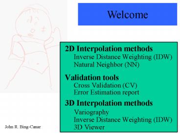
Welcome
- 2D Interpolation methods
- Inverse Distance Weighting (IDW)
- Natural Neighbor (NN)
- Validation tools
- Cross Validation (CV)
- Error Estimation report
- 3D Interpolation methods
- Variography
- Inverse Distance Weighting (IDW)
- 3D Viewer
John R. Bing-Canar
2
- Who am I? Why am I here?
- Admiral Stockdale, 1992 vice presidential
candidate
3
Overview
What is interpolation? Interpolation generates
estimates at unsampled locations. These
estimates are functionally dependent on
surrounding data. Why interpolate? In order to
generate a better picture of your data that can
be used to determine further sampling,
remediation areas, or generate risk estimates.
4
Overview
Many interpolation techniques are classified as
weighted, moving-averages. In brief, they use a
subset of the original data, weight these
selected values, and generate interpolated values
in a defined area. The weighted moving average
techniques employed by the FIELDS System are
Inverse Distance Weighting (IDW), Natural
Neighbor (NN), and Kriging. The other technique,
Spline, is not a weighted moving average
technique.
5
Overview
Limitations of interpolation? An area with a
large number of equally spaced data will likely
lead to good interpolation results, sometime
regardless of interpolation method use. A good
example is bathymetric data. An area with a
limited number of unequally spaced data values
will likely generate poor interpolation
results. No matter the data density, an
interpolation is an estimation procedure liable
to all the limitations inherent to prediction.
6
Overview
Outline of todays class 1 hour of lecture
(a.k.a., blah, blah, blah) 1.5 hours of an
in-class assignment The assignment Use FIELDS
System to interpolate a dataset using IDW and
Natural Neighbor. Use FIELDS 3D Viewer to view
and interpolate a dataset using 3D IDW
7
IDW -- ArcView
The Inverse Distance Weighted (IDW) interpolator
assumes that each input point has a local
influence that diminishes with distance. Hence,
the interpolated points (the new surface) will be
more influenced by nearby points than more
distant points.
8
IDW -- ArcView
Watson, D.F., Philip, G.M., A Refinement of
Inverse Distance Weighted Interpolation,
Geo-Processing, 2 (1985) 315-327.
ArcView appears to use an IDW equation published
by Watson and Philip (Watson and Philip, 1985)
where G(x,y) is the IDW estimation at (x,y) di
is the distance from (x,y) to (xi,yi) p is
power, a real number and f(xi,yi) is the
observed value at (xi,yi). The weights are
inversely related to distance and are scaled such
that the sum of all the weights will add to one.
9
IDW -- ArcView
For example, the estimated value at point P using
the three nearest neighbors is
Key original data are in red distances are in
purple estimate is in green
359
10
IDW -- ArcView
- The influence of other data is controlled by two
factors - power of the weighting parameter
- search option (i.e., selection of nearest
neighboring points) - In addition, a barrier can be used as a break to
limit the search for input sample points. The
barrier can represent a cliff, ridge, or some
other interruption in a landscape.
11
IDW -- ArcView
Significance of power parameter on interpolation
loss of hotspots
Reed-Keppler Park, IL
The power parameter controls the significance of
the surrounding points on the interpolated value.
A higher power results in less influence from
distant points (less smoothing). In contrast a
lower power results in more influence from
distant points (greater smoothing).
12
IDW -- ArcView
search option (radius or nearest neighbors)
13
IDW -- ArcView
Note can base radius value on semivariogram range
Significance of search options on interpolation
IDW radius 10 m power 3
IDW neighbors 10 power 3
Manistique, MI
There are two search options fixed radius and
nearest neighbors. A fixed search radius will
have a circular search distance based on the
radius set by the operator. In contrast, the
nearest neighbors has a fixed number of sample
values which will be used for interpolation. For
example, if 10 is specified, then only the
nearest 10 sample values will be selected.
14
IDW
Significance of nearest neighbors on
interpolation
IDW 20 neighbors power 4
IDW 5 neighbors power 4
Reed-Keppler Park, IL
For this data set, changing the number number of
neighbors used in the interpolation had very
little effect on the interpolated surface.
15
IDW
Note can base radius value on semivariogram range
Significance of fixed search radius on
interpolation
IDW 100 foot radius power 4
IDW 25 foot radius power 4
Reed-Keppler Park, IL
Although the previous slide of nearest neighbors
show little effect of the number of neighbors
used in the interpolation, this slide shows that
choice of the radius can have a very large impact
on the interpolated surface.
16
IDW
An additional consideration when interpolating is
the cell size or grid used. The cell size
represents the size of the cells which will
contain the interpolated values.
Original data overlain on cells
Original data
17
IDW
- The FIELDS System employs a Best Cell Size
algorithm which finds the average minimum
distance between all data points. However, the
choice of cell size may depend on several
factors - computation time
- sample volume or support (i.e., the original
data may be composites of a specific area or
volume) - units (e.g., m x m x m vs. ft x ft x m)
- evaluation of interpolation (i.e., the use of
smaller cell sizes can reveal inconsistencies of
the interpolation) (Watson, 1994)
18
IDW
Significance of cell size on interpolation
IDW cell size 10 feet 10 neighbors
power 4
IDW cell size 2.14 feet 10
neighbors power 4
Reed-Keppler Park, IL
The cell size for the figure on the left was
determined from the Best Cell Size algorithm
which gives a value of 2.14 feet. The use of a
cell size of 10 feet generates a similar picture
of the contaminant but the visualization is very
different.
19
IDW
- Limitations of IDW technique
- no extrapolation (estimated values will not be
higher or lower than the original data) - relationship of one datum to another is solely
dependent on distance directionality
(anisotropy) is not addressed - estimates obtained with IDW observations are
adequate only if sampling is sufficiently dense,
in terms of local variation. ... Otherwise the
interpolation can be subject to significant and
obvious distortion (Watson and Philip, 1985)
20
IDW
Resources Watson, D.F., and Philip, G.M., A
Refinement of Inverse Distance Weighted
Interpolation, Geo-Processing, 2 (1985)
315-327. Watson, D.F., Contouring A Guide to
the Analysis and Display of Spatial Data,
Pergamon, 1992.
21
Natural Neighbor
History Naturalists observed that larger trees
growing in a mature forest seem to be more evenly
spaced than one might expect from just the
haphazard dropping of seeds. They have
conjectured that each tree needs a certain amount
of space for its roots and branches trees that
are unable to find enough space to share with
their neighbors do not reach full size. A simple
sketch can illustrate the idea that there is some
sort of implicit dividing line between a pair of
neighbors, and a particular tree's patch of
ground is bordered by these dividing lines to
form an irregular polygon (a Voronoi polygon).
22
Natural Neighbor
Columnar pillars
Voronoi polygons
Giant's Causeway, Antrim (N. Ireland)
Salt flats
dried lake-bed, Salar de Atacama (Chile)
http//www.iinet.com.au/watson/natural.html
23
Natural Neighbor
The Natural Neighbor (NN) interpolator NN is a
weighted, moving-average technique. NN
interpolation uses geometric relationships in
order to choose and weight nearby
points. Natural Neighbor versus IDW NN differs
from IDW in the way the weighting (wi) is
performed. In NN, the weights depend on the area
about each of the data points (Voronoi polygons)
instead of the distance between data points as
with IDW (Owen, 1992). NN also differs from IDW
in the way the nearest neighboring points are
selected.
24
Natural Neighbor
The FIELDS system uses the natural neighbor code
developed and sold by Dave Watson. The code is
written in C and is called nngridr. The text and
code are in the following book Watson, D.F.,
nngridr An Implementation of Natural Neighbor
Interpolation, published by David Watson,
Australia, 1994.
25
Natural Neighbor
- Why use Natural Neighbor (NN) interpolating?
- is capable of generating estimates above and
below the maximum and minimum of the original
data (i.e., parameter-value extrapolation) - behaves well with clustered data as NN allows
an anisotropic, non-radially-symmetric response
to the original data through the use of the
gradients option
26
Natural Neighbor
The equation for the Natural Neighbor (NN)
interpolator is
where G(x,y) is the NN estimation at (x,y) n
is the number of nearest neighbors used for
interpolation f(xi,yi) is the observed value at
(xi,yi) and wi is the weight associated with
f(xi,yi).
27
Natural Neighbor
How Natural Neighbor (NN) works Delaunay
triangulation Circumcircles Voronoi
(a.k.a., Thiessen) polygons
28
Natural Neighbor
neighbor selection
Conceptualization
Jargon Voronoi polygons are sometimes called
Thiessen polygons
29
Natural Neighbor
neighbor selection
Original data
30
Natural Neighbor
neighbor selection
- Delaunay triangulation
- triangulation to nearest two neighbors
- meets Delaunay criterion
- the triangulation finds the most equilateral
triangles possible it minimizes long skinny
triangles.
31
Natural Neighbor
DEFINITION those data which lie are the same
circumcircle are called natural neighbors
- Circumcircles
- no data within circumcircles
- no other datum is closer to the centroid of the
circle - each circumcircle passes through three data
points
neighbor selection
32
Natural Neighbor
neighbor selection
- All the circumcircles must meet the Delaunay
criterion - no vertex of a triangle lies within any of the
circumcircles
33
Natural Neighbor
neighbor selection
- Voronoi tessellation
- centroids of circumcircles become vertices of
Voronoi polygon - sides are perpendicular bisects of Delaunay
triangulation ( ?__ ) - polygon creation
34
Natural Neighbor
neighbor selection
- Summary
- empty circumcircle criterion
- no vertex of a triangle lies within any of the
circumcircles (Delaunay criterion) - smallest radius criterion for any group of three
data
35
Natural Neighbor
neighbor weighting
How Natural Neighbor interpolation weighting works
Original data with Voronoi polygons
1
4
10
2
6
5
Key original data sides of Voronoi
polygons
7
8
4
9
3
36
Natural Neighbor
neighbor weighting
How Natural Neighbor interpolation weighting works
Addition of a point to be estimated (Pn) causes
changes in the Voronoi polygons
4
1
10
Pn
Key original data sides of new
Voronoi polygons sides of original Voronoi
polygons
2
6
4
5
7
8
9
3
37
Natural Neighbor
neighbor weighting
How Natural Neighbor interpolation weighting works
The addition of point (Pn) causes a new Voronoi
polygon to be formed, i.e.,
4
1
10
Pn
Key original data original Voronoi
polygons new Voronoi polygon for Pn
Pn
2
6
4
5
7
8
9
3
38
Natural Neighbor
neighbor weighting
How Natural Neighbor interpolation weighting works
The weights are determined from the changes in
Voronoi polygon areas
4
1
10
Pn
Key original data sides of new
Voronoi polygons sides of original Voronoi
polygons
2
6
4
5
7
8
9
3
39
Natural Neighbor
neighbor weighting
How Natural Neighbor interpolation weighting works
The weights are determined from the changes in
Voronoi polygon areas
4
1
10
Key area lost to Pn by area lost to Pn
by area lost to Pn by area lost to Pn
by area lost to Pn by
Pn
2
6
4
5
1
1
5
7
8
9
6
9
3
40
Natural Neighbor
neighbor weighting
How Natural Neighbor interpolation weighting works
Note that the area of Pns Voronoi polygon is
equal to the polygon areas lost to 4,1,5,9, and 6
4
1
10
Pn
Key area lost to Pn by area lost to Pn
by area lost to Pn by area lost to Pn
by area lost to Pn by area of Pn
2
Pn
The weights are determined from the changes in
Voronoi polygon areas
4
6
1
1
5
5
9
7
8
6
9
3
41
Natural Neighbor
neighbor weighting
How Natural Neighbor interpolation weighting
works The determination of the weights
associated with Pns nearest neighbors is
determined from the following equation wher
e wi(Pn) is the weight of point i (original
datum) Vi(Pn) is the difference in the Voronoi
polygon area of point i before and after
point Pn is inserted V(Pn) is the Voronoi polygon
area of Pn
42
Natural Neighbor
neighbor weighting
How Natural Neighbor interpolation works As is
evident from the equation, the weights, wi, for
all of point Pns nearest neighbors will sum to
one. Graphically,
Pn
43
Natural Neighbor
neighbor weighting
How Natural Neighbor interpolation works For
example, the weight from for Pn is
6
Difference in Voronoi polygon of after
insertion of point Pn
6
Voronoi polygon of Pn
Pn
44
Natural Neighbor
IDW compared to Natural Neighbor
45
Natural Neighbor
Resources Watson, D.F., Natural Neighbor
Sorting, The Australian Computer Journal, vol.
17, no. 4, 1995. Sibson, R., A Brief
Description of Natural Neighbor Interpolation,
Chapter 2 in Interpolating multivariate data,
John Wiley Sons, New York, 1981, pp.
21-36. Owen, S.J., An Implementation of Natural
Neighbor Interpolation in Three Dimensions,
Thesis, Brigham Young University, 1992. Watson,
D.F., nngridr An Implementation of Natural
Neighbor Interpolation, published by David
Watson, Australia, 1994.
46
Model Validation
- Model validation is the mean(s) used to quantify
the relationship of the interpolated surface (the
grid) with the original data. - Model validation is FIELDS
- Cross Validation
- Error Estimation
- How does one really know? Try collecting more
data and determine how well your interpolated
surface matches these new data values! You can
then tweak your model parameters to better fit
the new data.
47
Model Validation
cross validation
The cross validation tool in the FIELDS system
Cross validation is an iterative technique in
which an observation at a particular location is
temporarily discarded from the sample data set
the value at the same location is then estimated
using the remaining samples (Isaaks and
Srivastava, 1989). The difference between these
two values is called the cross-validated
residual. In the FIELDS system, cross validation
is performed for each unique interpolation
permutation (e.g., neighbors 1, power1
neighbors2, power1).
48
Model Validation
cross validation
Schematic of the cross validation algorithm
49
Model Validation
cross validation
The cross validation tool in the FIELDS system
Caveat Cross validation is a means of assessing
the performance of the interpolation parameters.
It is not a method which finds the best
interpolation parameters in the sense that these
parameters will more accurately interpolate the
data. The cross validation error values are the
result of a mathematical minimization algorithm.
The algorithm does not and cannot account for the
myriad chemical and physical processes which
created the locations and concentrations of the
pollutant.
50
Model Validation
error estimation
Error Estimation capabilities in the FIELDS
System The FIELDS Systems error estimation
determines the difference between each original
values and its respective interpolated
value. The five error estimation calculations
are difference absolute difference percent
absolute difference average estimation error
and average percent estimation error. The first
three methods generate point estimates. The last
two generate summary statistics (i.e., averages)
51
Model Validation
error estimation
52
Model Validation
error estimation
53
3D Interpolation
- Why 3D Interpolation?
- More accurate representation and estimation of
- pollutant concentrations
- volumes (sediment, pollutant)
- plume movement
- bathymetry
54
3D Interpolation
- If 3D interpolation is a better, then why not
always use it? - Inadequate or inappropriate data
- 3D software is very expensive
- 3D software often requires UNIX platforms
- Most 3D software is difficult to learn and use
- Rotational conventions differ by software
- Anisotropy
55
3D Interpolation
rotational conventions
56
3D Interpolation
rotational conventions
FIELDS 3D Viewer rotational conventions
57
3D Interpolation
spatial correlation
Spatial Correlation and anisotropy Spatial
correlation data that are "close together, in
time or space, are likely to be correlated (i.e.,
cannot be modeled as statistically
independent)..." (Cressie, 1991). Note mining,
D.G. Krige, Ecole des Mines. Spatial correlation
violates one of the major tenents of statistics
independence. However, we can take advantage of
the spatial correlation to help us interpolate
(e.g., kriging). One means to test for spatial
correlation (i.e., lack of independence) is to
model the spatial correlation (dependence) of the
data. The modeling is called variography. If
the data have different spatial correlations by
direction, then the data exhibit anisotropy.
58
3D Interpolation
spatial correlation
Idealized semivariogram
semivariogram a measure of dissimilarity over
distance
59
Spatial correlation and anisotropy
60
Spatial correlation and anisotropy
Directional semivariogram
Best fit semivariogram
Dip angle from horizontal
Azim. azimuth, clockwise from 0, north
SAGE2001
61
Spatial correlation and anisotropy
Directional semivariograms
Note anisotropy
SAGE2001
62
Spatial correlation and anisotropy
Directional semivariograms
Note anisotropy
Range ?17 m
Range ?10 m
SAGE2001
63
Spatial correlation and anisotropy
Directional semivariogram
SAGE2001
64
Rose Diagrams
Spatial correlation and anisotropy
Note anisotropy
65
Ellipsoid Diagrams
Spatial correlation and anisotropy
Note anisotropy
66
Spatial correlation and anisotropy
Arc View
67
Spatial correlation and anisotropy
Directional semivariograms
Note the lack of anisotropy
SAGE2001
68
Spatial correlation and anisotropy
Directional semivariograms
Note the lack of anisotropy
SAGE2001
69
In-class Assignment The assignment Use FIELDS
System to interpolate a dataset using IDW and
Natural Neighbor Use FIELDS 3D Viewer to view
and interpolate a dataset using 3D IDW
Recommended
