
GROUNDWATER ISSUES PowerPoint PPT Presentation
1 / 44
Title: GROUNDWATER ISSUES
1
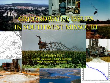
GROUNDWATER ISSUES IN SOUTHWEST MISSOURI
Jim Vandike, R.G. Missouri Department of Natural
Resources Water Resources Center-Rolla
2
Geologic Map of Southwest Missouri
Springfield Plateau
Mississippian-Age Strata
3
Geologic Map of Southwest Missouri
Osage Plains
Pennsylvanian Age Strata
4
PRECIPITATION.
Average 35 to 47 inches per year
5
ESTIMATED GROUNDWATER RECHARGE
Glacial drift 1-4 in/year
West-Central Missouri 1-4 in/year
St. Francois Mts. 1-4 in/year
Salem Plateau 6-14 in/year
Springfield Plateau 6-12 in/year
Southeast Lowlands 6-10 in/year
6
Available Aquifers...
Springfield Plateau Aquifer
Burlington-Keokuk Limestone Reeds Spring
Formation Elsey Formation
7
RESIDUUM
WARSAW FORMATION
Springfield Plateau Aquifer 0-450 feet
BURLINGTON LIMESTONE
ELSEY FORMATION
REEDS SPRING FORMATION
PIERSON LIMESTONE
Ozark Confining Unit 0 to gt 60 feet
NORTHVIEW FORMATION
COMPTON LIMESTONE
CHATTANOOGA SHALE
COTTER DOLOMITE
JEFFERSON CITY DOLOMITE
Ozark Aquifer 1,000-1,600 feet
ROUBIDOUX FORMATION
GASCONADE DOLOMITE
EMINENCE DOLOMITE
POTOSI DOLOMITE
8
Springfield Plateau Aquifer Thickness
Data Source USGS
9
Groundwater Storage, Springfield Plateau
Aquifer (Billion Gallons)
117
671
435
20
483
752
720
168
654
55
306
1
243
10
Springfield Plateau Aquifer...
Estimated Storage 4,625 Billion Gallons
Typical Yield 5 to 20 gallons per minute
Commonly used for private water supply except in
Greene and northern Christian counties
11
Springfield Plateau Aquifer Flooded Underground
Mine Workings
12
Springfield Plateau Aquifer Flooded Underground
Mine Workings
Storage volume Unknown
Production during dewatering of the
Oronogo- Duenweg mining belt 13,000 gallons per
minute (may include considerable recirculated
water)
Typically poor water quality Excessive sulfate,
total dissolved solids, hardness, metals (iron,
manganese, zinc, lead, cadmium.)
13
RESIDUUM
WARSAW FORMATION
Springfield Plateau Aquifer 0-450 feet
BURLINGTON LIMESTONE
ELSEY FORMATION
REEDS SPRING FORMATION
PIERSON LIMESTONE
Ozark Confining Unit 0 to gt 60 feet
NORTHVIEW FORMATION
COMPTON LIMESTONE
CHATTANOOGA SHALE
COTTER DOLOMITE
JEFFERSON CITY DOLOMITE
Ozark Aquifer 1,000-1,600 feet
ROUBIDOUX FORMATION
GASCONADE DOLOMITE
EMINENCE DOLOMITE
POTOSI DOLOMITE
14
Northview Formation
15
Compton Formation
Chattanooga Shale
16
Ozark Confining Unit Thickness
80
lt10
40
40
Data Source USGS
17
Available Aquifers...
Springfield Plateau Aquifer
Burlington-Keokuk Limestone Reeds Spring
Formation Elsey Formation
Ozark Aquifer
Cotter Dolomite Jefferson City Dolomite Roubidoux
Formation
Gasconade Dolomite Eminence Dolomite Potosi
Dolomite
18
RESIDUUM
WARSAW FORMATION
Springfield Plateau Aquifer 0-450 feet
BURLINGTON LIMESTONE
ELSEY FORMATION
REEDS SPRING FORMATION
PIERSON LIMESTONE
Ozark Confining Unit 0 to gt 60 feet
NORTHVIEW FORMATION
COMPTON LIMESTONE
CHATTANOOGA SHALE
COTTER DOLOMITE
Low-Yield
JEFFERSON CITY DOLOMITE
Ozark Aquifer 1,000-1,600 feet
ROUBIDOUX FORMATION
GASCONADE DOLOMITE
High-Yield
EMINENCE DOLOMITE
POTOSI DOLOMITE
19
Ozark Aquifer Thickness
Data Source USGS
20
Predevelopment Potentiometric Map, Ozark Aquifer
800
Divide
1000
Groundwater
800
Data Source USGS
21
Groundwater Storage, Ozark Aquifer (Billion
Gallons)
9,439
7,982
8,064
11,614
13,256
7,353
7,363
11,449
3,760
8,697
5,642
9,510
3,526
22
Ozark Aquifer...
20 - gt1000 gpm
Estimated storage 107 trillion gallons
Most important public water supply aquifer in
southwest Missouri
Nearly all of the major water use in
southwest Missouri is from the Ozark aquifer
High-yield wells may be from 600 to gt1,700 ft
deep and typically contain 250 to 550 feet of
casing
23
Total Dissolved Solids in the Paleozoic Aquifers
Marginal to Poor Quality Groundwater
Zone
Transition
water
Saline
Good Quality Groundwater
water
Fresh
24
Public Water Supply Wells
25
Available Aquifers...
Springfield Plateau Aquifer
Burlington-Keokuk Limestone Reeds Spring
Formation Elsey Formation
Ozark Aquifer
Cotter Dolomite Jefferson City Dolomite Roubidoux
Formation
Gasconade Dolomite Eminence Dolomite Potosi
Dolomite
St. Francois Aquifer Bonneterre Formation Reagan
(Lamotte) Sandstone
26
Southwest Missouri Groundwater Use...
27
Public Water Supply Wells. About 1,400
40
12
21
155
114
39
67
99
74
351
192
151
61
28
All Wells Drilled After September 1987
29
1990 Groundwater Use Reported by Major Water
Users.. 12.7 Billion Gallons
30
1990 Groundwater Use, Major Water Users (Million
Gallons)
514
808
624
377
2,289
2,381
883
612
401
553
1,516
1,133
819
31
2000 Groundwater Use Reported by Major Water
Users.. 20.3 Billion Gallons
32
2000 Groundwater Use, Major Water Users (Million
Gallons)
714
1,700
795
458
3,796
4,171
1,047
1,323
866
553
2,114
1,322
1,471
33
1990-2000 Increase in Groundwater Use.
7.7 Billion Gallons or 60.4
34
2006 Groundwater Use Reported by Major Water
Users.. 25.2 Billion Gallons
35
2006 Groundwater Use, Major Water Users (Million
Gallons)
646
2,499
260
690
5,548
6,302
1,035
2,510
1,017
785
2,090
1,516
859
36
2000-2006 Increase in Groundwater Use.
4.9 Billion Gallons or 24.1
37
Safe Yield.
The amount of water that can be withdrawn from an
aquifer annually without producing an undesired
result.
38
2007 Groundwater-Level Observation Well
Network (Currently 110 wells, expanding to about
156 wells by July 2008)
39
Sutron 8210 or SatLink II Data Collection
Platforms
40
Southwest Missouri Groundwater-Level Observation
Wells
35 Groundwater-level observation wells in
southwestern Missouri
Willard
41
Southwest Missouri Groundwater-Level Observation
Wells
Wells added since July 1, 2006 (14 wells)
Willard
42
Southwest Missouri Groundwater-Level Observation
Wells
Well pairs drilled by MDNR-Water Resources Center
Willard
43
(No Transcript)
44
Butterfield - Springfield Plateau Aquifer, June
15 to November 15, 2007
Butterfield - Ozark Aquifer, June 15 to November
15, 2007
45
Summary and Conclusions.
- Southwest Missouri has a lot of groundwater.
- Combined, the Springfield Plateau aquifer, Ozark
- aquifer, and St. Francois aquifer in the 13
county - area contain an estimated 116 trillion gallons.
- Major water users in the 13 county area report
- using about 25 billion gallons per year.
- Groundwater-level declines have occurred in the
- Ozark aquifer in areas where usage greatly
exceeds - recharge.
46
Questions???
To Obtain Real-Time and Historic Groundwater
Data.
http//www.dnr.mo.gov/env/wrc/groundwater/gwnetwor
k.htm
Recommended
