
Robotic Mapping and Exploration of Abandoned Mines PowerPoint PPT Presentation
1 / 33
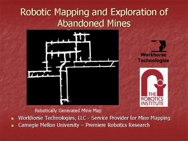
Title: Robotic Mapping and Exploration of Abandoned Mines
1
Robotic Mapping and Exploration of Abandoned Mines
Workhorse Technologies
Robotically Generated Mine Map
- Workhorse Technologies, LLC - Service Provider
for Mine Mapping - Carnegie Mellon University Premiere Robotics
Research
2
Mine Mapping Results from Boreholes
- Wet and Dry Ferret
- Early Results
- Lots Branch, Boone County, WV
- Riola Mine, Georgetown, IL
- Ore Mines, Oklahoma
- Future Borehole Robots
3
Ferret 3
Pan Axis
- Lowers into 6 borehole
- Pan and tilt motion
- 150ft range laser sensor
- Automated scan data collection
- Camera lights
Laser Laser Tilt
Camera Camera Tilt
4
Wet Ferret
Tether
Support Frame
- 5 borehole deployable
- Profiling sonar
- Readily deployed
- 300ft sensor range
- Magnetic sensor orientation
- Submersible to great depths
Sonar Profiling Unit
Underwater Camera
Compass
5
Laser Model from a Single Borehole In Coal
6
T-intersection in a Coal Mine
7
Map of Submerged Pillars in a Limestone Mine
8
Coal Mine Lots Branch WV
Models collected from abandoned dry coal mine
through 4 boreholes using Ferret 3 Laser For
DAppolonia, Monroeville, PA Drilling
verification task on Geophysical Demonstration
Projects for MSHA
Plan View for boreholes 31 and 34
9
Field viewer for laser data
10
BH 31 Plots, Lots Branch, WV
Orthographic View
Sectional View
11
VRML files Lots Branch, WV
BH 25
BH 31
12
Riola Mine, Illinois
Models collected from 4 boreholes in flooded coal
mine using Wet Ferret Sonar For Blackhawk a
division of Zapata Engineering Drilling
verification task on Geophysical Demonstration
Projects for MSHA
13
Match with Map, Riola Mine, Illinois
14
Ground truth plot, Riola Mine, IL
15
Sonar scan from 1 elevation
16
VRML view of Riola Mine, IL
Composite model from 3 holes
17
Flooded Ore Mine in Oklahoma
Sonar Composite Model of Mine From 1 borehole
18
Ore Mine in Oklahoma
Sonar Composite Model of Mine From 1
borehole overlayed and aligned with mine map
19
3 Ferret
- 3 hole
- 10 minute scan
- Sealed
- Half weight
- Half length
- 1 person deployment
- New program with PA-DEP
20
Borehole DeployedMobile Robot
21
Borehole Deployed Mobile Robot (Helix)
22
Mine Fish Underwater Mapping Robot
23
Subterranean Robot Archetypes
Static
Borehole
Mobile
Portal
Wet
Dry
24
Mine Mapping w/ Mobile Robots
25
Mine Exploration via Portal
26
Creating 3D Maps
27
Groundhog
- Autonomous Mobile robot vehicle
- 4 wheel drive steer
- 8 ft turning radius
- Battery powered
- Hydraulically driven
- 1 mile range
28
Long Traverse, Coal Mine, WV
- 2.25km of traverse
- 1.5 error
- 3D Model Creation
29
Cave Crawler
30
Continuous Laser Scanning
31
Real-Time Tunnel Imaging
32
Mine Fire Experiments
33
Contacts
Workhorse Technologies
- Dr. Red Whittaker, Professor
- Web www.ri.cmu.edu
- E-mail red_at_ri.cmu.edu
- Phone (412) 268-6559
- Fax (412) 268-1338
- Carnegie Mellon University
- Robotics Institute
- Field Robotics Center, NSH 2109
- 5000 Forbes Avenue
- Pittsburgh, PA 15213
Chuck Whittaker, Operations Web
www.workhorsetech.com E-mail chuck_at_workhorsete
ch.com Phone (412) 979-2632 Fax (412)
268-1338 Workhorse Technologies, LLC 484 W 7th
Ave Homestead, PA 15120
Recommended
