
Adeos PowerPoint PPT Presentations
All Time
Recommended

The 37th ARGOS Operation Committee Meeting. June 11-13, 2003 Les Saintes-Marie-de ... POLDER (Polarization and Directionality of the Earth's surface) Check out phase ...
| PowerPoint PPT presentation | free to view

Multisensors remote sensing of cloud properties from POLDER2/Adeos2 and MODIS/Terra J. Riedi, C. Oudard, JM. Nicolas, F. Parol and L. Labonnote,
| PowerPoint PPT presentation | free to view

... polarized passive microwave radiometer developed by NASDA. ... radiometers. ... Radiometer sensitivity. Time series of radiometric sensitivity while ...
| PowerPoint PPT presentation | free to download

ADEOS-II Initial Operation and Evaluation Result and Routine Operation status ... POLDER L0 data edit processing performance. Online delivery performance ...
| PowerPoint PPT presentation | free to view

... operation and evaluation procedure regarding Satellite,TT&C ... Check Out Phase. Cal/Val Phase. Routine Operation Phase. Routine Operation Phase. Overview ...
| PowerPoint PPT presentation | free to view

1. Assimilation of POLDER Aerosol Optical Thickness (AOT) into the LMDz-INCA ... POLDER (Polarization and Directionality of the Earth Reflectance aboard ADEOS) ...
| PowerPoint PPT presentation | free to view

ADvanced Earth Observing Satellite-II (ADEOS-II) , the successor ... Solar Array Paddle: Approx. 3 24m. Mass 3.68t. Power 5,350W (EOL) Orbit. Altitude: 802.92km ...
| PowerPoint PPT presentation | free to view

The 38th ARGOS Operations Committee Meeting. 1. June 30th, 2004. JAXA DCS processing system ... NOAA ARGOS Receiving System. DCS equipments in EOC Hatoyama ...
| PowerPoint PPT presentation | free to view

2003 January 22
| PowerPoint PPT presentation | free to download

... NASDA. JERS-1 project Forest project is going. Interferometry (water vapor) ... ALOS project Exercise by Airborne SAR,JERS-1 SAR, Allocation of the sensor time, ...
| PowerPoint PPT presentation | free to view

Argos: Where we are Where we re going by Debbie Shaw Service Argos, Inc.
| PowerPoint PPT presentation | free to download
Research in Earth Observation ... systems using imaging spectrometers and LiDAR; Momentum and mass budgets of surging glaciers using interferometric SAR; ...
| PowerPoint PPT presentation | free to download

... is a global system for locating, collecting, and transmitting data from remote ... mission of Argos DCS is the location and collection of data to support ...
| PowerPoint PPT presentation | free to download

Ocean Productivity and Export Flux Data derived from satellite: Biomass (concentration, type) Temperature Light Winds Eddies Sea Ice Data requiring models
| PowerPoint PPT presentation | free to download

The Global Satellite Mapping of Precipitation (GSMaP) project: ... Univ., Tokyo Univ., Shimane Univ., Hokkaido-Tokai Univ., NIED) ...
| PowerPoint PPT presentation | free to view

NASA GIFTS Measurement Concept Overview 4th Workshop on Hyperspectral Science (MURI, GIFTS, GOES-R) University of Wisconsin Madison (April 27-28, 2004)
| PowerPoint PPT presentation | free to download

s36 = (36H - (s (36V a) b ) ) / fac. 36H. 36V. a. b. s. calm ... parameters a ,b, s, fac depend on SST. fac. Removal of relative wind direction dependency ...
| PowerPoint PPT presentation | free to view

JAXA and science groups have been investigating the next mission of GLI for ... visible-infrared, middle-resolution, and global-coverage radiometer (S-GLI) ...
| PowerPoint PPT presentation | free to download

In this lecture the group of satellites in white text are ... Advanced Visible and Near Infrared Radiometer (AVNIR) Ocean Color and Temperature Sensor (OCTS) ...
| PowerPoint PPT presentation | free to view
Terra EOS Satellite (ASTER, MODIS, CERES, MOPITT, MISR) MAJOR EARTH OBSERVING SATELLITES ... POLDER (Polarization and Directionality of the Earth's Reflectance) ...
| PowerPoint PPT presentation | free to download

... has a near-polar Sun-synchronous orbit. Height of 830km. Period of 101 ... in satellite estimates and ECMWF and NCEP-NCAR calculations suggest satellites ...
| PowerPoint PPT presentation | free to download

Towards a global aerosol climatology ... is well-correlated with AERONET. Kaufman et al. (2005) ... correlates well against. two derivations from. AERONET. ...
| PowerPoint PPT presentation | free to download

ReEnvisioning the Ocean: The View from Space
| PowerPoint PPT presentation | free to view
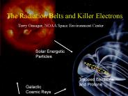
The Radiation Belts and Killer Electrons Terry Onsager, NOAA Space Environment Center Solar Energetic Particles Trapped Electrons and Protons Galactic
| PowerPoint PPT presentation | free to download

Upwelling radiation is scattered by ice. particles in the tops of ... Conversion from retrieval to rain rate (algo.) Temporal sampling. ERRORS: LIMITATIONS: ...
| PowerPoint PPT presentation | free to download

Coastal Ocean Nowcasting and Forecasting for Homeland Security. Scott Glenn ... (GLI/POLDER) ENVISAT(MERIS) Europe 2002. CODAR HF Radar. Long-Range ...
| PowerPoint PPT presentation | free to download

Programming Embedded System in C and C++ What is Embedded System? , ; ...
| PowerPoint PPT presentation | free to view

Energy Management. Climate Change. Water Resource Management. Weather ... Constellation Satellites. Microwave radiometer. Global precipitation every three hours ...
| PowerPoint PPT presentation | free to view

Mean seasonal cycle in precipitation in the NAME region ... here; thanks also to Robert Joyce, John Janowiak, Mingyue Chen and Yelena Yarosh ...
| PowerPoint PPT presentation | free to download

Still some issues (mainly data policy for product order) are remaining. ... I am just sent from Japan by Mobile mail. CEOS/WGISS 2003 in Chang-Mai. 4 ...
| PowerPoint PPT presentation | free to view

Satellite observations of atmospheric chemistry (MOPITT, IASI, ACE) for the ... Solar occultation measurements. from the ACE/SCISAT-1 instrument: ...
| PowerPoint PPT presentation | free to view

The NorthEast Observing System Scott Glenn, Oscar Schofield and many others Coastal Ocean Observatio
| PowerPoint PPT presentation | free to download

Title: PowerPoint Presentation Author: Dr. Mark Matties Last modified by: Dr. Mark Matties Created Date: 7/17/2002 3:27:31 PM Document presentation format
| PowerPoint PPT presentation | free to view
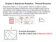
Chapter 6: Blackbody Radiation: Thermal Emission
| PowerPoint PPT presentation | free to download

Title: UZAKTAN ALGILAMADA H DROMETR UYGULAMALARI Author: Melek Last modified by: Melek Created Date: 5/10/2006 4:35:01 PM Document presentation format
| PowerPoint PPT presentation | free to download

Microwave Remote Sensing: Principles and Applications
| PowerPoint PPT presentation | free to download

... s s s s s s s s s s s s s s s s s s s s s s sPs s s s s s s s s s ss s s s s's' ... 456789:CDEFGHIJSTUVWXYZcdefghijstuvwxyz GpSs tFTO ...
| PowerPoint PPT presentation | free to view
Remote Sensing and Infectious Diseases
| PowerPoint PPT presentation | free to download

Wind speed correction table and extension to strong wind condition 20m/s. Conversion table PWI (Precipitalbe water index) to PWA (Precipitable water amount) ...
| PowerPoint PPT presentation | free to view

Collocation Methodology. Maximum Temporal Displacement: 90 min ... Collocations are binned in 5m/s intervals according to the Windsat retrieved wind speeds. ...
| PowerPoint PPT presentation | free to view

Global Cloud Characteristics (Cloudsat & CALIPSO) T. Global ... Global sea surface salinity (Aquarius) Improved space/time scales of ocean topography (OSTM) ...
| PowerPoint PPT presentation | free to view

... Atmospheric Research at Colorado State University Annual Review Jan 7-9, 2003 ...
| PowerPoint PPT presentation | free to view

THE EXPANDED SPACEBASED COMPONENT OF THE WORLD WEATHER WATCHS GLOBAL OBSERVING SYSTEM
| PowerPoint PPT presentation | free to download

... E, Advanced Microwave Scanning Radiometer for EOS. AMSR also flies ... Advanced Microwave Scanning Radiometer for EOS (AMSR-E) Global Sea Surface Temperatures ...
| PowerPoint PPT presentation | free to view


Cloud Filtering Algorithm For Nadir Viewing FTIR Spectrometers Over Oceanic Regions
| PowerPoint PPT presentation | free to download

HALONI IN ALTERNATIVNE SNOVI V LU I PREDPISOV Irena Male i Ministrstvo za okolje in prostor Agencija RS za okolje Posvet Gasilniki, URSZR/ marec 2006
| PowerPoint PPT presentation | free to download

EM wavelength (defines radiometer operating frequency) EM polarization ... SSM/I is a seven channel passive microwave radiometer operating at four frequencies ...
| PowerPoint PPT presentation | free to view

Now; Web, FTP, NCAR MSS, writable media ... ESA ERS-1 and ERS-2 Scatterometer Ocean Surface Winds. NSCAT Scatterometer Ocean Winds ...
| PowerPoint PPT presentation | free to view

Turtorial Training National Taiwan Ocean University Passive microwave remote sensing of the ocean-atmosphere system Leonid M. Mitnik V.I. Il ichev Pacific ...
| PowerPoint PPT presentation | free to download

History of Remote Sensing DUYGU BAYHAN 110020229
| PowerPoint PPT presentation | free to view

Supported by EC, FP5 Energy, Environment and Sustainable ... Hydrology and Land Surface Process Models ... COld REgions Hydrology High-resolution Observatory ...
| PowerPoint PPT presentation | free to view

... from ACE-Asia? ... Combining ACE-Asia suborbital and satellite measurements ... B. Huebert, ACE-Asia, 12/2002. Dust acts like a sponge, soaking up pollutant ...
| PowerPoint PPT presentation | free to download

Global Pattern and Transport of Aerosols Rudolf B' Husar CAPITA, Washington University, St' Louis
| PowerPoint PPT presentation | free to view
Linux Real-Time Introduzione a POSIX1003.1b E.Mumolo, DEEI mumolo@units.it Il Sistema Operativo Linux Numerazione versioni di linux: a.b.c (es. 2.4.16) dove a no ...
| PowerPoint PPT presentation | free to download

Chapter 5 The Ocean Heat Budget Physical oceanography Instructor: Dr. Cheng-Chien Liu Department of Earth Sciences National Cheng Kung University Last updated: 16 ...
| PowerPoint PPT presentation | free to view