
Part 4: Contextual Classification in Remote Sensing - PowerPoint PPT Presentation
Title:
Part 4: Contextual Classification in Remote Sensing
Description:
Part 4: Contextual Classification in Remote Sensing * There are different ways to incorporate contextual information in the classification process. – PowerPoint PPT presentation
Number of Views:47
Avg rating:3.0/5.0
Title: Part 4: Contextual Classification in Remote Sensing
1
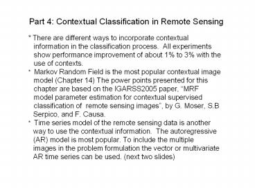
Part 4 Contextual Classification in Remote
Sensing
- There are different ways to incorporate
contextual - information in the classification process.
All experiments - show performance improvement of about 1 to 3
with the - use of contexts.
- Markov Random Field is the most popular
contextual image - model (Chapter 14) The power points presented
for this - chapter are based on the IGARSS2005 paper,
MRF - model parameter estimation for contextual
supervised - classification of remote sensing images, by
G. Moser, S.B - Serpico, and F. Causa.
- Time series model of the remote sensing data
is another - way to use the contextual information. The
autoregressive - (AR) model is most popular. To include the
multiple - images in the problem formulation the vector
or multivariate - AR time series can be used. (next two slides)
2
(No Transcript)
3
(No Transcript)
4
Part 5 Other Topics
- Normalized Hilbert Transform (Chapter 1)
- To deal with both nonstationary and nonliear
processes typically experienced in remote sensing
data such as ocean waves, Long and Huang proposed - normalization procedure for empirical mode
decomposition (NEMD) and Hilbert transform (NHT),
- which provides the best overall approach
to determine - the instantaneous frequency (IF) for the
nonlinear and - nonstationary data.
5
Other Topics continued-1
- Performance Assessment (Chapter 26)
- a) After a classification is being carried
out, its accuracy can be determined if ground
truth is available. Classification accuracy
refers to the extent to which the classified
image or map corresponds with the description of
a class at the earth surface. This is commonly
described by an error matrix, in which the
overall accuracy and the accuracy of the
individual classes is calculated. - b) The ?-statistic derived from the error
matrix is based on the difference between the
actual agreement in the error matrix, and the
chance agreement. The sample outcome is the
statistic, an estimate of ? is defined by - where p0 and pc are the actual agreement
and the chance agreement Let nij equal the number
of samples classified into
6
Other Topics continued-2
- category i, as belonging to category j in the
reference data. The value can be calculated
using the following formula, - where k is the number of classes, nii is the
number of correctly classified pixels of category
i, ni is the total number of pixels classified
as category i, ni is the total number of actual
pixels in category i and n is the total number of
pixels. - Inspite of its shortcomings, the ?-statistic
is more suitable for - performance assessment. The authors
proposed the use of Bradley-Terry model to assess
the uncertainly in an error matrix, which takes
into account of the preference of one category
over another category.
7
Thank You !!! Q A
Recommended
CrystalGraphics Presentations


