
Projeto da REDEPETRO - PowerPoint PPT Presentation
1 / 21
Title:
Projeto da REDEPETRO
Description:
Biological Oceanography. Biotic. Offshore Basins. Data center structure. Operational center ... National Oceanographic Data Center (NODC-USA) NOAA ... – PowerPoint PPT presentation
Number of Views:82
Avg rating:3.0/5.0
Title: Projeto da REDEPETRO
1
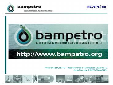
Projeto da REDEPETRO Rede de Ciência e
Tecnologia do Estado do RJApoio Financeiro
FINEP/CTPetro/CNPq
2
BAMPETROIs an environmental database related to
the hydrocarbon exploration and production
activities What for? - Store the environmental
information - Define the data standards -
Promote the data quality control - Offer
visualization tools - Disseminate the
information on the web
3
- What is stored?
- Any kind of environmental data with a geospatial
component, including - - Maps
- - Spreadsheets
- - Images
- - Time series
- What is available?
- - Geospatial data
- - Metadada (data description)
4
Kinds of environmental data
5
Data center structure Operational center ?
Database center Research Team ? Information
technology team? Environmental study team
Software Database ? Oracle 9.2 i
Geoprocessing ? ArcInfo Web Server ? APACHE
TomCat
6
Academic StructureBAMPETRO is organized as a
research network including the following
institutions ? Observatório Nacional MCT ?
Universidade Federal Fluminense ? Universidade
Federal do Rio de Janeiro ? Universidade do
Estado do Rio de Janeiro ? Universidade Estadual
do Norte Fluminense ? Instituto Macaé de
Metrologia e Tecnologia
7
Main Partners
8
- Geophysical Database
- Geographical area
- ?9oN - 54oW -22.5oE e -34oS
- Kinds of data stored
- ? Bathymetry
- ? Magnetometry
- ? Gravity
- ? High resolution seismic
- ? Seismology
9
Main data sources
- National and Internationa DataCenters
- ? GeoDAS Geophysical Data System (about
900.000 informations) - ? BNDO Banco Nacional de Dados Oceanográficos
- ? Seismolgy catalog IAG/USP
- Other Brazilian Navy surveys data
- Digital convertion of more than 2000 bathymetric
charts (depth points) surveyed by the Brazilian
Navy - Surveys executed by national and international
research institutes - Surveys executed by petroleum operators companies
10
Conceptual Model? Geophysical Data
11
Bathymetry
- Source GEODAS
12
Bathymetry
- Source Navigation charts (DHN/CHM)?
More than 2000 charts were vectorized? Digital
images and XYZ files were generated
13
- Search Types
- ?Type of data
? Day/Month/Year ? Latitude/Longitude ?
Sedimentary Basins
14
- Exporting Data
? Spreadsheet format
15
Accessing Data
- ? Public data free access through the internet
- ? Restricted data using password
- ? All users must fill out an identification file
16
- Participating Institutions
- Agência Nacional de Águas ANA
- Agência Nacional de Petróleo ANP
- Aeroportos Brasileiros S.A - INFRAERO S.A
- Banco Nacional de Dados Oceanográficos BNDO /
CHM - Banco Central do Brasil
- Centro de ciências Tecnológicas da Terra e do Mar
- CTTMar/UNIVALI - Serviço de Previsão do Tempo
- Centro de Estudos do Mar CEM/UFPr
- Companhia de Pesquisa de Recursos Minerais
CPRM/SGB - FAO Statistical Databases
- Instituto Brasileiro de Geografia e Estatística -
IBGE - Instituto Astronômico e Geofísico IAG/USP
- Inst. Bras. do Meio Amb. e Rec. Naturais
Renováveis IBAMA
17
- Participating Institutions
- Inst. Nacional de Pesquisas Espaciais INPE
Imagens e dados de satélite - Inst. Nac. de Estudos e Pesquisa Educacionais
Anísio Teixeira INEP/MEC - Sistema de estatísticas Educacionais
(Edudatabrasil) - Instituto Oceanográfico da Universidade de São
Paulo IOUSP - Instituto de Pesquisa Econômica Aplicada
IPEADATA - Inst. do Patrimônio Histórico e Artístico
Nacional IPHAN/MC - Laboratório de Geologia Marinha LAGEMAR/UFF
- Laboratório de Gestão do Território LAGET
- Ministério da Saúde Datasus
- Ministério do Meio Ambiente MMA/SQA
- Ministério do Trabalho e Emprego Disseminação
de Estatísticas do Trabalho - Ministério dos Transportes DIAGP
18
- Participating Institutions
- National Atmospheric and Space Administration
NASA - Satellite Mission TOPEX/POSEIDON
- National Imagery and Mapping Agency NIMA
- National Geophysical Data Center NGDC
- GEOphysical Data System - GEODAS
- National Oceanographic Data Center (NODC-USA)
NOAA - Rede de Meteorologia do Comando da Aeronáutica -
REDEMET - Forca Aérea Brasileira - FAB Divisão de
Meteorologia - D - MET - Sistema Integrado de Gerenciamento de Recursos
Hídricos - SIGRH - Superintendência Estadual de Rios e Lagoas
SERLA - University of Wyoming Department of Atmospheric
Science - Tribunal Superior Eleitoral TSE
- World Ocean Circulation Experiment WOCE
- WOCE Data Information Unit - WDIU
19
- Why should you be a partner?
- ? To be a part of the scientific process
(disseminate the information) - ? Makes your date visible
- ? Encourage others to participate ( you will be
able to see and use his data as well ! )
20
Advantages
Map CPRM
Bathymetry DHN and GEODAS
- ? Facilitate the location, visualization,
integration and exchange of environmental data. - ? Making easy the licensing processes
- ? Support the Regulating and Inspection
Environmental Agencies. - ? Opens up business opportunities
- Proprietary environmental data can be
negotiated between companies. - ? Generates applied research
- Shared data will be requested for use in
multiples research projects.
Earthquakes IAG-USP
Waves IEAPM
21
- Concluding
- Visit WWW.bampetro.org
- Search the possibility to participate ?Share
your data (or at least your metadata) - ?Help to develop standards
- ?Encourage others to participate
Recommended
CrystalGraphics Presentations


