
Research - PowerPoint PPT Presentation
Title:
Research
Description:
Research – PowerPoint PPT presentation
Number of Views:29
Avg rating:3.0/5.0
Title: Research
1
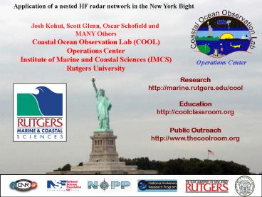
Application of a nested HF radar network in the
New York Bight
Josh Kohut, Scott Glenn, Oscar Schofield and
MANY Others Coastal Ocean Observation Lab
(COOL)Operations Center Institute of Marine and
Coastal Sciences (IMCS)Rutgers University
Operations Center
Research http//marine.rutgers.edu/cool
Education http//coolclassroom.org
Public Outreach http//www.thecoolroom.org
2
Coastal Ocean Observation Lab Operations Center
CODAR Network
Cable
Glider Fleet
X-Band
L-Band
3
5 MHz
CODAR System Antennas
Receive Antenna
Transmit Antenna
25 MHz and 13 MHz
4
Typical CODAR Remote Site Setup
Transmitter Receiver
5
Long Range (5 MHz) Range 200km
Resolution 3-6km Medium Range (13 MHz)
Range 60km Resolution 3km Standard Range
(25 MHz) Range 45km Resolution 1-3km
6
CODAR Total Vector Calculation
Kilometers
CODAR North
0 5 10
Little Egg Harbor
CODAR Central Site
Great Bay
LEO-15
A T L A N T I C O C E A N
CODAR South
Atlantic City
7
Standard range 25 MHz System
8
Long-range 5 MHz System
9
Long range Current Coverage
10
Nested Surface Current Coverage
11
National Weather Service Forecast Office - Mount
Holly, NJ
Marine/Aviation Desk
CODAR Storm Wave Data January 2004
NWS Mount Holly uses CODAR wave data in a linear
regression wave model. This model is part of a
Surf Zone Forecast including rip current
probability along the New Jersey and Delaware
Coasts
County Warning Area
12
Applications
13
Tanker runs aground off Cape May, NJ
At approximately 0715 EDT the T/V CRUDE TARGET
grounded while enroute into Delaware Bay. The
position of the ship is 3848.5 N / 07437.3 W or
approximately 13 miles ESE of Cape May, NJ. The
ship is carrying 42 million gallons of West
African Crude For comparison, the Exxon Valdez
spilled about 11 million gallons of the 53
million gallons of crude oil it was carrying
For this particular incident, we went to the
Rutgers CODAR site, to help with the calibration.
The web site provided not only data but valuable
analysis on the data. Through a phone number
provided on the web site I also contacted Josh
Kohut who was very helpful in providing
additional information concerning the real-time
data as well as personal observations of how the
coastal currents typically behave off the New
Jersey coastline. - Glen
Watabayashi Oceanographer
(NOAA/OPR/HAZMAT)
14
The wind switches to a more upwelling favorable
direction and glider ru02 is retasked to head up
toward the freshwater outflow. During the
mission, the glider looses communication with
mission control and begins to drift.
15
The days following the last glider communication,
the wind and currents oscillated between
upwelling and downwelling conditions
Downwelling favorable
Upwelling favorable
16
100 virtual drifters released to simulate the
potential location of ru02
d v t
d distance traveled during each time step v
surface velocity of closest CODAR grid point (/-
5 cm/s) t 1 hour (time sampling of the CODAR
system)
17
A search area is defined for the gliders
probable location 10 days after communication is
lost
10 nm
22 nm
18
Civil Air Patrol
Glider ru02 as seen from The search plane
Communication Plane
Search Plane
19
Integration of Coastal Ocean Dynamics Application
Radar (CODAR) surface current data and Short term
Predictive System (STPS) into the Search and
Rescue Optimal Planning System (SAROPS)
Josh Kohut, Hugh Roarty, Scott Glenn, Arthur
Allen, Paul Hall, Dave Ullman, Jim ODonnell,
and Todd Fake
20
Project Overview
Can HF radar data improve the effectiveness and
the efficiency of SAR operations in coastal
waters?
Does the use of HF Radar data result in improved
SAR trajectory predictions? - SLDMB deployment
(July August 2004) - Monte Carlo SAR
modeling Is it possible to reliably access
real-time HF Radar data and incorporate it into
an operational SAR model? - SAROPS/SARMAP -
Environmental Data Server (EDS) - Operational
test deployment (October November 2004)
21
Coast Guard SLDMB Deployments (July 27, 2004 to
August 31, 2004)
22
SAR Modeling
- Two components of motion
- Deterministic
- Stochastic
- Legend
- Red ? SLDMB
- Green ? Deterministic
- prediction
- Blue ? Stochastic
- predictions
23
Search and Rescue Trajectory Validation with a
Coast Guard Deployed SLDMB
NOAA CODARSLDMB
24
CODAR/SLDMB Data Evaluation
Coverage Jul 27, 2004 Aug 31, 2004
43057
Climatology SLDMB 43057 CODAR
25
Example Trajectory Simulations
- For each trajectory segment, simulate 1000
trajectories - Blue dots represent endpoints of simulated
trajectories. - Region comprising gray rectangles enclose 95 of
the final locations.
Random Walk
Random Flight
Red drifter. Green predicted assuming no
CODAR errors.
Start
26
Monte Carlo Modeling Results
BIS
MAB
27
Project Overview
Can HF Radar data improve the efficacy and the
efficiency of SAR operations in coastal waters?
Does the use of HF Radar data result in improved
SAR trajectory predictions? - SLDMB deployment
(July August 2004) - Monte Carlo SAR
modeling Is it possible to reliably access
real-time HF Radar data and incorporate it into
an operational SAR model? - SAROPS/SARMAP -
Environmental Data Server (EDS) - Operational
test deployment (October November 2004)
28
SARMAP/SAROPS EDS Connections
1) Combining of radials and data QA/QC performed
by providers 2) EDS accumulates and serves Total
Vector Files
29
SARMAP/SAROPS Data Interface Currents
1) User selects desired data product from
interactive menu 2) User specifies time window of
interest
30
Coastal SurveillanceM/V Oleander118m Container
ShipNew York, NY to Bermuda
COOL-CAST
31
CODAR Vessel Tracking Test Targets
USCGC Finback
R/V Endeavor
SeaTow 41
M/V Oleander
SeaTow 25
32
13-MHz Heptagonal Array Being Built and Tested at
CODAR
SuperDirective System
- 23-foot (7-m) high mast
- 2 masts 21 dB directivity over ground
- -32 dB efficiency
- The gain of a directional antenna with the
footprint of an omni directional antenna
33
Conclusions
- HF Radar provides significantly better trajectory
predictions over 24-hour period typical of SAR
cases with appropriate QA/QC. - Comparisons show strong agreement between CODAR
and drifter velocity estimates. - Real-time data was reliably provided for two HF
Radar networks for two 1-month demonstration
periods and served by the EDS and SAROPS
Interface. - HF Radar is a dual-use system with real-time
surface current maps and hard target detections.
34
(No Transcript)
35
SIFTER Results
Cross Spectra after SIFTER
Cross Spectra before SIFTER
36
- Developed by Mission Research Corporation (MRC)
- Originally developed for ROTHR (Relocatable Over
The Horizon Radar) - SIFTER rejects peaks that do not move in a
consistent way - SIFTER finds smoothest distribution of
scatterers that reproduces HFSWR or ROTHR
measurements - Targets appear as localized peaks
37
Data Sources
38
SuperDirective Beam Patterns 360 degree coverage
- Blue curve is theoretical pattern for 7-element
array - Red results from use of measured transponder
pattern
39
Short Term Prediction System (STPS)
- Need to cover the time from availability of CODAR
(-2 hours) to end of search time (25 hours) - A Statistical Data-based Algorithm Is
Transferable and relatively Inexpensive - Currents Can Be Separated into Tidal and Residual
(Low Frequency) Parts - Tides Are Easy to Predict (Harmonic Analysis)
- The Residuals Are Difficult
- Gauss-Markov Estimation
40
Project Overview
Can HF radar data improve the effectiveness and
the efficiency of SAR operations in coastal
waters?
Does the use of HF Radar data result in improved
SAR trajectory predictions? - SLDMB deployment
(July August 2004) - Monte Carlo SAR
modeling Is it possible to reliably access
real-time HF Radar data and incorporate it into
an operational SAR model? - SAROPS/SARMAP -
Environmental Data Server (EDS) - Operational
test deployment (October November 2004)
41
NJ Shelf Region Monte-Carlo Results
- For each trajectory and
- prediction time
- Estimate region in which
- 95 of the simulated drifters
- are found.
- 2. Determine whether real
- drifter is within this region.
- 3. Average over all cases to
- get percentage of cases in
- which the real drifter is within
- the predicted 95 region.
- Velocity standard deviation
- is same for all 3 cases.
- Random Flight cases use same
- time scale
42
BIS Region 10 Screening
43
MAB Region GDOP, 10 Screening
44
NJ Shelf, Separation vs. Time
45
CODAR/Drifter Difference The North-South Compone
nt
Velocity Difference (cm/s)
Climatology SLDMB 32773 CODAR
46
CODAR/SLDMB Data Evaluation
CODAR Observations Mariano Climatology
Coverage Jul 27, 2004 Aug 31, 2004
43057
47
Conclusions
- Is it possible to reliably access real-time HF
Radar data and incorporate it into an operational
SAR model? Yes! - Real-time data was reliably provided for two HF
Radar systems for two 1-month demonstration
periods and served by the EDS - SAROPS/SARMAP provides easy interface for
accessing real-time data and using it in SAR
modeling - Does the use of HF Radar data result in improved
SAR trajectory predictions? Yes, but - HF Radar provides significantly better
trajectory predictions over 24-hour period
typical of SAR cases if data is adequately
QA/QC-ed
48
Lessons Learned
- Determining appropriate level of QA/QC is
critically important - - Include flags/variables to allow user to
choose level of QA/QC - - Archive radials combine to totals and QA/QC
at EDS level? - 2) Need for automated filling of data gaps
(spatial and temporal) - - Spatio-temporal interpolation of radials?
- - Blending with other data sets (climatology,
tidal harmonics)? - - Data assimilation into hydrodynamic models?
- USCG SAR operators are sophisticated users
- - Need to pass along data quality flags via
meta-data - - Need meta-data flags to differentiate sources
in blended data - Need for better characterization of measurement
error - - Can we separate measurement error from
velocity variance?
49
Data Sources
Mid-Atlantic Bight - 4 Long Range (5 MHz) CODAR
stations (Rutgers) - STPS hourly 24-hour
forecast (UConn) - Hourly total vectors at grid
spacing of 6 km Block Island Sound - 3 Standard
Range (25 MHz) CODAR stations (URI) - STPS
hourly 24-hour forecast (UConn) - Hourly total
vectors at a grid spacing of 1 km
50
Data QA/QC
Radials - Measured Antenna Patterns - SNR 5.0
dB Totals
Without Geometric Filter
With Geometric Filter
51
Water Quality and Pollution Response
NOAA HAZMAT Dept. of Environmental Protection
Recommended
CrystalGraphics Presentations


