
Coastal, Navigation, and Emergency Response Data Use - PowerPoint PPT Presentation
1 / 25
Title: Coastal, Navigation, and Emergency Response Data Use
1
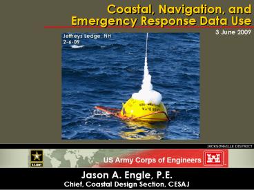
Coastal, Navigation, and Emergency Response Data
Use
3 June 2009
- Jason A. Engle, P.E.
- Chief, Coastal Design Section, CESAJ
2
Outline
- Coastal Storm Damage Reduction Projects
- Beach-fx
- Inlets and Navigation Projects
- Coastal Modeling System
- Post-Storm Missions
- Damage assessment and recovery
3
Conclusions
- Coastal Storm Damage Reduction Projects
- Historical storm databases
- Improved tropical/extra-tropical storm data
- Beach-fx support tools for data manipulation
- Inlets and Navigation Projects
- Central data repository--IOOS
- High resolution survey data
- Post-storm Missions
- Annual LIDAR surveys
- More permanent wave and water level gages
4
What and Why
- Data Uses in Coastal Engineering
- Existing conditions/problems/opportunities
- Model inputs/boundary conditions
- Model calibration/verification
- Monitor project performance
- Site specific data are required at every project
phase
5
Beaches
- Coastal Storm Damage Reduction Studies Beach-fx
is the USACE Required Model - Evaluates the physical performance and economic
benefits of shore-protection projects along sandy
shores. - Economic and engineering inputs required
6
Beach-fx Inputs
- SBEACH Storm-inducted BEAch Change model
- Shoreline response to storm impacts
- Wave attack
- Inundation
- GENESIS GENEralized model for Simulating
Shoreline Change - Shoreline position throughout project life
- Erosion rate of planned nourishments
- Historical storm data
- Utilized for Monte Carlo simulations of many
project lifetimes - Tropical and extra-tropical (noreasters)
- Other inputsnot covered in this presentation
- Structure/damage element data for EVERY property
in study area - Values
- First floor elevations
- Structure type
- Coastal armor
7
SBEACH
- Input data
- waves, water level, winds
- Beach profiles pre- and post-storm for
calibration - Output
- detailed waves, surge, and erosion for each
historical storm - Simulation time scale days-weeks
RMAP
8
GENESIS
- Shoreline position data
- Multiple years
- Calibration/verification
- Wave data
- Height
- Period
- Direction
- Time scale years-decades
9
Historical Storm Data
- Site-specific storm database
- Time series for each storm
- Waves
- Water levels
- Wind
- Decades of storm seasons required
10
Beach-fx Data Sources
- Profile data, shoreline data
- Periodic surveys
- FDEP, Sponsors
- LIDAR
- Wave Data Long-Term
- Wave Information Studies (WIS) ERDC
- 1980-1999
- Needs updating/longer hindcast
- Commercial Sources
- Custom, site-specific wave hindcasts 50 years
11
Beach-fx Data Sources
- Short-Term (Storms)
- Wave and wind
- Wave buoy data
- NDBC (NOAA)
- CDIP (Scripps)
- Commercial sources Oceanweather storm hindcasts
- Storm Data Long-Term
- Tropical NOAA HURDAT 1851-2005
- Developed in 1960s, updated periodically
- Storm track, central pressure, winds
- No water level or wave information
- Extra-tropical storms
- No central database
- Site-specific historical storm database
- Difficult to formulate
- Time consuming/expensive
12
Inlet and Navigation Projects
- Coastal Modeling System (CMS)
- 2D Hydrodynamic Circulation Model
- Spectral wave transformation model
- Hydrodynamic/Wave coupling sediment transport
capability - Evaluate existing morphology and alternatives
- Regional spatial scale
- Increased expectation to include comprehensive
models at inlets and Navigation projects - Powerful
- Data hungry
- Time consuming/expensive
13
CMS Inputs
- CMS Wave Spectral wave transformation model
- Wave, wind boundary conditions
- Gridded bathymetry
- Hydrodynamic model
- Water level, water current boundary conditions
- Gridded bathymetry
- Sediment characteristics
14
CMS Data Sources
- High-resolution bathy data
- Multibeam
- USACE survey vessels
- Contractors
- LIDAR JALBTCX
- Essential for Calibration/Verification
- Multiple surveys morphology
- Closely spaced in time
15
CMS Data Sources
- Water level and directional wave data
- NOAA tide stations
- Too few permanent gages
- Permanent directional wave gages
- NDBC, CDIP, IOOS
- Too few, some too far from shore
- Custom field data sets
- Contracted
- 5 In-situ gages
- 3 Mobile current sites
- 104k
- Need ability to share/search data
16
Post-Storm Missions
- Example 2004 Hurricane Season
- 4 Land falling Hurricanes
- Majority of Florida Beaches Sustained Significant
Damage
17
Survey Data
Type of Survey
Data Pre-Storm Post-Storm
PS Provider Brevard Co. Profile
Profile Profile
Sponsor Broward Co. LIDAR LIDAR
Profile JALBTCX/Sponsor Duval Co.
Profile Profile Profile
JALBTCX/Sponsor Ft. Pierce Profile
Profile Profile
JALBTCX/Sponsor Lee Co. Profile Profile
Profile Sponsor Manatee Co.
LIDAR LIDAR LIDAR
JALBTCX Martin Co. Profile Profile
Profile JALBTCX/Sponsor Palm Beach
Co. LIDAR LIDAR LIDAR
JALBTCX Pinellas Co. LIDAR LIDAR
LIDAR JALBTCX
Sarasota Co. LIDAR LIDAR
LIDAR JALBTCX St. Johns Co.
Profile Profile Profile
JALBTCX/Sponsor
18
2005 Beach Restorations
- 14 Federal Shore Protection Projects Renourished
2005 Renourishment
2004 Post-Storm(s)
19
Post-Storm Inspections
- LIDAR Surveys Port Everglades South Jetty
Post-Storm
Pre-Storm
Isopach Surface
20
Post-Storm Data Sources
- Pre- and post-storm season surveys are essential
- Post-storm data collected asap following storms
- LIDAR data served a vital need
- Too few water level and wave gages
- Commercial hindcast data utilized for wave/wind
information - Important storm surge information not collected
21
Conclusions
- Coastal Storm Damage Reduction Projects
- Historical storm databases
- Improved tropical/extra-tropical storm data
- Tools for site-specific data extraction
- Inlets and Navigation Projects
- Long-term wave and water level measurements
- Improved field data reduction tools
- Open-source code
- Post-storm Missions
- Annual LIDAR surveys
22
Conclusions
- Coastal Storm Damage Reduction Projects
- Historical storm databases
- Improved tropical/extra-tropical storm data
- Beach-fx support tools for data manipulation
- Inlets and Navigation Projects
- Long-term wave and water level measurements
- High resolution survey data
- Post-storm Missions
- Annual LIDAR surveys
23
Conclusions
- Coastal Storm Damage Reduction Projects
- Historical storm databases
- Improved tropical/extra-tropical storm data
- Beach-fx support tools for data manipulation
- Inlets and Navigation Projects
- Central data repository--IOOS
- High resolution survey data
- Post-storm Missions
- Annual LIDAR surveys
- More permanent wave and water level gages
24
Conclusions
- Coastal Storm Damage Reduction Projects
- Historical storm databases
- Improved tropical/extra-tropical storm data
- Tools for site-specific data extraction
- Inlets and Navigation Projects
- Long-term wave and water level measurements
- High resolution survey data
- Post-storm Missions
- Annual LIDAR surveys
25
- Thank You
- Jason Engle
- CESAJ-EN-WC
- 904.232.2230
- jason.a.engle_at_usace.army.mil
Recommended
CrystalGraphics Presentations


