
GPS Scavenger Hunt - PowerPoint PPT Presentation
1 / 6
Title:
GPS Scavenger Hunt
Description:
Students will learn navigation skills with the Garmin eTrex Legend GPS receiver. ... http://www.winzip.com/ Teacher Guide p. 3. GPS Scavenger Hunt. GPS Scavenger Hunt ... – PowerPoint PPT presentation
Number of Views:33
Avg rating:3.0/5.0
Title: GPS Scavenger Hunt
1
GPS Scavenger Hunt
Teacher Guide
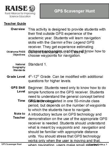
This activity is designed to provide students
with their first outside GPS experience of the
academic year. Students will learn navigation
skills with the Garmin eTrex Legend GPS receiver.
They get experience estimating distances and
angles, and they will know how to choose
waypoints for navigation.
Overview
Content Standards 3-1, 4-1, and 4-2.
Oklahoma PASS Objectives
Standard 1.
National Geography Standards
4th-12th Grade. Can be modified with additional
questions for higher levels.
Grade Level
Beginner. Students need only to know how to do
simple functions on the GPS receiver. Students
need to understand the general concept behind GPS
technology.
GPS Skill Level
Should be completed in one 50-minute class
period, but depends on the number of waypoints to
which the students have to navigate.
Time
Note to Teacher
A introductory lecture on GPS technology and
demonstration on the use of the appropriate GPS
receiver is needed. Students should understand
what is meant by waypoints and navigation and
should be familiar with appropriate distance
units. You should stress that GPS technology
works only when the user is moving and that, when
navigating, users make small steering corrections
towards destination waypoints.
Teacher Guide p. 1
GPS Scavenger Hunt
2
GPS Scavenger Hunt
Teacher Guide
Materials
Enough GPS receivers for each team of two or
three students. The teacher will need to
determine appropriate locations for waypoints. I
suggest the teacher consider choosing
destinations that are not within sight of any
other destination. Have teams begin at different
starting points to reduce cheating. You will
need to make signs for each waypoint to mark its
position. (We had students navigate to the first
waypointan ice chest full of 12 oz. lemonades.
After navigating to two other waypoints, the
final waypoint was a recycle bin.) Each GPS
receiver should have all of the waypoints used in
the activity. Waypoint names should be consistent
with those listed in the activity. There is a
simple program (DNR Garmin) that will allow you
to copy the waypoints from one GPS receiver to
many. DNR Garmin is a program that helps users
both manage GPS waypoints and integrate GPS with
GIS technology. It is designed for use with
certain Garmin GPS receivers only. To prepare for
this activity, you will use it to load the same
waypoints onto several GPS receivers. Follow the
steps listed on the next page.
Developed by Brad W. Watkins bwatkins1997_at_yahoo.co
m
Teacher Guide p. 2
GPS Scavenger Hunt
3
GPS Scavenger Hunt
Teacher Guide
Instructions for Using the DNR Garmin GPS Program
1. Download and install the DNR Garmin program
from the website listed under Sourcesuse
the 4.4.2 version. You will need to unzip the
file. 2. Plug the GPS receiver that contains the
waypoints for the exercise (the teachers
receiver) into computer using the data cable
provided. Make sure the GPS receiver is
on. 3. Open DNR Garmin. Make sure that DNR Garmin
recognizes your GPS receiver. (Hint You may
need to change the port setting by choosing Set
Port under the GPS menu or change the baud
rate to match that of your GPS receiver by
choosing Set Baud Rate under the GPS menu.) 4.
From DNR Garmin, choose Download from the
Waypoint menu. You will see a list of all
of the waypoints contained in your GPS
receiver. 5. Select the waypoints you wish to
transfer to the student GPS receivers by clicking
on the gray box on the left side of the
table. From the File menu, choose Save to?
File . Save the file to a location. (It is saved
as a .txt file). 6. Leave data cable plugged into
computer. Disconnect data cable from
teachers GPS receiver and plug into the first
student receiver. Turn on the receiver.
(As long as datum and projection are the same on
all receivers, you should be able to simply
connect each receiver with no problems). 7. From
the File menu, choose Load From? File . Find the
file you saved from the previous step.
Double click on the file or click on the file and
choose Open. You will see the waypoints for
the activity listed in the table. 8. Choose
Upload from the Waypoint menu. All waypoints
should be transferred to the receiver and
it is ready to use. Continue these steps for all
of the GPS receivers that are to be used in
the activity. Things to Remember - All
receivers must be set to the same datum and
projection. - You have created a file of
waypoints for the next time you do the activity.
Be sure to save it! Saving waypoint files
will help you plan lessons in advance.
Sources
http//www.dnr.state.mn.us/mis/gis/tools/arcview/e
xtensions/DNRGarmin/DNRGarmin.html http//www.win
zip.com/
Teacher Guide p. 3
GPS Scavenger Hunt
4
GPS Scavenger Hunt
Today you will use your GPS receiver to
navigate to different positions on the schools
campus. All of the information you need is
contained in your GPS receiver or in this
exercise.
Step 1
Turn on your GPS unit. Push the Page button on
the right side of the GPS receiver twice (see
picture below). Wait for the message Ready to
Navigate to appear on the Satellite screen.
Step 2
Click the Find button located on the left side of
the GPS receiver (see picture below). From the
Find menu, choose Waypoints with the click stick.
Choose Nearest with the click stick.
1
5
GPS Scavenger Hunt
Step 2 (continued)
Use your click stick to choose the first waypoint
listed on page 3 (depending on your group) of
your exercise. Find the waypoints in the order
listed for your group. At the bottom of the
screen, make sure GOTO is highlighted (see
picture below). Click it with your click stick.
Step 3
You now should be on the Navigation screen (see
picture below). Begin walking towards the
target waypoint. You should follow the
direction of the arrow on the Navigation
screen. Keep an eye on the distance to the
waypoint in the upper right corner of the
Navigation screen. REMEMBER If you stop moving,
the GPS receiver cannot track your location.
2
6
List of Waypoints
Group A Wpt001 Wpt002 Wpt003 Wpt004
Group B Wpt002 Wpt003 Wpt004 Wpt001
Group C Wpt003 Wpt004 Wpt001 Wpt002
Group D Wpt004 Wpt001 Wpt002 Wpt003
GPS Scavenger Hunt
3
Recommended
CrystalGraphics Presentations


