
Using GPS - PowerPoint PPT Presentation
1 / 26
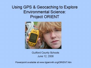
Title: Using GPS
1
Using GPS Geocaching to Explore Environmental
ScienceProject ORIENT
- Guilford County Schools
- June 12, 2008
Powerpoint available at www.bjpenn4h.org/ORIENT.ht
m
2
- Outdoor Environmental Education has been great
for Elementary School students
but Middle School students are not engaged by
the same lessons or methods.
3
So what does engage middle school youth?
- Technology
- Connections to the Real World
- Perceived Trust / Freedom
- Social Opportunities
- Challenges / Quests
4
Can we turn any of these things to our advantage?
- Technology
- Students become acquainted with handheld
GPS Units finding locations using latitude and
longitude.
5
Can we turn any of these things to our advantage?
- Perceived Freedom / Trust
- Students make their own group decisions.
Instructors are there for safety and support, NOT
to direct students in where to go or how to
accomplish a task.
6
Can we turn any of these things to our advantage?
- Challenges / Quests
- Students are engaged in geocaching a
quest to find hidden treasures, using a GPS unit,
a map, a set of known coordinates, and one's own
wits.
7
Geo-what?
- Geocaching? Geo-cashing?
- Im gettin paid?
- Cash money?
- Woohoo!
8
- www.geocaching.com
9
- In traditional geocaching, the fun is in the
search, and once you find the cache there are a
few trinkets to exchange. Then you head on your
way.
If this were true in Project O.R.I.E.N.T., wed
have a fabulous geography program, but would have
only scratched the surface of the potential
science
10
So rather than trinkets, students find
instructions and equipment leading them to
perform various tasks
- Scientific
- Mathematical
- Team Challenges
- Social Science
11
The Result
- A technological scavenger hunt - perfect for
engaging middle school students - that sends
groups of 10-12 students exploring deep into the
forests, streams and natural environs of our 220
acre campus. Once there, they participate in
age-appropriate science math explorations.
Project O.R.I.E.N.T. Outdoor Research In
Environment, Navigation Technology
12
Project O.R.I.E.N.T.
- Day One
- Morning Travel, Arrival Orientation
- Afternoon Skills Rotations
- Day Two
- Geocaching on site, with science, math and other
challenges at each cache. - Day Three
- Further Geocaching
- Afternoon Departure
- Travel Home
13
Weve done the setup work, and we have the
facilities staff to provide the program
- But we havent put a patent on it. If you want
to set up a similar program based from your own
classroom, - GO DO IT!!!
14
- In planning your own GPS scavenger hunt, consider
these questions - 1. What Guiding Principles Will You Consider?
- What Base of Knowledge is Necessary
- How will you Build this Base of Knowledge?
- 3. What Topics Will You Include At Caches?
- 4. What Equipment Resources Will You Need?
- 5. What are the Logistical Details?
- 6. Where Can We Grow From Here?
15
What Guiding Principles Will You Consider?
Here are a few of ours, for examples sake
- Teaching students how to use a GPS without also
increasing their map literacy is just plain
irresponsible! - We must take advantage of the 220 Acres we are
blessed with!! - We will paint with a wide brush, exposing
students to a wide range of Environmental
Sciences, not just one specific area. - Every student should be involved in group
decisions, especially when searching for caches.
- Our focus must always be on getting students
excited about science, and excited about the
outdoors.
16
2. What Base of Knowledge is Necessary
How will you Build this Knowledge?
- Understanding of Latitude Longitude
- Coordinate System
(Including Direction, Minutes/Degrees, etc)
17
2. What Base of Knowledge is Necessary
How will you Build this Knowledge?
- Understanding of Topographic Maps
- (Including how to find locations using
landforms /or latitude/longitude)
18
2. What Base of Knowledge is Necessary
How will you Build this Knowledge?
- Understanding of How Why GPS Receivers Work
- (Including satellite system and
triangulation)
19
2. What Base of Knowledge is Necessary
How will you Build this Knowledge?
- Understanding of How to employ a GPS Receiver
- (Including four main Navigation Screens,
Mark Goto)
20
4. What Topics Will You Include At Caches?
- Science Topics
- Plankton Nets Microscope Searches in
Pond Water - Classification of Stream Macroinvertebrates
- Forest Mapping
- Wildlife Habitat Checklists
- Stream Flow
- Slope Erosion
- Leaf Litter Macroinvertebrates
- Biotic Indices (Aquatic Health)
21
3. What Topics Will You Include At Caches?
- Interdisciplinary Topics
- Creative Storytelling
- Local Cultural History Landmarks
- Math Problems based on Historical Dates
- Algebraic Puzzles
- Mind-Benders
- Team Challenges
22
4. What Equipment Resources Will You Need?
- GPS Units (13 ratio?)
- Maps, Globes, etc for Lat/Long Discovery
- Topos for Cache Location
- Open Spaces for Cache Placement
- Cache Containers
- Specific Cache Contents/Equipment
23
5. What are the Logistical Details?
- Where is the area you will use to hide caches?
- How much time do you have to teach the Base
- Knowledge?
- How much actual search time do you have?
- How will you keep track of the caches you have
hidden? - What sort of rotation will you use, if you have
multiple - groups searching for caches at the
same time? - What happens if groups catch up to
each other?
24
6. Where Can We Grow From Here?
- GPS GIS can be Complementary
- So far, the GPS is used only to locate the cache.
Wouldnt it be cool to use it as a tool at the
cache? - Real Data Collection, then manipulation with data
from other data collectors, especially into GIS
mapping projects. - Imagine if every Guilford County School
25
Special Thanks
- A big thanks goes out to the
- Student Science Enrichment Program
- at the
- Burroughs Welcome Fund.
- Who will you be thanking??
26
Contact Info
- Feel Free to Contact Me with any Questions
- Kevin Moore
- Betsy-Jeff Penn 4H Education Center
- 336-349-9445
- kevin_moore_at_ncsu.edu
- www.bjpenn4h.org
- This Powerpoint is available for download at
www.bjpenn4h.org/ORIENT.htm
Recommended
CrystalGraphics Presentations


