
Overview - PowerPoint PPT Presentation
1 / 18
Title: Overview
1
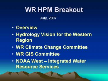
WR HPM Breakout
July, 2007
- Overview
- Hydrology Vision for the Western Region
- WR Climate Change Committee
- WR GIS Committee
- NOAA West Integrated Water Resource Services
2
HCSD Personnel
- Dave Brandon Division Chief
- Scott Dummer Deputy Chief
- Dan Matusiewicz Hydrology Services Program
Manager - Andrea Bair Climate Services Program
Manager - Jenna Meyers GIS Program Manager
- Climate Services Specialist
- Susan Nelson Data/Observing Sys Program Manager
3
HCSD Programs
- Hydrology Services
- RFCs River Forecast Centers
- WFOs Weather Forecast Offices
- ( OCWWS-HSD, OHD ) NWSH Climate Weather Water
- Climate Services
- RFCs
- WFOs
- ( OCWWS-CSD ) Climate Services Division
- Data and Observing Systems
- WFOs
- RFCs
- ( OCWWS-OSD , OST NERON Project Office )
- GIS
4
VISION Widely recognized as the authority and
source for reliable water and river forecasts in
the Western US. We value customer service,
strong partnerships, sound science, innovation,
effective use of public resources and the
well-being of all who contribute to our mission.
- Five interconnected Focus Areas
- Connected to national programs (e.g. AHPS, NOAA,
etc.)
5
Outreach
- Robust outreach and customer service that
leverages modern technology including customer
and hydrology databases, dynamic web sites to
leverage the databases, and a coordinated effort
from NWS Hydros and Mets. - More Emphasis on Water/Water Resources
- Expand outreach by prototyping the Service
Coordination Hydrologist at the RFCs and leverage
RFC expertise in WFO outreach activities
collaboratively with WCMs and SHs - Leverage product suite
- Strong partnerships across NOAA Other Groups
- Utilize Focus Groups to set requirements
6
Outreach Activities
- Outreach Workshop
- Mix of WCMs, SSHs
- Brought in Leader of Hydrology Program for both
NWS and NOAA Gary Carter - Reinforcement of the importance of Water and
Climate - Displays
- AHPS Funding to support buying Hydrology Pop-Up
display for every field office
7
Verification
- Meaningful hydrologic and hydrometeorologic
verification information readily available to
managers, forecasters, and customers to foster
better decision making - Categorical text products including watches, and
warnings - Hydrograph forecasts including deterministic and
probabilistic - Hydrometeorology forecasts including
precipitation and temperature
8
Verification Activities
- WR Recently Chartered a Hydrology Verification
team - OHD Chartered Hydrologic Verification System
Requirements Team - River Forecast Verification Tools Identified and
being developed - New team chartered to develop operational
expertise-develop standard verification
9
Innovation
- Innovative and powerful collection of software
used at both WFOs and RFCs - Nationally supported tools (e.g. WHFS, FFMP)
where available and appropriate - Integrate promising new technologies including
GIS - Move toward a modular system to foster rapid
prototyping and implementation at field offices,
e.g. CHPS - Develop and adapt a WR Hydrologic Services
Evolution that meshes with agency priorities - Leverage products produced at the finer time and
space scales - Where possible, adopt modeling technology
consistent with other NOAA line offices and
partners outside of NOAA. - Finish / polish existing tools and products
10
Innovation Activities
- CHIPS meeting at NWRFC Prototype to begin
- Distributed model set up and running at CBRFC
- RFCs are moving toward shorter time steps
- Get WR slant into Nationally supported tools
(e.g. WHFS, FFMP, MPE) - Created WR GIS Technical Advisory Group
- Field Seminar Series
11
Services
- Flexible product suite to address forecast
problems across timescales from minutes to years - drought and low flow
- water supply
- flash flood, flood, recreational
- Ensemble and probabilistic forecasts
- Support Ecosystem Management
- User feedback mechanism
12
Services Activities
- WR Water Supply Web Page
- New probabilistic forecast displays
- WR RFC Web Pages
- All have creative ideas to support customers
13
People
- Integration of our cohesive work force,
technology, and processes that maximize the
response to high impact events within the
hydrology program - In accordance with existing agreements, adjust
workload and resources as it becomes necessary
due to increased workload, or as a decrease in
capacity occurs at an office. - Quickly utilize resources between RFCs, WFOs, and
WRH to respond to needs - Develop virtual RFC concept not inhibited by
physical locations - Streamline and improve hydrology program
oversight
14
People
Outreach
Verification
People
CUSTOMERS
Services
Innovation
- Retool training program to holistically support
hydrology program - Promote SH / RFC personnel pairs to promote
interaction between field offices - Revitalize Hydro Intern Program
15
People Activities
- Continue to push for SCH at the RFC
- Emphasis on Hydrology Training-New Comet Modules
- First region to hire 3 Hydrology Interns
- Increased station visits-Hydrology Program
Reviews
16
What Else are we doing?
- Formed WR Technical Advisory Committee on Climate
Change (great response) - Base outreach information on Intergovernmental
Panel on Climate Change-4th Assessment (IPCC4) - Provide information/guidance to field offices
- Interface with Climate Program Office and CSD
17
What else are we doing?
- Host Gotos on climate change/variability
- Coordinating/producing facts sheets on drought
and climate change - Connect with other NOAA Line Offices through
NOAA-West to present consistent messages on CC
and Impacts
18
What Else are we doing?
- Formed WR GIS Technical Advisory Group (great
response) - Purchased ESRI licenses for shared pool
- Planning on GIS Training/Workshop
- Produced WR skills matrix
- Purchased ESRI DVD Technical Sessions for field
use - Participate in OSIP Enterprise GIS in NWS
Recommended
CrystalGraphics Presentations


