
ALTIKA OCEANSAT3 ISRO CNES mission - PowerPoint PPT Presentation
1 / 16
Title: ALTIKA OCEANSAT3 ISRO CNES mission
1
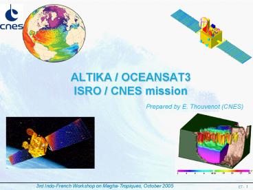
ALTIKA / OCEANSAT3 ISRO / CNES mission
Prepared by E. Thouvenot (CNES)
2
International context for altimetry missions
- Need expressed by IGOS (Integrated Global
Observing Strategy) GODAE (Global Ocean Data
Assimilation Experiment) since 2000
Continuity of high accuracy, high resolution
near-real time observations of the ocean surface
topography is required. At least, 2 simultaneous
altimetry missions are required (including one
of the Jason reference class) - Consequence need to prepare a post-ENVISAT
mission that would fly at the same time as
JASON2 - Additional requirements to take into account
- post-GODAE IGOS needs about performance
improvement (high resolution altimetry coastal
altimetry)- GMES needs
3
Altimetry missions from research to operational
Possible gap in 2007
AltiKa Oceansat3
NPOESS, GMES (S3)
To-day very good situation ! (5 satellites)
4
CNES involvement in altimetry
Reference mission Ocean Large scale
Complementing mission mesoscale, ice
Earth reference system
1990
experiment
SPOT2 (CNES) DORIS
ERS-1 (ESA) Altimeter algorithm
TOPEX/POSEIDON (CNES/NASA) Launcher DORIS
POSEIDON Mission Center
SPOT3 (CNES) DORIS
ERS-2 (ESA)
SPOT4 (CNES) DORIS
2000
Jason-1 (CNES/NASA) Satellite bus DORIS
POSEIDON Control Mission Center
ENVISAT (ESA) DORIS Altimeter Processing Archive
distrib.
SPOT5 (CNES) DORIS
2005
CRYOSAT (ESA) DORIS
Jason-2 / OSTM (CNES/NASA/EUMETSAT/NOAA) Satellit
e bus DORIS POSEIDON Control Mission Center
ALTIKA/OCEANSAT (CNES/ISRO) Altimeter,
radiometer, DORIS, Lra Process, archive
distrib.
PLEIADES (CNES) DORIS
SALP Altimetry and precise positioning service
operational
MERCATOR assimilation, forecast CNES / SHOM /
METEOFRANCE / IFREMER / CNRS / IRD
5
(No Transcript)
6
(No Transcript)
7
ALTIKA System Requirements
- Orbit selection
- Sun synchronous orbit
- Altitude range 700 900 km
- Ground track repetitivity lt35 days, gt15 days
- Ground system
- Altika payload near real time monitoring and
commands ISRO OCEANSAT control center - Altika Payload expertise and long term monitoring
CNES SALP - Science and auxiliary telemetry recovery and
distribution ISRO OCEANSAT control Center - Sizing parameter data latency
- Three hours max required between data
measurements on-board and near real time
distribution to operational users (for gt 75
data) - Implies science data dump once per orbit
- One hour for data exchange and processing
- Science Data Processing, Archive and
distribution - ISRO Mission Center
- CNES SALP ( EUMETSAT TBC)
8
AltiKa payload
- Ka-band altimeter with enhanced bandwidth
- ? ionospheric effects are negligible
- ? better vertical resolution
- ? error budget improvement
- ? Ka-band (35 GHz) authorizes a compact,
lightweight instrument easier to
accommodate on a wide range of satellite buses - Dual-frequency radiometer (24/37 GHz)
- ? required for tropospheric correction
- ? derived from Madras (Megha-Tropiques)
developments - Laser Retro-reflector Array
- ? useful for orbitography and system
calibration - DORIS
- ? required for achieving adequate orbitography
performances in low earth orbit (oceanography
need) - ? enable to have similar performance than
reference missions like T/P, JASON, ENVISAT - ? required for mean sea level analysis and
coastal/inland applications (real- time coupling
with altimeter)
9
Altimetric measurement system
Orbit
Ionosphere
Troposphere
Altimeter beam
satellite Altitude
Altimeter measurement
Doris Beacon Earth Reference
Sea level
Topography
Geoid
Ellipsoid
10
AltiKa performance
Large improvement wrt current altimetry missions
- altimetrer noise 3 times better on ocean-
very good coastal and inland (rivers, lakes)
performance
Comparison of tracking performance on western
Corsica coastline -AltiKa alone (at
left) -AltiKa DIODE/DORIs (at right)
11
AltiKa applications
SeaState
Geodesy
Light rainfallclimatology
InlandIce
Meso-ScaleVariability(Central Objective)
MeanSea Level
OperationalOceanography
Inlandwaters
CoastalAltimetry
12
Ocean heat influence on Hurricanes
13
Dec. 2004 Tsunami as seen by Jason 1
14
Proposed OCEANSAT / ALTIKA Responsibility Sharing
- ISRO responsibilities
- Project Management
- Launch vehicle
- Satellite development, IRS bus
- Payload
- TBD
- Satellite integration and test
- Ground System Operations
- Satellite Operations Control Center
- Command Data Acquisition Stations (TBD)
- Near Real Time product processing
- Product distribution
- Archiving
- Ground network for housekeeping data, science
data and products exchange - User interface
- CNES responsibilities
- Project Management
- Payload
- Nadir Ka band Altimeter
- Nadir microwave radiometer
- DORIS tracking receiver
- Laser retro reflector array
- CNES support for Payload integration and test
- Ground System Operations
- Product processing tool development
- Off line global product processing and
distribution - Archiving
- Ground network for housekeeping data, science
data and products exchange - EUMETSAT responsibilities (TBC)
- Near Real Time global product processing,
archiving, distribution and user interface - User interface
- ALTIKA System Coordination with other altimetry
missions
15
AltiKa development plan
- AltiKa instruments are based on proven concepts
and already developed sub-systems innovative
mature solutions - AltiKa payload development plan discussed with
ISRO in the frame of OCEANSAT-3 mission - Launch planned on 1st semester 2009
- Nominal lifetime 3 years
- OCEANSAT3 payload not yet decided candidates
are OCM sensor (probably), TIR sensor (possibly),
Wind scatterometer (may be difficult to combine
with AltiKa), ... - AltiKa payload current status
- Delta phase B January 2005 to October
2005(Very fruitful technical meetings with ISRO
on May 16-17) - Phase C/D October 2005 to June 2008
- DORIS Phase C/D started since January 2005
16
CONCLUSION The AltiKa Payload as a precursor to
future altimetry systems
- AltiKa has been designed to solve the
post-ENVISAT altimetry gap issue and reach
the mission objectives derived from
post-GODAE/IGOS requirements, in complement to
the operational Jason-2 mission - At a longer time scale, AltiKa payload could be
the core of a permanent, operational,
high-resolution altimetry system, flying as a
multi-microsatellite system embarking the same
payload, or as a combination of microsatellites
and minisatellites.
Recommended
CrystalGraphics Presentations


