
usepa lakes conf 2003 outreach, support, scheduling - PowerPoint PPT Presentation
1 / 103
Title:
usepa lakes conf 2003 outreach, support, scheduling
Description:
usepa lakes conf 2003 outreach, support, scheduling – PowerPoint PPT presentation
Number of Views:108
Avg rating:3.0/5.0
Title: usepa lakes conf 2003 outreach, support, scheduling
1
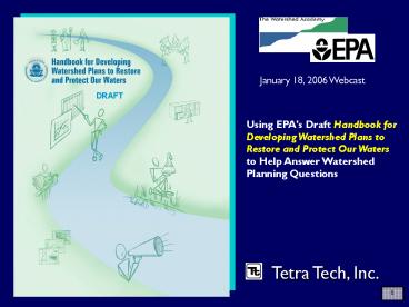
January 18, 2006 Webcast
DRAFT
Using EPA's Draft Handbook for Developing
Watershed Plans to Restore and Protect Our Waters
to Help Answer Watershed Planning Questions
Tetra Tech, Inc.
2
Cast of Characters(in order of appearance)
- Charlie MacPherson, Tetra Tech
Stuart Lehman, USEPA NPS Control Branch
Leslie Shoemaker, Tetra Tech
Barry Tonning, Tetra Tech
3
Road Map for Webcast
- Handbook Overview
- EPAs perspective
- Step 1 Build Partnerships
- Step 2 Characterize Watershed
- Step 3 Set Goals, Identify Solutions
- Step 4 Develop implementation Program
- Step 5 Implement Plan
- Step 6 Monitor and Evaluate
4
Overview of Handbook
- www.epa.gov/owow/nps/watershed_handbook
- 13 Chapters
- Worksheets, checklists
- Resources
- Glossary
5
- Ohio EPA
6
- Watershed Management Guide, 2003
6
7
(No Transcript)
8
Watershed Planning is Iterative
8
9
Watershed Planning Steps
- STEP 1
- BUILD PARTNERSHIPS
- ID stakeholders
- ID issues of concern
- Set preliminary goals
- Develop indicators
- Conduct outreach
9
10
Watershed Planning Steps
- STEP 2
- CHARACTERIZE WATERSHED
- Gather existing data
- Create data inventory
- ID data gaps
- Collect additional data, if needed
- Analyze data
- ID causes and sources
- Estimate pollutant loads
- STEP 1
- BUILD PARTNERSHIPS
- ID stakeholders
- ID issues of concern
- Set preliminary goals
- Develop indicators
- Conduct outreach
10
11
Watershed Planning Steps
- STEP 3
- FINALIZE GOALS AND IDENTIFY SOLUTIONS
- Set goals and management objectives
- Develop indicators/targets
- Determine load reductions needed
- ID critical areas
- ID management measures needed
- STEP 2
- CHARACTERIZE WATERSHED
- Gather existing data
- Create data inventory
- ID data gaps
- Collect additional data, if needed
- Analyze data
- ID causes and sources
- Estimate pollutant loads
- STEP 1
- BUILD PARTNERSHIPS
- ID stakeholders
- ID issues of concern
- Set preliminary goals
- Develop indicators
- Conduct outreach
11
12
Watershed Planning Steps
k
- STEP 4
- DESIGN IMPLEMENTATION PROGRAM
- Develop Implementation schedule
- Set Interim milestones
- Determine how you will measure success
- Develop monitoring component
- Develop evaluation process
- ID technical and financial assistance needed
- Assign responsibility
- STEP 3
- FINALIZE GOALS AND ID SOLUTIONS
- Set goals and management objectives
- Develop indicators/targets
- Determine load reductions needed
- ID critical areas
- ID management measures needed
- STEP 2
- CHARACTERIZE WATERSHED
- Gather existing data
- Create data inventory
- ID data gaps
- Collect additional data, if needed
- Analyze data
- ID causes and sources
- Estimate pollutant loads
- STEP 1
- BUILD PARTNERSHIPS
- ID stakeholders
- ID issues of concern
- Set preliminary goals
- Develop indicators
- Conduct outreach
12
13
Watershed Planning Steps
k
- STEP 5
- IMPLEMENT WATERSHED PLAN
- Implement management strategies
- Conduct monitoring
- Conduct outreach activities
- STEP 4
- DESIGN IMPLEMENTATION PROGRAM
- Develop Implementation schedule
- Set Interim milestones
- Determine how you will measure success
- Develop monitoring component
- Develop evaluation process
- ID technical and financial assistance needed
- Assign responsibility
- STEP 3
- FINALIZE GOALS AND ID SOLUTIONS
- Set goals and management objectives
- Develop indicators/targets
- Determine load reductions needed
- ID critical areas
- ID management measures needed
- STEP 2
- CHARACTERIZE WATERSHED
- Gather existing data
- Create data inventory
- ID data gaps
- Collect additional data, if needed
- Analyze data
- ID causes and sources
- Estimate pollutant loads
- STEP 1
- BUILD PARTNERSHIPS
- ID stakeholders
- ID issues of concern
- Set preliminary goals
- Develop indicators
- Conduct outreach
13
14
Watershed Planning Steps
k
- STEP 6
- MEASURE PROGRESS AND MAKE ADJUSTMENTS
- Review and evaluate
- Share results
- Prepare annual plans
- Make adjustments
- STEP 5
- IMPLEMENT WATERSHED PLAN
- Implement management strategies
- Conduct monitoring
- Conduct outreach activities
- STEP 4
- DESIGN IMPLEMENTATION PROGRAM
- Develop Implementation schedule
- Set Interim milestones
- Determine how you will measure success
- Develop monitoring component
- Develop evaluation process
- ID technical and financial assistance needed
- Assign responsibility
- STEP 3
- FINALIZE GOALS AND ID SOLUTIONS
- Set goals and management objectives
- Develop indicators/targets
- Determine load reductions needed
- ID critical areas
- ID management measures needed
- STEP 2
- CHARACTERIZE WATERSHED
- Gather existing data
- Create data inventory
- ID data gaps
- Collect additional data, if needed
- Analyze data
- ID causes and sources
- Estimate pollutant loads
- STEP 1
- BUILD PARTNERSHIPS
- ID stakeholders
- ID issues of concern
- Set preliminary goals
- Develop indicators
- Conduct outreach
14
15
(No Transcript)
16
The Nine Elements
- a. Identify causes sources of pollution
- b. Estimate load reductions expected
- c. Describe mgmt measures targeted critical
areas - d. Estimate technical and financial assistance
needed - e. Develop education component
- f. Develop schedule
- g. Describe interim, measurable milestones
- h. Identify indicators to measure progress
- i. Develop a monitoring component
- Source US EPA, 2004 319 Supplemental Guidelines
17
Steps in the Watershed Planning and
Implementation Process
18
Incorporation of the nine minimum elements
19
EPAs Perspective
- What are we learning from watershed efforts
across the country? - Water problems are not spread evenly across the
landscape - There is a growing vast body of knowledge on BMP
effectiveness, as well as, assessment tools - Partnerships are imperative, but how
- does one organize and manage clean-up
- efforts more effectively?
- Results are elusive How do know if you
- are achieving goals unless you are
- monitoring for them?
19
20
EPAs Perspective
- We think the 9 elements are critical to watershed
plans, particularly - Quantifying pollutant sources to guide plan
development - Understanding what NPS management practices will
achieve along with the point source controls - Looking ahead to implementing and
- revising the watershed plan
- Watershed plans should contain more than
- our 9 elements e.g. Protection, Drinking
Water, Habitats, Fisheries, State Priorities
20
21
EPAs Perspective
- What should watershed plans provide?
- Clear Purpose a Roadmap - needed to
coordinate complex scientific, social, and
economic activities - Accountability What indicators are we going to
count and why are they important to watershed
resources? - Program Integration thru Partnerships - TMDLs,
319, NPDES, Source Water Protection, wetlands,
Farm Bill Programs, local planning, private
investment
22
EPAs Perspective
DRAFT
- Our hope it that this
- handbook will supplement
- existing guides
- Provides assistance in developing the necessary
details of effective plans - Serves as a starting point for an updateable
document on planning across programs and levels
of governance.
23
Step 1. Build Partnerships
- ID stakeholders
- ID issues of concern
- Set preliminary goals
- Develop indicators
- Conduct outreach
23
24
How do I know who to involve in my watershed
planning effort?
24
25
Answer the following
- Whos responsible for implementation?
- Who will be affected?
- Who has information on issues?
- Who can provide technical and/or financial
support?
26
How do I know what other programs I should
coordinate my watershed planning efforts with?
27
Start Localgo National
- Local programs
- Planning and zoning
- Stormwater management
- State/Tribal
- DOT
- Fish and Wildlife programs
- National
- Wetlands protection
- Public lands
28
DRAFT
Questions?
29
Step 2. Characterize Watershed
- Gather existing data
- Create data inventory
- ID data gaps
- Collect additional data, if needed
- Analyze data
- ID pollution causes and sources
- Estimate pollutant loads
29
30
- What do we know about the watershed?
- What does the available information tell us?
- What information is missing?
31
Collecting the Data
32
Programs that Focus Characterization Needs and
Data
33
Collecting the Available Information
- Earlier reports
- Multiple agencies
- Targeted to concerns and current study
34
Its all a matter of scale
35
- Supplementing available data
- Windshield Surveys
- Interviews
- Volunteer monitoring
- Bioassessment
- Targeted sampling
- Chemical/biological sampling
36
and an ongoing learning process
37
Data Analysis Techniques
- Maps
- Statistics
- Graphs
- Interpretation/experience
38
Evaluating the water quality
39
Looking across the watershed
40
Diagnosing Sources
40
41
Interpreting Graphs
42
How can we estimate loads?
- Monitoring data
- Mass balance approach
- Modeling
43
Is modeling necessary?
43
44
Selecting the Appropriate Model
45
Combining data sources and estimating watershed
response
45
46
(No Transcript)
47
Seven most commonly used models
- STEPL
- Excel spreadsheet with a BMP calculator
- AGNPS
- USDA model that predicts nitrogen, phosphorus,
and organic carbon - GWLF Generalized Watershed Loading Function
- Simulates runoff, sediment, nutrients
- P8
- Urban model including management practices
- SWAT
- Agriculture, management practices
- SWMM
- Detailed urban/stormwater model
- HSPF (Hydrologic Simulation Program-Fortran)
- Detailed mixed land use model
48
Relating endpoints to models
49
Step 3 Finalize Goals and Identify Solutions
- Set goals and management objectives
- Develop indicators/targets
- Determine load reductions needed
- ID critical areas
- ID management measures needed
49
50
Goals and Objectives
- Refine big picture goals set in the
characterization phase - Restore aquatic habitat in Turtle Creek watershed
- Meet water quality standards for bacteria
- Translate into Specific Management Objectives
- Restore aquatic habitat in the upper main stem of
Turtle Creek by controlling agricultural sources
of sediment - Reduce bacteria loads from livestock operations
51
Select Indicators/Targets
- Measurable parameters to link pollutant sources
to environmental conditions - Peak flow
- Nutrient concentration
- Temperature
- Specific numeric value set as target for each
- Based on water quality criteria, reference
conditions, etc.
52
(No Transcript)
53
(No Transcript)
54
Reference watersheds can be used to set targets
55
Identify management targets
56
Examples of Different Scenarios to Meet the Same
Load Target
56
57
(No Transcript)
58
Identify candidate practices
59
Select the most appropriate BMPs
- Look at whats worked and what hasnt
- Research effectiveness
- Consider costs/benefits
- Property ownership/site access
- Look for added benefits
- Use a combination of techniques
- Focus efforts on critical areas use more or
better BMPs there
60
Selecting Management Practices
61
References for determining BMP effectiveness
- Stormwater/Urban (BMP Effectiveness database
Menu of BMPs) - Agriculture (Ag Management Measure document)
- Forestry (Forestry Management Measures document)
- Mining (Development document for proposed
Effluent Guideline for Mining) - www.epa.gov/nps
62
www.epa.gov/owow/nps/ agmm/index.html
63
www.epa.gov/owow/nps/agmm/ index.html
63
64
www.bmpdatabase.org/docs.htm
65
Sample BMP effectiveness table
65
66
Analysis of multiple management practices using
multiple indicators
67
DRAFT
Questions?
68
Final Planning and Implementation
- Designing an implementation program
- Implementing the watershed plan
- Measuring progress and making adjustments
69
Assigning tasks, implementing actions, and
monitoring progress
69
70
Step 4 Design Implementation Program
- Develop Implementation schedule
- Set Interim milestones
- Determine how you will measure success
- Develop monitoring component
- Develop evaluation process
- ID technical and financial assistance needed
- Assign responsibility
- Documentation of these items completes the plan
70
71
Asking the right questions . . .
- Who can help implement the BMPs or controls?
- Agencies, businesses, non-profits, citizens
- How can they be implemented?
- What has been done in the past?
- How well did it work?
- Can we do it (or adapt it) here?
- When can we get started?
- Reasonable short-term actions
- Long-term or major actions
- How do we know if its working?
- And what do we do if its not?
72
Developing info/ed activities
- Define overall goal and objectives
- Identify and characterize target audience
- Create message(s) for target audience(s)
- Package the messages for distribution
- Distribute messages to the audiences
- Evaluate the information/education effort
72
73
Prioritizing management efforts
- Integrate assessment results across objectives
- Example factors to consider
- Highest threats to achieving objectives
- Regulatory requirements
- Where are existing management regulations,
programs, policies, practices falling short - Stakeholder preferences
73
74
Setting times and targets
- Develop implementation schedule
- Think about short term (lt 2 yrs) and long-term (gt
5 yrs) goals - Determine how you will measure success
- What indicators are linked to the problems youre
dealing with? - Set interim milestones
- What helps to show progress?
- Can be both water quality programmatic
indicators
75
Work from your big picture management objectives
- Examples
- Restore aquatic habitat by addressing channel
instability and sedimentation - Protect drinking water reservoir from excessive
nutrient loads eutrophication
76
Establish indicators targets for management
objectives
- INDICATOR measurable parameter used to evaluate
relationship between pollutant sources and
environmental conditions - TARGET value of indicator that is set as the
goal to achieve
77
Other types of indicators
- Environmental Indicators
- of occurrences of algal blooms
- miles of streambank restored or fenced off
- increase in healthy-stream critters
- Increase in DO
- of waterbodies restored
- Administrative/programmatic indicators
- of BMPs installed
- of newspaper stories printed
- of people educated/trained
- of public meetings held
- of volunteers attending activities
- of storm drains stenciled
77
78
Social (surrogate) indicators
- of calls reporting illegal dumping
- of people surveyed with increased knowledge of
watershed issues - of people who report picking up pet waste
- increase in households who had their septic
systems inspected
79
Finalizing the watershed plan
- Develop monitoring component
- Measuring your chosen indicators
- Develop evaluation process
- Comparing indicator targets with collected data
- ID technical and financial resources needed
- Short-term should be somewhat specific regarding
sources - Long-term can be less specific
- Assign responsibility for actions
80
Indicators targets short/long term
80
81
Example milestones
- Short-term (lt1 yr)
- Achieve 5 reduction in sediment load on 1,000
acres of ag land in the Cross Creek watershed by
implementing rotational grazing practices. - Mid-term (1-4 yrs)
- Reduce streambank erosion and sediment loading
rate by 15 by reestablishing vegetation along
3,600 feet of Cross Creek. - Long-term (gt5 yrs)
- Restore upper reaches of 6 tributaries and create
buffer easements along 15,000 ft of Cross Creek
feeder streams.
82
Planning to get it done!
83
Identify sources of support
- Funding sources
- Grants, contracts, donations
- Sources of technical assistance
- Internal and external
- Matching support sources
- Be creative!
84
Financial resources examples
- Catalog of Federal Funding Sources for Watershed
Protection, posted at www.epa.gov/watershedfunding
- Guidebook of Financial Tools Paying for
Sustainable Environmental Systems, available for
download at www.epa.gov/efinpage/guidbkpdf.htm - Directory of Funding Sources for Grassroots River
and Watershed Groups (www.rivernetwork.org) - Plan2Fund, directory of watershed resources for
federal, state, and private funding sources see
http//sspa.boisestate.edu/efc/Tools_Services/ - Plan2Fund/plan2fund.htm
85
The watershed plan is done . . .
- Now the real work begins!
86
Step 5 Implement Watershed Plan
- Implement management strategies
- Conduct monitoring
- Conduct outreach activities
86
87
Who will implement the plan?
- Structure can vary widely
- Public agencies
- Cities, counties
- Water or wastewater utility
- State agency or river authority
- Tribal nations / agencies
- Private entities
- Watershed association
- Ag producer council
- Any well-organized single or multiple entity
approach - can coordinate and document the effort
88
Adaptive Management
89
Coordinate with other water resource and land use
programs
- Section 303, Water Quality Standards, TMDLs
- Section 319, NPS Program
- Section 402, NPDES Permits, CAFOs, Stormwater I
II - Source Water Protection Plans
- Wetlands Protection Programs
- EQIP, CRP, BLM, USFS, USFWS
- More
89
90
Measuring water quality improvements
- Revisit the parameter(s) youre trying to impact
(sediment, nutrients, etc.) - Identify measurable criteria associated with the
parameter(s) - Check to see if anyone out there is monitoring
your parameters - If not, develop a low-cost effective monitoring
program - Be selective! Dont monitor everything!
91
Implementing a monitoring program
- Staffing
- Equipment procurement
- Training
- Field preparation
- Laboratory coordination
- Data and information management
92
(No Transcript)
93
Sampling Protocols
- Standard Methods for field and laboratory
analyses - Collection
- Storage
- Transport
- Analysis
- Reporting
- Quality Assurance Project Plans (QAPPs)
94
Extracting CWA 319 Program Workplans from the
Watershed Plan
94
95
Use indicator summary data to communicate with
partners and the public
95
96
96
97
Step 6 Measure Progress and Make Adjustments
- Review and evaluate
- Share results
- Prepare annual plans
- Make adjustments
97
98
During implementation, remember
- Plans are guides, not straitjackets
- Be aware of unforeseen opportunities
- Picking the low-hanging fruit is easy, but it
helps to build a sense of progress momentum - If possible, work quietly for as long as you can
on the most contentious issues
99
FinallyMake Adjustments
- Monitor water quality and BMPs
- Compare results to goals
- Are you making progress?
- Are you meeting your goals?
- If you arent meeting implementation milestones
- If you arent making progress toward reducing
pollutant loads. - Thendo it all over again!
100
Linking planning to outcomes
100
101
The Bottom Line
- Load reduction estimates are critical for
nonpoint sources - Preliminary info estimates can be modified
corrected over time, if necessary - Clean Water Act, section 319 - funded management
measures should proceed only after reasonable
estimates are made of how far they will go
towards achieving water quality targets.
101
102
Most of All, You Need Patience
103
Questions?
DRAFT
Links to additional resources
www.epa.gov/owow/nps/watershed_handbook/
Recommended
CrystalGraphics Presentations


