
Honolulu Satellite Tv PowerPoint PPT Presentations
All Time
Recommended

Overview of Current and Future NOAA Polar Satellite Systems Emily Harrod Office of Satellite Data Processing and Distribution Asia-Pacific Satellite Data Exchange ...
| PowerPoint PPT presentation | free to download

Honolulu is the capital of Hawaii and gateway to the U.S. island chain. Many top internet providers are serving Honolulu providing high-speed internet in this area. Know about the leading internet providers who serve Honolulu, and compare them to choose the best wireless internet service providers by zip code.
| PowerPoint PPT presentation | free to download

NOAA/NMFS/SWFSC Environmental Research Division (ERD) (formerly PFEL) Integrating Satellite Data Products into Ecosystem-Based Management of Living Marine Resources
| PowerPoint PPT presentation | free to download
University of Oklahoma; Cooperative Institute for Mesoscale Meteorological Studies. Norman, Oklahoma. Hazardous Weather Testbed- Experimental Forecast and Warning ...
| PowerPoint PPT presentation | free to download

GENE DASHIELL. ENVIRONMENTAL PLANNING SERVICES, HONOLULU. dashiell.e@hawaiiantel.net. GARMIN. BUTTONS. SIGNAL STRENGTH. SATELLITES. HEADING BUG. MENU -- SETUP ...
| PowerPoint PPT presentation | free to download

xmlns:exif='http://ns.adobe.com/exif/1.0/' exif:ColorSpace 1 /exif:ColorSpace ... xmlns:xap='http://ns.adobe.com/xap/1.0 ... 4*l J ;G #2 Xy1 ...
| PowerPoint PPT presentation | free to download
Product Integration - GEO & LEO Blended TPW Lessons Learned! NOAA Training Community ... Thanks to Frank Alsheimer and Jon Jelsema, CHS, SC. Future ...
| PowerPoint PPT presentation | free to download

Delivers complete Downlinks for reception, processing and dissemination of ... Az-El mount. Integrated LNA/downconverter. Polar Tracker. 1.7 m reflector ...
| PowerPoint PPT presentation | free to view
CIRA Update on the GOESR Satellite Proving Ground
| PowerPoint PPT presentation | free to download

NOAA Ocean Satellite Data Course. Logistics and Objectives. Oregon State University ... Ocean Color Rick Stumpf, lead (Cara ... Ocean color frontal products ...
| PowerPoint PPT presentation | free to view

... constraints upon the fixed and mobile, except aeronautical mobile, services. ... meteorological-satellite installations, engineering adjustments to either the ...
| PowerPoint PPT presentation | free to view

Can we close the global freshwater budget in the next decade? 4th Aquarius/SAC-D Science Workshop Zuojun Yu (zuojun@hawaii.edu) and Jan Hafner (jhafner@hawaii.edu)
| PowerPoint PPT presentation | free to download

... 2NASA Ames Research Center, Moffett Field, CA, 3NASA Postdoctoral Program, ORAU, ... The near-UV (OMAERUV) retrieval algorithm consistently yields AODs that agree ...
| PowerPoint PPT presentation | free to view

What: Oahu Satellite Party for Cat Griz Football game ... I need to give Legends a more accurate attendance count. Remember inter island flights are cheap! ...
| PowerPoint PPT presentation | free to view

NOAAs Satellite Services Program Environmental Satellite Processing Center ESPC
| PowerPoint PPT presentation | free to view

Wide Area Augmentation System (WAAS) Presentation GNSS 2.2 Hank Cabler, FAA Co-Chairman, Satellite Operational Implementation Team (SOIT)
| PowerPoint PPT presentation | free to download
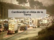
Cambiando el clima de la Tierra * * Location and satellite image of the Quelccaya Ice Cap (pronounced kell-KIE-yah). * * * * Satellite images reveal a widening melt ...
| PowerPoint PPT presentation | free to download

gps in the field gene dashiell environmental planning services, honolulu dashiell.e@hawaiiantel.net compass & data fields bearing the end gps in the field gene ...
| PowerPoint PPT presentation | free to download

... from ACE-Asia? ... Combining ACE-Asia suborbital and satellite measurements ... B. Huebert, ACE-Asia, 12/2002. Dust acts like a sponge, soaking up pollutant ...
| PowerPoint PPT presentation | free to download

Long Range Communications Satellite Phones and Radios MF/HF SSB Radio MComm Ch7 - * * 1.32 is constant for VHF (150 MHz) Number gets smaller as frequency goes up 1 ...
| PowerPoint PPT presentation | free to download
GOIN'99 ... of earth observation applications for the Global Observation Information Network (GOIN) 1999 Plenary and Workshops in Honolulu during the week of ...
| PowerPoint PPT presentation | free to download

Diurnal cycle biases (Yang and Slingo 2001) UKMO Unified Model. Satellite ... Slingo 2006. a. 5-AGCM ensemble hindcast skill. b. OBS SST-rainfall correlation ...
| PowerPoint PPT presentation | free to view

AVHRR images of Hudson River plumes (thanks to Rutgers website) Results 3.0 ... Satellite images and data of the Hudson River plumes. ...
| PowerPoint PPT presentation | free to view

Svetlana Y. Kotchenova1, Eric F. Vermote1,2, Philip A. Farris1, & Jose G. Roa1 ... of Honolulu near the end of the Hawaiian Archipelago (28.12 N, 177.22 W) ...
| PowerPoint PPT presentation | free to view

Save big with perfect Satellite TV and Best High Speed Internet broadband services that are right for you at Hawaii and Honolulu. For more details log on http://www.oceanic.com/

This report was prepared for Professor L. Orozco-Barbosa. in partial fulfillment of the ... [2] Fossa, C. E., Raines, R.A., Gunsch, G.H., M. A. Temple, A Performance ...
| PowerPoint PPT presentation | free to view


World War Two 1939 - 1945 By: Sam, Andrea, Sarah and Cinnamon Hitler Nazi s When did World War Two start, and when did the Americans enter? World War Two started in ...
| PowerPoint PPT presentation | free to download

MAGNETIC HISTORY OF THE MOON AND MARS
| PowerPoint PPT presentation | free to view

... light trespass & sky glow Restores dark skies for stargazing Good for human health & ecosystems Prevents the pervasive spread of light pollution Preserves ...
| PowerPoint PPT presentation | free to download


U.S. Department of Defense. 19. Global Positioning ... to the broadcast corrections, and ... 140,000 GA aircraft are equipped with Garmin receivers. GNS ...
| PowerPoint PPT presentation | free to view

Title: Regional meteorological telecommunication network for region V Subject: implementation Author: rainer Last modified by: Kelvin Created Date
| PowerPoint PPT presentation | free to download

IMTN-MDCN FR 1.5 M (CIR:32/768) Tokyo Washington New Delhi FR 192/64 (CIR:16) Bangkok Two 56 TCP/IP FR 64 (CIR:16) IMTN-MDCN FR 256 (CIR:32) Manila 9.6 X.25
| PowerPoint PPT presentation | free to download

... With the end result of improved flood science. Status ... What it is and How it Works, Advances in Environmental Monitoring and ... pp.5-36 Wright, R ...
| PowerPoint PPT presentation | free to view

BILL MASSEY HURRICANE PROGRAM MANAGER
| PowerPoint PPT presentation | free to view

Evolution of a. Coastal Ocean Observing System. LEO-15 LEO NJSOS ... Data Sharing: Hourly Radial Data Files via ftp. Products: Discretion of Individual Institutions ...
| PowerPoint PPT presentation | free to download

'Garmin' GPS (plus batteries) Computer with a serial port. Serial cable for the GPS ... Garmin Supplemental. US Cities. US Topography. Foreign (some detail) ...
| PowerPoint PPT presentation | free to view

Average Angstrom Exp (440-870 nm) = 1.56 on Feb 25 at Phimai, Thailand ... Angstrom Exponent was typically 1.4 : Therefore Fine mode particles (radius ...
| PowerPoint PPT presentation | free to download

National Center for Secure and Resilient Maritime Commerce and Coastal Environments CSR
| PowerPoint PPT presentation | free to download

WORLD METEOROLOGICAL ORGANIZATION Weather Climate - Water WMO Information System J.-M. Rainer, Chief ISS Division World Weather Watch, jmrainer@wmo.int
| PowerPoint PPT presentation | free to download

2) Soundings provide measurements at only one point and time ... Mechanical design for moving shadow band in now being machined ...
| PowerPoint PPT presentation | free to download

'Research underpins NOAA's science-based mission... 1 vehicle owned (Manta), several partnerships with NASA (Altair) ... Manta. Autonomous Benthic Explorer. 9 ...
| PowerPoint PPT presentation | free to view

Baltimore County. Maryland. GOES-R Proving Ground ... Need real time and archived events (AWIPS2, WES) ... Monona Terrace Convention Center. Madison, Wisconsin ...
| PowerPoint PPT presentation | free to download

AOR-W (Covers Eastern CONUS to Rocky Mountain Area) POR (Covers Western CONUS, Alaska, Hawaii) ... To Expand Service Area And Improve Availability. Additional ...
| PowerPoint PPT presentation | free to view

NDMO Case Study: HAWAII, USA EMERGENCY RESPONSE AND TSUNAMI PREPAREDNESS IOC Expert Missions May-August, 2005 Major Natural Disaster Fatalities in Hawaii during the ...
| PowerPoint PPT presentation | free to download

... extinction was modeled from Twin Otter composition and size data. ... Twin Otter. C-130 ... CIRPAS Twin Otter. ARA KingAir. Ships. R/V Ron Brown. R/V ...
| PowerPoint PPT presentation | free to download

TOWARDS AN AEROSOL CLIMATOLOGY. TOWARDS AN AEROSOL CLIMATOLOGY: It's all about ... to the understanding of the climatology and variability of aerosol over the ...
| PowerPoint PPT presentation | free to download

Rescue 21 (formerly NDRS) US coastal and inland waters ... Cellular Provides voice, Internet and data communications plus short messaging ...
| PowerPoint PPT presentation | free to view

Hurricane. Flash Flood. Tsunami. Earthquake. Volcano. Subsidence/Land ... First wave arrival to Hawaii is 4 hrs 30 mins after earthquake origin time. ...
| PowerPoint PPT presentation | free to download

Evan A' Howell1 and Jeffrey J' Polovina1
| PowerPoint PPT presentation | free to view

Science Chicago. It's Showtime! Facilitated Shows. Non ... Additional planets. Shifts in plant and animal life (polar bears, coral reefs, etc) Questions? ...
| PowerPoint PPT presentation | free to view

Int'l Communications Satellite Systems Conf (ICSSC) - Jerry Fiedziuszko ... Continued to provide advice and support to conference planners ...

McIDAS Users' Group Information October 2005. Dee Wade - Program Manager ... 5,700. SX - one or two machines. Inquiries Received by Membership. January 2000 ...
| PowerPoint PPT presentation | free to download

TSUNAMI PREPAREDNESS
| PowerPoint PPT presentation | free to view