
WATERWAYS AND - PowerPoint PPT Presentation
1 / 20
Title:
WATERWAYS AND
Description:
WATERWAYS AND BRIDGES IN TEXAS CE 394K 11-22-05 Dr. Maidment Final Presentation by: Brandon Klenzendorf Background TxDOT to use crash-tested bridge rails May ... – PowerPoint PPT presentation
Number of Views:211
Avg rating:3.0/5.0
Title: WATERWAYS AND
1
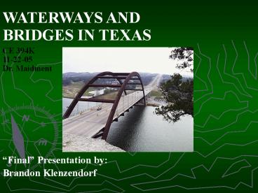
WATERWAYS AND BRIDGES IN TEXAS
CE 394K 11-22-05 Dr. Maidment
Final Presentation by Brandon Klenzendorf
2
Background
- TxDOT to use crash-tested bridge rails
- May impact FEMA 100-year floodplains
- Cause for map revisions time and money!
- Need to determine how bridge rails affect water
surface profiles
3
TxDOT Design Frequencies
TxDOT Hydraulic Design Manual
4
Project Purpose
- In order to solve this problem, we need to
predict - Hydraulic impact of crash-tested bridge rails
- 100-year peak flood discharges
- Determine peak discharge for 100-year return
period flood - Use GIS and NFF programs to gain info on flood
discharges
5
GIS Data Collection
- State of Texas HUCs from TNRIS
- http//www.tnris.state.tx.us/
- Major highway network from TNRIS
- Major stream network from TNRIS
- DEMs for selected bridges from USGS
- http//seamless.usgs.gov/
6
1
3
7
10
4
2
8
11
5
9
6
7
(No Transcript)
8
ArcHydro Tools
- DEM processing
- Problems with gaps in stream layer
- Drainage line creation
- Batch point watershed delineation
- Longest upstream length
- Upstream and downstream elevations
9
Bridge 1
Problems!
10
USGS NFF Program
- National Flood Frequency Program
- Estimates the magnitude and frequency of flood
peak discharges and hydrographs - 2, 5, 10, 25, 50, 100, and 500-year frequency
floods - Uses Visual Basic and regression equations
specific for each state - FREE!!!
- http//water.usgs.gov/software/nff.html
11
NFF Program Parameters
- Drainage Area (A) area (mi2) contributing to
flow at the bridge - Shape Factor (SH) ratio of stream length
squared (mi2) to drainage area (mi2) - Represents stream length to average width
- Stream Slope (SL) change in elevation (ft)
divided by steam length (mi)
12
Hydrologic Regions
- Determined based on physiography and climatic
conditions - Each hydrologic region has range of applicable
parameters - Hydrologic Region 1 - Q100371A0.847SH-0.307
13
Determined NFF Parameters
Hydrologic Region Area (mi2) Upstream Length (mi) Slope (ft/mi) Shape Factor Latitude (DD) Longitude (DD)
R-1 1120.9 29.12 9.85 0.756 36.202 -101.306
R-2 548.4 17.16 37.62 0.537 31.878 -103.947
R-3 3408.1 45.53 13.24 0.608 34.090 -99.730
R-4 2098.0 40.19 7.77 0.770 32.399 -100.894
R-5 1447.0 43.04 11.66 1.280 29.514 -97.494
R-6 489.2 27.966 -98.973
R-7 1917.4 33.072 -97.532
R-8 2590.9 31.435 -97.759
R-9 571.0 28.703 -97.047
R-10 991.2 32.777 -95.798
R-11 923.2 30.396 -94.255
14
NFF Interface
15
Flood Region Map
16
NFF Results
- 100-year hydrograph for five bridges
- Bridge 5 has largest peak, but third largest area
- Bridge 3 has second lowest peak, but largest area
5
1
4
3
2
17
(No Transcript)
18
Completed Work
- Geodatabase of Texas rivers, highways, and HUCs
- ArcHydro tools for all bridges
- Batch point watershed delineation for all bridges
- Partial completion of longest stream length
- Partial completion of NFF analysis
19
Future Work
- Longest stream lengths for remaining Hydrologic
Regions - NFF analysis for all bridges
- Comparison of results
- Analyze errors in DEMs, HUCs, and bridge
locations - Write final report
20
Questions
?
Recommended
CrystalGraphics Presentations


