
Aerotriangulation Data Reduction using AeroSys-AT PowerPoint PPT Presentation
1 / 107
Title: Aerotriangulation Data Reduction using AeroSys-AT
1
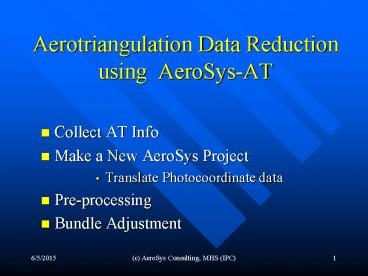
Aerotriangulation Data Reduction using
AeroSys-AT
- Collect AT Info
- Make a New AeroSys Project
- Translate Photocoordinate data
- Pre-processing
- Bundle Adjustment
2
Collect AT Info
- Gather Ground Control Point file
- Convert to AeroSys CTL format
- How good is your control?
- Get gcp sigma's!, Time
- Plot out in scatter chart PtID,X,Y
- Measure AT Data
- Softcopy or Analytical Plotter
- Export to desired format (ptb, etc.)
- Refined vs. Raw
- Collect Camera Calibration Info
- Focal Length, Xo, Yo, K0, K1, K2, K3, P1, P2, P3
3
Make New AeroSys Project
- Put data files into designated directory
- Measured photocoordinates (.ptb, etc)
- Ground Control (.ctl)
- Project (File) Basename CTL file
- Photocoordinate Format Type
- Block Configuration
- Camera Information
4
Translate Photocoordinate Data into AeroSys
(.REF) Format
- Verify input format type
- Refined vs. Raw
- Refined No Fiducials or Interior Points
- Raw How many fiducials 4 or 8
- Units millimeter or microns
- Did translation parse OK?
5
Data Pre-processing
- Prepro
- Photocoordinate Refinement (REFINE)
- Relative Orientation (RELORN)
- Strip Formation (STRIPFORM)
- Block Formation (BLOCKFORM)
- Model Coords to Ground (ESTIMATE)
- Photo Resection (RESECT)
- Point Intersection (INTERSECT)
- Merge data files (MERGE)
- Pre-Bundle Data Check (IMAGE RAYS)
6
Photocoordinate Refinement (REFINE)(raw
photocoordinates only)
- 2D-Affine transformation from plate coordinates
to camera system - Option to remove radial lens distortion
- Input .PHC, .CAL
- Output .REF
7
Relative Orientation (RELORN)
- Makes independent models from adjacent
over-lapping photos in each strip - Is direction of flight correct?
- Input .REF, .CAL, .CTL
- Output .REL
8
Strip Formation (STRIPFORM)
- Connects adjacent independent models together in
a strip in model space coords - Minimum 3 common points photo center
- Input .REL
- Output .STP
9
Block Formation (BLOCKFORM)
- Similar to STRIPFORM, but makes a single block of
coordinates from adjacent strips in model space - Checks that strips are tied together
- Ideal for AB-GPS application with few gcps
- Input .STP
- Output .BLK
10
Model Coordinates to Ground (ESTIMATE)
- Transforms model space coordinate to object space
(ground) coordinates - 2 Options
- Strip Polynomial Adjustment Input .STP, .CTL
- 2D/3D Hybrid transformation Input .BLK, .CTL
- Tie point analysis in log file
- Output .EST
11
Photo Resection (RESECT)
- Computes the Exterior Orientations of each photo
in each strip - Omega, Phi, Kappa, XL, YL, ZL
- Input .CAL, .REF, .EST
- Output .CAM, .RST
12
Point Intersection (INTERSECT)
- Computes object space (ground) coordinates for
points missed-out during model and strip
formation - Input .REF, .EST, .RST
- Output updated .EST
13
Merge data files (MERGE)
- Merges data files from previous PREPRO step into
a first approximation data file for the Aero
bundle adjustment - Inputs .CAL, .CAM, .EST, .REF
- Output .AER
14
Pre-Bundle Data Check (IMAGE RAYS)
- Performs space (point) intersections on all
object (ground) points from initial
approximations - Warning Tool for gross blunders
- Input .AER
- Output GUI
15
PREPRO Statistics
- .LOG text files for each step
- REFINE
- RELORN
- STRIPFORM
- BLOCKFORM
- ESTIMATE
- RESECT
- INTERSECT
- IMAGERAYS
- Full Statistics, observations and residuals
16
Special PREPRO Features
- RELORN
- Auto eliminate gross misfits
- Explicitly remove observation with FLAG 0
- BLOCKFORM
- Reports used and un-used control points
- ESTIMATE
- Auto eliminate gross misfits
- Re-designates bad ground control into check
points - Tie-point reporting Threshold Limits on deltas
- RESECT
- Auto eliminate gross misfits
17
Bundle Adjustment
- Aero.exe
- Input
- Prepro Approximations (.AER)
- Cycle
- Run
- Analyze Statistics
- Quick Summary
- Model Check
- Edit
- Output
- Adjusted Ground Coordinate (.XYZ)
- Adjusted Orientations (.ORN)
- Other formats (ORI, Itera, Dapor, Z/I, VirtuoZo,
etc)
18
Before we get started
- AeroSys main menu gui
- Title bar
- Data directory
- Project base name
- Menu Bar
- Button (Icon) Bar
19
Main Menu Title Bar
- Data Directory
- G\AeroTriangulation\Projects\CityofSaintPaul\
- Project Basename
- TwinCities
- AeroSys file extensions ( )
20
Main Menu Bar
- Pull-down Menus
- File
- Preferences
- Translate
- Aerial
- Bundle
- Utils
- Help
21
Main Menu Button Bar
- Project GUI
- Auto-Prepro
- Convert / Translate
- Prepro
- Aero Bundle
22
Prepro Functions
- Refine
- RelOrn
- StripForm
- BlockForm
- Estimate
- Resect
- Intersect
- Merge
- Image Rays
- Flip-Flop
- Add GPS
- Legacy Functions
- Split
- Build
- Combine
23
Prepro GUI
24
Prepro GUI
- Status Info
- Options Group Box
- Quick Summary
- Messages
- Operation Buttons
- Function Tabs
25
Prepro GUI
- Status Info
- Current Status
- Which Prepro step
- Progress Bar
26
Prepro GUI
- Options Group Box
- Different for each step
27
Prepro GUI
- Quick Summary
- Lists RMSE residuals
28
Prepro GUI
- Messages
- Internal Processing
29
Prepro GUI
- Operation Buttons
- GO start processing step
- NEXT advance to next step
- SKIP skip over processing step
- BACK back-up to previous step
30
Prepro GUI
- Function Tabs
- Not Enabled, Visual Feedback Only
- Use operation buttons to navigate
31
Set Operating Preferences
- File Preferences Aerial Auto-Sequence
- Run Sequence
- Options
- Passpoint Prefix
- Lens Distortion
- Estimate
- Check Image Rays
32
Program Run Sequence
- Check Box to enable step
- Usually start with RelOrn
- End with Aero Bundle
33
Prepro Options
- Delete Passpoint Prefix
- Legacy option from JFKs historical RABATS/BRATS
- Required 99 to prefix passpoints
- Afterwards stripped-off prefix from the point ID
34
Prepro Options
- Remove Lens Distortion
- For RAW photocoords only
35
Prepro Options
- ESTIMATE step
36
Prepro Options
- Pre-Bundle Adjustment Error Checking step
37
Other Preferences
- Default Standard Deviations
38
Other Preferences
- Max
- residual limits
39
Other Preferences
- Passpoint ID
Needed for RelOrn Poly Strip Adjustment
40
Other Preferences
- Tie point thresholds
41
Other Preferences
- Plug-in to your favorite text Editor
42
Getting Started step 1
- Organize your data
- Project directory?
- Project basename?
- Ground control data
- sigma's?
- Camera calibration on-hand?
- Photocoordinate measurements
- Exported format
43
Getting Started step 2
- Make AeroSys Project
- Launch Project GUI
44
Getting Started step 2
- Need Info in for these categories
45
Getting Started step 2(a.1)
- Select File New menu item
- from Project Info gui
Select Data Directory Enter Project Base Name
46
Getting Started step 2(a.1)
- Data directory Project basename are extracted
from file chooser
47
Getting Started step 2(a.2)
- Select Ground Control (.CTL) file
- Click on 2 to get file chooser dialog
48
Getting Started step 2(b)
- Select Photocoordinate Type
- Example PAT-B format, Refined, Unpaired
49
Getting Started step 2(b)
- Special Settings for ABC32 and ALBANY
- Converts Strip Photo (position) Number into a
unique Photo ID
Example Strip no.3, Photo no.11 Photo ID no. ?
? 311
50
Getting Started step 2(c)
- Enter Block Configuration Info
51
Getting Started step 2(c)
- First, set total number of flight strips
52
Getting Started step 2(c)
- Next, assign data file to strip number
- Select Strip No. using spin buttons
- Click Green Plus to assign data file
- File parser will determine first, last
- and total photos in strip
53
Getting Started step 2(c)
- Use
- Green plus sign to assign data file with chooser
- White text icon to view data file
- Red minus sign to remove assignment
54
Getting Started step 2(c)
- Use
- Blue-green icon to swap first last photo Ids
- Direction of actual flight must be the same as
the ordered IDs - Hand enter photo IDs if data file contains all
strips-in-1 file - Photo Ids can be incremented by 2 in special
overlap cases
55
Getting Started step 2(c)
- Are all flight strips in 1 data file?
- Enter first last photo Ids by hand
- Click on, strips All-in-1 file
- Click on, Green Plus sign to get file chooser
56
Getting Started step 2(d)
- Assign camera to project from data base
57
Getting Started step 2(d)
- To add camera to data base
- Click on the blue arrow icon in URH corner
58
Getting Started step 2(d)
- Click on
- Edit to modify an existing camera
- New to add a new camera
- Delete to remove a camera
- Done to finish input of data
- Select_OK to save camera entry
- Cancel to return without saving
59
Getting Started step 2(d)
- Enter camera calibration data into gui, or
- Click the yellow file open icon to select a
pre-existing - AeroSys .CAL data file to import
60
Getting Started step 2(d)
- Click on Save to write the new project file
- Click on OK to save and exit gui
- Click on Cancel to exit gui without saving
You are done setting up a project !
61
Getting Started after step 2
- Take a quick look at your project data directory
- Photocoordinate files .PTB
- Ground Control file .CTL
- Camera Info file .CAL
- Project file .PRJ
(legacy .idx)
62
Getting Started step 3
- Translate the photo coordinates to native AeroSys
.REF refined format
Click here to translate
Settings are saved for next time you translate
63
Getting Started step 3
- Translation Options
- Supported Photocoordinate Formats
64
Getting Started step 3
- Translation Options
- Coordinate Type
- Number of Fids
- Units
65
Getting Started step 3
- Translation Feedback
- Parsing Error?
66
Getting Started step 3 ½
- Start Pre-processing . with REFINE
- Done only with RAW photocoordinate type such as
ABC32 .TRI files - If photocoords are refined, skip this step and go
on to step 4 - Converts .PHC to .REF
67
Getting Started step 4
- Start Pre-processing . with RELORN
- Relative Orientation of independent models
Click on GO
68
Getting Started step 4
- If photo IDs are listed in reverse order (i.e.,
opposite the direction of flight), go back to
project setup, edit (i.e., swap), save and then
re-translate photo coordinates
69
Getting Started step 4
- Check Quick Summary window
- want ROs to be squeaky clean !!
- RMS_Vy lt 3.0 microns
- Click the NEXT button to proceed
70
Getting Started step 5
- Next after RELORN is STRIPFORM
- Click on GO
- Just want models to reasonably connect together,
dont sweat the residuals unless they are very
large (order of magnitude in 100s of microns)
71
Getting Started step 6
- Next after STRIPFORM is BLOCKFORM
- Click on GO
- Just want Strips to reasonably connect together,
dont sweat the residuals unless they are very
large (order of magnitude in 100s of microns)
72
Getting Started step 7
- Next after BLOCKFORM is ESTIMATE
- Strip Polynomial or 2D-3D Hybrid transformation ?
- Prefer strip polynomial
- Does every strip have enough GCPs ?
- Otherwise, use Hybrid method
- Tie point analysis see log file
73
Getting Started step 7
- Check Quick Summary
- Are residuals reasonable?
74
Getting Started step 8
- Next after ESTIMATE is RESECT
- Check Quick Summary
- Do all Photo EOs solve?
- Dont sweat the residuals, just need to solve!
75
Getting Started step 9
- Next after RESECT is INTERSECT
- Finds missed-out points in data
76
Getting Started step 10
- Next after INTERSECT is MERGE
- Creates initial approximation (.AER) input file
for the Aero.exe least-square bundle adjustment
from previous PREPRO steps - .CAL (camera info)
- .CAM (orientations)
- .EST (ground coords)
- .REF (photo coords)
77
Getting Started step 11
- Next after MERGE is IMAGE RAYS
- Data checking for mis-IDed points
78
Getting Started after step 11
- You are now ready to run the Aero bundle
adjustment!! - Things to keep in mind?
- Blunders still may exist in data
- Turn override option OFF until no blunders
- When only random error, turn override ON
79
Getting Started step 12
- Run the AERO.exe bundle adjustment
- Check operating parameters
- Override option
- Self-Cal
- AB-GPS
- Earth Curvature
80
Getting Started step 12
- AERO gui
- Click stop light icon to run
81
Getting Started step 12-run
- Aero run-time GUI
82
Getting Started step 12
- Aero Quick Summary gui
83
Analysis Details
- Image space stats
- Final Sxy
- RMSE Vx Vy (mm)
- Standardized Residuals Wx Wy (unit-less)
84
Analysis Details
- Top Ten Largest Residuals
- Units mm
85
Analysis Details
- Root Mean Square Photocoordinate Residuals
- Units micrometers
- Vx Vy
86
Analysis Details
- Final Weights assigned to photocoordinate
observations - Static Override Option OFF
- So Override ON
87
Analysis Details
- What is Override Option?
- Feature that automatically balances the weights
assigned to the photocoordinate observations with
the other observational types in the block
adjustment - Want final So (S-naught) to equal 1.0
- Ensure optimal solution and needed by Data
Snooping mathematics
88
Analysis Details
- Standardized Photocoordinate Residuals
- Wx, Wy
- Unit-less statistic
- Outliers
- Greater than /- 3.29
89
Analysis Details
- Possible Blunders?
- Click button to view list of suspected points
- Only the largest is the likely candidate !
90
Analysis Details
- Ground (object) Space Residuals
- RMSE for control
- Check Points List
- Wx, Wy, Wz
- Blunders List
91
Analysis Details
- Post-Adjustment Predicted Coordinate Mean
Accuracies - Units ground control
92
Analysis Details
- Want So to be 1.0
- Chi-square interval Lo ... 1.0 Hi
- Based on DOFs
- Why ?
- Balanced Weights
- Optimal Solution
- Data Snooping Theory
93
Analysis Details
- Evaluation Criterion
- RED critical fail
- YELLOW warning
- GREEN passed
- Use as guide, not gospel
94
Analysis Details
- Criterion Components
- Photocoords
- 1 - 4
- Ground Coords
- 5 - 7
- Error Budget
- 8 - 9
95
Analysis Details
96
Analysis Details
97
Analysis Details
98
Analysis Details
- Mean predicted accuracies of aero-triangulated
points in X, Y Z - Represents 1 sigma
99
Analysis Details
- Want 90 confidence that error component of AT-ed
points are no greater than one-sixth of contour
interval - One-sixth rule-of-thumb, not gospel
100
Analysis Details
- Want 90 confidence that error component of AT-ed
points are no greater than one-sixth of delta
map scale values
101
Analysis Details
- Quick access to Model Check Tool
- Tool to evaluate how well model AOs are expected
to setup - Check for bad models
- Check for bad points
- Check for duplicate points
102
Model Check Gui
103
Point Check Output
- 3103 2431584.352 1867925.503
647.214 PP4 - 3 7 311_310 0.155 0.113
0.133 . . . - 3 8 310_309 0.665 -1.153
-1.410 4.4 6.2 5.1 - 4 9 409_410 0.344 0.335
-0.369 . . . - 4 10 410_411 -0.237 0.330
-0.415 . . . - -9
- A dot . signifies that the residual is less
than 3xs the mean RMSE, otherwise print how many
times greater than the overall mean
104
AeroSys Output Files
Adjusted Orientations
- .ORN (AeroSys)
- .ASO (Z/I)
- .OPK (ER Mapper)
- .ORI (PAT-B)
- .Triang (Softplotter)
- Dapor.dat (BLUH)
- ITERA.dat (BINGO)
- .PXYZOPK ( ??? )
- .VZ.aop (VirtuoZo)
105
AeroSys Output Files
Adjusted Object (Ground) Space Coordinates
- .ADJ (AeroSys)
- .XYZ (AeroSys)
- .CON (ABC)
- .PXYZ (VirtuoZo)
- .GCP (R-Wel)
- .GPE (CalTran)
- .GPA ( ??? )
- .PBM (BC-Gov)
- .DATA
- .DATM
106
AeroSys Output Files
Miscellaneous Files
- .AER (bundle input)
- .AQS (aero quick summary)
- .CQS (control quick summary)
- .PQS (pcoords quick summary)
- .CKP (check points)
- .ICA (image coords adjusted)
- .ELLIPSE (error ellipses)
- .RES (pcoords residuals)
- .PRJ (project file)
107
Prepro Data Files
- .BLK (model coords as 1 block)
- .CAL (cam calibration)
- .CAM (camera orientations)
- .CTL (ground control)
- .EST (ground coordinates)
- .REF (refined photocoords)
- .PHC (raw photocoords)
- .REL (model coords)
- .RST (resection)
- .STP (model coords as per strip)
Recommended
