
Characterizing Controls of Geothermal Systems through Integrated Geologic and Geophysical Studies: D - PowerPoint PPT Presentation
1 / 23
Title:
Characterizing Controls of Geothermal Systems through Integrated Geologic and Geophysical Studies: D
Description:
Characterizing Controls of Geothermal Systems through Integrated Geologic and Geophysical Studies: D – PowerPoint PPT presentation
Number of Views:191
Avg rating:3.0/5.0
Title: Characterizing Controls of Geothermal Systems through Integrated Geologic and Geophysical Studies: D
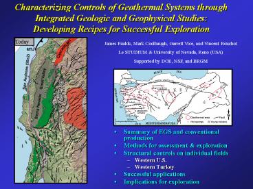
1
Characterizing Controls of Geothermal Systems
through Integrated Geologic and Geophysical
Studies Developing Recipes for Successful
Exploration
James Faulds, Mark Coolbaugh, Garrett Vice, and
Vincent Bouchot Le STUDIUM University of
Nevada, Reno (USA) Supported by DOE, NSF, and BRGM
- Summary of EGS and conventional production
- Methods for assessment exploration
- Structural controls on individual fields
- Western U.S.
- Western Turkey
- Successful applications
- Implications for exploration
2
Geothermal Exploration Success Stories
Steamboat, USA
Kizildere, Turkey
Salavatli, Turkey
Bradys, USA
Germancek, Turkey
Desert Peak, USA
3
Exploration Challenges
- Hot dry wells
- Overturn in down-hole temperature gradients
- Wet cool wells
- EGS one answer
- Recent reports by MIT (USA) and ENGINE (Europe)
stress the importance of EGS - OR Do we need better conceptual models to guide
exploration?
Blue Mt., Nevada, USA
Germancek, Turkey
Desert Peak, Nevada, USA
4
Conventional vs. EGS Methods
- EGS
- Ideas around for 35 years
- Experiments in 8 countries
- Soultz most successful project (1990-2008)
- Engineering successes but limited production
- Current production of 1.5 MW but anticipated 3 MW
- Conventional
- Commercial production since 1913
- Identified in 90 countries
- Utilized in at least 72 countries
- Present installed capacity is 9 GW (Bertani, 2008)
Yet in both the USA and Europe, future of
geothermal energy presumed to be in EGS projects
5
Characterizing Controls on Geothermal Systems
- Favorable settings generally not well
characterized - Fault controls
- Magmatic
- Deep sedimentary basins
- In many regions, dependent on data from oil
industry - Good catalogues but no systematic syntheses of
favorable settings - Atlas of Geothermal Resources in Europe (Hurter
and Haenel, 2002) - Turkish Geothermal Inventory (Akkus et al., 2005)
- Few syntheses in geothermal industry capable of
guiding ongoing or future exploration - Contrasts with petroleum and minerals industries
6
Methods
- Detailed mapping and reconnaissance
- Structural analysis
- Gravity surveys
- Studies of surficial geothermal features
- Shallow temperature surveys
- Geochemical analyses
- GIS compilation
Ephesos, Turkey
7
Methods
- Detailed mapping and reconnaissance
- Structural analysis
- Gravity surveys
- Studies of surficial geothermal features
- Shallow temperature surveys
- Geochemical analyses
- GIS compilation
Sinter (opal)
Clay Alteration
Shallow temperature surveys
Carbonate tufa/travertine
GIS 3D
8
Tectonic Settings
- Dextral shear in adjacent region
- Early extension generated by collapse of
over-thickened crust - Transtensional to extensional domains
- Volcanism generally ceased in middle to late
Miocene - Geothermal belts Loci of extension
9
Newberry Crater
Geothermal Systems in Great Basin, USA
Borax Lake
China Hat
Medicine Lake
Roosevelt/ Cove Fort
Current GB Geothermal Power Plant Capacity is
600 MWe
Mammoth
Coso
Boundary of Great Basin
10
Bradys Desert PeakSteps in Normal Faults
- Bradys reservoir 180oC
- 4-km-long NNE-trending zone of mudpots,
fumaroles, warm ground - Bradys fault Holocene offset
- Desert Peak blind reservoir
- Along NNE fault zone
- Temp 218oC
- Power plants producing 40 MWe
- Abundant subsurface data
- En echelon normal faults with multiple step overs
- Multiple fault splays produce subvertical
conduits of highly fractured rock that provide
avenue for fluids - No major range-front faults
11
Gerlach Hot SpringsEnd of Major Normal Faults
- Boiling springs, mud pots, siliceous sinter
- Geothermometers suggest 160-200oC resource
- Two range-front fault systems terminating
- Horse-tailing multiple fault splays
- Intersecting steeply dipping faults
- Subvertical conduits of highly fractured rock
12
Salt Wells Overlapping Fault Systems
N
- 12 km long anomaly
- Shallow reservoir 140oC
- Geothermometry suggests 180oC deeper reservoir
- 10 MWe binary plant planned
- South end of E-dipping Quaternary fault system
- Overlap with W-dipping fault system
- Possible intersection with NW dextral fault
- Conduits of highly fractured rock some
subvertical
13
Blue Mountain Dilational Fault Intersection
- Blind system Discovered due to mineral
exploration in hydrothermally altered area - Temperature to 190oC at 1 km
- Meta-sedimentary rocks
- Basement fabric affecting normal fault
orientation - Induces adjustments or steps
- Complex fault intersections and small pull aparts
- West-plunging reservoir of highly fractured rock
14
Lee-Allen Hot Springs Pull Apart
- Undeveloped but promising
- NW terminus of major dextral fault
- Pull-apart region
- Geothermometers 170oC
Lee Hot Spring (96oC)
N
15
Western Turkey
- 3,900 MW capacity
- Menderes graben Germancek Kizildere
- Salihli Kursunlu hot springs
16
Menderes Graben Ends of Major Normal Faults
Fault Intersections
- Germancek west end (232oC)
- Kilzedere east end (242oC)
17
Salihli (Kursunlu) Dilational Fault Intersection
- Kursunlu springs (63-89oC)
- Geothermometers (150-230oC)
- Problems with draw-down
- Complex fault intersection
- detachment fault
- high-angle normal faults
- sinistral cross fault
18
Summary of Structural Controls
- Most fields not on major range-front faults
- Majority on less conspicuous normal faults
- Most common occurrences
- Discrete steps in fault zones
- Intersecting faults dilational
- Overlapping fault zones
- Terminating, horse-tailing faults (some
range-front faults) - Small pull aparts in strike-slip faults or in
complex fault intersections
19
Testing Models Recent Exploration
- Salt Wells
- Geologic mapping Quaternary faults
- Surface features sinter, clay alteration,
silicified sands - Recommended drilling sites
Silicified Holocene sands
20
Astor Pass Pyramid Lake
- NW belts of tufa towers
- To 117oC in wells drilled in 1960s near lake
- 143-213oC geothermometers
- Sacred site to Piute tribe
- Integrated
- Detailed mapping
- Structural analysis
- Gravity survey
- Quaternary fault studies-trenching
- Bathymetry
- Seismic reflection data
Fault
Seismic Line
21
Astor Pass Pyramid Lake
1 km
- A
Tufa Tower
87C
94C
79C
550 m
90C
93C
116C
22
Testing Model Desert Queen
- Hot Springs Mountains Desert Queen area
- Terminating and overlapping fault systems
- Shallow temperature survey indicates thermal
anomaly - Up to 44oC at 2 m depth
10 km
Hot Springs Mts
23
Conclusions
- Implications
- Better geologic characterization critical for
geothermal development - Improving conceptual models through integrated
geologic-geophysical work may be more cost
effective than EGS - Many undiscovered conventional geothermal systems
- Work on EGS and conventional systems not mutually
exclusive - Some regions require more EGS than others
- Structural controls
- Not common on major range-front faults
- Steps in normal faults and overlapping normal
faults - Ends of major faults, especially Quaternary
faults - Intersecting faults
- Pull aparts in strike-slip faults
- Subvertical conduits of highly fractured rock
Recommended
CrystalGraphics Presentations


