
Digital Elevation Models DEM Digital Terrain Models DTM Digital Surface Models DSM Brief Review - PowerPoint PPT Presentation
1 / 18
Title:
Digital Elevation Models DEM Digital Terrain Models DTM Digital Surface Models DSM Brief Review
Description:
Anaglyph - Malaspina. DEM products. Elevation 0- ? 16 bit (signed) Shaded relief 0-255 ... Visual: Anaglyphs and 3D perspectives. DEM quality and errors ... – PowerPoint PPT presentation
Number of Views:2001
Avg rating:3.0/5.0
Title: Digital Elevation Models DEM Digital Terrain Models DTM Digital Surface Models DSM Brief Review
1
Digital Elevation Models (DEM) Digital Terrain
Models (DTM) / Digital Surface Models (DSM)
Brief Review
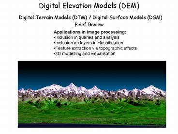
- Applications in image processing
- Inclusion in queries and analysis
- Inclusion as layers in classification
- Feature extraction via topographic effects
- 3D modelling and visualisation
2
DEM data formats
A. Discrete data Contour lines from maps or
digital files Mass points . And break
lines terms http//www.satimagingcorp.com/svc/dem
.html These can be interpolated into GRIDS (PCI
etc..) Method of interpolation can have high
impact on the DEM B. Continuous
data Triangulated Irregular Networks
(TIN) Raster grids needed for remote sensing
should be same pixel size
3
DEM sources global GTOPO30 1993 1km
http//edc.usgs.gov/products/elevation/gtopo30/gto
po30.html
4
DEM sources
Canada NTDB 150,000 1950-90 25 100m
pixels 1250,000 1950-90
100 400m www.geobase.ca Aerial photography
1946 -gt 2-5 m Municipal
1 5,000
1 (usually contours) BC TRIM
120,000 25 1980s photogrammetry TRIM II
breaklines 1995- Landsat
MSS 1250,000 80 1972- Satellite path
overlap Landsat TM/ETM 1100,000 30 1982-
Satellite path overlap
5
DSM sources 2000
Shuttle Radar Topographic Mission (SRTM) Feb 2000
30-90m
6
ASTER 1999 15 25m
0.78-0.86 microns
7
SPOT DEM 2002 5-15m
http//www.spot.com/web/SICORP/1809-spot-3d.php
8
Directed high res sensors- Ikonos 1999 2-5m
http//www.satimagingcorp.com/galleryimages/ikonos
-high-resolution-dem-eritrea.jpg
9
LiDAR 10cm 10m (Mt.St. Helens)
- http//www.nasa.gov/centers/goddard/images/content
/67409main_dh2.gif
10
Photogrammetry Tatras, Slovakia 2m
11
Anaglyph - Malaspina
12
DEM products
Elevation 0- ? 16 bit
(signed) Shaded relief 0-255 Slope
0-90 (if in degrees) Aspect
0-359 16 bit Incidence 0-90
requires orbital metadata Visual Anaglyphs
and 3D perspectives
13
DEM quality and errors
- Scale Match with needs and imagery
- Type of terrain - pixel homogeneity
- Horizontal and vertical accuracy
- DSM or DTM ?
- Interpolation / resampling method from points
or lines? - Null values and spikes
- Errors are more easily spotted from a hillshaded
model
14
(No Transcript)
15
BC provincial DEM 1985 (1981-1989) Homathko
Icefield - mapplace.ca or lrdw.ca
16
Assiniboine Spillway, MB
http//www.gov.mb.ca/stem/mrd/geo/demsm/metadata.h
tml
17
SRTM ASTER comparisonSample area in Indonesia
18
Paper to review for next week
http//www.geog.ucsb.edu/kuzera/kuzera_rogan_east
man_1.pdf