
Abiotic Control of Stream Biota: Physical, Chemical, Hydrological and Spatial Factors - PowerPoint PPT Presentation
1 / 105
Title:
Abiotic Control of Stream Biota: Physical, Chemical, Hydrological and Spatial Factors
Description:
Wheeling Creek is typical of the upper Ohio River tributary streams. ... the smallest, first-order, to the largest, the twelfth-order (the Amazon River) ... – PowerPoint PPT presentation
Number of Views:196
Avg rating:3.0/5.0
Title: Abiotic Control of Stream Biota: Physical, Chemical, Hydrological and Spatial Factors
1
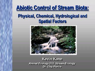
Abiotic Control of Stream BiotaPhysical,
Chemical, Hydrological and Spatial Factors
Kevin Kane
Animal Ecology 518, Stream Ecology Dr. Clay Pierce
2
Topics of Discussion
- Describe physical, chemical, hydrological and
spatial factors that influence the stream
environment. - Illustrate these factors using the Wheeling Creek
watershed project in West Virginia. - Illustrate the interdependence of these factors
using GIS as a tool for rivers and watersheds in
Iowa.
3
(No Transcript)
4
Wheeling CreekBackground Information
- Wheeling Creek is a tributary of the Ohio River
and drains a portion of northern West Virginia
and the southwestern area of Pennsylvania. - Total drainage basin area is approximately 30,000
mi2, and consists of forested, agricultural,
urban, and industrial landcover. - Wheeling Creek is typical of the upper Ohio River
tributary streams.
5
Wheeling Creek Location Map
6
Watershed Site Map
7
Streams, Sites, and Sampling Locations in the
Watershed
Sites A-F
Wheeling Creek Watershed
8
Topographic Map Sites A-F
9
Site F High Altitude Photo
Lower Wheeling Creek Site F 2.6 km upstream of
the Ohio River at Tunnel Green area, Wheeling, WV.
10
Site F Topographic Map
11
Site F Low Altitude Aerial Photo
12
Site F Stream Level View
13
Site of Wheeling Creek Wall in 1890
14
Site of Wheeling Creek Wall in 1996
15
(No Transcript)
16
Physical Hydrological Factors
- Stream Order
- Current / Discharge
- Substrate
- Temperature
- Human Factors
17
Stream Order
- Stream order is a measure of the relative size of
streams. - Stream sizes range from the smallest,
first-order, to the largest, the twelfth-order
(the Amazon River). - Over 80 of the total length of Earth's rivers
and streams are headwater streams (first- and
second-order).
18
Stream Order
- Streams gradually increase their widthand depth
as theygo from 1st orderto nth order. - Water discharge also increases asorder
increases.
19
Topography and Stream Order
20
Comparison of 3rd and 4th Order Stream Watersheds
21
Comparison of 3rd and 5th Order Stream Watersheds
22
1st Order Stream
23
2nd Order Stream
24
3rd Order Stream
25
4th Order Stream
26
5th Order Stream
27
6th Order Stream
28
Hydrology and Stream Order
29
Current / Discharge
- Water velocity and associated forces are huge
factors affecting organisms of running waters - food delivery
- every day physical forces
- in-stream ecological distributions
- behavioral adaptations
30
Current / Discharge
- Effects of flow on aquatic organisms
- Flow environments
- channel
- nearbed
- pools
- Boundary layers
- friction between moving fluid and a stationary
surface - organisms attaching to surfaces
31
Hydrology and Body Shape
32
Substrate
- Bottom, sides, and projecting into streams
- Mineral Substrate
- Current and parent material
- geology
- soils
- Organic Substrates
- minute organic fragments
- fallen trees
- rooted plants
- other animals
33
Limestone Bed
34
Substrate
35
Substrate and Biology
36
Temperature
- Natural Influences
- climatic zone
- altitude
- air temp
- season
- streamside vegetation
- water depth
- flow rate
- snow melt
- groundwater mixing
37
Temperature
- Human Activity (Thermal Pollution)
- coolant discharge
- storm water (roofs, pavement)
- removal of streamside vegetation
- lancover changes
- agricultural practices
- construction
- recreation
- erosion (suspended solids)
38
Temperature / ChemicalInteraction
- Chemical processes involved in
- metabolism
- growth
- reproduction
- behavior
- Sensitivity (thermal stress and shock) of
organisms to - toxic wastes
- parasites
- diseases
- Dissolved Oxygen
- Warmer temps decrease the ability of water to
hold oxygen molecules
39
Temperature
40
Temperature and Biology
41
Human Factors
- Landcover / Landuse Change
- Sewage
- Pollution
42
Human Factors
43
Landcover vs.Diversity
44
Sewage
45
Pollution
46
Weather and Biology
47
Physical Data
48
Chemical Factors
49
Water Chemistry
- Many factors influence the composition of river
water - There is much spatial variation of stream water
chemistry - The ultimate source of all the constituents of
stream water originate from dissolution of the
earths rocks
50
Water Chemistry
51
Chemical Factors
- pH
- Alkalinity
- Conductivity
- Hardness
- Dissolved Gasses (oxygen, carbon dioxide, and
nitrogen)
52
Chemical Settling
53
pH
- The concentration of hydrogen ions in the
solution (acidity and alkalinity) - Every unit change in pH represents a ten fold
change in acidity - Factors in pH of Natural Water
- bedrock and soil type
- vegetation type
- nature and discharge of pollutants
- concentration of carbonates and carbon dioxide
- high concent. produce alkaline water (hi pH)
- low concent. produce acidic waters (low pH)
54
pH
Normal surface waters range from 5.5 - 8.5
55
pH
56
AlkalinityBuffering Action of Streams
- Chemical reactions within streams can cause a
weak buffer - Buffering is the ability of water to resist a
change in its pH - As acidity increases, the buffering capacity is
consumed
57
Water Hardness
- Total concentration of cations
- calcium
- magnesium
- iron
- manganese
- A reflection of the watershed geology and also
human activity in the watershed - Important in the formation of cell material in
aquatic plants and animals
58
Conductivity
- The ability of an aqueous solution to carry an
electrical current through the movement of ions - Indicator for dissolved chemicals in water
59
Dissolved Oxygen
- Two main sources in stream water
- atmosphere
- waves and tumbling water mix air into water where
oxygen readily dissolves until saturation occurs - photosynthesis
- oxygen is introduced by aquatic plants and algae
as a byproduct of photosynthesis - Dissolved oxygen decreases with rise in
temperature
60
Dissolved Oxygen
61
Dissolved Oxygen
- Essential for fish, invertebrate, plant, and
aerobic bacteria respiration - 5-6 ppm - normal fish growth activity
- 3 ppm - stressful to most aquatic organisms
- lt1-2 ppm will not support fish
- Oxygen deficiency factor examples
- aquatic organism consumption
- sewage
- urban and ag runoff
- industrial discharge
62
Leaf Litter
63
Stream Chemist
64
Chemical Data
65
Spatial Factors
66
Spatial Factors
- Spatial scale and spatial distribution of
physical and chemical factors influence an
individual stream dramatically. - The interdependence of these factors and their
analysis can predict a given stream environment.
67
Spatial Factors
- Geology
- Soils
- Landcover
- Human activities
- landfills
- industrial areas
- cities
- agricultural uses
- Maps and GIS - Spatial monitoring and Analysis
68
Spatial Factors
69
Typical Landcover in Watershed
70
Geology and Biology
71
Remote Sensing Data
72
Site Topographic Map
73
Site A High Altitude Photo
Lower Wheeling Creek Site A 12.0 Kilometers
upstream of the Ohio River at Elm Grove, W.V.
74
Site A Topographic Map
75
Site A Low Altitude Aerial Photo
76
Site A Stream Level View
77
Scene on Big Wheeling Creek in 1904
78
Sampling Sites
- Water quality sampling sites are representative
of various sized streams from north to south and
east to west. - This allows comparison of water quality at one
site with the water quality at other sites within
the watershed. - This is a watershed approach, which means that
it is important to view water quality at any one
site within the context of water quality in the
overall watershed.
79
Streams, Sites, and Sampling Locations in the
Watershed
80
Sampling Locations
81
Physical Data From Sampling Locations
82
Chemical Data From Sampling Locations
83
Biological Data From Sampling Locations
84
Biological Data From Sampling Locations
85
Spatial Factors and Biology
86
(No Transcript)
87
Volunteer Monitoring Group
88
Stonefly
89
Biomonitoring
90
Mollusk
91
Biological Data
92
River Continuum Concept
93
Interdependence of Abiotic Factors Using GIS As
a Tool for Streams and Watershed Analysis in
Iowa.
94
Iowas Native Landscape
95
Surveying Crew
96
Iowas Prairie
97
Prairie Stream
98
Plowing the Prairie
99
Tiling the Prairie for Agriculture
100
Tiling the Prairie for Agriculture
101
Straightening a Prairie Stream
102
Abiotic FactorsVisualization and Analysisin a
GIS
103
Summary
- Stream environment is very dependent on the
physical and chemical factors of the watershed. - A specific stream environment is very dependent
upon the spatial distribution of these factors in
the watershed.
104
References
- Allan, J.D. 1995. Stream Ecology -- Structure
and Function of Running Waters. Chapman and
Hall, UK. - Andersen, K., et al. 1997. Historical Land Use
and Surface Hydrology Alterations in Iowa
Agricultural Watersheds. ISU Dept. of Animal
Ecology, Ames. - Roth,N.E., J.D. Allan, and D.L. Erickson, 1996,
Landscape influences on stream biotic integrity
assessed at multiple spatial scales. Landscape
Ecology 11 141-156. - Myers, Robert. 1998. NASA Classroom of the
Future Exploring the Environment - Water
Quality. Wheeling, WV. http//www.cotf.edu/ete/mai
n.html
105
References (cont.)
- Anderson P. F. 1997. GIS Research to Digitize
Maps of Iowa 1832-1859 Vegetation from General
Land Office Township Plat Maps. Iowa Department
of Natural Resources. - Iowa Department of Natural Resources. 1998.
Natural Resources Geographic Information System
Library. Iowa DNR, Des Moines. - Photo Credits
- NASA Classroom of the Future Exploring the
Environment - Water Quality. Wheeling, WV.
http//www.cotf.edu/ete/main.html - Andersen, Kathy. ISU Dept. of Animal Ecology
- Arbuckle, Kelly. ISU Dept. of Animal Ecology