
Homeland Security PowerPoint PPT Presentation
1 / 92
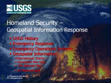
Title: Homeland Security
1
Homeland Security Geospatial Information
Response
- USGS History
- Emergency Response
- Emergency Operations Systems
- Geospatial Information
- International Charter
- Geospatial One-Stop
- The National Map
- US National Grid
2
Organizational Context
3
(No Transcript)
4
USGS Topographic Mapping
1807
1889
1879
1925
1975
1991
2000
2004
Survey of the Coast
U.S. Geological Survey
U.S. Geological Survey Mapping Funds
Temple Act Congressional
124K Mapping Program Completed
National Topographic Mapping Program USGS
GIO Created
NGPO Established
5
USGS Topographic Mapping
1975 National Topographic Mapping Program
2004 NGPO
2000 GIO Created
1991 124K Mapping Program Completed
1994 Exec. Order 12906 NSDI FGDC
6
USGS Topographic Mapping
1975 National Topographic Mapping Program
2004 NGPO
2000 GIO Created
1991 124K Mapping Program Completed
1994 Exec. Order 12906 NSDI FGDC
2001 TNM GOS
7
Emergency Response and Disaster Support
8
Hazard Response Executive Committee (HREC)
- Bureau Deputy Director, Chair of HREC
- Regional Director(s) for the impacted area
- Associate Director for the program associated
with the hazard event - Senior Advisor for Science Applications, Bureau
Emergency Management Coordinator - Associate Director for Geospatial Information
- Associate Director for Administrative Policy and
Services - Senior Science Advisor for Earthquakes and
Geologic Hazards - Chief, Bureau Office of Communications
- Chair of the Geospatial Information Response Team
- Emergency Management Specialist, HREC Coordinator
- http//www.usgs.gov/emergency/
9
Hazard Response Executive Committee
- Earthquake Hazards Program Coordinator
- Volcano Hazards Program Coordinator
- Landslide Hazards Program Coordinator
- Invasive Species Program Coordinator
- Coastal Marine Geology Program Coordinator
- Water Resources lead for flooding/severe inland
weather events - Wildland Fire Science Lead
- Biological Threat Lead
- Bureau Operational Coastal Storm Team Lead
- Science Coastal Storm Team Lead
- Other Equivalent Event Coordinator, as needed
10
Geospatial Information Response Team (GIRT)
- NGPO Director Co-chair (Bill Carswell)
- NCAP Coordinator Co-chair (John Crowe)
- NGPO Emergency Operations Coordinator (Craig
Skalet) - NGTOC Operations Response Coordinator (Kari
Craun) - EROS Operations Response Coordinator (Wayne
Miller) - Geography Operations Response Coordinator
(Bruce Molnia) - HREC Coordinator (Dave Bortnem)
- SRV Operations Response Coordinator (Scott
Wilson) - NGPO Partnership Chief (Vicki Lukas)
- Eastern Region Directors Office Coordinator
(Dan Cavanaugh) - Central Region Directors Office Coordinator
(Ely Brouwers) - Western Region Directors Office Coordinator
(Alan Mikuni)
11
(No Transcript)
12
USGS Mission
- USGS serves the nation by providing reliable
scientific information to - Describe and understand the earth
- Manage water, biological, energy, and mineral
resources - Enhance and protect our quality of life
- And
13
USGS Mission
- Minimize loss of life and property from
- natural disasters such as
- Landslides
- Earthquakes
- Volcanic Activity
- Flooding
- Wildfires
- Biological Diseases
14
Landslide Hazards
Alpine Debris Flow triggered by July 29, 1999
Thunderstorm Colorado Front Range
http//landslides.usgs.gov/
15
Earthquake Monitoring
http//earthquake.usgs.gov/
16
Volcanoes
http//volcanoes.usgs.gov/
17
Flooding
http//waterdata.usgs.gov/nwis
18
Wildfires
http//www.usgs.gov/hazards/wildfires/
19
Biological Diseases
http//www.nbii.gov/portal/server.pt
20
Emergency Operations Systems
21
Emergency OperationsSystem Architecture
EO Portal
HDDS
SEAMLESS SERVERS
Pixia Encoders
CR1 SL8500 Silo Mass Storage System
eSATA/FireWire/USB HD
WMS Servers
ADIS
SAN FC HD
HDDS Products
Manual Ingest Pre-Processor
22
EO Portal
- Provide comprehensive front-end to USGS/EROS EO
project data and other related resources - Single point of entry for Emergency Response user
community - Access to documentation as well as to data
- Provide consolidated access to
- Pixia Viewer and WMS
- HDDS via Tiled and direct FTP downloads
- Seamless and other IADD services
- Provide EO-specific information
- i.e. presentations, announcements, special
projects - Distribute USGS Hurricane Maps
http//hdds.usgs.gov
23
Hazards Data Distribution System (HDDS)
24
WMS Quick-Look Viewer
25
Seamless Viewer
http//seamless.usgs.gov/
26
System Demands
27
VULNERABILITY BUSINESS OVERVIEW
- Vulnerability Growth 2000-2006
- Vulnerability Trends
- Mitres Common Vulnerabilities and Exposures
(CVE) provides a historical view of the volume of
security problems that have impacted computing
systems in the last 6 years.
- Historically, attackers sought out
vulnerabilities that could provide them the
greatest potential control over systems with the
least amount of effort focusing on Operating
Systems. As those easy vulnerabilities get
more scarce, attackers have diversified their
efforts and turned to Applications.
- Severity Increasing
- Industry-wide Problem
- As attackers gain experience looking for
exploits, they strive for efficiency and
productivity. Their effectiveness is shown in
the increasing number and percentage of
high-severity vulnerabilities that can be used
for targeted attacks.
- Skilled attackers are equal-opportunity
exploiters. When they are focusing on a target,
they will work to find vulnerabilities in
whichever technologies the target has employed.
A listing of high- and medium-severity
vulnerabilities from 2006 shows just how
pervasive the problem is.
28
ACKNOWLEDGEMENTS AND ATTRIBUTIONS
- Special Thanks to
Jeff R. Jones, Senior Security Strategist,
Microsoft Corporation
All Data Referenced from
Microsoft Security Intelligence Report
http//download.microsoft.com/download/f/d/a/fda58
50e-269f-40a3-9708-c60eb837456f/MS_Security_Report
_Jul-Dec06.pdf
29
TNM Seamless Server Data On Line
30
TNM Data Delivery
31
TNM Monthly Seamless Maps Delivered
32
TNM Monthly Visitors
33
GeoMACs Home Page
http//geomac.gov/
34
Geospatial Information
International Charter, Geospatial One-Stop
(GOS), Geospatial Product and Services
Contract (GPSC), The National Map, US National
Grid
35
International CharterSpace and Major Disasters
- http//www.disasterscharter.org/main_e.html
36
International Charter- Support to Major Disasters
- An International agreement among Space Agencies
to support, with space-based data and
information, relief efforts in the event of
emergencies caused by major disasters - Multi-satellite data acquisition
- Fast data turn-around priority acquisition
- Archive retrievals and spacecraft tasking
- Data processing at pre-determined level
- Space Agency contribution in image/data
- Space Agency initiative for value-added-data
fusion - The Charter requests receive high priority in
data acquisition planning schemes of the
participating agencies
37
Charter Member Agencies
CSACanada
CNSA China
ESAEurope
JAXA Japan
CNESFrance
NOAA USGS USA
BNSC/DMC UK NI TR DZ
ISRO India
CONAE Argentina
38
Charter Operational Loop
Emergency On-Call Officer (ECO)
CSA
RADARSAT-1
ESA
ERS-2 and ENVISAT
CNES
SPOT-1, 2, 4 5
On-Duty Operator (ODO)
NOAA-12, 14, 15, 16 17, POES and GOES
NOAA
ISRO
IRS
Project Manager (PM)
CONAE
SAC-C
Authorized User (AU)
JAXA
ALOS
USGS
Landsat
DMC
DMC Constellation
Disaster
End User (EU)
Value-Added Reseller (VAR)
39
Charter Activation Cases (disaster types)
40
Charter Activation Cases(Activated 154 times,
2001-2007)
Lena River, Russia
Sweden
Denmark
British Columbia, Canada
Germany 1,23
British Columbia, Canada
Czeck Republic 12
UK 1,23
Luxembourg
North Ossetia, Russia
Northern France
Austria 12
Canada
Manitoba, Canada
Saône, Rhône France
Slovenia 12
Caucassus, Russia
English Channel 12
Lago Maggiore, IT
France
Switzerland
Romania 1,23
Galicia, Spain
Hungary
Bulgaria
New York, USA
Portugal
Stromboli, IT
North Korea
Etna, IT
Tehran, Iran3
USA
Greece
Bingol,Turkey
Afghanistan 34
North Korea 23
Morocco
Algeria 12
USA
Hindu Kush, Afghanistan 12
Al Hoceïma, Morocco
Lebanon 12
Kashmir, Pakistan
Louisiana, USA
Iran 1,24
Kashmir, India
Canary Islands 12
China 1,23
Nepal
Gonaives, Haiti
Florida, USA
Pakistan 1,23
Mexico 12
India
India
India
Dominican Republic
Soufrière, Montserrat
El Salvador 12
Hispaniola, Haiti
Philippines 25
Senegal
Gulf of Aden, Yemen
Nicaragua
Central America
Grenada Island
Vietnam 12
West Africa
India
Philippines 13
Sudan 12
Suriname
Guaranda Municipe, Colombia
Ethiopia 1
Ethiopia 23
Georgetown, Guyana
Philippines 4
Somalia
Colombia 34
Sri Lanka 12
Venezuela
Nias Island, Indonesia
Indonesia 12
Kenya 12
Galapagos, Ecuador
Nyiragongo, Congo
Indonesia 6
Nabire, Indonesia
Rarotonga, Cook Islands
Java, Indonesia 34
Bolivia
SolomonIslands
Indonesia 5
Comoros
Peru
Bolivia 2
Earthquake
Madagascar
Bolivia 3
Bolivia-Paraguay-Argentina
Mozambique
Caprivi,Namibia
Volcanic Eruption
Paraguay
Argentina 3
Landslide
Santa Fe, Argentina 1
Uruguay
Flood/ocean wave
Chile 2
Argentina 3
Storm/hurricane
Chile
Patagonia, Argentina 2
Oil Spill
Forest Fire
Other
41
Geospatial One-Stop
- http//gos2.geodata.gov/wps/portal/gos
42
Geospatial One-Stop
Geospatial One-Stop is an on-line portal to
access and discover geospatial information at
Federal, State, and local levels.
- Communities of Interest Portals- Discover and
access geospatial information by subject matter - Homeland Security
- Fire Mapping
- Hurricanes
- The Marketplace- Find planned data acquisition
and data requests in a specific area of interest - Map Viewer- Access live map services and
interactive maps
43
Geospatial One-Stop- Communities of
InterestHomeland Security
44
Geospatial One-Stop- Communities of
InterestHurricanes
45
Geospatial One-Stop- Marketplace
46
Geospatial Product and Service Contracts (GPSC)
- http//geodatacontracts.er.usgs.gov/
47
GPSC Emergency Response
- USGS-EROS is DHS-FEMAs executive agent (named in
National Response Plan) for acquisition of
commercial imagery in Nationally declared
disasters - USGS-EROS assesses existing data and where
necessary, initiates acquisition - EROS contacts NGTOC-Rolla (GPSC-POC) to activate
airborne imagery acquisition via GPSC
48
Emergency Acquisition Case StudyTaum Sauk Dam
Failure( 8 Hours from Concept to Award)
- 12/14/2005Upper Reservoir Dam Failure
- 12/15/2005LIDAR acquisition
- Contacted by WRD at 800am
- Funding put into place
- Department of Natural Resources
- WRD
- Other partners at state and Federal levels
- Contractor brought in as partner
- Established Availability
- Established Resources
- Pre-Established Low Cost High Resolution LiDAR
- 12/15/2005AWARDED 400pm
Cover PERS November, 2006,
49
Emergency Acquisition Case StudyVerdigris River
Oil Spill(48 Hours from Concept to Award)
- 7/3/2007 Flooding - Verdigris River in SE KS
- 7/3/2007Imagery Acquisition Ortho Production
- 7/3/20077/4/2007
- FEMA defines project area
- FEMA, EROS, and NGTOC define specifications
- Task order sent to Contractor and Negotiated
- 7/5/2007AWARDED
- 7/6/2007 Acquisition Begins
- 7/8/2007 First Data Delivered
- 7/23/2007 ALL DATA DELIVERED
50
The National Map
http//nationalmap.gov/
51
John Wesley Powells National Map Vision
December 5, 1884
- Paper maps
- Tile the the nation at a variable scale
- Simple terrain (prairies) 1250,000
- Important mining districts 1125,000
- Densely clustered population 162,500 (15
minute quad) - 2,600 sheets for (conterminous) USA
- Estimated completion 24 years (1908)
- Estimated cost 18 Million
52
Powells National Map
- Roads (unnamed)
- Railroads (named)
- Rivers, ponds, streams
- Canals (named)
- Spot elevations and contours
- Wetlands
- Place names and boundaries
- Benchmarks
- Structure points
53
1904
54
1944
55
(No Transcript)
56
(No Transcript)
57
1957
58
1977
Powells National Map finally finished in 1990!
59
And whats happening in 1990.
- Computers had arrived
- 85 of people had city-delivery addresses
- ZIPCodes, Census Tracts, FIPS codes, etc
- GPS, GIS and desktop mapping emerging
- WWW only five years away
60
USGS Topographic Maps
- Once-over mapping was an immense feat
- The only national synthesis of geography that is
- Comprehensive
- Transjurisdictional
- Border to border and coast to coast
- Cost of replication today would be 2 to 3
billion
61
An Urgent Need Homeland Security
- The Nations urban areas are home to more than
180 million people and much of our critical
infrastructure - The National Map must be immediately available to
plan for, respond to, and recover from natural
and human-induced disasters
62
Homeland Security Partnership
- The USGS is an active partner with DHS, NGA,
other Federal agencies, and State and local
governments - The National Map provides the base landscape view
- Imagery
- Elevation
- Other base layers
- Critical infrastructure
Seattle, WA
http//www.fgdc.gov/
63
Homeland Security Sharing Data
- The National Map partnerships ensure Web access
to critical data
Charlotte and Mecklenburg County, NC
64
Todays Secret Words
- Partnerships
- Stewardship
- Currentness
- National Consistency
- 24/7 Access
- Revised
- Topographic
- Maps
65
National Databases of Base Content
- Themes
- Elevation - National Elevation Database
- Hydrography National Hydrography Dataset
- Orthoimagery Seamless Server
- Geographic Names Geographic Names Information
System - Land Cover National Land Cover Dataset
- Boundaries (Governmental Units)
- Structures
- Transportation
- Acquired through partnerships and purchases
- Used
- To upgrade national databases of base content
- For production of topographic maps
- By customers for various applications
66
Elevation
- National Elevation Dataset (NED)
- The NED is the elevation data component of The
National Map - New data are supplied by Federal, State, and
local partners - Current coverage includes
- 100 at 1 arc-second (30 m)
- 68 at 1/3 arc-second (10 m)
- 5 at 1/9 arc-second (3.3 m)
http//seamless.usgs.gov/
67
Orthoimagery
- The National Map provides links to orthoimagery
holdings of Federal, State, county, and local
governments - These links ensure
- access to
- Historical coverage
- More recent images
- Higher resolution coverage
Austin, TX
http//165.221.201.14/NAIP.html
http//seamless.usgs.gov/
68
Hydrography
- Stewardship
- Functioning in 10 states
- Under development in 25 states
- Integration
- Improved integration with Elevation
- Theme
- Enhancements
- 124,000 scale complete by 8/28/07
- 14,800 scale under development in 6 states
- Network events added for hydrographic features
- Improved web capability
- Tools developed to enhance stewardship
- Coverage extended into boundary watersheds
http//nhd.usgs.gov/index.html
69
Structures
- Stewardship
- Automated data synchronization
- Integration
- Integration of updated data from partnership
providers - Continued integration development with GNIS
- Coordination with NGA and DHS for improved
program integration - Enhancements
- Partner data 30 states from HSIP updates (ie
TGS data) - National coverage (initial load FEMA HAZUS)
- Completed updates along Gulf and Atlantic (50
mile buffer) by 12/31/07 (hospitals, schools,
fire, police, and emergency) - Refinement of data model and specification
- Data returned to FEMA, States and TGS
http//bpgeo.cr.usgs.gov/viewer.htm
70
Transportation
- Stewardship
- Initial data load from Census
- Coordination with USDOT and Census
- Automated data synchronization
- Integration
- Initial trails integration
- Enhancements
- Census MTAIP updates complete by 12/31/07
- Major corrections to Census data (breaks in
Interstates, US highways) - Acquire commercial roads dataset
- Refinement of data model and specifications
- Investigate commercial provider options
http//bpgeo.cr.usgs.gov/viewer.htm
71
Boundaries
- Stewardship
- Initial data load from Census
- Automated data synchronization
- Initial coordination with BLM and other Federal
agencies on Federal lands incorporation - Integration
- Continued integration with GNIS
- Coordination with NGA and DHS for improved
integration - Enhancements
- Partner data from states
- Census 2007 MTAIP updates by 6/30/08
- Census 2008 MTAIP updates by 12/31/08
- Updated major Federal boundaries by 12/31/08
- Refinement of data model and specifications
http//bpgeo.cr.usgs.gov/viewer.htm
72
Land Cover
- Develop land cover requirements and definitions
- Explore use of 2001 National Land Cover (NLCD)
30-meter data - NLCD 2001 land cover product completed by
12/31/07 - NLCD 19922001 change product completed by
12/31/07 - NLCD 2001 impervious product completed by
12/31/07 - NLCD 2001 canopy product completed by 12/31/07
- Explore re-sampling of NLCD to provide improved
124,000 scale land cover
Land Cover
http//landcover.usgs.gov/
http//www.mrlc.gov/
73
Geographic Names
- Geographic Names Information System (GNIS)
- The GNIS is the names component of The National
Map - Feature names were collected from USGS and FS
maps and from NOAA charts - Contractors are collecting more names from State
and local documents (Phase 2)
http//geonames.usgs.gov/
74
Integration of Data Themes
- Centralized database
- Horizontal integrationfeatures joining
seamlessly across administrative boundaries - Vertical integrationspatial relationship of
features across data themes is same as on the
ground
75
Products and Services of The National Map
76
Products and Services of The National Map
- Data Products
- National databases of base content
- Various data holdings of base content
- Graphic Products
- Legacy topographic maps
- Standard digital image maps with overlays
- Standard digital topographic maps
- Custom topographic maps
- Services
- Data download
- Integrated data download
- WMS, WFC, WCS, replication services
- OGC catalog
- Marketplace
- Status graphics
77
Legacy Topographic Maps
- Latest revision of manually compiled paper maps
- Scanned maps available as GeoPDF
- Printed maps available from USGS warehouse and
business partners at standard price - Scanned map separates as special request
78
GeoPDF Accessibility -- USGS Store
http//store.usgs.gov
79
Scanned Topo GeoPDF
- Resolution 508 dpi
- GeoMark Tools
- Measure
- Coordinate Readout
- Add Text
- Add Features
- Google Map View
- Current Coverage
80
GeoPDF GoogleTM View
Link to GoogleTM Map map view
81
GeoPDF GoogleTM View
Link to GoogleTM Map hybrid view
82
Image Maps
- Designed as Companion Product for New Topo Quads
- 124,000-Scale
- Based on most recent NAIP Orthoimagery
- Natural Color
- Framed with 7.5-Minute Projection Line
- Full U.S. National Grid
- Selected Overlays
- PDF and Georeferenced, Layered PDF
83
Image Maps
- CA_Malibu_Beach_geo.pdf
84
U.S. National Grid
85
USGS Supports Katrina Search and Rescue
- http//www.nwrc.usgs.gov/
86
911Call Spatial Data Base
8/29/2005 955 PM Chalmette High School Trapped
on roof Trapped on roof GAVE BIRTH TO CHILD
Street Address USELESS
Plotted on Maps/Photo Images
Converted to LAT/LON
20 people stranded in Chalmette high school.
Teachers and students Enough food for another
day or so.
87
US National Grid It has its place
- Here are a few reasons why it should be used
- Classic points of reference may be gone street
signs, streets, buildings, etc
88
(No Transcript)
89
There is a better way
- Its called the US National Grid and here are a
few reasons why it needs to be used - Classic points of reference may be gone street
signs, streets, buildings, etc - Reporting of locations for evacuation, search and
rescue, recoveries - Already being used by military emergency
responders - Comes complete with ready made grid boxes
- Solves many other problems for emergency managers
by allowing them to manage an event using maps to
provide a common, spatially-based, operational
framework.
90
U.S. National Grid
http//www.fgdc.gov/usng/index.html
91
Thank You!
- Craig D. Skalet
- Senior Geospatial Advisor
- Emergency Response Office
- U. S. Geological Survey
- (303) 202-4306
- cdskalet_at_usgs.gov
92
Harry S TrumanPresident of theUnited States
of America1948 - 1953
- It is amazing what you can accomplish if you do
not care who gets the credit.
Recommended
