
Regional GAP Analysis and Research in Great Lakes Tributary Rivers and Streams and Coastal Habitats - PowerPoint PPT Presentation
1 / 33
Title:
Regional GAP Analysis and Research in Great Lakes Tributary Rivers and Streams and Coastal Habitats
Description:
Regional GAP Analysis and Research in Great Lakes Tributary Rivers and Streams and Coastal Habitats – PowerPoint PPT presentation
Number of Views:153
Avg rating:3.0/5.0
Title: Regional GAP Analysis and Research in Great Lakes Tributary Rivers and Streams and Coastal Habitats
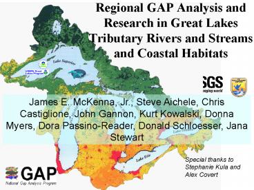
1
Regional GAP Analysis and Research in Great
LakesTributary Rivers and Streams and Coastal
Habitats
James E. McKenna, Jr., Steve Aichele, Chris
Castiglione, John Gannon, Kurt Kowalski, Donna
Myers, Dora Passino-Reader, Donald Schloesser,
Jana Stewart
Special thanks to Stephanie Kula and Alex Covert
2
The Great Lakes Region Contains The largest
freshwater system on Earth
- A diverse assemblage of aquatic organisms,
including 300 species of fish. - ¼ of the North American human population.
- Fishing, recreation, and tourism are
multibillion-dollar industries.
3
Aquatic GAP Analysis
An important component of GAP, because water is
the habitat and conduit by which the problems of
the land (land use) are transferred to our large
water bodies and the coast often magnified in
the process.
Especially in the Great Lakes
4
The Great Lakes hydrologic system has been
strongly modified and in some cases severely
degraded.
Loss of habitat quality and availability
threatens biodiversity
5
The regional scale
- The goal of the Great Lakes Aquatic GAP Program
is to evaluate the biological diversity of
aquatic species and their habitats and to
identify gaps in the distribution and protection
of these species and their habitats within the
Great Lakes basin.
6
People, States, and Stages
The planning year produced an assessment of the
feasibility of developing a regional aquatic Gap
project for streams in the Great Lakes watershed
and a pilot coastal aquatic Gap analysis.
Coastal GAP group effort focused on limited
geographic areas
Jana Stewart (USGS WRD)
Jim McKenna (USGS BRD) Chris Castiglione
(USFWS)
Steve Aichele (USGS WRD) John Gannon, Kurt
Kowalski, Dora Passino-Reader, Don Schloesser
(USGS BRD)
Donna Myers Stephanie Kula Alex Covert (USGS WRD)
7
Timeline
8
Great Lakes Aquatic Gap Analysis
- Rivers and Streams and the main component for the
first phase - Fish will be the primary class of organism
examined, but other groups will be incorporated
as data allows
9
Regional Standardization
- Valley Segment Type (VST) classification
- Biological coding (IT IS) and data assessment
- Organization of databases for all states and
areas in the region into a single central Oracle
database system.
10
The process
Riverine Component
4 basic steps in Basic GAP analysis approach
1. Habitat classification and its
distribution 2. Coarse filter
conservation 3. Predict species and richness
distributions 4. Refine conservation
statements (status recommendations)
unique VSTs
Blackstripe Topminnow
11
- VSTs classify stream segments based on their
physicochemical attributes, which are,
presumably, of biological significance (at least
for the taxa of interest).
- IFR Groundwater model will be adapted to
estimate stream thermal regime for the region
12
Ecoregional Drainage Units (EDU)
Help establish the basic species pool available
as a source for each region
13
Glacial lithology
Bedrock
Ecoregional Drainage Unit
Temperature
OH VSTs based on 9 variables
gt
Gradient
Glacial drift thickness
Valley Segment Types
Link
Sinuosity
Dlink
14
Number of Valley Segment Types
15
Biological distributions and species-environment
models
Gathering the biological data, filtering it for
proper spatial and temporal coverage and
accuracy, and organizing it effectively is a
major undertaking.
Numerous data sources have been identified in
each state that should provide the necessary
information to successfully complete this
regional GAP analysis.
16
Species-Environment Relationships
Multiple Regression
GARP model
Neural Network
HSI
Habitat Suitability Index
17
Some example results from OH
American Brook Lamprey
Samples / Location
Brook Silverside
18
Progress and Status
- By State
19
Wisconsin
Extensive and accessible databases from WDNR,
USDA, and universities
WDNR already working with version of IFR
temperature model ? VST. Also interested in
increasing resolution to 124,000
WDNR has gt24,000 fish samples in OracleTM
database.
Stakeholders include USDA, WDNR, TNC, and UW
20
Michigan
Extensive and accessible databases from IFR (Paul
Seelbach) and State agencies IFR has already
developed VST classification for MI
advisory group including MDEQ, MDNR, and MIC, as
well as UM, MSU, GVSU
Master OracleTM database being developed at GLSC
21
Ohio
Statewide Aquatic GAP gt50 complete fish
species/diversity modeling and mussel, crayfish,
and wetland components underway.
VSTs are defined on 9 variables gt gt10,000 VSTs
gt15,000 samples from gt4,500 locations provided by
several agencies, including OEPA, ODOT, USGS
22
New York
Biological Surveys
NY has several fisheries databases available from
the state DEC, US FWS, USGS, and Universities
List of stakeholders is being developed.
23
Other states
List of stakeholders is being developed.
Some data sources have been examined for the
states occupying smaller components of the GL
drainage basin.
As part of projects in Minnesota and Illinois,
the UMESC (Lacrosse, WI) has agreed to help us
with the rivers and streams in those states
Considerable database for fish exists in
association with Pennsylvania GAP
24
Coastal Gap Analysis
- Pilot Project
25
Process and Progress
26
Coastal Habitat Classification
- Preliminary approach
- Ribbon of coastal habitat between the 3m
elevation contour and the 10m isobath - Dividing the coast into 1 km long polygons.
- Values scored and standardized similar to that
for VSTs .
27
Examples of the 24 Candidate Variables used to
distinguish coastal habitats
28
Preliminary identification of data sources
- Les Cheneaux Islands - Lake Huron
- Western Lake Erie Islands
- Nearshore Lake Erie
- Nearshore Lake Ontario
- USGS Offshore Fisheries Datasets
29
Other work and plans
- EPA GLNPO-sponsored US FWS workshop
- NOAA N. C. coastal Hydrologic drainage unit
designations - Great Lakes Biocomplexity Study
- Investigations of Coastal Bathymetry and Geology
30
Potential Research Topics
- How does the scale examined affect the outcome
of planning/preservation scenarios? - Is cluster analysis an effective means of
objectively simplifying Valley Segment Type
classification for aquatic habitats of the Great
Lakes Basin? - Can areas akin to Significant Biodiversity Areas
(e.g., NY terrestrial GAP) be identified and used
to characterize conservation status? - Do significant differences in diversity and
distribution of Great Lakes Basin fish
assemblages exist?
31
Proposed list of Products
- GAP analyses for rivers and streams by state and
for the region - Assessment of coastal GAP analysis for selected
pilot areas within the Great Lakes - State-level fact sheets on the riverine projects
- Peer-reviewed journal publications targeted to
address biodiversity and conservations issues of
concern to natural-resource managers at the state
and project level
32
Project Effects on Policy?
- Help with regional efforts to identify
Biodiversity Investment Areas and development
of State of the Lakes Indicators (e.g., for
tributaries and coastal areas)
- MI, WI, OH ready to use aquatic GAP data as a
planning tool for fish management and
conservation by linking watershed scale features
to biological integrity
- "Decision Support System" for integrating
Transportation and Watershed planning in Ohio
- Assist New York with establishment of first
statewide digital database of aquatic species
- Expanding understanding of aquatic ecosystems of
the Great Lakes by pilot wetlands (OH) and
freshwater coastal aquatic GAPs.
33
Conclusions
- This project takes the next steps in GAP with
regional scale riverine aquatic Gap and pilot
Coastal Gap Analyses - The project is important to state cooperators who
have joined the effort - Aquatic GAP in the Great Lakes will be done at
the statewide, lakewide, and regional scales
providing multiple spatial scales for analysis of
biodiversity
Recommended
CrystalGraphics Presentations


