
Lidar Data PowerPoint PPT Presentations
All Time
Recommended

Get 3D point cloud dataset with 3D Lidar Annotation services offered by Data Annotate for autonomous vehicle driving development through machine learning AI. https://www.dataannotate.ai/lidar-annotation/
| PowerPoint PPT presentation | free to download

To Get sample Brochure now@ http://tinyurl.com/h5oszl2 A detailed qualitative analysis of the factors responsible for driving and restraining growth of the World LiDAR Market and future opportunities are provided in the report.
| PowerPoint PPT presentation | free to download

LiDAR Data Products ... Generation (cont d) The Zmean to Zidw difference (2ft contours from 5 ft ... Detection And Ranging Uses an active sensor to ...
| PowerPoint PPT presentation | free to download

Reality Check: Processing LiDAR Data
| PowerPoint PPT presentation | free to view

Assess the potential of lidar data to initialize a height-structured ecosystem ... Lidar data of canopy height was effective to initialized an ED model ...
| PowerPoint PPT presentation | free to view

Laser speed gun, weather radar , airborne. Data is gathered by detecting the reflection of the light. Distance, intensity, return number. Raw results are ...
| PowerPoint PPT presentation | free to view

'Bootstrapping' to get an organization that has never worked with lidar data up ... Leica Ortho Accelerator (Distributed Processing Engine) Photoshop ...
| PowerPoint PPT presentation | free to view

The Wind Lidar Mission ADM-Aeolus Data Processing David Tan Research Department ECMWF Acknowledgements: ESA (Mission Science & Aeolus project team) Aeolus ...
| PowerPoint PPT presentation | free to download

(1888 PressRelease) Data Control Technitic calls on Elon Musk to embrace LiDAR for Tesla’s foray into self-driving, semi-autonomous cars.
| PowerPoint PPT presentation | free to download
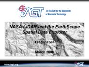
Shaded relief images. Illumination Azimuth: 225 degrees. Illumination ... http://www.earthscope.org/data/explorer.php. http://www.iagt.org/earthscope/es-sde.asp ...
| PowerPoint PPT presentation | free to download

1888PressRelease - Data Control Technitic is to partner with a commercial consumer drone maker to develop a lightweight LiDAR sensor.
| PowerPoint PPT presentation | free to download

(1888 PressRelease) Data Control Technitic says it will showcase a new LiDAR-based security system at leading security show next year.
| PowerPoint PPT presentation | free to download

(1888 PressRelease) Data Control Technitic is said to be close to unveiling its highest resolution LiDAR/Video package.
| PowerPoint PPT presentation | free to download

(1888 PressRelease) Data Control Technitic to unveil new handheld scanner for construction industry.
| PowerPoint PPT presentation | free to download

The GEON LiDAR Workflow: CyberinfrastructureBased Data Distribution and Processing
| PowerPoint PPT presentation | free to view

LiDAR acquisition over 1200 km2 = billions of LiDAR returns ... The Challenge of Community LiDAR data. Delivery. Hard Disc or DVD. Files organized into tiles ...
| PowerPoint PPT presentation | free to view

ECE 583 Lectures 23 LIDAR Different types of LIDAR
| PowerPoint PPT presentation | free to view

The LiDAR drone market is projected to grow from USD 133 million in 2020 to USD 392 million by 2025; it is expected to grow at a CAGR of 24.2% from 2020 to 2025.
| PowerPoint PPT presentation | free to download

1888 Press Release - Data Control Technitic – A recent report estimates automotive LiDAR market could be worth US$5.2 billion by 2023.
| PowerPoint PPT presentation | free to download

The LiDAR market was valued at 1.39 Billion in 2016 and is expected to reach USD 3.22 Billion by 2022, at a CAGR of 12.4% from 2016 to 2022.
| PowerPoint PPT presentation | free to download

1888PressRelease - Data Control Technitic has revealed that its next generation LiDAR products will be capable of measuring the velocity of objects.
| PowerPoint PPT presentation | free to download

The LiDAR drone market is projected to grow from USD 133 million in 2020 to USD 392 million by 2025; it is expected to grow at a CAGR of 24.2% from 2020 to 2025.
| PowerPoint PPT presentation | free to download

Title: The fusion process of LiDAR and map data to generate 3D city and landscape models Author: University of Twente Last modified by: Anjali Created Date
| PowerPoint PPT presentation | free to download

Lidar Elevation Data in the McMurdo Dry Valleys and Ross Island
| PowerPoint PPT presentation | free to view

Enabling Access to HighResolution LiDAR Topography through CyberinfrastructureBased Data Distributio
| PowerPoint PPT presentation | free to view

1888 Press Release - Data Control Technitic to commit to increasing its presence in non-automotive sectors including construction and security.
| PowerPoint PPT presentation | free to download

G. D. Emmitt and C. O'Handley. Simpson Weather Associates. Charlottesville, VA. Hangzhou, China. October, 2002. TODWL: the program (Twin Otter Doppler Wind Lidar) ...
| PowerPoint PPT presentation | free to view

The LiDAR market was valued at 1.39 Billion in 2016 and is expected to reach USD 3.22 Billion by 2022, at a CAGR of 12.4% from 2016 to 2022
| PowerPoint PPT presentation | free to download

The LiDAR market was valued at 1.39 Billion in 2016 and is expected to reach USD 3.22 Billion by 2022, at a CAGR of 12.4% from 2016 to 2022
| PowerPoint PPT presentation | free to download

To Get sample Brochure now@ http://tinyurl.com/h5oszl2 A detailed qualitative analysis of the factors responsible for driving and restraining growth of the World LiDAR Market and future opportunities are provided in the report.
| PowerPoint PPT presentation | free to download

The LiDAR market was valued at 1.39 Billion in 2016 and is expected to reach USD 3.22 Billion by 2022, at a CAGR of 12.4% from 2016 to 2022.
| PowerPoint PPT presentation | free to download

Analysis of Terrain Evolution using Lidar data and open source GIS
| PowerPoint PPT presentation | free to view

Joint ECMWF-University meeting on interpreting data from spaceborne radar and lidar: ... 10:35 Marta Janiskova - Overview of CloudSat/CALIPSO activities at ECMWF ...
| PowerPoint PPT presentation | free to download

Combining data from different lidar surveys and photogrammetry to quantify shortterm topographic cha
| PowerPoint PPT presentation | free to view

The LiDAR market was valued at 1.39 Billion in 2016 and is expected to reach USD 3.22 Billion by 2022, at a CAGR of 12.4% from 2016 to 2022.
| PowerPoint PPT presentation | free to download

Image processing, LiDAR and high resolution 2D interpolation and 3D visualization for data integrati
| PowerPoint PPT presentation | free to view

The LiDAR drone market is projected to grow from USD 133 million in 2020 to USD 392 million by 2025; it is expected to grow at a CAGR of 24.2% from 2020 to 2025
| PowerPoint PPT presentation | free to download

Retrieve aerosol extinction and optical thickness profiles from lidar data ... Use backscatter and extinction 'color ratios' to infer aerosol type and ...
| PowerPoint PPT presentation | free to download

The LiDAR market was valued at 1.39 Billion in 2016 and is expected to reach USD 3.22 Billion by 2022, at a CAGR of 12.4% from 2016 to 2022.
| PowerPoint PPT presentation | free to download

The LiDAR market was valued at 1.39 Billion in 2016 and is expected to reach USD 3.22 Billion by 2022, at a CAGR of 12.4% from 2016 to 2022. The base year used for the study is 2015 and the forecast period is from 2016 to 2022. This report provides a detailed analysis of the LiDAR market based on product, component, service, application, and region. It has been estimated that the ground-based segment would hold the largest share of the LiDAR market among all product types.
| PowerPoint PPT presentation | free to download

In the LiDAR market by product, UAV segment is estimated to grow at the highest CAGR during the forecast period. The increasing adoption of UAV for various applications such as media and entertainment, precision farming, and many other commercial applications is reason for the high growth of UAV LiDAR segment.
| PowerPoint PPT presentation | free to download

... Laser Altimeter System) data sets provides both the ... polar cloud cover from the Geoscience Laser Altimeter System, observations and implications ...
| PowerPoint PPT presentation | free to view

GEON Points2Grid (DEM generation) ... GEON Points2Grid ... Same algorithm as available in the GEON LiDAR Workflow system online. Algorithm by Han Kim (UCSD) ...
| PowerPoint PPT presentation | free to view

Large eddy model simulations of lidar and Doppler radar data from a mixed phase cloud: constraining vertical velocities and fallspeeds. John Marsham1, Steven Dobbie1 ...
| PowerPoint PPT presentation | free to download

... used to delineate watersheds, create contours, and general resource management ... and LIDAR Meet Digital Ortho Photography: A Sensor Fusion Boon for GIS, ...
| PowerPoint PPT presentation | free to download

SATPALDA offers LiDAR services, which is a highly accurate and efficient way to capture elevation data from the ground. LiDAR technology uses laser pulses to measure the distance to or other properties of a target, providing a precise and detailed representation of the terrain.
| PowerPoint PPT presentation | free to download
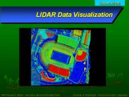
LIDAR Data Visualization
| PowerPoint PPT presentation | free to download
lidar gajendra kumar ec 3rd yr. roll no.- 0800131040
| PowerPoint PPT presentation | free to download

LIDAR Light Detection And Ranging
| PowerPoint PPT presentation | free to download

LiDAR (Light Detection And Ranging) is a technology that can be used as a ... create contour lines at the required interval (these lines are 1 foot contours) ...
| PowerPoint PPT presentation | free to download

Title: Understanding LIDAR Technology Burlington County GIS Users Group May 16, 2005 Author: tblak Last modified by: Brian Mayfield Created Date
| PowerPoint PPT presentation | free to view

GLOW Data System. Fibertek Laser. Lidar data. Lidar signal. Scanner control ... Fabrication complete 23 July 2004. Assembly & alignment complete 27 August 2004 ...
| PowerPoint PPT presentation | free to view

Acquire 20 Foot Gridded LIDAR Elevation Data from NCFMP - currently have Phase I ... LIDAR included as part of terrain data with limited photogrammetric ...
| PowerPoint PPT presentation | free to download

LIDAR Market by Product-Type (Airborne LiDAR, Terrestrial LiDAR and others) by Technology (1D, 2D and 3D), by Component (Laser Scanner, Navigation & Positioning Systems and other Component), by Functional Areas (Engineering, Corridor Mapping, Environment, ADAS & Driverless Car, Urban Planning, Cartography and Meteorology) by Region - Forecast till 2023
| PowerPoint PPT presentation | free to download

LiDAR Market Research Report: by Product-Type (Airborne LiDAR, Terrestrial LiDAR and others) by Technology (1D, 2D and 3D), by Component (Laser Scanner, Navigation & Positioning Systems and other Component), by Functional Areas (Engineering, Corridor Mapping, Environment, ADAS & Driverless Car, Urban Planning, Cartography and Meteorology) by Region - Forecast till 2023
| PowerPoint PPT presentation | free to download

Data need to be stored in data structures on external storage media such that on ... Example: LIDAR terrain data. Massive (irregular) point sets (1-10m resolution) ...
| PowerPoint PPT presentation | free to view