
Geomorphologic PowerPoint PPT Presentations
All Time
Recommended

Hydrologic and Geomorphologic Assessment of Debris Flow Events for Mount Hood Highway
| PowerPoint PPT presentation | free to view

... www.w3.org/1999/02/22-rdf-syntax-ns#' xmlns:iX='http://ns.adobe.com/iX/1.0 ... xmlns:xapMM='http://ns.adobe.com/xap/1.0/mm ...
| PowerPoint PPT presentation | free to download

Types of alluvial fans (Classification by Stanistreet & McCarthy, 1993) Taquari fan ... Basic alluvial-fan processes. Rapid aggradation localized in active lobes ...
| PowerPoint PPT presentation | free to view

Geospatial Analysis of Dynamic Geomorphological Features and Their Management ... Transformation from crescent to parabolic dunes; Consistent pattern over 30 years ...
| PowerPoint PPT presentation | free to view

Kinematic fold models imply hinge migration ... ( a) Kinematic evolution. ... new material from near-by plains become deformed and uplifted toward fold slopes. ...
| PowerPoint PPT presentation | free to view

Watershed and Stream Network Delineation Geomorphological Considerations
| PowerPoint PPT presentation | free to download
... kabaran zemin Temperature Subsidence EXPLORATION & INVESTIGATIONS RELATED of SLOPE STABILITY Geomorphologic maping and preparation of longitudinal & cross ...
| PowerPoint PPT presentation | free to download

... (Great Wall of China) 2) Paleoseismology 3) offset geomorphologic surfaces + surface dating San Gorgonio, CA Paleoseismology Paleoseismology: ...
| PowerPoint PPT presentation | free to view
Structural styles in the Zagros. Geomorphologic evolution suggests buckle sheet ' ... Buckle fold development. Finite element modelling by Martin Casey ...
| PowerPoint PPT presentation | free to download

Terrain analysis Reference Terrain analysis by Douglas S. Way Definition Processes of interpreting a geomorphological area To ...
| PowerPoint PPT presentation | free to download

Geological/geomorphological map of the Holocene Rhine-Meuse delta ... 3D high vertical exaggeration. Late Weichselian subsurface. Present delta surface. E ...
| PowerPoint PPT presentation | free to view

F:(x,y) h : one height value at each point. Efficient to represent ... Ridges, Valley and Transfluent. Most Frequently Used Geomorphological Information ...
| PowerPoint PPT presentation | free to view

Topographic Map (1:50,000) Satellite images. Aerial Photo. Geomorphologic Map. Surface geologic Map. Seismic Map. Tectonic geologic Map ...
| PowerPoint PPT presentation | free to view

Soil humus & mineral content, depth to bedrock & water table, annual pattern of ... Local climatic, hydrologic, edaphic, and geomorphologic factors as well as ...
| PowerPoint PPT presentation | free to view

... use change, and hydrologic/geomorphologic conditions in the stream to analyze ... was assumed as forest in good condition; and, the soil was hydrologic group B. ...
| PowerPoint PPT presentation | free to view
Fluvial biogeomorphology Research using GI: a case study of the Sabie River 1999-2000 Hypothesis H0: Riparian vegetation communities are not preferentially related to ...
| PowerPoint PPT presentation | free to download

Title: Lake District Mapping Vol. II Author: L Last modified by: Leo Ritchie Created Date: 9/24/2006 12:30:41 PM Document presentation format: On-screen Show
| PowerPoint PPT presentation | free to view

Galapagos Island Attractions
| PowerPoint PPT presentation | free to download
Week 1 Geoarchaeology Historical development and relations with geography and the geosciences * * * * * * * * * * * * * * * * * * * * * * The word geoarchaeology ...
| PowerPoint PPT presentation | free to download

cold-based (friction of ice-ground contact greater than shear strength ice) ... New grounds for reassessing palaeoclimate of the Sirius Group, Antarctica. ...
| PowerPoint PPT presentation | free to view

Human Capacity Building for Disaster Prevention and Preparedness in Afghanistan ... deliver visually attractive map sheets by optimizing ...
| PowerPoint PPT presentation | free to view

USING GIS IN GEOMORPHOLICAL STUDIES Background Need for dealing with massive data. GIS: Visualize and analysis of spatial data. GIS can assist in carrying out ...
| PowerPoint PPT presentation | free to view

Most popular method for paper maps. Set of pairs (polygon, h) Nested ... Tradeoff Relationship between Size and Accuracy. Loss of Geo-morphological Properties ...
| PowerPoint PPT presentation | free to view

... Air-sea interaction study in School of Atmospheric Science Marine geochemistry in School of Earth Sciences Marine Environmental Chemistry in School of ...
| PowerPoint PPT presentation | free to download
Lecture 4 Overland and channel routing (b) Calibration
| PowerPoint PPT presentation | free to download

Developing a Physical Habitat Characterization ... Stratigraphy and Sediment ... But, stratigraphic mapping of floodplain, colluvium, and terrace deposits/soils ...
| PowerPoint PPT presentation | free to view
perencanaan permukiman dr. suratman woro, m.sc. materi kuliah satuan permukiman faktor fisik lingkungan permukiman evaluasi lokasi permukiman perubahan lingkungan ...
| PowerPoint PPT presentation | free to download

Project 3 : Interactions of Landscape Processes within Intensively Managed Watersheds
| PowerPoint PPT presentation | free to view

'Emergent behaviour cannot be simply inferred from the behaviour of the components' ... rather easy to generate complex behaviour by starting from simple initial ...
| PowerPoint PPT presentation | free to view

The Geographic Cycle WM Davis William Morris Davis Born February 12, 1850, Philadelphia, PA -Graduated from Harvard 1869 -Instructor of geology at Harvard, 1879 ...
| PowerPoint PPT presentation | free to download

Keywords: Samoa Islands, Tonga Trench, multibeam ... of the Samoa island chain ... Comparison of Samoa seafloor geomorphology with that of similar locales ...
| PowerPoint PPT presentation | free to view

Bathymetry, Gravity and Magnetic Images of the Mediterranean water of the Nile Delta, Egypt, using GIS Technique, Part IV Interpretation of Gravity Data of the
| PowerPoint PPT presentation | free to download

The Application of Remote Sensing and Geographic Information Systems (GIS) to Prehistoric Site Location Predictive Models Exploitation of remote sensing and GIS for ...
| PowerPoint PPT presentation | free to view

Climatic Influences on Geomorphic Systems Riley Hole Topics Definitions Historic Figures Areas of Study What Climate Does Climatic Regions Climate Change Problems ...
| PowerPoint PPT presentation | free to view

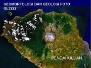
GEOMORFOLOFI PENDAHULUAN DEFINISI Geomorfologi dari bahasa Yunani kuno, geo = bumi, morfo = bentuk, logos = ilmu, ( landscape ). Mula-mula digunakan istilah ...
| PowerPoint PPT presentation | free to view

PINGOS Jennifer Vinck Geology 495 University of Regina, 2006 To be discussed: What is a pingo? Distribution Pingo Features Pingo Growth and Development - Hydrostatic ...
| PowerPoint PPT presentation | free to view
perencanaan permukiman dr. suratman woro, m.sc. materi kuliah satuan permukiman faktor fisik lingkungan permukiman evaluasi lokasi permukiman perubahan lingkungan ...
| PowerPoint PPT presentation | free to download

Classify and organize bypass reaches (river reaches ... Sinuosity (ratio of stream distance to valley distance) Water surface slope. Bed particle size ...
| PowerPoint PPT presentation | free to download

Source: Photo courtesy of Dominic Habron Pearson Education Limited 2005. OHT 14.11 ... River restoration. Where human activity resulted in ecological devastation ...
| PowerPoint PPT presentation | free to view

WACoast a new information resource for WA coastal managers
| PowerPoint PPT presentation | free to view

affecting critical habitats at Cape Sable. Everglades National Park ... Cape Sable may serve as an analog for other sensitive ...
| PowerPoint PPT presentation | free to view

Toward Cyber National Land
| PowerPoint PPT presentation | free to view

Processes that create/modify landforms (Modern) quantitative analysis ... Catastrophism proposed by Cuvier. Both well received. Hutton 'Theory of the Earth' (1788) ...
| PowerPoint PPT presentation | free to view

Geography (from Greek geographia, lit.
| PowerPoint PPT presentation | free to view

... of landforms on or near the Earth's surface and the processes working on ... close ties to other sub-disciplines in Physical Geography and the Earth Sciences ...
| PowerPoint PPT presentation | free to view

EvaporiteCarbonate Sediments of Abu Dhabi, UAE
| PowerPoint PPT presentation | free to view

Lithosphere and geomorphology Lithosphere-crust: The crust is the outer layer which is thin and rigid. It floats on the semi-molten rock mantle.
| PowerPoint PPT presentation | free to view

... from head-cut. Channel incision downstream of head-cut followed by mass ... If head-cutting occurs, then sediment erosion rates will be less, downstream ...
| PowerPoint PPT presentation | free to view

Accounting for Sediment and Geomorphology in Flood Risk Management Colin Thorne Chair of Physical Geography, Nottingham University and Faculty Affiliate, Portland ...
| PowerPoint PPT presentation | free to download

Wavelet-based multifractal formalism (Muzy et al., 1993; Arneodo et al., 1995) CWT of f(x) ... The multifractal formalism (Parisi and Frisch, 1985) allows this ...
| PowerPoint PPT presentation | free to download
Kerangka proses-proses geomorfologi : - Endogenic processes (Eypogene proc.) - Exogenic processes (Epigene proc.) - Extraterrestrial processes. 3. Proses Exogen ...
| PowerPoint PPT presentation | free to download

TopAS is a program system for automatic evaluation of Digital Terrain Models ... By the use of modules of the program SISCAT, TopAS calculates and ...
| PowerPoint PPT presentation | free to view

Consiglio Nazionale delle Ricerche, Istituto di Ricerca ... Within the framework of the INTERREG IIIA-Program Italy-Switzerland (2002-2006) ...
| PowerPoint PPT presentation | free to view

Hydrometer method and sieving. Organic C: Determined by a Leco-apparatus ... Texture (hydrometer sieving) Total carbon (dry combustion) Total nitrogen (Kjeldahl) ...
| PowerPoint PPT presentation | free to view

GEOL 325: Stratigraphy
| PowerPoint PPT presentation | free to view

Enda O'Connell1, Jaime Amezaga1, James Bathurst1, Chris Kilsby1, ... Tern. Frome. Pang/Lambourn. 13. NICHE-CHASM Catchments. Feshie. University of Aberdeen ...
| PowerPoint PPT presentation | free to view