
Semiannual Weather Briefing - PowerPoint PPT Presentation
1 / 49
Title:
Semiannual Weather Briefing
Description:
Semiannual Weather Briefing – PowerPoint PPT presentation
Number of Views:362
Avg rating:3.0/5.0
Title: Semiannual Weather Briefing
1
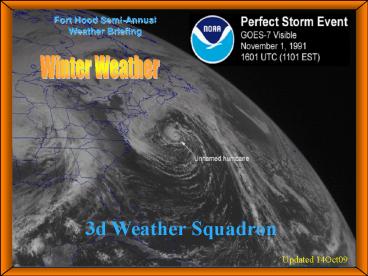
Fort Hood Semi-Annual Weather Briefing
- Winter Weather
3d Weather Squadron
Updated 14Oct09
2
OVERVIEW
- Local Area Influences
- Winter Climatology
- Winter Hazards
- Watches/Warnings/Advisories
- Weather Operations
- POCs
3
Winter Synoptic Pattern
- Polar Front Jet (PFJ) moves further south
- Frontal passages generally occur every 5-7 days
- Decrease in thunderstorm activity but increase in
morning fog and low ceilings
4
Local Area Influences
- Rolling hills with peaks up to 1,500
- Upslope under easterly flow can cause prolonged
IFR conditions - Large lake areas and abundant foilage
- Act as moisture sources for fog and low ceilings
- Isolated weather conditions throughout
reservation - What looks good at RGAAF can be different at HAAF
- Low river crossings, hard ground, low water
retention causes flash flood situations
5
Winter Climatology
- Degraded Flying Operations
- Lower AM visibility/ceilings due to fog/stratus
- Can extend into afternoon
- Induced by upslope conditions (easterly flow)
- Cooler temperatures
- Aircraft Icing
- Major winter weather hazardlower freezing level
- Can extend down to surface (frost)
6
CEILING AND VISIBILITY CLIMO
7
Winter Hazards
- Turbulence
- Icing
- Low-Level Wind Shear
- Reduced Visibility
- Colder Temps
8
- Turbulence
9
TURBULENCE
- Turbulence is one of the most unexpected aviation
hazards to fly through and one of the most
difficult to forecast - Caused by abrupt, small-scale variations in wind
speed and direction - Pilot Reports (PIREPS) are crucial!
- May trigger advisories to help warn others
- Always include location, time, intensity, flight
level, and aircraft type
10
TURBULENCE(Continued)
- May occur any time without warning
- - Directly proportional to speed
- Faster aircraftmore turbulence experienced
- - Inversely proportional to weight
- Heavier aircraftless turbulence experienced
- - Directly proportional to wing area
- Greater distance between leading and trailing
edge of wingmore turbulence
11
TURBULENCE(Continued)
- Intensities based upon Airspeed Climb Rate
- Light Slight, erratic changes in altitude and or
attitude (pitch, roll, yaw) - Moderate Greater intensity than light, but
aircraft remains in positive control - Severe Large abrupt changes in
altitude/attitude, large variations in airspeed
control becomes very difficult - Extreme Aircraft violently tossed around with
control virtually impossible may cause
structural damage
12
TURBULENCE(Continued)
- Also caused by strong wind over rough terrain
(Fort Hood area not considered rough terrain) - - Rougher terrain More turbulence
- - Higher wind speed More Turbulence
- Frontal Transition Zone Turbulence
- Jet Stream (CAT)
13
TURBULENCE(Continued)
- Wake Turbulence Caused by Wingtip Vortices
- Virtually all aircraft produce wingtip vortices
while in flight, even rotary wing aircraft. This
is especially apparent with heavier aircraft.
14
LOW-LEVEL WIND SHEAR (LLWS)
- Rapid change in wind direction or speed below
2,000 feet AGL - May occur with or without Turbulence
- Causes sudden changes in aircraft performance and
attitude - Common occurrence in Central Texas associated
with night-time low-level jet - Can occur with fronts and thunderstorm gust
fronts (microburst)
15
ICING
16
ICING
- Types of Icing
- Rime Rough, milky, and opaque--similar to ice
in a refrigerator associated with stratiform
clouds lighter in weight than clear ice - Clear Glossy and clear formed by slow freezing
of large supercooled water droplets found in
cumulus clouds and freezing preciphard to remove - Mixed Rime and Clear Water droplets vary in
size or mixed rain and snow can form rapidly - Frost Light feathery deposit occurring when an
aircraft is descending from cold air to warmer
air layers or parked on the surface and exposed
to freezing temps
17
ICING(Continued)
- Adds weight, blocks flow of air into engine
- Destroys efficiency of the airfoil by altering
its shape--when the lifting qualities of the wing
are gone, the aircraft can no longer remain
airborne! - Icing on rotary-wing aircraft may cause
vibration, loss of efficiency or control
rotational speed of main and tail rotors can
produce rapid icing growth on certain surfaces - Shedding of ice can result in structural damage
(FOD) or injury to ground personnel
18
VISIBILITY CEILINGS
19
Visibility and Ceilings
- Historically, poor visibilities low ceilings
have contributed to many aircraft accidents - Types of visibility
- Prevailing greatest horizontal visibility
observed throughout at least half of the horizon
circle - Tower prevailing visibility determined to be
different by tower personnel (trained
controllers) - Sector visibility within a specific 45 degree
arc (NE, SE, etc.) of the horizon circle - Slant Range angle from which you view an
airfield or target from above ground vantage
pointoften lower than prevailing visibility
20
Visibility and Ceilings(Continued)
- ASOS (HLR)
- There are inherit limitations especially during
rapidly changing weather conditions when some
delay in reporting cloud ceilings and
visibilities may occur - Ceilings
- Height above the earths surface (AGL) of the
lowest (thin or opaque) layer as broken or
overcast, or vertical visibility into
surface-based total obscuration (indefinite
ceiling)
21
Fog
- Surface-based cloud composed of either water
droplets or ice crystals - Ideal fog conditions
- Small temperature dew point spread 1 to 2 C
- Abundant condensation nuclei
- Light surface wind
- Cooling land surfaces, warmer air above
- Rarely forms at Fort Hood under west to north wind
22
Fog(Continued)
- Reduces Visibility and Ceilings
- Patchy Fog
- Visibility can be severely restricted 1/4 mile
away it can be unrestricted - Usually appears in low lying areas
- Not very thick
- Hardest to forecast
- Wide-spread Fog
- Large continuous even fog
- Usually at least 800 ft thick
23
- Weather Alerts
24
WEATHER WATCHES
- Issued for the potential of weather conditions
that can effect operations and safety at Ft Hood
and/or the Western Training Area -- Command
decision on whether or not operations are altered - Valid for area as described in the text
- Ft Hood (northern, southern, or both)
- Western Training Area (northeast, southeast,
southwest or northwest)
25
WEATHER WARNINGS
- Actions should be taken to protect property and
life - Valid Times are as per text
26
WEATHER ADVISORIES
- General -- All Ft Hood advisories are observed
thus have the same effect on flight operations as
warnings do. - Terminal Weather Advisories
- Valid within 5 NM of RGAAF and/or HAAF
- Issued for weather conditions that effect
airfield operations and safety
27
FT HOOD Watch / Warning / Advisory
WEATHER WARNINGS - Tornado (30 min) - Damaging
Wind gt 50 kts (2 hrs) - Hail gt 3/4 inch dia (2
hrs) - High Wind 35-49 kts (90 min) - Hail
1/2-lt3/4 inch dia (90 min) - Lightning
(Observed) - Heavy Rain or Snow (90 min) -
Freezing Precipitation (90 min) - Blizzard
Conditions (90 min)
- WEATHER WATCH
- (Forecast Potential)
- - Tornado
- - Damaging Wind gt 50 kts
- - Hail gt 3/4 inch dia
- - Lightning (30 min)
- - Heavy Rain or Snow
- Freezing Precipitation
- Blizzard Conditions
- Flash Flood
Ft Hood North Ft Hood 50NM of Corps HQ (Area) 5NM
of RGAAF (Terminal)
AREA WEATHER ADVISORIES (AWA) MDT TURBC
(Observed) MDT ICG (Observed) LLWS lt 2k AGL
(Observed) Wind Chill lt 10F (Observed)
TERMINAL WEATHER ADVISORIES (TWA) WND gt 30kts
(Observed) Gust Sprd gt 15kts (Observed)
28
WESTERN TRAINING AREA Watch / Warning
WARNINGS Thunderstorms (Observed)
Western Training Area (WTA) Divided into 4
sectors (NW,NE,SW,SE)
WEATHER WATCH Thunderstorms (2 hrs)
29
PILOT REPORTS (PIREPS)
- Provide forecasters additional observations
around the reservation and Western training areas - Thunderstorms
- Turbulence
- Icing
- Low-Level Wind Shear (LLWS)
- Cloud conditions
- Wind, temperature, etc..
- Visibility, weather (i.e., fog, rain, etc.)
- PMSV frequencies UHF 306.5
FM 41.20
30
- Weather Ops
31
RGAAF Weather Station Operations
- RGAAF Weather Station located on West Fort Hood,
Airfield Ops Bldg 90029 - 24/7 Operations
- 2 Forecasters Mon-Fri 0700-1500L
- 1 Forecaster Nights, Weekends, Holidays
- Manual Weather Observations
- Flight Weather Briefings
- HAAF Automated Weather Observations Only
32
FLIGHT WEATHER BRIEFINGS
- Call 288-9620 or 288-9400
- E-mail hood.3asog3ws.woc_at_us.army.mil
- Please arrange DD175-1 weather briefings as far
in advance as possible - IAW AR 95-1, ONLY PILOTS CAN RECEIVE FLIGHT
WEATHER BRIEFINGS
33
FLIGHT WEATHER BRIEFINGS (Continued)
- DD175-1 Weather Briefs can be faxed or E-mailed
- IMPORTANT Aircrews must call 288-9620/9400
after receiving the brief for briefers initials,
brief void times--otherwise briefing is not
official! - For weather information visit our web site
www.hood.army.mil/3ws - Current local airfield weather conditions
- Current weather watches, warnings, advisories
- Other weather information products
34
DOPPLER RADAR TECHNOLOGY
35
DOPPLER RADAR TECHNOLOGY
- Tracks storm movement
- Provides vertical wind profiles (LLWS)
- Determine storm relative motion
- Highlights potential severe weather
- Hail
- Storm rotation--Tornadoes
- Cross-sections
36
Tactical Weather Support
- Five Battlefield Weather Flights (BWFs)
- III Corps
- 1CD (Division and Air Cavalry Brigade)
- 4ID (Division and Combat Aviation Brigade)
- Staff Weather Officers (SWOs) provide
- Weather intelligence when deployed real-world or
exercises - Climatology, exercise planning weather
- Staff weather briefings
- Electro-optical data (tactical decision aids)
- Doctrine/manning does not permit BWFs to deploy
with maneuver brigades or lower echelons of
aviation - SWOs will arrange for support to aviation
battalions lower echelons - Weather support may be from other weather units
or reach-back
37
3D Weather SquadronHomepage
- www.hood.army.mil/3ws
38
Can be found fromFort Hood Home Page
Click here, then here
39
3D Weather SquadronHomepage
40
5-Day Forecast
41
3 WS Mission Planning/Execution Forecast
- Located on our web page
www.hood.army.mil/3ws/Flimsy/Flimsy.pdf - Updated 3 times daily (0000Z, 0800Z, 1600Z)
- Amended for
- 1000 / 3 (IFR VFR)
- 500 / 1/2 (HAAF Airfield Minimums)
- Thunderstorms, Moderate or Greater Icing /
Turbulence - Aircrews flying within Fort Hood Reservation
Test Flight Areas III V may use the flimsy to
self-brief - Call 288-9620 or 9400 to verify current Flimsy ,
any updates, watches/warnings/advisories and
receive brief/void times/initials - Units ops may post copy of flimsy in common
areas for aircrews - IMPORTANT Check website periodically for
changes especially during inclement weather
42
Mission Execution Forecast (Flimsy)
43
Forecast Performance Metrics
- How well are we forecasting mission impacting
weather? - Best measure of our performance is direct
feedback from aircrews - Click on Feedback Icon on flimsy send an
E-mail - Complete Flight Weather Briefing Feedback Form
on our webpage or faxed with all DD175-1s - Call RGAAF weather station NCOIC at 288-9166
- Well take good and bad comments!!!
44
Monthly Performance Metrics
- Check out our monthly performance reports on our
web site www.hood.army.mil/3ws/MEFVERFeedback.pp
t
45
Objective Verification
- In addition to direct feedback we employ an
objective method to measure (verify) our forecast
performance - We selected two key operational parameters
- Ceiling / Visibility lt 1000 feet / 3 miles (IFR)
- Ceiling / Visibility lt 500 feet / 1/2 mile (HLR
Airfield Minimums) - We measure the accuracy of each Fort Hood
Reservation Forecast (Flimsy) published on the 3
WS web page - We use observations at GRK, HLR, and GOP
(Gatesville) and any PIREPs to verify each flimsy
at the 3-, 6-, and 12- hour point from the
original issuance time
46
Did the Forecast or WeatherImpact the Mission?
- Did we forecast GO weather for your mission
and weather was a GO -- mission completed - Did we forecast GO weather for your mission
and weather was a NO GO -- mission cancelled or
changed due to un-forecast weather - Did we forecast NO GO weather for your mission
and weather was GO-- mission cancelled or
changed due to forecast (lost opportunity or
needless change) - Did we forecast NO GO weather for your mission
and weather was NO GO -- mission cancelled or
changed due to forecast/weather (if inserted
early in planning process this situation can
prevent wasted time and enhance planning process)
47
POCs
- 3 WS Commander (III Corps SWO) 288-1313
- 3 WS Operations Officer 287-7397
- 1CD SWO 288-0197
- 4ID SWO 288-5965
- 21CAV / 13SC(E) SWO 288-9176
- RGAAF Weather Station 288-9620 or 288-9400
- RGAAF Weather Station Flight Chief 288-9166
48
SUMMARY
- Local Area Influences
- Winter Climatology
- Winter Hazards
- Watches/Warnings/Advisories
- Weather Operations
- POCs
49
- THE END!!
- Any Question or comments?