
Remote Sensing - PowerPoint PPT Presentation
1 / 31
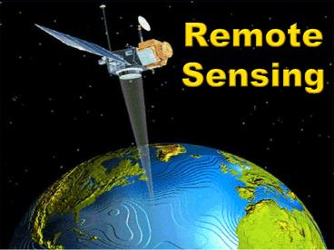
Title:
Remote Sensing
Description:
Remote Sensing Space-based Earth exploration and planetary exploration began with the International Geophysical Year (IGY) which was also the beginning of the space ... – PowerPoint PPT presentation
Number of Views:763
Avg rating:3.0/5.0
Title: Remote Sensing
1
Remote Sensing
2
Remote Sensing
- Space-based Earth exploration and planetary
exploration began with the International
Geophysical Year (IGY) which was also the
beginning of the space race (1957) - IGY was an 18-month international scientific
research project that spanned 1957-1958 - Research included Earth sciences aurora and
airglow, cosmic rays, geomagnetism, gravity,
ionospheric physics, longitude and latitude
determinations (precision mapping), meteorology,
oceanography, seismology and solar activity
3
Remote Sensing
- Instruments for the early Explorer program were
improved and modified for lunar and planetary
exploration in the Pioneer (lunar) and Mariner
(Venus, Mars) missions - Explorer 1 was Americas first satellite
- Continued through Explorer 78
- Launched in 2000
4
Remote Sensing
- Remote sensing is traditionally used for Earth
observation, but also applies to planetary
exploration - The same or similar or instruments used for both
- Measurements at a distance use electromagnetic
(EM) sensors - Radio, microwave
- IR
- Visible
- UV
5
Remote Sensing
- Sampling (in situ) measurements
- Generally for accurate measurements of
composition and abundance - Include
- Mass spectrometers
- Atmospheric particle detectors
- Surface analysis
- Particle and EM radiation detectors
6
Remote Sensing
- Sampling (in situ) measurements on Earth can be
relatively inexpensive - In situ measurements on planets/moons are the
most expensive space exploration projects - Earth observation
- Ground-based
- Airborne
- Space-based
7
Remote Sensing
- Atmosphere is an important element in Earth
observation - 1. Direct atmospheric studies
- Complex circulation effects climates in many ways
- Changes in circulation important
- 2. Atmospheric interaction includes
- Absorption
- Emission
- Chemical interactions
- Water (liquid and vapor)
8
Remote Sensing
- Atmospheric absorption spectra
Mostly due to H2O, O2, CO2
9
Remote Sensing
- Space-based observations
- EM radiation sensors include
- Imaging data
- Spectral data
- Spectral imaging data
- Color television is an example of sequential
spectral (color) images
10
Remote Sensing
- Spectral data example
- (Chandra X-ray
- Telescope data)
11
Remote Sensing
- Spectral image data mosaic
12
Remote Sensing
- Spectral image data of aurora
13
Spectral Bands
14
Remote Sensing Spectral Bands
15
Remote Sensing Spectral Bands
- Radio band
- Various definitions of frequency range
- 0 - 300 MHz (1 MHz 106Hz)
- 0 - 1 GHz (1GHz 109Hz)
- Lowest EM frequencies
- Often used for upper-atmosphere and ion/electron
measurements
16
Remote Sensing Spectral Bands
- Microwave band
- 300 MHz - 300 GHz
- Used for
- Surface feature identification
- Atmospheric layer measurements
- Radio astronomy
- Synthetic aperture (imaging) radar
17
Remote Sensing Spectral Bands
- Infrared band
- 300 GHz - 400,000 GHz (400 THz)
- 1 THz 1 Tera Hertz 1012Hz 1,000 GHz
- Used for
- Surface feature identification
- Atmospheric layers and thunderstorm activity
- Atmospheric energy exchange
- Energy absorption or emission in atmosphere
- Vegetation characteristics
- Planetary heat flow
- Stellar and galactic activity
18
Remote Sensing Spectral Bands
- Visible band
- 4x10¹⁴Hz - 8x10¹⁴Hz (400 THz - 800 THz)
- Used for
- Surface feature identification
- Clouds precipitation
- Vegetation layers
- Ocean surfaces
- Mineral identification
19
Remote Sensing Spectral Bands
- UV band
- 7.5x10¹⁴Hz - 3x10¹⁶Hz
- Used for
- Upper atmosphere measurements
- Solar emissions
- Stellar characteristics including star birth and
star death - Galaxy characteristics
20
Remote Sensing Spectral Bands
- X-ray band
- 1016 - 1019Hz
- Used for
- Planetary surface composition from radioisotope
emission spectra - Stellar activity (primarily for stars, including
our sun, and galaxies) - Excited (hot) gas in the solar system,
surrounding stars, in galaxies, and between
galaxies
21
Remote Sensing Spectral Bands
- Gamma-ray band
- 1019Hz and higher (no defined maximum)
- Used for
- Planetary surface composition from radioisotope
emission spectra - Used to identify energetic stars and galaxies
- Supernova detection
- Neutron star formation
22
Applications
23
Applications
- Agriculture
- Crop type classification
- Crop condition assessment
- Crop yield estimation
- Mapping of soil characteristics
- Mapping of soil management practices
- Compliance monitoring (farming practices)
24
Applications
- Forestry
- Forest mapping
- Clear-cut mapping
- Forest inventory
- Deforestation evaluation
- Watershed evaluation
- Coastal forest protection
25
Applications
- Geology
- Bedrock mapping
- Surface deposit mapping
- Surface deformation changes
- Sedimentary mapping
- Structural mapping
- Mantle crust motion
- Volcanic evolution
- Event mapping
- Mineral exploration
- Hydrocarbon exploration
- Environmental geology
- Geo-hazard mapping
- Planetary mapping
26
Applications
- Ice Pack Hydrology
- Wetlands mapping monitoring
- Soil moisture estimation
- Snow pack evaluation
- River lake ice
- Flood mapping monitoring
- Glacier dynamics
- River delta changes
- Irrigation evaluation monitoring
27
Applications
- Environmental planning
- Atmosphere
- Oceans
- Public health
- Coastal changes
- Industrialization
- Forests
- Rivers, lakes estuaries
28
Applications
- Disaster Planning Evaluation
- Floods
- Tornadoes
- Hurricanes/cyclones
- Fires
- Earthquakes
- Droughts
29
Applications
- Weather
- Forecasting
- Adverse weather planning
- Aviation marine weather
- Global atmosphere
- Sun-Earth interactions
30
Applications
- Planetary Observations
- Surface characteristics
- Geology
- Composition
- Activity
- Atmosphere
- Environment
- Solar interactions
31
- Questions?
Recommended
CrystalGraphics Presentations


