
Hydrosphere - PowerPoint PPT Presentation
1 / 48
Title:
Hydrosphere
Description:
Hydrosphere Lesson starter: What do we mean by Hydrosphere? Factors affecting a drainage basin output Interception Relief Soil Rock type Rock type Drainage density ... – PowerPoint PPT presentation
Number of Views:474
Avg rating:3.0/5.0
Title: Hydrosphere
1
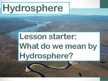
Hydrosphere
Lesson starter What do we mean by Hydrosphere?
2
(No Transcript)
3
Title Hydrosphere
- 18/11/2016
- Aims
- To find out the relationship water has with the
planet Earth. - To look at the Hydrological cycle and understand
how it works. - To find out how river drainage basins effect
flooding and river flow. - To look at the different features of rivers from
their source to their mouth.
4
Water on planet Earth
- Why do you think that the study of the
Hydrosphere is important to us?
5
Water on planet Earth
This all means that studying the Hydrosphere is
more important now that it ever has been.
- Water is extremely important to us!
- It is a vital resource that we take for granted
in countries such as the UK. - It is estimated that there will be vast water
shortages around the world before 2050 and that
it will lead to tension between countries. - Many people believe that this could lead to
future wars, much like the oil wars of the late
1990s. - We are also at constant risk of flooding and
water levels rising over the planet.
6
So where is all of our water
- Take the sub heading
- Location of the Earths water.
- Underneath try and write a list of where you
think all of the Earths water can be found. - 4 minutes.
7
(No Transcript)
8
The Hydrological Cycle
9
Task The Hydrological cycle
- You have been given a piece of poster paper in
front of you. In your group I want you to explain
the Hydrological cycle. - Try your best I dont expect you to be an
expert yet. You may use diagrams.
10
Part 2
- You have now been given a diagram that has no
labels on it. - You must now try and annotate on the labels that
you think should go onto the diagram.
11
4
3
2
6
1
5
7
8
9
12
Hydrological Cycle (Closed System)
Percolation
13
Hydrological Cycle (Closed System)
Percolation
14
Hydrological Cycle (Closed System)
In your groups write a detailed description of
the hydrological cycle and how it works. You
should structure it like an exam style question
worth 5 marks.
15
The global hydrological cycle is a closed system.
What does this mean?
Copy
A closed system means that nothing is ever added
or taken away. The amount of water in the system
stays the same but it is just transferred and
stored in different ways at different times.
16
- https//www.youtube.com/watch?val-do-HGuIk
17
The Hydrological cycle
- Heat from the sun results in evaporation of water
from the oceans - Moist air is blown inland advection
- Condenses further as it rises over mountains
- Precipitation falls
- Rainwater returns to the sea/oceans via rivers
and streams or overland flow
18
The Hydrological cycle
- Some precipitation falls as snow. Snow and ice
stored in glaciers, so slow down the rate of
return of moisture - Water can infiltrate the soil and moves slowly
down the slope as throughflow - Or percolating into the rock stored as
groundwater store - Vegetation take up water and through
photosynthesis release water for evaporation as
transpiration. Also known as evapotranspiration. - Process starts again when water returns back to
the ocean - Closed system no water is lost or gained through
the process
19
- http//earthguide.ucsd.edu/earthguide/diagrams/wat
ercycle/
20
Hydrological cycle lesson 2Drainage Basins
- 18/11/2016
- Aims
- To find out what we mean by drainage basins.
- To look at the hydrological cycle of a drainage
basin.
21
Lesson starter
- Answer the following questions
- What are labels 1-9?
- Is the hydrological cycle a closed or open cycle?
Answer the following questions 3) Describe the
global hydrological cycle.
4
3
2
6
1
5
7
8
9
22
What is a drainage basin?
- A drainage basin is an area of land drained by a
river and its tributaries (river system).
23
Drainage Basins
A drainage basin is the catchment area of a river
and its tributaries. The boundary of the
catchment area is called the watershed. Drainage
basins involve water being returned to the oceans
as part of the global hydrological cycle. What
is important in drainage basins is not the size
of the basin but how much water flows through
it.
24
Watersheds
- http//techalive.mtu.edu/meec/module01/whatiswater
shed.htm
25
Diagram of drainage basin.
26
The hydrological cycle of a drainage basin.
- An OPEN system means that it has INPUTS and
OUTPUTS.
27
Soil Infiltration
Precipitation
Soil Moisture Storage
- Out of the boxes here which ones are inputs,
outputs and processes (storage or movement)?
Rivers flowing into the sea
Groundwater
Overland Flow
Interception
Percolation
Throughflow
Surface Storage
Evaporation
28
INPUTS TRANSFERS OUTPUTS
Precipitation Interception Evaporation
Surface Storage Rivers flowing into the sea
Soil Infiltration
Soil Moisture Storage
Percolation
Groundwater
Overland Flow
Throughflow
29
The Drainage Basin is an OPEN system
An OPEN system means that it has INPUTS and
OUTPUTS.
30
- http//www.bbc.co.uk/learningzone/clips/the-hydrol
ogical-cycle/406.html
31
Past paper question
- A drainage basin is an open system with four
elementsinputs, storage, transfers and outputs. - Describe the movement of water within a drainage
basin with reference to the four elements above. - 7 marks
32
InputsThe main input to the system is precipitation. The type of precipitation (rain or snow, etc), the intensity, the duration and frequency all have an effect on the amount of water in the system. Each subsystem of the drainage basin system will also have inputs and ouputs, and the output from one stage of the diagram will form the input for another. StorageWater is stored in a drainage basin on the surface in lakes and channels or underground in the groundwater store. Water reaches the groundwater store via the processes of infiltration and percolation. During these processes, some water will be stored in the soil and rock. The amount of water stored will vary depending on the porosity of the soil and on the permeability of the rock. Water can also be temporarily stored via interception. This refers to the storage of water on leaf and plant stems. Dense foliage may result in little water reaching the ground, since it often evaporates from the leaves. InputsThe main input to the system is precipitation. The type of precipitation (rain or snow, etc), the intensity, the duration and frequency all have an effect on the amount of water in the system. Each subsystem of the drainage basin system will also have inputs and ouputs, and the output from one stage of the diagram will form the input for another. StorageWater is stored in a drainage basin on the surface in lakes and channels or underground in the groundwater store. Water reaches the groundwater store via the processes of infiltration and percolation. During these processes, some water will be stored in the soil and rock. The amount of water stored will vary depending on the porosity of the soil and on the permeability of the rock. Water can also be temporarily stored via interception. This refers to the storage of water on leaf and plant stems. Dense foliage may result in little water reaching the ground, since it often evaporates from the leaves. InputsThe main input to the system is precipitation. The type of precipitation (rain or snow, etc), the intensity, the duration and frequency all have an effect on the amount of water in the system. Each subsystem of the drainage basin system will also have inputs and ouputs, and the output from one stage of the diagram will form the input for another. StorageWater is stored in a drainage basin on the surface in lakes and channels or underground in the groundwater store. Water reaches the groundwater store via the processes of infiltration and percolation. During these processes, some water will be stored in the soil and rock. The amount of water stored will vary depending on the porosity of the soil and on the permeability of the rock. Water can also be temporarily stored via interception. This refers to the storage of water on leaf and plant stems. Dense foliage may result in little water reaching the ground, since it often evaporates from the leaves.
TransferThe sum of all the water flowing over the drainage basins surface is called runoff. It is made up of streamflow, which is flow through permanent river channels and overland flow or surface runoff. Overland flow transfers water through the basin either as sheetwash, across the surface, or in tiny channels called rills. Beneath the surface, water is transferred via throughflow, which is the movement of water through the lower soil towards rivers, and groundwater flow. Groundwater flow is typically very slow. Water that has been intercepted by foliage may also be transferred, either directly as throughfall, or by running down branches and stems via stemflow. OutputsThe final release of the water in a drainage basin is known as its output. Typically, rivers flowing into the sea will be the main output of a drainage basin. Some water will also be lost via evapotranspiration. This process refers to direct evaporation, and also to the extend that moisture lost from leaves will result in plants withdrawing water from the soil via their roots. TransferThe sum of all the water flowing over the drainage basins surface is called runoff. It is made up of streamflow, which is flow through permanent river channels and overland flow or surface runoff. Overland flow transfers water through the basin either as sheetwash, across the surface, or in tiny channels called rills. Beneath the surface, water is transferred via throughflow, which is the movement of water through the lower soil towards rivers, and groundwater flow. Groundwater flow is typically very slow. Water that has been intercepted by foliage may also be transferred, either directly as throughfall, or by running down branches and stems via stemflow. OutputsThe final release of the water in a drainage basin is known as its output. Typically, rivers flowing into the sea will be the main output of a drainage basin. Some water will also be lost via evapotranspiration. This process refers to direct evaporation, and also to the extend that moisture lost from leaves will result in plants withdrawing water from the soil via their roots. TransferThe sum of all the water flowing over the drainage basins surface is called runoff. It is made up of streamflow, which is flow through permanent river channels and overland flow or surface runoff. Overland flow transfers water through the basin either as sheetwash, across the surface, or in tiny channels called rills. Beneath the surface, water is transferred via throughflow, which is the movement of water through the lower soil towards rivers, and groundwater flow. Groundwater flow is typically very slow. Water that has been intercepted by foliage may also be transferred, either directly as throughfall, or by running down branches and stems via stemflow. OutputsThe final release of the water in a drainage basin is known as its output. Typically, rivers flowing into the sea will be the main output of a drainage basin. Some water will also be lost via evapotranspiration. This process refers to direct evaporation, and also to the extend that moisture lost from leaves will result in plants withdrawing water from the soil via their roots.
33
Factors affecting a drainage basin output
- What factors do you think affect the
output/discharge of a river basin? (What factors
make the water flow out faster or slower) - Can anyone think of an answer?
- Take 2 minutes to discuss and come up with ideas.
34
Factors affecting a drainage basin output
- Interception
- Relief
- Soil
- Rock type
- Rock type
- Drainage density
- Other use of the river
- Land use
- Now that you know some of the factors discuss how
you think each one could affect output.
35
Interception
- Water can be intercepted in many different ways
and this can greatly affect the river basin
discharge. - More trees and vegetation means that discharge
will be decreased as water is stopped and stored.
36
Relief
- How steep is the land? If it is very steep then
water will run through the basin quickly and it
will have a greater discharge. If it is flat then
the opposite will happen as the water will flow
gently, reducing discharge.
37
Soil
- If the soil is very thin in an area then there
will be less infiltration (percolation) and
therefore groundwater flow and through flow will
happen more quickly leading to a greater
discharge. If the soil is thick and takes up a
lot of water then this will mean that the
discharge is less as it is stored in the soil.
38
Rock type
- If the rock type is impermeable (water cant get
through it granite for example), then you will
get far more surface run off. This increase the
speed of water discharge. - If the rock is permeable chalk for example then
you will get more through flow and groundwater
flow, reducing the speed of water discharge.
39
Drainage density
- The higher the drainage density the greater the
discharge. - The more streams that you have the greater the
drainage density will be. - (Drainage density is the total length of all the
streams and rivers in a drainage basin divided by
the total area of the drainage basin.)
40
Drainage density
- (Drainage density is the total length of all the
streams and rivers in a drainage basin divided by
the total area of the drainage basin.)
41
Other use of the river
- If the river is not used for other reasons (by
humans) then output is generally increased. - If the river is used for industry, HEP,
reservoirs, irrigation or domestic use all of
these will decrease discharge.
42
Land use
- If it is urban then there will be an increase of
tarmac (impermeable layer) and drains which
increase runoff. - Urban also means less trees and forestry this
will mean less trees for interception and exposed
soil, increasing output speed.
43
Land use
- Rural areas mean less tarmac, drains and
concrete. - Trees and crops mean more interception decreasing
output.
44
- Lot of vegetation
- Urban area
- Rural area
- HEP station
- Thick soil
- Impermeable rock
45
Lesson plenary
- Think, pair, share
- Working in 2s you will answer the following
questions and be ready to feed back. - Q1) Is the hydrological cycle of a drainage basin
a closed or open system? - Q2) In what ways is water stored in a drainage
basin. - Q3) What factors affect the output of a drainage
basis?
46
- Extension work below
47
Task 1
- Using your New Higher Geography textbook, page
12. - Answer question (a), (b), (c) and (d) in Activity
2. - You have 30 minutes to do this
48
Task 2
- With the aid of an diagram, describe the
- movement of water within the drainage
- basin system.
- You have 15 minutes to answer this question
Recommended
CrystalGraphics Presentations


