
Chapter 8: Landscape Evaluation and Land Use - PowerPoint PPT Presentation
Title:
Chapter 8: Landscape Evaluation and Land Use
Description:
Chapter 8: Landscape Evaluation and Land Use Earth scientists as part of evaluation team provide info on: site history (previous use) physical and chemical properties ... – PowerPoint PPT presentation
Number of Views:378
Avg rating:3.0/5.0
Title: Chapter 8: Landscape Evaluation and Land Use
1
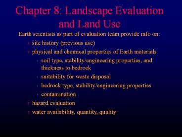
Chapter 8 Landscape Evaluation and Land Use
- Earth scientists as part of evaluation team
provide info on - site history (previous use)
- physical and chemical properties of Earth
materials - soil type, stability/engineering properties, and
thickness to bedrock - suitability for waste disposal
- bedrock type, stability/engineering properties
- contamination
- hazard evaluation
- water availability, quantity, quality
2
Environmental Geology Maps
- Distribution of geologic, hydrologic, etc. info.
- Interpretive Environmental Geology Maps
- Suitability of areas for a specific land use
- Ideally a series of maps, one for each possible
land use - Color code for suitability (yes, maybe, no)
- soil maps
- suitability for landfill
- stable foundations
- slope stability
- groundwater contamination
- earthquake vulnerability, etc.
3
Environmental Geology Maps
Map showing the vulnerability of aquifier
contamination, New Mexico
4
Environmental Geology Maps
Map showing the major sources of potential
groundwater contamination, New Mexico
5
Environmental Geology Maps
- Environmental Resource Units (ERUs)
- Multidisciplinary approach studies total natural
environment (geo, hydro, bio) - ERU areas with similar physical and biological
characteristics - Used to establish patterns of land use and
suitability in multidisciplinary approach
6
Environmental Geology Maps
- Environmental Resource Units (ERUs)
- 10.4 km2 study site in Morrison Colorado test site
7
Environmental Resource Units (ERUs)
- Mountain-forest
- Floodplain forest
- Pleistocene grassland
- Hogback wood and grassland
8
Environmental Geology Maps
- Geographic Information Systems (GIS)
- Computer composite maps capable of storing and
displaying geographic distribution of anything - The ability to combine and create maps of the
combinations is a powerful technique
9
Site Selection
- Evaluation of places for various human activities
- Can be quite multidisciplinary
- Assure that development is both possible and
compatible with local environment - Want to know all that you can before develop
10
Site Selection
Finally proceed to final site evaluation
specific criteria dep on intended use, but 2
common approaches
- 1) Cost-Benefit Analysis
- Assess long-range desirability of a project
- Calculate estimates of total benefits in and
compare to costs - Best site has lowest C/B
11
Site Selection
Finally proceed to final site evaluation
specific criteria dep on intended use, but 2
common approaches
- 2) Physiographic Determinism
- Apply ecological principles in design
- Maximize social benefit while minimizing social
costs - Consider physical, social, aesthetic data of
site itself do determine proper use and design
12
Environmental Impact Statements (EIS)
- NEPA (1969) required all major federal actions
which possibly affect the quality of the
environment be preceded by an evaluation of the
project and its impact - Council of Environmental Quality set forth
guidelines for EISs (revised in 1979) . The major
components are - Summary Statement of purpose and need for the
project - Rigorous comparison of reasonable alternatives
- Succinct description of the area to be affected
13
Environmental Impact Statements (EIS)
- Discussion of the environmental consequences of
the proposed project and alternatives which must
include - Direct and indirect effects
- Energy requirements and conservation
- Resource depletion
- Impact on urban quality and cultural/historical
resources - Possible conflicts with state and local land-use
plans - Mitigation measures
14
Environmental Impact Statements (EIS)
- Scoping
- Initial NEPA EIS process criticized for ?
mountains of paperwork that could obscure
critical issues - 1979 revisions introduced concept of scoping
preliminary identification of major environmental
issues that require more detailed evaluation
early in the process
15
Environmental Impact Statements (EIS)
- Mitigation
- Identify actions that will avoid, lessen, or
compensate for anticipated adverse impact - If an action involves a wetland, may either avoid
the wetland area or compensate by enhancing or
creating wetland elsewhere - NEPA requires address of this in EIS, but doesnt
require implementation of any measures - However, DEIS is reviewed by many agencies and
citizens groups that may require action - Environmental Assessments in cases where full EIS
deemed unnecessary
16
Environmental Impact Statements (EIS)
- State Environment Impact Legislation
- About half of the states have followed the
federal lead, either following NEPA for state and
municipal projects or enacting their own SEPAs
17
Environmental Impact Statements (EIS)
- Negative Declarations (Ds of non-significant
impact) - Filed when an agency determines no significant
impact - In lieu of full EIS much less rigorous and need
not consider alternatives - Many try this first, but may be required to do
full EIS if not grounds for ND - Mitigated Negative Declarations
- Filed when decided that initial project would ?
significant environment impact, but that it can
be modified so as to reduce them to
insignificance
18
Environmental Impact Statements (EIS)
- Big projects use teams of investigators with
varied expertise - Good case histories
- Cape Hattaras
- San Joaquin Valley
19
Land Use and Planning
- Most land use in USA is agriculture or forest
- Only about 3 or area is urban
- Conversion of rural non-ag is several thousand
km2/yr - half wilderness, parks, recreation, wildlife
- half urban, transportation, other facilities
- Scenic Resources
20
Land Use Options
- Multiple Use
- Using the same land for gt 1 purpose
- ball field doubles as aquifer recharge basin
- horse trails in floodplain
- wind generators in agricultural fields
- Sequential Use
- One use follows another
- Reclaimed mine used for underground storage,
waste... - Walla Walla landfill ballparks
- Gravel pits parking lots
21
Land Use Planning
- Nation, State, or City may decide to enact
land-use legislation for planning
22
Comprehensive or General Plans
- Used as a policy guide for development decisions
over a 10-20 yr period - Sets forth intended basic land uses
- Indicates zoning and subdivision regulation
- Regulated in separate specific ordinances
- Control slopes, floodplain development, soils...
- Residential
- Commerical
- Industrial
- Open spaces
23
Comprehensive or General Plans
- Land Management
- Follow-up to planning
- Possible impacts that need to be monitored
- Natural processes floods, landslides, erosion...
- Impact of human use on chemistry, biology,
resources... - Goals
- Protection of lives and property
- Protection of water quality and supply
- Protection of wildlife
- Ecosystem protection
- Recreation and public access
- Emergency Planning (regulation of response)
24
Environmental Law
- NEPA (National Environmental Policy Act) 1969,
1977 - EPA establishes and enforces air and water
quality standards - Federal Water Pollution Act (1956) req. municipal
sewage treatment - Clean Air Act (1963) and Air Quality Act (1965)
amended in 1970 and 1990 addresses all sorts of
air pollution (autos, CFCs, ozone...) - Solid Waste Disposal Act (1965) aimed at
municipal dumps - Resource Conservation and Recovery Act (1976)
- Toxic Substances and Control Act (1976) req.
tests and control - Clean Water Act (1977) addresses wider range of
pollution - CERCLA (Comprehensive Env. Resource,
Compensation, and Liability Act) (1980)
Superfund - NEPA also set up requirement of EIS or EA (and
enforces) - CEQ (Council on Env. Quality) promotes interest
and research in environment and implements