Status of the Multi-Functional Transport Satellite (MTSAT) Program - PowerPoint PPT Presentation
1 / 21
Title:
Status of the Multi-Functional Transport Satellite (MTSAT) Program
Description:
Polar-stereographic projection covering East Agea. Polar-stereographic projection covering the north-east of Japan. – PowerPoint PPT presentation
Number of Views:72
Avg rating:3.0/5.0
Title: Status of the Multi-Functional Transport Satellite (MTSAT) Program
1
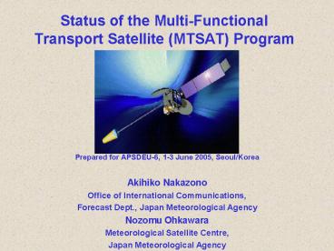
Status of the Multi-Functional Transport
Satellite (MTSAT) Program
- Prepared for APSDEU-6, 1-3 June 2005, Seoul/Korea
- Akihiko Nakazono
- Office of International Communications,
- Forecast Dept., Japan Meteorological Agency
- Nozomu Ohkawara
- Meteorological Satellite Centre,
- Japan Meteorological Agency
2
First images from MTSAT-1R ( 24 March 2005)
IR3(WV6.7mm)
IR1 (11mm)
IR2 (12mm)
IR4 (3.7mm)
VIS
3
Back-up of GMS-5 with GOES-9
Sub-satellite point of GOES-9
The left end of a picture is missing
?
?
- MTSAT-1 was failed to launch in November 1999
- GMS-5 had been deteriorating its function
- The imaging function has been backed up by
GOES-9, in cooperation with NOAA/NESDIS, since
22 May 2003
Sub-satellite point of the GMS-5
4
MTSAT (-1R / -2) Program
- The successor to the GMS-5
- 3 axis stabilized satellite
- 2 missions
- Aeronautical Mission (JCAB)
- Meteorological Mission (JMA)
5
MTSAT-1R
- MTSAT-1R was successfully launched on 26th Feb
2005. - The in-orbit test of MTSAT-1R has been performed.
- After checking-out of the whole system, including
ground facilities, dissemination of imagery from
MTSAT-1R will be started. - Test dissemination started on 31th May
- The commencement of operational dissemination
is to be announced as soon as defined.
6
MTSAT-2
- The functions are same as MTSAT-1R
- MTSAT-2 is planned to be launched within the
fiscal year (by the end of March 2006).
7
Improved Functions(Common to MTSAT-1R/-2)
Note At the sub-satellite point New
Function Improved Function
- An additional 3.7mm channel (IR4)
- Improved data quantization 10 bits (1024
levels) /pixel
8
Improvement of Services
- Half hourly observation for northern hemisphere
- No cancellation of observations caused from
eclipse phenomena - New HRIT and LRIT dissemination services
- Continuance of HiRID (S-VISSR compatible) and
WEFAX dissemination services to support users
migrations - Separate and Independent dissemination service
for MDUSs and SDUSs - Continuance of the Internet dissemination service
for MDUS users (IR1 only)
9
Observation Schedule of MTSAT-1R
10
Low Rate Information Transmission (LRIT, 2005)
- Digital data transmission (64Kbps)
- Conventional data compression (JPEG, lossless or
lossy) - Contents
- MTSAT Imagery
- MANAM
11
High Resolution Imager Data (HiRID, 20052007)
- Compatible with S-VISSR format of GMS-5
- IR data with 10 bits level resolution are
available - An additional 3.7mm data are also available
12
High Rate Information Transmission (HRIT, 2005)
- Digital Data Transmission (3.5Mbps)
- Conventional data compression (JPEG, lossless)
- Contents
- Full resolution imagery of all channels
- Spatial resolution of all channels are improved
- VIS data are also available with 10 bits
resolution - NAMAM
13
Timetable of observation and imagery dissemination
14
Summary of Satellite Operation and Data
Dissemination
X
15
Expected improvements of Products
- Sea Surface Temperature (SST)
- Aerosol Optical Thickness (AOT)
- Cloud Water Vapor Motion Winds
- (CMWs WVMWs)
- Cloud Grid Information Data (CGID)
16
Sea Surface Temperature (SST)
- IR4 (3.7mm) data was useful to discriminate low
level clouds from cloud-free sea in nighttime - - Decrease the error due to misjudged low level
clouds in nighttime
bias (mean)
RMSE (mean)
With 3.7mm -0.21 (K)
1.55 (K) Without 3.7mm
-0.29 (K)
1.78 (K)
Comparisons between satellite SST with/without
3.7mm data and buoy measurements ( Left bias,
Right RMSE )
17
- IR channels data with 10 bits level resolution is
expected to improve the accuracy of calculated SST
with 8 bits data
with 10 bits data CORR
0.994
0.998 RMSE
0.873
0.441
Comparisons between satellite SST and surface
temperatures of numerical weather prediction
(NWP) model ( Left SST
calculated with 8 bits IR simulation data
Right SST calculated with 10bits IR
simulation data )
18
Aerosol Optical Thickness (AOT)
- VIS data with 10 bits level resolution will
enable the calculated AOT resolution to be 0.01
from 0.1
19
Cloud Water Vapor Motion Winds (CMWs and WVMWs)
- 15 minutes interval observations increased the
number of CMWs and WVMWs about 20 - (Tokuno, 1997)
Cloud Grid Information Data (CGID)
- CH4 (3.7mm) data will improve the classification
of low level clouds in nighttime - (Tokuno, 1999)
20
For Your Reference
- General Informations, Announcements and
Imageries http//www.jma.go.jp/JMA_HP/jma/jma-e
ng/satellite/index.html - Time Table http//www.jma.go.jp/JMA_HP/jma/jma-
eng/satellite/NEWS/timetable_test.pdf
http//www.jma.go.jp/JMA_HP/jma/jma-eng/satellite/
NEWS/dissemination_plan.pdf - Technical Informations Samples
http//mscweb.kishou.go.jp/ - MANAM Examples http//mscweb.kishou.go.jp/user_
support/manam_sample/mtsat_manam.htm
21
- Thank you for your attention!
?????


