
3001 LiDAR Services - PowerPoint PPT Presentation
Title:
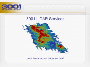
3001 LiDAR Services
Description:
Title: 3001 Overview Author: schristopher Last modified by: Tom Bertke Created Date: 1/5/2006 8:34:15 PM Document presentation format: On-screen Show – PowerPoint PPT presentation
Number of Views:147
Avg rating:3.0/5.0
Title: 3001 LiDAR Services
1
- 3001 LiDAR Services
- VGIN Presentation December 2007
2
3001 LiDAR History
- Co-developed one of the first commercial
topographic LiDAR sensors deployed in 1997 - Developed and continually upgraded proprietary
LiDAR processing software, ELVIS, to fill
industry void - Helped pioneer the application of LiDAR for
floodplain mapping with work in the Everglades
and in Southern Louisiana - Helped pioneer the use of LiDAR for large scale
topographic mapping programs on Louisianas
Statewide LiDAR program
3
3001 LiDAR Sensors
- We offer the two most advanced LiDAR sensors on
the market - Optech ALTM Gemini with Multipulse
- 167 kHz pulse rate
- Leica ALS50 Phase II with Multipulse
- 150 kHz pulse rate
- Both ideal for large scale mapping
- Advances save the customer money
- Higher pulse rate and Multipulse technology
allows higher collection altitude and less flight
lines, equaling lower cost while still meeting
FEMA standards and customer specifications
4
3001 Resources
- 3 LiDAR Sensors
- Optech ALTM Gemini with Multipulse
- Leica ALS50 Phase II with Multipulse
- Leica ALS40
- 5 Digital Cameras
- 2 Z/I DMCs (frame)
- 3 Leica ADS40 Phase IIs (push-broom)
- 9 Aircraft
- 7 Twin-Engine Cessnas
- 2 LearJets
5
3001 LiDAR Experience
- 10 years of LiDAR project and RD experience
- Nationwide projects
- From Alaska to Florida
- Customers include states, counties, cities, U.S.
Army Corps of Engineers, U.S. Navy, FEMA, and the
National Geospatial-Intelligence Agency - We estimate our LiDAR past performance to
encompass more than 150,000 square miles - Recently awarded 5-year contract by the Federal
government to provide worldwide operations and
maintenance of the JALBTCX CHARTS system
bathymetric LiDAR mapping and hyperspectral
imaging
6
Processing Where It Counts
- There is typically little variation in raw LiDAR
datasets given vendors follow standard collection
protocol - The real finesse with LiDAR is in processing
- Boresighting
- Filtering
- Manual editing
- 3001 developed ELVIS to give us abilities not
available in COTS software
7
ELVIS
- The result the most robust LiDAR editing
environment in the industry that allows the
analyst to customize every aspect of the
processing - Your product is not the result of a standard
filter/edit setting it is a unique, customized
throughput that provides an elevation model that
truly represents your terrain
8
Meeting Federal Standards
- FEMAs Guidelines and Specifications for Flood
Hazard Mapping Partners is accepted by most as
the national standard for elevation data - Our data are certified to meet FEMA vertical
accuracy specifications for 2 contours (RMSEz
18.5 cm / Accuracyz 36.3 cm) at a nominal post
spacing of 3 m - Accuracy has two definitions with LiDAR
- Accuracy identifying the elevation (Z) at a
particular XY position - Accuracy depicting the true topography of the
Earth
9
Two Definitions of Accuracy
- Accuracy identifying the elevation (Z) at a
particular XY position (Vertical Accuracy) - Predominantly influenced by post-processing,
editing, and ground control surveying - Post-processing/boresighting ensures trajectory
consistency across the dataset - Accurate filtering and editing ensures only the
points that reflect off the ground are identified
as such and remain in the bare-earth dataset - A well planned and executed ground control survey
can mean the difference between certifiable data
and just a pretty picture - 2 GPS base stations for coincident positioning
and triangulation operated during airborne data
collection, not to exceed 35 km from aircraft at
all times - Land cover checkpoint surveys to verify
positioning in the predominant land cover of the
project area(s) conducted post-airborne
operations, minimum of 5 land cover classes,
minimum 40 points per class
10
Two Definitions of Accuracy
- Accuracy depicting the true topography of the
Earth (Model Accuracy) - Largely dependent on the data collection
methodology, point density, post-processing, and
quality of the data filtering and editing - Successful flight planning ensures consistent
point spacing across the dataset and quality data
with which to work - Higher point density means more detail but is
it necessary? - Diligent post-processing ensures consistency
across the dataset - Accurate editing ensures ground points remain in
the bare-earth dataset - Your dataset should meet both definitions for
accuracy
11
Example Flight
12
Accuracy and the Sensor
- What is contingent upon the LiDAR sensor?
- Flight/data collection parameters
- The sensor (and aircraft) dictates your operating
altitude, pulse rate, flight line spacing, air
speed, etc.
13
Data Density
- 1 m LiDAR product provides 25x more surface
detail than a 5 m LiDAR product but also requires
much more storage - Next slide illustrates the difference in detail
between 5 m and 1 m LiDAR models
14
5 m Bare-Earth LiDAR Model
5 m Bare-Earth LiDAR Terrain Model
1 m Bare-Earth LiDAR Terrain Model
15
3001 Data
- LiDAR products include
- Elevation models (terrain and surface) ranging
from 5 m to sub-meter - Breaklines
- 2 contours
- We certify our LiDAR data to meet FEMA 2 contour
specifications - 100 of our data is better than 15 cm RMSEz
- Well exceeding FEMA standard (18.5 cm RMSEz)
- 70 of our data is better than 9 cm RMSEz
- 2D and 3D breaklines developed
- 2D collection and draping, and
- Most hydrographic features can be enforced in
this manner - 3D LiDAR-grammetry where needed
- Best used for bridge aprons, edge of pavement,
and building - Breaklines collected without supporting imagery
are limited by LiDAR post spacing and horizontal
accuracy (/- 0.5 m)
16
Quality Management is Key
17
LiDAR in Real Life
- Redefining flood plains
Q3 Flood Plain
LIDAR Flood Plain
Additional homes in the flood plain
18
LiDAR in Real Life
- Emergency response routing and evacuation
According to State officials, 10 lives were saved
in Louisiana by having 3001 LiDAR maps during the
Katrina response
19
LiDAR in Real Life
- Forest metrics
20
LiDAR in Real Life
- River morphology
21
Contact Information
- Tom Bertke
- Area Director
- Fairfax, VA
- Office 703.385.3001, ext. 1902
- Mobile 703.850.8032
- Carter Christopher
- Area Director
- Fairfax, VA
- Office 703.385.3001, ext. 0199
- Mobile 504.810.4748
Recommended
CrystalGraphics Presentations


