
Navigational Elements - PowerPoint PPT Presentation
Title:
Navigational Elements
Description:
Navigational Elements Know the four elements of navigation. 1. State how the Earth s size and shape affect navigation. 2. State how to determine position. – PowerPoint PPT presentation
Number of Views:125
Avg rating:3.0/5.0
Title: Navigational Elements
1
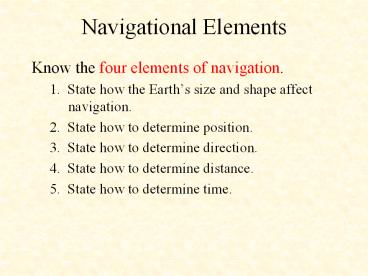
Navigational Elements
- Know the four elements of navigation.
- 1. State how the Earths size and shape affect
navigation. - 2. State how to determine position.
- 3. State how to determine direction.
- 4. State how to determine distance.
- 5. State how to determine time.
2
Overview
- 1. Earths Size and Shape
- 2. Position
- 3. Direction
- 4. Distance
- 5. Time
3
Earths Size and Shape
- For most navigational purposes, the Earth is
assumed to be a perfect sphere. - Measured at the equator, the Earth is
approximately 7,926.41 miles in diameter, and the
diameter through the poles is approximately 7,901
miles.
4
Earths Size and Shape
- Great Circles and Small Circles
- Defined as a circle on the surface of a sphere
whose center and radius are those of the sphere
itself. It is the largest circle that can be
drawn on the sphere. - The single most important aspect of great circles
for navigators is that the arc, or piece of the
circle, is the shortest distance between two
points on a sphere. - Circles on the surface of the sphere other than
great circles are defined as small circles.
5
Earths Size and Shape
- Great Circles and Small Circles
6
Position
- Lines of reference are necessary in order to
locate specific points on the Earth. - These lines are known as parallels of latitude
and meridians of longitude. - The numbers representing a position in terms of
latitude and longitude are known as coordinates
of that position.
7
Position
- Latitude
- The equator is a great circle midway between the
poles, and its plane is perpendicular to a line
connecting the poles.
8
Position
- Latitude
- The location of the latitude is determined by
figuring the angle at the center of the Earth
between the latitude and the equator.
9
Position
- Longitude
- Indicates east-west location.
- There is no natural starting point for numbering
longitude. - When the English-speaking people began to make
charts, they chose the meridian through their
principle observatory in Greenwich, England, as
the zero degree line.
10
Position
- Longitude
- The Greenwich Meridian is sometimes called the
first or prime meridian, although it is actually
the zero meridian. - Longitude is counted east and west from this
meridian through 180o. - The Greenwich Meridian is the 0o longitude on one
side of the Earth and, after crossing the poles,
it becomes the 180th meridian. - These designations define the Eastern and Western
Hemispheres.
11
Position
- Finding the Place
- If a globe has the circles of latitude and
longitude drawn upon it and if the latitude and
longitude of a place has been determined, a given
point can be located on the globe in its proper
position.
12
Position
- Finding the Place
- Latitude is expressed as either north or south of
the equator in degrees up to 90, and longitude is
expressed as either east or west and is expressed
in degrees up to 180. - A degree (o) of arc may be subdivided into
smaller units by dividing each degree into 60
minutes () of arc. - Each minute may be further subdivided into 60
seconds () of arc. - Smaller areas can be located by going beyond
degrees and minutes and using seconds.
13
Direction
- Direction is the position of one point in space,
relative to another, without reference to the
distance between them. - The points of a compass are not adequate for
modern navigation. It has been replaced, for the
most part, by a numerical system.
14
Direction
15
Direction
- Since determination of direction is one of the
most important parts of the navigators work, the
various terms involved should be clearly
understood. - Course Intended direction of travel
- Heading where the airplane if pointed
- Track The actual direction that was traveled
16
Direction?
- Course
- In Red
- Track
- Heading
- Aircraft
- Heading changes
17
Heading Track - Course
- Note the winds
18
Direction
- A line that makes the same angle with each
meridian is called a rhumb line. - Flying this sort of path results in a greater
distance traveled, but it is easier to steer. - Between two points on the Earth, the great circle
is shorter than the rhumb line, but the
difference is negligible for short distances
(except in high latitudes).
19
Distance
- Measured by the length of a line joining two
points. In navigation, the most common unit of
measuring distance is the nautical mile. - The nautical mile is about 6,076 feet.
- Equal to 1 minute of arc on a meridian, which is
1 minute of latitude. - To convert nautical miles to statute miles, the
nautical mile figure can be multiplied by the
factor 1.15. - To convert statute miles to nautical miles,
multiply the statute miles by 0.87.
20
Distance
- Speed is closely related to the concept of
distance, which determines the rate of change of
position. - Speed is usually expressed in miles per hour,
either statute or nautical. - If the measure of distance is nautical miles, it
is customary to speak in terms of knots.
21
Time
- The Earth makes a complete rotation of 360o
during a 24 hour day. - Zone Time
- Before the establishment of zone time in 1883,
every city and town had its own time. - Each time zone is 15o of longitude (1 hour of
angular measure) in width, and the first zone
centers on the prime meridian. - The United States has four standard time zones
(in the contiguous states).
22
Time
- Greenwich Mean Time
- The use of Greenwich Mean Time (GMT) avoids the
necessity of considering time zones. - GMT is the time of day at any given moment at
Greenwich, England.
23
Around the world in 24 zones!
- 24 Time Zones
- A through Z
- Zulu time last
- I and O not used
24
World View
- 24 Zones
25
Summary
- 1. Earths Size and Shape
- 2. Position
- 3. Direction
- 4. Distance
- Time
- Website for further information
- http//www.americanflyers.net/aviationlibrary/pilo
ts_handbook/chapter_14.htm
Recommended
CrystalGraphics Presentations


