Currents and Climate - PowerPoint PPT Presentation
1 / 21
Title: Currents and Climate
1
Currents and Climate
2
Currents
- A current is a large stream of moving water that
flows through the oceans. - Currents carry water great distances and some
currents move water at the surface of the ocean,
while others move the deep water. - Currents move the Suns energy from the equator
to the poles. - They also move cold water from the poles towards
the equator. - This moderates the climate of our planet.
3
One Way to Explore Currents
- Norwegian explorer Thor Heyerdahl proved his
theory that ocean currents influenced human
migration by using a raft that was powered only
by wind and ocean currents. - He showed that Polynesia could have been settled
from people migrating from South America.
4
Surface Currents
- The wind mainly drives surface currents, which
affects water to the depth of several hundred
meters. - If Earth were not rotating, winds and currents
would only flow in straight lines to the north
and south poles. - This Coriolis effect causes the winds to curve.
5
Coriolis Effect
- The Earths rotation causes the winds and
currents to curve in relation to Earths surface. - In the northern hemisphere the Coriolis effect
causes the currents to curve to the left.
6
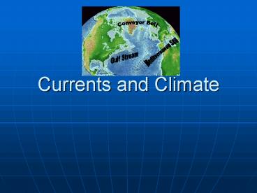
The Gulf Stream
- The largest and most powerful surface current is
the Gulf Stream in the North Atlantic Ocean. - It is caused by strong winds from the west.
- The Gulf Stream carries warm water from the Gulf
of Mexico to the Caribbean Sea, then northward
along the coast of the United States. - This current keeps Northern Europe much warmer in
the winter than it would otherwise be.
7
Ocean Current Map
8
How Surface Currents Affect Climate
- Climate is a pattern of temperature and
precipitation, typical for an area over a long
period of time. - Currents affect the climate by moving cold and
warm water around the globe. - A surface current warms or cools the air above
it, affecting the climate of the land near the
coast.
9
Deep Currents
- Streamlike movements of ocean water located far
below the surface are called deep currents. Deep
currents are not controlled by wind. - Deep currents form in parts of the ocean where
water density increases. The density of the ocean
is affected by temperature and salinity.
Deep currents are caused by changes in density.
10
Deep Currents, continued
- Formation and Movement of Deep Currents
Differences in water density cause variations in
the movement of deep currents.
11
Surface Currents and Climate
- Warm-Water Currents and Climate Warm-water
currents create warmer climates in coastal areas
that would otherwise be much cooler.
12
Surface Currents and Climate, continued
- Cold-Water Currents and Climate Cold-water
currents keep climates along a coast cooler than
the inland climate year-round.
13
Surface Currents and Climate, continued
- Upwelling is the movement of deep, cold, and
nutrient-rich water to the surface of the ocean. - The nutrients that are brought to the surface
support the growth of plankton. Plankton support
larger organisms, such as fish and seabirds. - Upwelling is shown on the next slide.
14
(No Transcript)
15
El Nino
- El Nino is an abnormal climate event that occurs
every two to seven years in the Pacific Ocean. - It begins when an unusual pattern of winds form
over the western Pacific. - This causes fast sheets of warm water to move
eastward to the south American coast. - It can last one to two years.
16
El Ninocontinued
- Effects of El Niño
- El Niño alters weather patterns enough to cause
disasters, including flash floods, mudslides, and
droughts. El Niño also prevents upwelling off the
coast of South America.
17
El Nino Impact (Western Coast of South America)
- El Nino can have disastrous consequences.
- Warm surface water prevents upwelling off of the
western coast of South America. - Without nutrients brought up by upwelling, fish
die or go somewhere else to find food. - Sea birds have no fish to eat, and also must
leave the area or die.
18
El Nino (On Land)
- El Nino causes shifts in weather patterns around
the world, bringing severe conditions to
different areas. - El Nino caused an unusually warm winter in
northeastern U.S. - It also brought heavy rains, flooding, and mud
slides in California. - It also brought a string of deadly tornadoes in
Florida.
19
Surface Currents and Climate, continued
- Studying and Predicting El Niño Learning as
much as possible about El Niño is important
because of its effects on organisms and land. - To study El Niño, scientist use a network of
buoys located along the equator. The buoys
collect data about surface temperature, air
temperature, currents, and wind.
20
Forecasting El Nino
- Scientist dont fully understand the conditions
that create El Nino - They can predict its occurrence by using computer
models of the world climate - Knowing when El Nino will strike, officials will
give notice and can plan for unusual weather
patterns.
21
El Nino (2006 hurricane season)
- Why hasnt there been many hurricanes in the 2006
hurricane season? - The seasonal activity was lower than expected
because of the rapid development of El Nino. - This year there were only 9 named storms, 5
became hurricanes, and 2 became major hurricanes
in Category 3 or higher. - 2005 was the most active season on record, with
28 named storms, of which 15 became hurricanes. - Five of the seven major storms hit the US,
including Katrina.


