
GIS in Water Resources Consortium - PowerPoint PPT Presentation
Title:
GIS in Water Resources Consortium
Description:
GIS in Water Resources Consortium GIS Water Resources CRWR David R. Maidment, University of Texas at Austin Dean Djokic, Environmental Systems Research Institute (ESRI) – PowerPoint PPT presentation
Number of Views:1025
Avg rating:3.0/5.0
Title: GIS in Water Resources Consortium
1
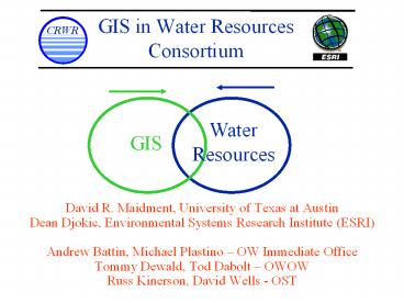
GIS in Water Resources Consortium
- David R. Maidment, University of Texas at Austin
- Dean Djokic, Environmental Systems Research
Institute (ESRI) - Andrew Battin, Michael Plastino OW Immediate
Office - Tommy Dewald, Tod Dabolt OWOW
- Russ Kinerson, David Wells - OST
2
Overview
- What is the Consortium, why is EPA interested ?
- Activities of the Consortium 1999-2002
- Arc Hydro Data Model
- Arc Hydro Tools
- Directions for Consortium work 2002-2005
3
Who is in the GIS WATER Resource Consortium ?
- Led by University of Texas Center for Research in
Water Resources and ESRI - USGS (NHD, EROS Data Center), EPA, DHI, HEC, BYU,
CDM, Dodson, LCRA, TNRCC, TWDB, City of Austin - Many individuals in academia, government and
industry
4
First Product of the Consortium ArcGIS Hydro Data
Model
Hydrology
Hydrography
5
First Product of the Consortium ArcGIS Hydro Data
Model
Hydrology
Hydrography
National Hydrography Dataset
BASINS Water Quality Models
6
Why is EPA OW involved the GIS WATER Resource
Consortium ?
- ArcHydro Data Model integrates
- Mapping and linear referencing NHD capabilities
- BASINS hydrologic modeling capabilities
- ArcHydro Tools can be incorporated into
applications - BASINS data management and modeling tools
- NHD indexing functions in the NHD Reach Indexing
Tool (RIT) and Web-based Reach Indexing Tool
7
EPA interest in National Hydrography Dataset
- EPA helped USGS develop NHD
- Rich cartographic feature content for making maps
- A stream addressing system for linking
water-related information to the national
drainage network - Upstream/downstream modeling along the drainage
network
2
1
3
8
Indexing EPA and other program information to NHD
Watershed 02050701
NHD Reach Address Database (RAD)
2
3
1
4
5
9
NHD information in EPA Applications
UserLayer
EnviroMapper For Water
WebRIT / WATERS Locational Tool
WATERS Query Tool
ReusableMappingCapabilities
Total WATERS
NHD Navigate
ServiceLayer
Beaches
Integrated Geospatial Database
NHD Reach Address Database
DataLayer
STORET, Nutrients
SDWIS
Impaired / Assessed Waters
No Discharge Zones
10
EPA interest in BASINS
- Designed to meet modeling needs for Total Maximum
Daily Loads (TMDLs) and other environmental
programs - Combines screening and detailed models with GIS
data and interface tools - Database and CDs contain wide variety of data
needed for modeling
11
(No Transcript)
12
ArcGIS Hydro Data Model Integrates features of
NHD and BASINS
National Hydrography Dataset
BASINS Water Quality Models
13
What is a Geodatabase (Dean Djokic)
14
ArcGIS Introduces
- A new geographic data model
- A new geographic database
- Stored in an RDBMS
- Many new capabilities
- ArcObjects
- COM objects that access geographic data
- Work with Geodatabases and existing file formats
Geodatabase MS Access OracleSQL Server
Informix DB2
15
Geodatabase Overview
- ArcGIS new GIS technology
- Applications
- Data management
- Data model
- Customization
- Internet
Applications
Data Model
Data Management
16
Geodatabase Terms
- Geodatabase
- Persistent store of geographic information in a
DBMS - Geodatabase Object Model
- Collection of ArcInfo objects
- Geodatabase Access Components
- Components (objects) to work with data in a
geodatabase
17
Key Capabilities
- Features
- Geometric Networks
- Relationships
- Validation Rules
- Subtypes
- Default Values
- Versions
- Custom Features
- Data Management GUI (Arc Catalog)
- CASE tools
18
Features
- Features are geographic objects
- Object with a geometry attribute
- Vector model for geographic entities
- Features (rows) belong to FeatureClasses (tables)
- Feature location is an attribute of type geometry
- Point, Multipoint, Line, Polygon
19
Feature DataSets
- Same Spatial Reference
- Similar conceptually to an ARC/INFO coverage
FeatureDataSet
FeatureClass
Object Class
20
Relationships
- Association between two Object Classes
- Spatial and / or non-spatial
- Peer-to-peer associations or composite
relationships - Cardinality 1-1, 1-n, n-1, n-m, . . .
- Notification
- Validation Rules optional
- Subtypes
21
Geometric Networks
- A network relationship between Feature Classes
- Solve network problems
- Connectivity traces
- Cycle detection
- Set flow directions
- Directed tracing
- Isolation tracing
- Custom solvers
- Solvers in ArcMap (COM)
- Build Network topology in ArcCatalog/CASE
22
Geodatabase Model
23
Extensible Data Model
Row
Feature
Measurement
NetworkFeature
Basin
JunctionFeature
EdgeFeature
ComplexEdge
SimpleJunction
Stream
Gage
Confluence
24
Questions and Discussion
25
What is Arc Hydro? (David Maidment)
26
What is Arc Hydro?
- An data infrastructure for storing and
integrating hydro data within ArcGIS - A set of hydro objects built on top of ArcObjects
- A set of standardized attributes
- A vocabulary for describing data (glossary)
- A toolset for implementing the data model
27
Hydrologic Information System
Analysis, Modeling, Decision Making
Arc Hydro Geodatabase
28
Arc Hydro Components
29
(No Transcript)
30
Arc BASINS Data Model
Arc BASINS Data Model
31
Arc Hydro Extension for EPA Basins
- Arc Basins
- Builds on core Arc Hydro landscape representation
- Provides additional feature datasets and tables
to store Basins data
Arc Hydro Feature classes
Basins feature classes
32
Arc Basins as one geodatabase
33
Data Model Based on Inventory
Streams Drainage Areas Hydrography Channels
Terrain Surfaces Rainfall Response Digital
Orthophotos
34
Data Model Based on Behavior
Follow a drop of water from where it falls on the
land, to the stream, and all the way to the ocean.
35
Integrating Data Inventory using a Behavioral
Model
Relationships between objects linked by tracing
path of water movement
36
Arc Hydro USA
- Arc Hydro Framework dataset for USA at 1500,000
scale - Built from USGS and National Weather Service data
- MonitoringPoints are USGS stream gaging stations
37
(No Transcript)
38
Arc Hydro Framework Input Data
Watersheds
Waterbody
Streams
Monitoring Points
39
Arc Hydro Framework
40
Hydrologic Cataloging Units (HUCS)
Hydrologic Unit Code 12100203
Guadalupe Basin (4 HUCs)
- 2015 HUCs cover continental US
- average area 1 county
41
Arc Hydro Framework Dataset for the Guadalupe
Basin
42
HydroNetwork through Canyon Lake
Flowlines through water body
Generic Junction (for topological connection of
edges)
43
(No Transcript)
44
HydroJunction has Waterbody Relationship
45
Network Tracing
Upstream Tracing
Downstream Tracing
46
National Hydro Data Programshttp//www.crwr.utexa
s.edu/giswr/nhdconf/nationalhydro.html
National Elevation Dataset (NED)
National Hydrography Dataset (NHD)
Watershed Boundary Dataset
Elevation Derivatives for National Application
(EDNA)
47
Scales of representation of Drainage Systems
Basins drainage areas for water resources
management
Watersheds subdivision of Basin for a
particular hydrologic purpose
Catchments subdivision of Basin into elementary
drainage areas by physical rules
Digital Elevation Model land surface terrain
grid cells
48
Watersheds of the Guadalupe Basin
NWS forecast Watersheds (flooding)
Guadalupe HydroNetwork
EPA TMDL Segments (water quality)
TNRCC water availability points (water supply)
49
Catchments, DrainageLines and DrainagePoints
50
Catchments Subdivided at Watershed Outlet
51
Tracing on Catchments
(Each catchment knows the next downstream
catchment)
Upstream Tracing
Downstream Tracing
52
Regional Analysis
HydroNetwork to provide connectivity of flow
through large regions
Digital elevation model for terrain analysis
within basins
53
(No Transcript)
54
HydroID and HydroCode
55
National Water Information System
Arc Hydro NWIS data retrieval tool
Web access to USGS water resources data
56
Arc Hydro Time Series Object
TSDateTime
TSValue
FeatureID
TSType
57
Streamflow Time Series
Arc Hydro Time Series Table
58
Time Series Extracted to Excel(In Excel, use
Data/Get External Data to query Geodatabase)
Excel view
Geodatabase view
59
(No Transcript)
60
Coupling Spatial and Temporal Data
1 hour Nexard Rainfall on the Guadalupe
Basin October 13, 2001
61
EDNA Catchments
Average area 7.5 km2
EDNA Elevation Derivatives for National
Application
62
Intersection of Nexrad and Catchments
Surface Water Balance
Atmospheric Water
Soil Water
Surface Water
63
Modflow Groundwater Cells
Modflow Model of the Edwards-Trinity aquifer
Average area 2.6 km2
64
Intersection of Nexrad and Modflow Cells
Atmospheric Water
Groundwater Balance
Groundwater
65
Intersection of Nexrad, Catchments and Modflow
Atmospheric Water
Soil Water
Surface Water
Groundwater
66
(No Transcript)
67
Arc Hydro Tools (Dean Djokic)
68
Arc Hydro Tools
- A set of tools that exercises the Arc Hydro
model - Key field (property) management.
- HydroID related IDs
- Length measures
69
Arc Hydro Tools
- Core functions (in addition to standard ArcGIS
functionality) - DEM-based watershed delineation (local, global)
- Network generation
- Attribute and network tracing and summary
operations
70
Arc Hydro Tools Principles
- A toolbar with packaged menus and buttons
- Developed using consistent development
methodology - Easy addition of new functionality
71
Arc Hydro Tools Version 1.0
- Raster processing
- DEM processing
- Watershed delineation
- Vector processing
- Arc Hydro attributes
- Network analysis
- Time Series and Application Utilities
- Buttons
72
Questions and Discussion
73
Role of the Geography Network (Dean Djokic)
74
Geography Network Overview
- Provides a framework for sharing and discovering
geographic data services - GN Components
- User Communities
- Content Providers
- Web Site (content catalog)
75
GN Components
User Communities
Web Site (Clearinghouse)
Content Providers
76
GN User Communities
- GIS Users
- Users Needing GIS Data and other Content
- Web Users
- Groups Sharing Common Interests
- Application Developers
- Building Solutions for End-Users
77
GN Content Providers
- Government Data Providers
- USGS, EPA, NIMA, UN, Texas, California
- Commercial Data Providers
- GDT, ORBIMAGE, Meteorlogix, Tele Atlas
- Potentially ALL GIS Users
- Any Organization Publishing Data, Services
78
Types of GN Contentdynamic services
- Live Data and Maps (Map Services)
- Image and Feature Services
- Downloadable Data
- Clip and Ship Data Services
- GIS Web Services
- Tools for Developers
- Applications
- Custom Built Web Applications
79
Live Data and Maps
80
Downloadable Data
81
GIS Web Services
82
Applications
83
Types of GN Contentstatic maps and data
- Offline Data
- Geographic Data for Your GIS
- Clearinghouses
- Web Sites offering Data and Maps
- Static Map Images
- Finished Map Graphics (e.g. TIF, JPG)
- Map Files
- Published Map Documents (e.g. PMF)
84
Building Your Own GN
- Several Organizations at All Levels of Government
Interested in Building GNs - UN, NIMA, BLM, EPA, Texas, Delaware
- ESRI Distributors Building Local GNs
- ArcIMS 4 is Out-of-the-Box GN Toolkit
- Publish Metadata
- Search Metadata
- Publish Maps
- Distribute Data
85
Steps to Building a GN
- Configure Your ArcIMS System
- Develop and Publish Map Services
- Develop and Publish Metadata
- Customize and Deploy Web Site
86
Integrating Arc Hydro with other Media Data
Models and Modeling Tools (David Maidment)
87
Water Balance in the Landscape
Atmospheric Water
Precipitation
Evaporation
Runoff
Soil Water
Surface Water
Recharge
Baseflow
Groundwater
88
Vertical and Horizontal Water Balance
Atmospheric Water
Soil Water
Surface Water
Groundwater
89
Decoupling and connecting hydrologic systems
90
Source http//www.acnatsci.org/research/anserc/me
rcurybiogeochemistry.htm
91
Integration of Data and Models(XML as a data
transfer package mechanism)
Model 1
Model 2
Model 3
Model 6
Model 4
Model 5
Data
92
Model Integration !?
- Integration of data, data models, and analyses in
a functional system
SWMM
RAS
GIS
EPANet
MIKE 11
SWAT
HSPF
Other
93
Integration Issues(direct interfacing)
94
Integration Issues(intermediary interfacing)
95
Why XML-Based Spatial Data Exchange
- Semantic tags for spatial data are user specified
- Easy customization of data structure for
different systems - Data structure is extensible
- Good for data distribution on Internet
(multi-platform) - Existing technologies for XML management
(parsers, editors, viewers, components, checkers,
converters, ) economy of development
96
System Design of the XML-Based Exchange System
- Architecture
- A central exchange mechanism accompanied by
customizable XML structures - Three components
- Central data exchange mechanism embedded in GIS
(ArcMap-based) - Customizable control XML structure for import
- Customizable control XML structure for export
97
Import
Customizable Import XML Structure
Import Data as XML Document
GIS
External Data Analysis Package
Central Exchange Mechanism
Export
Import Engine
Export GIS Data as XML Document
Export Engine
Customizable Export XML Structure
98
Central XML-Driven Spatial Data Exchange Mechanism
- GIS Import Engine
- Transform data from various XML data exchange
structures into spatial data in a user-defined
data model - An intermediate XML to XML conversion might be
required - Input data exchange structure and geodatabase
design are managed by import control XML - GIS Export Engine
- Transform spatial data from a user-defined data
model into various XML data exchange structures - Output data exchange structure and geodatabase
design are managed by export control XML
99
Anatomy of an Interface
100
A Close Look of Export Process
GIS Data
Determine Data Structure
Output Data
Export
XML Structure
- System reads export control XML
- Determines output data structure
- Generates output
101
Control XML in Export Process
Sample Control XML
ltNode1 NameStreamNetwork SourceTypeFeatureLay
er IdentityLayerName IdentityValueReaches
gt ltNode2 NameStream SourceTypeFeature
EntriesMultiple gt ltNode3
NameStreamID SourceTypeFeatureTable
IdentityFieldName IdentityValueReach_ID
TargetAttribute /gt lt/Node2gt lt/Node1gt
Sample Output Data
ltStreamNetworkgt ltStream StreamID1 /gt
ltStream StreamID2 /gt lt/StreamNetworkgt
102
Export Workflow
103
Data Import Process
Import XML Structure I
- Read in data
- Read control XML structure
- Validate import data structure against the
control structure - Generate spatial data
- Store spatial data in a geodatabase
Import Data as XML Document
GIS
Import Engine
Import XML Structure II
Spatial Data I
Spatial Data II
Import Data as XML Document
104
A Close Look of Import Process
GIS Data
- System reads input data and XSL style sheet
- Validates data structure against XSL style sheet
- Generates new import data
- Reads XML schema and validates input data values
- Generates GIS data
- Currently supported spatial data point, line,
polygon, TIN
105
Customizing Input XML
- Input format never correct
- Use XSLT to convert XML to XML (or ASCII if need
be) - Allows reduction in code on GIS side easier
maintenance.
106
Questions and Discussion
107
OW Goals for Consortium 2002-2005
- USGS has migrated NHD and associated tools to
ArcHydro Model - EPA NHD Reach Address Database is in geodatabase
and linked to USGS NHD in ArcHydro - EPA NHD-based applications utilize Arc Hydro
Tools - EPA BASINS and other modeling applications
utilize Arc Hydro Tools
108
OW Goals for Consortium 2002-2005 USGS has
migrated NHD and associated tools to Arc Hydro
Model
- Consortium supports USGS effort to move NHD into
the ArcHydro Model - Consortium supports USGS effort to migrate NHD
data management tools to Arc Hydro - Consortium helps maintain integration of USGS NHD
in Hydro with Arc Hydro Data Model
109
OW Goals for Consortium 2002-2005 EPA NHD-based
information resources Reach Index Tool (RIT),
WebRIT, NHD RAD utilize Arc Hydro Model/Tools
- Consortium supports linear referencing functions
(point and linear events) against NHD in Hydro. - Consortium supports ability to port NHD in Hydro
into Oracle Spatial format. - Consortium supports ability for applications to
perform navigation in NHD in Hydro
110
OW Goals for Consortium 2002-2005 EPA BASINS
and other modeling applications utilize Arc Hydro
Tools
- Develop DEM editing and management tools
- Develop time series interfaces including
English-Metric conversion tools - Support for EPA effort to establish standard
watershed delineation tool - Develop watershed curve numbers for use in
ArcHydo - Develop stream cross section estimation (with
USGS)
111
Potential EPA Goals for Consortium
2002-2005Support ability to download data
- Modeling and other needs to download data from
various sources - NHD in Arc Hydro from USGS
- Water Program information addressed to NHD in EPA
Reach Address Database - Other EPA Program information in EPA Enterprise
Repository - Other Geospatial Information in
- Agency Integrated Geospatial Database
- Other federal and Geography Network geospatial
data
112
Potential EPA Goals for Consortium 2002-2005
Integration of Arc Hydro Data Model with other
media for integrated data modeling environment
- Account for movement of water between different
media - atmospheric water, surface water and
subsurface water - Communication of data among Arc Hydro and other
models using a hydrologic version of XML
Recommended
CrystalGraphics Presentations


