
Microsoft Map 97 - PowerPoint PPT Presentation
1 / 35
Title:
Microsoft Map 97
Description:
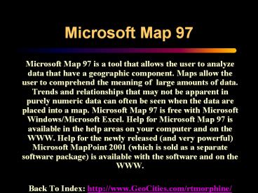
Microsoft Map 97 Microsoft Map 97 is a tool that allows the user to analyze data that have a geographic component. Maps allow the user to comprehend the meaning of ... – PowerPoint PPT presentation
Number of Views:114
Avg rating:3.0/5.0
Title: Microsoft Map 97
1
Microsoft Map 97
- Microsoft Map 97 is a tool that allows the user
to analyze data that have a geographic component.
Maps allow the user to comprehend the meaning of
large amounts of data. Trends and relationships
that may not be apparent in purely numeric data
can often be seen when the data are placed into a
map. Microsoft Map 97 is free with Microsoft
Windows/Microsoft Excel. Help for Microsoft Map
97 is available in the help areas on your
computer and on the WWW. Help for the newly
released (and very powerful) Microsoft MapPoint
2001 (which is sold as a separate software
package) is available with the software and on
the WWW. - Back To Index http//www.GeoCities.com/rtmorphine
/
2
(No Transcript)
3
(No Transcript)
4
(No Transcript)
5
(No Transcript)
6
Microsoft Map 97 Provides 16 Different Colors
- BLACK SILVER
- MAROON RED
- GREEN LIME
- OLIVE YELLOW
- NAVY BLUE
- PURPLE FUCHSIA
- TEAL AQUA
- GRAY WHITE
7
Microsoft Map 97 Colors On A White Background
8
Microsoft Map 97 Colors On A Black Background
9
Microsoft Map 97 Has 9 Major Geographic Regions
- WORLD
- NORTH AMERICA
- UNITED STATES w/ AK and HI Inset
- CANADA
- MEXICO
- EUROPE
- UNITED KINGDOM IRELAND
- SOUTHERN AFRICA
- AUSTRALIA
10
Geographic Regions Installed In Microsoft Map 97
11
Types Of Maps In Microsoft Map 97
- Single-Series Maps
- Value Shading (default)
- Category Shading
- Dot Density
- Graduated Symbol
- Others
- Labels (Feature)
- Highways, Cities, Lakes, Etc. (Feature)
- Multiple-Series Maps
- Pie Chart w/ Value Or Category Shading
- Column Chart w/ Value Or Category Shading
- Custom Pin Map
- Others
- Zoom
- Mapstats (Demographic Data Included With
Microsoft Map 97)
12
Value Shading Map Format
- Single-Series
- Uses Different Shades Of A Color
- Shows Map Regions As Having Different Numeric
Values Based On Their Color Shade
13
Value Shading Map
14
Category Shading Map Format
- Single-Series
- Uses Different Colors
- Shows Map Regions As Belonging To Different
Categories Based On Their Color
15
Category Shading Map
16
Category Shading Map
17
Dot Density Map Format
- Single Series, But Can Be Used To Build Multiple
Series - Shows Data As Dots
- Each Dot Represents Some Quantity
18
Dot Density Category Shading Map
19
Graduated Symbols Map Format
- Single-Series, But Can Be Used To Build Multiple
Series - Shows Data As Symbols Of Various Sizes
- Larger Symbols Represent Higher Data Values
20
Graduated Symbols Category Shading Map
21
Pie Charts Map Format
- Multiple-Series
- A Pie Chart Is Displayed Over Each Area
- Can Be Used With Either Category Or Value Shading
- Can Have Either Absolute Or Percentage Values
22
Pie Charts Category Shading Map
23
Column Charts Map Format
- Multiple-Series
- A Column Chart Is Displayed Over Each Area
- Can Be Used With Either Category Or Value Shading
- Can Have Absolute, Percentage, Or Time-Series
Values
24
Column Charts Value Shading Map
25
Custom Pin Map Format
- User Can Place Symbols Add Text
- Different Symbols Can Be Used To Represent
Different Features - Size, Color, Text, And Placement Of Symbols Can
Be Altered
26
Custom Pin Map
27
Zoom Map Format
- User Can Increase Or Decrease The Magnification
Of Any Area On The Map - Select A Higher Zoom Percentage To Expanded An
Area - Select A Lower Zoom Percentage To Contract An Area
28
Zoom Map
29
Included Features Map Using Highways Option
30
Included Features Map Using Labels Option
31
Included Features Map Using Mapstats Data
32
Microsoft/USGS TerraServer SW Washington, D.C.
33
Summary Of Microsoft Map 97
- Microsoft Map 97 is a tool that allows the user
to analyze data that have a geographic component.
Microsoft Map 97 has several major limitations,
though. It does not allow more than 16 different
colors, although Value Shading maps show
various shades of a color. It does not have
separate maps for Asia or for most of Africa.
When a map is revised it sometimes loses data
this can be a major problem and is something the
user needs to check during revisions and when
copying a map. Microsoft has released Microsoft
MapPoint 2001, a truly awesome mapping and
geographic information system (GIS) package, as
part of their Microsoft Office Suite of
productivity software. However, where Microsoft
Map 97 is free with Microsoft Windows/Microsoft
Excel, Microsoft MapPoint 2001 is sold as a
separate software package. A free 60-day trial
version of Microsoft MapPoint 2001 is available
from Microsoft.
34
Internet HyperLinks For Maps (In No Particular
Order)
- Expedia.com http//www.expedia.com/
- An Atlas Of Cyberspaces http//www.cybergeography
.org/atlas/atlas.html - MS USGS MSN Encarta Learning Zone
TerraServer http//terraserver.microsoft.com/ - MS USGS TerraServer.com http//www.terraserver
.com/ - Microsoft MS MapPoint 2001 http//www.microsoft.
com/office/mappoint/default.htm - MP2K (Magazine For MS MapPoint)
http//www.mp2kmag.com/ - Microsoft MSN Encarta Learning Zone Atlas
http//encarta.msn.com/maps/mapview.asp - NationalGeographic.Com MapMachine
www.nationalgeographic.com/resources/ngo/maps/ - U.S. Census Geography Topics http//www.census.go
v/geo/www/index.html - U.S. Census Bureau Gazetteer http//www.census.go
v/cgi-bin/gazetteer - U.S. Census Bureau (TIGER) http//www.census.gov/
geo/www/tiger/index.html - USGS Map Browser Information http//www.nationala
tlas.gov/mapit.html - USGS National Mapping Information
http//mapping.usgs.gov/ - WSI Corporation Intellicast.com
http//intellicast.com/ - The Library Of Congress Map Collections
http//lcweb2.loc.gov/ammem/gmdhtml/gmdhome.html - About.com Geography http//geography.about.com/e
ducation/geography/ - CIA WWW Site http//www.odci.gov/cia/publications
/factbook/index.html - IRI/LDEO Climate Data Library http//ingrid.ldgo.
columbia.edu/ - NAVSTAR Global Positioning System Joint Program
Office http//www.laafb.af.mil/SMC/CZ/homepage/
35
Microsoft Map 97
- The End Of The Presentation
- Back To Index http//www.GeoCities.com/rtmorphine
/
Recommended
CrystalGraphics Presentations


