
GPS - PowerPoint PPT Presentation
Title:
GPS
Description:
Paul Lammertsma Universiteit Utrecht GPS & Galileo Satellite Navigation Introduction Why by satellite? History TRANSIT System GPS Galileo Competition Cooperation ... – PowerPoint PPT presentation
Number of Views:188
Avg rating:3.0/5.0
Title: GPS
1
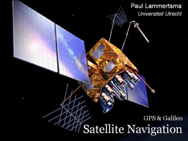
GPS Galileo Satellite Navigation
Paul Lammertsma Universiteit Utrecht
2
Introduction
- Why by satellite?
- History
- TRANSIT System
- GPS
- Galileo
- Competition
- Cooperation
- Prospective
Paul Lammertsma
Universiteit Utrecht
3
Why by satellite?
- Signal reception is better than by land
- Signals can pass through clouds and rain
- As long as a satellite is in the receivers
horizon, a signal is always perceivable - Worldwide
- High accuracy
Paul Lammertsma
Universiteit Utrecht
4
History
- The Russians kept the Doppler-effect in mind with
the launch of Sputnik I in 1957 - To keep radio contact with a moving object, you
have to keep changing your frequency - The Americans discovered how to invert this in
1959 with the start of the TRANSIT navigation
system - If you know the position of the satellite, you
can determine your relative position to it
Paul Lammertsma
Universiteit Utrecht
5
TRANSIT System
Navy Navigation Satellite System
- Satellite sends its exact position and time over
a fixed frequency - Receiver monitors the difference between the
received frequency and the expected frequency - When these frequencies are equal, the satellite
is directly above the receiver
Paul Lammertsma
Universiteit Utrecht
6
TRANSIT System
?
?
?
Paul Lammertsma
Universiteit Utrecht
7
TRANSIT System
150 MHz
200 MHz
Paul Lammertsma
Universiteit Utrecht
8
TRANSIT System
150 MHz
150 MHz
Paul Lammertsma
Universiteit Utrecht
9
TRANSIT System
- The receiver only knows that the satellite is
neither approaching or departing - So the ship must be on a line perpendicular to
the orbit of the satellite - However, farther from the orbit, the frequency
transition is less - A calculation will tell the receiver how far, but
not which side
Paul Lammertsma
Universiteit Utrecht
10
TRANSIT System
dual frequency
single frequency
Paul Lammertsma
Universiteit Utrecht
11
TRANSIT System
Pros
- Up and running 2 years after concept
- Only need 1 satellite per measurement
Cons
- Low orbit few satellites bad coverage
- Receiver needs a continuous signal
- Receiver has to wait for satellite to pass
overhead - Only up to 500/25 meter accuracy
- Assumes sea level altitude
Paul Lammertsma
Universiteit Utrecht
12
NAVSTAR GPS
Navigation Satellite Timing and Ranging
Concept
- The American Department of Defense started
development in 1973 - Six orbital planes
- (plane orbit containing multiple satellites)
- 21 active satellites, plus 3 spares
- Four per plane
Paul Lammertsma
Universiteit Utrecht
13
NAVSTAR GPS
History
- First three prototype satellites Timation from
1967-74 - First prototype configuration Block I of 10
satellites from 1978-85 - Current configuration is the Block II from
1989-94 - Delayed partially because of the 86 Challenger
disaster
Paul Lammertsma
Universiteit Utrecht
14
NAVSTAR GPS
Configuration
Paul Lammertsma
Universiteit Utrecht
15
NAVSTAR GPS
Configuration
orbital plane
20,200 km
55
equator
6 planes
Paul Lammertsma
Universiteit Utrecht
16
NAVSTAR GPS
Configuration
- Why not geostationary at 36,000 km?
- Stronger transmitter required
- More powerful launcher required
- Poor coverage of polar regions
- Compromise 20,200 km so period is 12h
- However, many satellites needed
- At least 17 satellites required
- Today 27 satellites five to twelve in range!
Paul Lammertsma
Universiteit Utrecht
17
NAVSTAR GPS
- Coverage
Paul Lammertsma
Universiteit Utrecht
18
NAVSTAR GPS
- Satellite Broadcast
- Satellite position
- Time
- Other parameters
- Satellite status
- Possible inaccuracies
- Information about other satellites
- etc.
Paul Lammertsma
Universiteit Utrecht
19
NAVSTAR GPS
How it works
- A receiver receives a signal from a GPS satellite
- It calculates the difference from the current
time and the time sent by the satellite - It now knows how far away the satellite is
- Because we know that radio signals travel at the
speed of light, we can calculate this
Paul Lammertsma
Universiteit Utrecht
20
NAVSTAR GPS
How it works
Paul Lammertsma
Universiteit Utrecht
21
NAVSTAR GPS
How it works (cont.)
- There are two possible locations
- One is practically impossible, so it can be ruled
out - Too far away from Earth (too high)
- Velocity is not realistic
- Still, we need a fourth satellite
- Confirm this location
- Improve accuracy
Paul Lammertsma
Universiteit Utrecht
22
NAVSTAR GPS
How it works (cont.)
Paul Lammertsma
Universiteit Utrecht
23
NAVSTAR GPS
- Satellite requirements
- Each satellite must be uniquely identified
- Satellites must know their exact position
- Satellites must know the exact time
- 2 rubidium 2 cesium atomic clocks
- At least once every 4 hours it synchronizes
position and time with a Monitoring Station
Paul Lammertsma
Universiteit Utrecht
24
NAVSTAR GPS
- Why is this important?
- It only takes a signal about 63 milliseconds to
reach the receiver - Inaccuracy of 1 millisecond puts you off by 300
kilometers! - So the satellites are equipped with four atomic
clocks - But what about the receiver?
Paul Lammertsma
Universiteit Utrecht
25
NAVSTAR GPS
- The receiver
- The receiver has a simple digital clock
- It doesnt have to be spot-on
- It just has to get the travel time of each
satellites signal relative to each other - But this means we do need a fourth satellite
Paul Lammertsma
Universiteit Utrecht
26
NAVSTAR GPS
- Pseudo range
In two dimensions, this is the ideal
situation Note that in 2D, we need 3 measurements!
Paul Lammertsma
Universiteit Utrecht
27
NAVSTAR GPS
- Pseudo range (cont.)
In two dimensions, this would be the reality
Paul Lammertsma
Universiteit Utrecht
28
NAVSTAR GPS
- Pseudo range (cont.)
With a calculation, we can make the circles
intersect again
Paul Lammertsma
Universiteit Utrecht
29
NAVSTAR GPS
- Pseudo range (cont.)
- We can adjust the local time until the spheres
more or less intersect - The effect is twofold
- We can more precisely determine our position
- We can update the receivers clock
Paul Lammertsma
Universiteit Utrecht
30
NAVSTAR GPS
- The Broadcast
- Satellites broadcast over two reserved
frequencies - L1 frequency, at 1575.42 MHz
- L2 frequency, at 1227.6 MHz
- L1 carries a C/A code, which can be identified by
civil receivers - L1 L2 carry a P code, which can only be
identified by the U.S. military
Paul Lammertsma
Universiteit Utrecht
31
NAVSTAR GPS
- Content of the Broadcast
Block of bits
1200 bits
60
5
1500 bits
- We need to send, say, 1200 bits of data
- The beginning of each frame must be identifiable
- A receiver shouldnt have to wait until the next
broadcast to join
Paul Lammertsma
Universiteit Utrecht
32
NAVSTAR GPS
- Content of the Broadcast (cont.)
Paul Lammertsma
Universiteit Utrecht
33
NAVSTAR GPS
- Content of the Broadcast (cont.)
- The Navigation Message is transmitted over the L1
frequency - Although the frequency is 1575.42 MHz, the
message is carried at exactly 50 Hz - Thats 50 bits per second
- To send a sub-frame of 300 bits, it takes
precisely 6 seconds - So a frame is repeated every 30 seconds
Paul Lammertsma
Universiteit Utrecht
34
NAVSTAR GPS
- Content of the Broadcast (cont.)
Sub-frames
Paul Lammertsma
Universiteit Utrecht
35
NAVSTAR GPS
- Content of the Broadcast (cont.)
Sub-frame
30 bits
30 bits
240 bits
TLM
HOW
Data
Telemetry Word (TLM)
10001011
Preamble
(reserved)
Parity
- Telemetry Word states the beginning of the
sub-frame - Contains reserved information
Paul Lammertsma
Universiteit Utrecht
36
NAVSTAR GPS
- Content of the Broadcast (cont.)
Sub-frame
30 bits
240 bits
30 bits
TLM
HOW
Data
Handover Word (HOW)
Sub-Frame ID Alert AS-flag
00
17 bits 100799 6 7 days
Time of week
Data
Parity
- Handover Word states the time of week
- Also states the current sub-frame
- Tells receiver if of possible inaccuracy
Paul Lammertsma
Universiteit Utrecht
37
NAVSTAR GPS
- Reception of the Broadcast
- Acquire lock on frequency
- Search for the preamble
- Collect the following 16 bits of reserved data
from TLM check it with the parity - Gather all the data from the HOW and check the
parity again - Identify the current sub-frame and start
gathering data after HOWs two 0-bits
Paul Lammertsma
Universiteit Utrecht
38
NAVSTAR GPS
- Data in the Broadcast
Header words
Data words
240 bits
Satellite clock health data
Satellite ephemeris (position) data
- Every sub-frame is split up in 10 words
- (word block of 30-bits)
- The data is in words 3-10
- 7 30 240 bits
Support data to be sent to Monitoring Station
over 25 looping pages
Paul Lammertsma
Universiteit Utrecht
39
NAVSTAR GPS
- Data in the Broadcast (cont.)
- Receiver can use this data to pinpoint his
relative location - Time elapsed to send signal
- Position of that satellite
- Where the other satellites are
- Receiver now only needs to calculate the time
from the other three satellites - This can happen at the same time!
Paul Lammertsma
Universiteit Utrecht
40
NAVSTAR GPS
- Limitations
- The chosen microwave-frequencies are highly
sensitive - They cant even pass through thin foliage!
- This means reduced service
- Worse coverage
- Multipath Range errors by signal bounce
- During wartime, the U.S. reduces accuracy or even
shuts down civil GPS
Paul Lammertsma
Universiteit Utrecht
41
Galileo
- Concept
- Four navigation services and one Search and
Rescue service - Six different navigation signals
- Three carrier frequencies
- Better performance than other satellite
navigation systems - Compatibility and interoperability with other
satellite navigation systems
Paul Lammertsma
Universiteit Utrecht
42
Galileo
- Services
- Open Service
- Free of user charge
- Safety of Life Service
- OS with timely warnings of integrity problems
- Commercial Service
- Two additional signals improve accuracy
- Public Regulated Service
- Two additional signals for high continuity
Paul Lammertsma
Universiteit Utrecht
43
Galileo
- Services (cont.)
- Search and Rescue Service
- Finds a beacon broadcasting a distress signal
- Broadcasts the distress signal and beacon
location globally
Paul Lammertsma
Universiteit Utrecht
44
Competition
- GPS against Galileo
- The U.S. disliked the upcoming competitor Galileo
- Such accuracy poses a threat to the U.S. military
- GPS III, currently being researched, will match
or surpass Galileos accuracy
Paul Lammertsma
Universiteit Utrecht
45
Competition
- Galileo against GPS
- The EU wants to be more than the consumer and
partner in the background - The EU dislikes the U.S.s reduced accuracy
policy - They want to improve the existing service
- They want fully civil satellite navigation
- They want to have a guarantee that the service is
always available
Paul Lammertsma
Universiteit Utrecht
46
Cooperation
- GPS Galileo
- Political issues put aside, GPS and Galileo will
cooperate - Galileo will complement the existing GPS in
accuracy and availablility - However, Galileo will also be able to run
independently
Paul Lammertsma
Universiteit Utrecht
47
Cooperation
- GPS Galileo
- All the satellites will be able to communicate
with each other - Existing GPS-receivers will be able to make use
of Galileo
Paul Lammertsma
Universiteit Utrecht
48
Prospective
- Galileo will be fully active in 2008
- Improved signal strength
- Global positioning within buildings
- Major improvements within cities
- Always functioning guarantee
- Aircraft might be allowed official usage
- Improved service
- Improved performance for existing uses
- New uses
Paul Lammertsma
Universiteit Utrecht
49
Questions, etc.
Paul Lammertsma
Universiteit Utrecht
Recommended
CrystalGraphics Presentations


