
Drainage - PowerPoint PPT Presentation
1 / 33
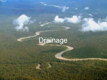
Title:
Drainage
Description:
Drainage Introduction Water is component of all landscape designs that cannot be ignored. Water issues include: Too much Not enough Water being at an undesirable ... – PowerPoint PPT presentation
Number of Views:263
Avg rating:3.0/5.0
Title: Drainage
1
Drainage
2
Introduction
- Water is component of all landscape designs that
cannot be ignored. - Water issues include
- Too much
- Not enough
- Water being at an undesirable point
- Water flowing across an undesirable point
- Frost heave
- Too much water can be handled by drainage.
- Not enough water can be resolved by using
irrigation. - Drainage can also be used to move water from
unwanted areas. - Drainage structures can be used to reroute water.
- Drainage can also be used to reduce the effects
of frost heave.
3
Site Analysis
- Before starting to survey a site for drainage
purposes it is important to evaluate the site. - If the site adjoins a waterway, do not remove the
vegetation adjacent to and along the stream bank.
- This vegetation is an essential buffer zone that
will help maintain the water quality and curb
erosion problems. - Check your survey or plat for the location of
nearby flood plains. - If the land is in a flood plane, it is reasonable
to expect the area will be inundated with water
at some point. - It is important that no structures, especially
homes, are built within a designated flood plane.
4
Site Analysis--cont.
- Also check the map for drainage easements.
- They should be labeled "d.e." on the plat and are
usually located along property lines. - A drainage easement indicates that water will be
probably flow along the easement after rainfall. - Erosion can be a problem along drainage
easements. - Structures, fences, roads, etc. should not be
constructed within drainage easements.
5
Drainage
- Drainage is the natural or artificial removal of
surface and sub-surface water from a given area. - Drains can be either
surface
or subsurface.
6
Need For Drainage
- A landscape design that does not properly control
runoff may cause damage to and devaluation of the
property. - To prevent damage or devaluation of property,
three questions must be answered. - What is the elevation of the design property in
relation to adjacent properties. - Will water run onto the property, if so, were
does it enter and were does it exit? - How will the landscape plan change the drainage
at the site. - Drainage is needed to handle rooftop, driveway,
and overland run off. - Four main issues to consider when caring for soil
and grass roots are fertilization, drainage,
aeration, and thatch control.
7
Eight Drainage Principles
- Water flows downhill
- Whenever it rains you have the potential for
runoff. - The greater the intensity of the rain--the
greater the potential for runoff. - Reducing the permeability of the soil increases
runoff. - Increasing the non-permeabile area will increase
runoff. - Water or silt on walkways during, or after a
rain, is an indication of poor design. - A good landscape plan includes drainage in the
plan. - Drainage plans rely upon slope, pipes, berms or
other structures to control the direction the
water flows.
8
Slope
- Any area that is exposed to rainfall should
always have some slope to direct the flow of
water. - Water will puddle on flat, horizontal surfaces.
- The amount of slope varies with the surface and
the conditions of the site. - Turf areas 2 - 3
- Paved areas 2
- Foundations special requirements
One recommendation is a six inch drop within the
first 10 feet.
9
Surface Drains
- Surface drainage is controlling the flow of water
using slope and shaped surfaces. - Shaped surfaces
- Swales
- Ditches
- Berms
- Surface drainage works best with small sites or
for sites with a small amount of runoff.
10
Subsurface Drain
- Subsurface drain is a system of collecting and
disposing of rain water. - Common means of collection are a drain grate or
perforated pipe.
11
Drain Outlet
- Both surface and sub surface drains must have an
outlet. - Modification of existing outlets is usually not
very problematic, changing the location of an
outlet may cause problems. - One alternative is to direct the water towards
the street. - May require a permit.
- Greater problem if the drain is a redirect and
not the natural path. - Part of drainage plan that most municipalities
require for development.
12
Drain Outlet--cont.
- If codes do not allowed the redirection of water
to the street, what are the options? - Unless you already have a landscape drainage
system in place (allowing you to route the runoff
into that system), you have two (2) options.
1. Channel the water to a location on the site
(but make sure its not a neighbor's!) where it's
less troublesome and where it can percolate into
the ground.
13
Drain Outlet-cont.
- 2. Build a pond and direct the water into it.
- A pond may be constructed of stone or concrete
- A storm detention cell may be a code requirement.
or natural.
14
Estimating Runoff
- Before a decision is made on the type and size of
drainage structure or storage structure that is
needed, the peak runoff rate and total volume of
runoff must be determined.
- The peak rate of runoff is required when sizing
drainage channels and pipes. - The total amount of runoff is needed to size a
pond.
15
Estimating Peak Runoff Rates
- Several different methods are available.
- Rational
- Useful for estimating peak runoff rates from
small areas. - Does not estimate volume of runoff.
- USDA-NRS Technical Release 55 (TR-55)
- Most popular method
- Two methods
- Tabular method
- Graphical discharge method
- US Army Corps of Engineers HEC-1 Model
16
Rational Method
- The rational method is useful for estimating peak
runoff rates from small lt20 acre areas that are
relatively uniform in topography and vegetation. - Peak runoff rates are important when sizing
drainage structures, especially pipes. - Rational method uses a simple equation
The difficulty is getting accurate values for
each variable.
17
Runoff Coefficient (C)
- The runoff coefficient (C) is defined as the
ratio of the peak runoff rate to the rainfall
intensity. - The runoff coefficient mathematically indicates
whether the runoff is likely to be high or low
for the watershed. - The value of C depends on the type and
characteristics of the watershed. - Values for C are usually determined from tables.
18
Coefficient Table
19
Rainfall Intensity (I)
- The rainfall intensity used in the rational
method is based on a specific rainfall duration
and recurrence interval. - The recurrence used depends on the importance of
the project. - Terraces and waterways are designed for a 10-year
recurrence. - Spillways for dams may require a design based on
a recurrence interval of 100 years or more. - The rainfall intensity can be determined from an
intensity-duration-recurrence interval chart.
20
Rainfall Intensity, Duration Recurrence Interval
To find the correct value for rainfall intensity
from the chart, the time of concentration must be
known.
21
Time of Concentration (TOC)
- The time of concentration for a watershed is
defined as the time required for water to flow
from the most remote point of the watershed to
the outlet. - The peak rate will occur when the entire
watershed contributes to the runoff. - The time of concentration is a function of
drainageway length and slope. - Tables are available for TOC.
22
TOC Table
23
Area
- The area used is the number of acres in the
watershed above the outlet.
- Watershed area can be difficult to determine.
- When a map is available a planimeter can be is
used for this purpose.
- Another method is placing a grid over the map and
counting squares. - If the map is digital, mapping software can
calculate area.
24
Rational Method Example
- Determine the peak runoff for a1- 1/2 acre lot
that has grass planted on heavy soil with an
average slope of 3. The client says a 50 year
reoccurrence interval is appropriate. The
drainageway is 850 feet long and has a slope of
1.25 .
The first step is determining the C value.
C 0.18 to 0.22 Use 0.22
25
Example--cont.
- The next step is to determine an appropriate
value for the rainfall intensity. - The time of concentration is used to determine
the intensity.
A drainageway of 850 feet at 1.25 slope
7 min
- This example shows one of the problems of using
tabular data. - What do you do when the data falls in between
columns and/or rows? - In this case the lower number was used knowing
that this will cause the calculated peak flow to
be slightly higher.
26
Example--cont.
- With a TOC of 7 minutes and a 50 year interval,
the IDR graph can be used to estimate rainfall
intensity.
I 10 in/hr
27
Example--cont.
- Solving for peak runoff
28
Mixed Watershed
- The previous example assumed that the entire
watershed had the same surface and slope. - This seldom happens, therefore the equation must
be modified to accommodate mixed watersheds. - This is accomplished by calculating a Weighted
C.
29
Mixed Watershed Example
- Determine the peak runoff for a watershed that
consists of .75 acres of impervious surface, 3.4
acres of lawn at 1.8 slope and sandy soil and
2.2 acres of lawn at 0.75 slope and heavy soil.
The drainageway is 400 feet long with a slope of
1.2. - The first step is to determine the weighted C.
30
Mixed Watershed Example--cont.
The next step is to determine the time of
concentration and rainfall intensity.
- With a drainageway length of 400 feet and a slope
of 1.2 the best number for TOC is 6 minutes.
31
Mixed Watershed Example--cont.
- With a TOC of 6 minutes and a reoccurrence
interval of 100 years, the rainfall intensity can
be determined from the chart. - Rainfall intensity 12 in/hour
32
Mixed Watershed Example--cont.
- The peak runoff rate from the mixed watershed is
33
Questions?
Recommended
CrystalGraphics Presentations


