
Geophysical and Geochemical Exploration Techniques - PowerPoint PPT Presentation
1 / 15
Title:
Geophysical and Geochemical Exploration Techniques
Description:
Magnetic survey using a proton magnetometer They are fast, ... find faults etc. Electrical conductivity (resistivity) ... Document presentation format: – PowerPoint PPT presentation
Number of Views:546
Avg rating:3.0/5.0
Title: Geophysical and Geochemical Exploration Techniques
1
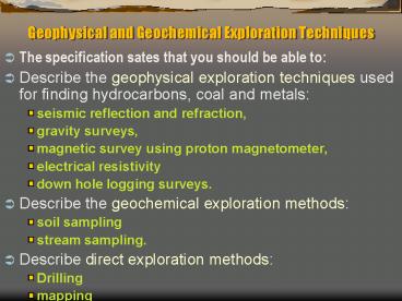
Geophysical and Geochemical Exploration Techniques
- The specification sates that you should be able
to - Describe the geophysical exploration techniques
used for finding hydrocarbons, coal and metals - seismic reflection and refraction,
- gravity surveys,
- magnetic survey using proton magnetometer,
- electrical resistivity
- down hole logging surveys.
- Describe the geochemical exploration methods
- soil sampling
- stream sampling.
- Describe direct exploration methods
- Drilling
- mapping
2
Seismic Reflection
- This technique is used extensively in oil
exploration as well as for metal ores. - Read pages 26 27 of the oil book.
- Also look at page 289 of McLeish.
3
Seismic Reflection 2
- The seismic reflection method works by bouncing
sound waves off boundaries between different
types of rock. - The reflections recorded are plotted as dark
lines on a seismic section.
4
Seismic Reflection 3
- This can be done on land or at sea.
- It can show up oil traps and dipping beds.
- It shows up rocks with contrasting densities so
ores show up well as well as less dense rocks
like salt.
5
Seismic Refraction
- This is basically the same as seismic reflection
but this time the waves are refracted through the
layers before returning to the surface. - These waves hit the boundary between 2 rocks and
then travel along the boundary before returning
to the surface.
6
Gravity Surveys
- These use a gravimeter that measure the gravity
at a given point. - These can be carried in planes, ships or carried
by hand. - If there are denser rocks below (ores) they will
give a positive gravity anomaly. - If there are less dense rocks (salt/halite) there
will be a negative anomaly.
7
Magnetic survey using a proton magnetometer
- They are fast, provide a great deal of
information for the cost and can provide
information about the distribution of rocks
occurring under thin layers of sedimentary rocks,
useful when trying to locate orebodies - Aeromagnetic surveys are taken from a moving
plane. - A magnetometer is the instrument used to measure
the intensity of the magnetic field at a
particular place.
8
Magnetic survey using a proton magnetometer 2
- The data for a survey can be plotted as a contour
map using lines which join points of equal
"magnetic" value. - From these maps geoscientists can locate magnetic
bodies (even if they are not outcropping at the
surface), interpret the nature of geological
boundaries at depth, find faults etc.
9
- Electrical conductivity (resistivity) can be
measured by applying a current directly into the
ground through a pair of electrodes. - A voltage difference measured across a second
electrode pair provides the necessary information
to calculate the apparent earth resistivity. - The depth of investigation depends on the
electrode separation and geometry, with greater
electrode separations yielding resistivity
measurements to greater depths.
10
Down hole logging surveys.
- In the oil industry many types of geophysical
survey can be carried out by placing instruments
down the exploration borehole. - See page 35 of the oil book.
- Such things as
- Resistivity
- Sound wave velocity
- Gamma ray radiation
- These give clues about
- Porosity and permeability
- Dip of beds
- Fluid pressures
11
Geochemical Exploration Methods
- There are only really two
- Soil surveys/sampling
- Water surveys/sampling
- Soil surveys give an indication of the chemistry
of the underlying rocks (that have been
weathered). - If on a slope the rock will be further up slope
from the soil.
12
Geochemical Exploration Methods 2
- With stream sampling the chemistry of the water
will be influenced by the rock it flows over. - The concentration of an element will be highest
just downstream from the ore. - The concentration will then decrease as the water
gets diluted further downstream.
13
Direct exploration methods
- There are 2 main methods
- Drilling
- Mapping
- Drilling
- Drilling in an area is often the only way of
being absolutely sure what is underground. - The geochemical and geophysical methods will give
a clue. - Analysing the samples and noting the depths at
which rocks occur can help decide whether an ore
is worth mining.
14
Direct exploration methods 2
- Mapping
- If rocks are exposed at the surface then mapping
them can give a clear indication of the geology
not only on the surface but also underground. - You may be able to work out an underground cross
section.
15
- It is usual for a whole array of techniques to be
used together in order to finally decide - Where an ore or resource is.
- How much there is.
- The grade of the resource.
- Any geological problems.
- Whether it is worth exploiting.
Recommended
CrystalGraphics Presentations


