
Cadastral Resurveys Early Experiences from Jamnagar Pilot Project - PowerPoint PPT Presentation
1 / 25
Title:
Cadastral Resurveys Early Experiences from Jamnagar Pilot Project
Description:
Cadastral Resurveys Early Experiences from Jamnagar Pilot Project Murali Mohan IIC Technologies Private Limited Hyderabad mohan_at_iictechnologies.com – PowerPoint PPT presentation
Number of Views:169
Avg rating:3.0/5.0
Title: Cadastral Resurveys Early Experiences from Jamnagar Pilot Project
1
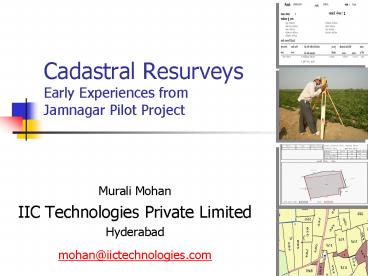
Cadastral ResurveysEarly Experiences from
Jamnagar Pilot Project
- Murali Mohan
- IIC Technologies Private Limited
- Hyderabad
- mohan_at_iictechnologies.com
2
Presentation Outline
- A-B-C of Resurvey
- The Cadastral Control
- Sample Results
- Quality Checks
- Cadastral Dynamics
- Learnings Conclusions
3
A-B-C of Resurvey
- Form A Form B
Form C
4
Control Grid
- P/S/T
- National Framework
- Regional at PrimaryLocal in Tertiary
- Leveling (geoid)
- Enhancements
- Dept to acquire SoI data pro-actively
5
Height
Pavlis, N.K., S.A. Holmes, S.C. Kenyon, and J.K.
Factor, An Earth Gravitational Model to Degree
2160 EGM2008, presented at the 2008 General
Assembly of the European Geosciences Union,
Vienna, Austria, April 13-18, 2008.
6
The cadastral maps of the study area
7
Tippan Conversion
Convert
8
The Registers
9
Parcel blocks Adjacency with Govt. Lands
10
Correlation
11
From history..
- The field-to-field survey . thoroughly
revised during the past decade, it is final and
will never have to be done again - In Bombay and Madras, where what is called the
Raiyatwari system prevails, the boundaries of
fields or holdings are invariable. - BADEN-POWELL , 1907 LAND REVENUE AND TENURE IN
BRITISH INDIA
12
QC Systems
13
Entities of a Cadastral Database
- The attributes of cadastral objects
- temporal (e.g., value of a parcel)
- non-temporal (e.g. name of a village)
- The relationships between cadastral objects can
be - spatial (e.g. village-district relationship)
- temporal (e.g. Parcel-Khatedar relationship)
- spatiotemporal (e.g. Shape-Change with time)
14
Dynamics
Chalta .. Sy_No Landuse Value Area Geometry
15
Dynamics Parcels within Parcels
16
2002 ?05
17
(No Transcript)
18
Resurvey Probable Issues
- Data Anomalies
- Data redundancy (e.g. multiple records)
- Data inconsistency (e.g. missing land parcels
new parcels) - Geometry problems
- Field Issues
- Farmers presence
- Sub-divisions
- Monument tampering
- Non-acceptance of Notices
19
Observations / Conclusions
- Interactions of DB ? InterOperability
- Design as spatio-temporal database
- Use of UTM / WGS84 / MSL height as Control Grid
- Maintenance of DB (pro-active, reactive)
- Flying of conterminous areas
- Unique-id tag for stake-holder
20
Observations / Conclusions..
- Maintenance of monuments
- Village accountant (Talati)
- There is no SINGLE/PERFECT cadastral model
- Model making in India to begin, evolve
- Backbone of NLRMP essential
21
Observations / Conclusions..
Operations
P R O J E C T S C H E D U L E
22
Interests outgrow the parcel extent
(Bennett et al., 2005)
23
- We have only to guard the ryots from oppression
and they will create the revenue for us Munro
24
The IICSince 1993, 1000 employees, Global
footprint, ISO certified
25
Technical Capabilities
- Areas of Expertise
- GIS, Photogrammetry, LIDAR
- Cadastral Surveys
- Aerial flying
- LiDAR Data Processing
- Marine Solutions
- Corridor Mapping
- GIS Applications in Urban Management, Cadastral
Information System, Utility Infra-structure
Management, Highway Asset Management, Gas
Pipeline Corridor Risk Classification - Application Development
Recommended
CrystalGraphics Presentations


