
Watershed Boundary Dataset (WBD) - PowerPoint PPT Presentation
Title:
Watershed Boundary Dataset (WBD)
Description:
National Watershed Boundary Data Set Status Report Information Management Subcommittee Meeting Chesapeake Bay Program November 17, 2004 What is the Geospatial ... – PowerPoint PPT presentation
Number of Views:117
Avg rating:3.0/5.0
Title: Watershed Boundary Dataset (WBD)
1
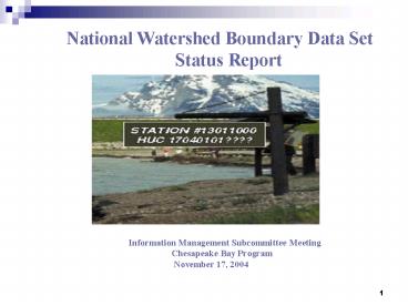
National Watershed Boundary Data Set
Status Report
Information Management Subcommittee
Meeting Chesapeake Bay
Program November 17, 2004
2
What is the Geospatial Framework for Surface
Water?
A standard set of Watershed Boundaries
(WBD) coupled with a National Stream Network
(NHD) and the Topography that dictates the flow
of Water across the Land Surface (NED)
3
Vision for the geospatial framework for surface
water
Follow a drop of water from where it falls on the
land, to the stream, and all the way to the ocean.
4
Integration of Key National Datasets
5
Partnering . . .
Tools Standards Coordination Pilots Data
sets Servers
NWS (NED-H stage 1)
NRCS (WBD)
USFS (6M hi-res NHD, WBD)
Subcommittee on spatial water data
USEPA (NHD,NED-H tools Stage 2)
NOS (coastal watersheds)
Products
State Partners (hi-res NHD, NED-H stage 2)
BLM
USGS
6
Watershed Boundary Dataset (WBD)
- A Multi-Agency Effort to create single,
seamless, hierarchical, and Integrated hydrologic
unit dataset for the nation. - Consistent base scale of 124,000
- Integrated with other key national datasets
- Common reporting unit for different levels of
management needs
7
Hydrologic Unit Levels
8
Overview of the Watershed Boundary Data
Set
.
9
Watershed Boundary Dataset Why?
- Allows EPA to realize the Watershed Management
Approach delineated in our strategic goals - Provides locally-significant watershed data that
integrates features of EPA programs related to
land and those related to water - Provides the Public an easier way to visualize
the EPA Watershed Management progression. - Benefits many environmental programs
- State and regional water quality monitoring and
bioassessment programs, - Environmental Monitoring Assessment Program
(EMAP) - Regional Monitoring Assessment Program (R-EMAP)
- Surface Water and Landscape Ecology programs
- Source assessments for Total Maximum Daily Load
(TMDL) - Identification and analysis of critical habitat
for both terrestrial and aquatic endangered
species - Conservation Security Program (Farm Bill)
- Stimulates Generation of Predictive Modeling
Tools - Integrates the landscape with waters and the NHD
at a management level to discretely manage
watershed components and - Complements the NHD and NED (topographic lines)
water quality analysis and models.
10
Watershed Boundary Dataset
Challenges
- Agency support is highly variable
- Delineation methods vary state to state
- Addressing cooperators needs to preserve
existing watershed boundaries - Inconsistent funding
- Edge-matching
11
(No Transcript)
12
Watershed Boundary Dataset (WBD)
- Data Availability
- Currently - 12 states or territories certified
- Goal - 32 states certified by end of December,
2004 - 2005 goal - 38 states certified
- Anticipated completion by summer, 2006
- WBD website
- http//www.ncgc.nrcs.usda.gov/branch/gdb/products
/watershed/index.html - Website to download WBD Geospatial Data Gateway
- http//datagateway.nrcs.usda.gov/GatewayHome.html
13
Watershed Boundary Dataset New
York
- EPA R3 GIS analysts are currently finishing the
delineation process on the last sub-basin in the
Upper Susquehanna - Attributions will begin once last sub-basin is
delineated. - This will complete the bulk of the grunt work
for the CB Watershed - All should be completed by end of CY04
14
Watershed Boundary Dataset Pennsylvania,
Maryland, Delaware
- (To the best of our knowledge) all sub-basins
completed within Chesapeake Bay Watershed in
Pennsylvania - All sub-basins completed in Maryland
- All sub-basins are completed in Delaware and the
state has been submitted for certification
15
Watershed Boundary Dataset Virginia and
West Virginia
- For Virginia there are delineation issue(s) with
Maryland along the Bay portion of the state
boundaries. R3 will be moving into this area once
NY is completed. - Karl Huber can better respond to other VA
questions. - All sub-basins completed for West Virginia
16
Watershed Boundary Dataset State
Stitching in CB
- Some states claim all issues are addressed with
some neighboring states. This has yet to be
verified by R3. - Main areas for focus NY-PA, VA-MD
- Other stitching issues exist in R3 states but
beyond the CB Watershed (WV-OH, WV-KY, etc.)
17
Watershed Boundary Dataset Summary for CB
States
- All CB states should be delineated and attributed
by end of CY04 - Completion of stitching efforts will depend on
willingness of states to revisit areas in
dispute. At this point we dont know if any such
areas exist. - Stitching will also depend on timeliness of
state response to problems
18
Watershed Boundary Dataset Chesapeake Bay
States
- Have Questions on WBD in the
- Chesapeake Bay States ?
- Call Don Evans EPA Region 3
- Mid-Atlantic Coordinator for the WBD
- 215- 814-5370
Recommended
CrystalGraphics Presentations


