
Mars: Overview - PowerPoint PPT Presentation
1 / 63
Title: Mars: Overview
1
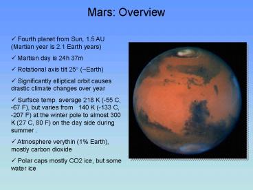
Mars Overview
- Fourth planet from Sun, 1.5 AU (Martian year is
2.1 Earth years) - Martian day is 24h 37m
- Rotational axis tilt 25? (Earth)
- Significantly elliptical orbit causes drastic
climate changes over year - Surface temp. average 218 K (-55 C, -67 F), but
varies from 140 K (-133 C, -207 F) at the
winter pole to almost 300 K (27 C, 80 F) on the
day side during summer . - Atmosphere verythin (1 Earth), mostly carbon
dioxide - Polar caps mostly CO2 ice, but some water ice
2
Mars Learning Goals
- Understand the configurations under which Mars is
best observed from Earth. - Be able to describe the history of observations
of Mars and speculations about it. - Know what kinds of surface features unmanned
spacecraft found on Mars. - Understand the differences between craters found
on Mars and those found on the Moon. - Be able to explain the similarities and
differences among volcanoes found on Mars, Earth,
and Venus. - Be able to describe the evidence that water once
flowed on Mars. - Know the composition of Mars's atmosphere.
- Be able to explain how the atmospheres of Mars
and the Earth evolved differently. - Understand seasonal variations on Mars.
- Be able to describe the experiments that have
been conducted to search for life on Mars, as
well as their results.
3
Earth and Mars Relative sizes
Earth radius 6400km Mar radius 3400km
4
Early History of Mars Exploration
- Ancient History Planets were wanderers
Babylonians called Mars Nergal, King of
Conflicts Greek Ares , God of War Roman
Mars - Kepler (1610) Elliptical orbit, correct
distance - Galileo (1612) First telescope obs.
- Schiaparelli (1880s) Canals!
- Lowell (1910s) Lowell Observatory (Flagstaff),
Martian civilization maps - H.G. Wells War of the Worlds radio broadcast
(1938) by Orson Wells widespread panic (audio
intoduction) - Mariner 4 (1964) First Spacecraft to visit Mars
5
Canals and Martian Civilization Percival Lowell
The most extraordinary development (in 1907) has
been the proof afforded by the astronomical
observations (showing) that conscious,
intelligent human life exists upon the planet
Mars... Dr. Lowell, director of the Lowell
Observatory in Arizona... gives a number of
photographs taken of Mars. . He sums up the
testimony of these photographs by saying that
they reveal to laymen and astronomers that
markings exist on Mars which are, of course, the
lines of the great canals constructed on Mars for
the purpose of irrigating that globe..." (Wall
Street Journal, 1907)
6
Martian Seasons
10 closer at perihelion and 10 further at
aphelion. As a result the Southern summers are
somewhat warmer. This results in greater heating,
convection, and lifting of dust leading to
significant dust storms that can last for several
weeks.
7
Next Mars Oppositions 2001, 2003, 2005, 2007
Oppositions every 26 months
8
Martian Moons
- Two moons Deimos, Phobos
- Small (20km) irregularly shaped
- Orbit Mars in 8hr, 30hr
- Probably captured asteroids
Phobos (20 km x27 km)
9
Mars Global Surveyor View (1998)
Volcanoes
Valles Marinaris
10
Mars Today Location, temperature, winds
11
Mars topography movies
Elevation map (purple is low, red is high)
Relief map true color images (Viking mission)
12
Mars Topographic Map (MOLA radar 1998/99)
Olympus Mons
Rover Opportunity
Rover Spirit (Gusev Crater)
13
Google MARS
14
Radar map of Martian surface MOLA (Mars Orbiter
Laser Altimeter) Color indicates elevation (Blue
low, red high) (Ancient ocean in southern
Hemisphere?)
Low area Former Ocean?
15
Hellas Impact Basin
- 2000 km diameter, 9 km deep!
- Probably formed by asteroid impact
- Debris from collision would cover US with layer
3 km thick
16
Valles Marineris Grand Canyon of Mars
- Likely a result of river erosion in early
history of Mars (3-4Gyr BP)
17
Martian Volcanoes
Tharsis Bulge
18
Olympus Mons Largest Volcano in Solar System
- Shield volcano, similar to volcanoes in Hawaii.
- No longer active
- Summit caldera 24 kilometers (15 miles) above
the surrounding plains. - Surrounding the volcano is an outward-facing
scarp 550 kilometers (342 miles) in diameter and
several kilometers high. - Farther out is an aureole of characteristically
grooved terrain, just visible at the top of the
frame.
19
Martian Atmosphere
Earth Venus Mars N2 0.79 3 0.0004 O2
0.20 lt 0.002 0.00004 Ar 0.01 small 0.0002
CO2 0.0003 86 0.015 H2O 0.02 0.01
0.00001 ----------------------------------------
-------- Total 1.00 90 0.015
20
Martian Surface Temperature
21
Martian Polar Caps
- Caps are carbon dioxide CO2 (dry ice) and Water
H20). N.B. CO2 freezes at 150?K. - Southern residual cap is 300 km diameter, T
150K. - Northern cap is 1,000 km, 200 ? K (implies
mostly water ice)
22
Seasonal Variation in Clouds(Movie)
23
North Polar Cap
24
North Polar Cap of Mars
25
Martian Dust Storms
Edge of dust storm (August 1999)
26
Recent History of Mars Exploration
- Viking I, II (1976) First detailed maps, first
landers, tantalizing signs of life in dirt - Pathfinder (1997) First in NASA series of Mars
missions, tests robotic rovers - Mars Global Surveyor (1996) Highly detailed
photos from low orbit - Mars Athena Exploration Rovers (2) 2003
- Mars Rovers (2004-present) Spirit, Opportunity
Viking Lander
Pathfinder/ Sojourner
Rover
27
Face on Mars (Viking 1976 Image)
28
Face on Mars Revisited 1998 Mars Global Surveyor
29
Martian Rock ALH84001
Mass 1.9 kg igneous rock, discovered in
Antarctica 1984, formed on Mars 4.5 Gyr ago,
ejected 16 Myr ago probably by an asteroid
impact, landed in Antarctica 13,000 yr ago)
The black-and-white "Oreo cookie" rims of the
carbonate globules are visible in this magnified
thin section 0.5 mm wide. The rims contain iron
oxides (including magnetite) and iron
sulfides--incompatible minerals that on Earth
would suggest microbial action
Globules of carbonate minerals (the yellow-orange
grains) are scattered along cracks in this small
chip of ALH 84001.
30
- The carbonates may have been deposited in the
cracks by Martian groundwater laden with carbon
dioxide. All the evidence for life is in the tiny
carbonate globules or their rims. - The four lines of evidence are
- Carbon compounds suggestive of decayed organic
matter, - (2) Unusual, small crystals of magnetite (an
iron oxide) matching identical crystals that are
made only by Earth bacteria, - Apparently incompatible minerals close together
whose proximity would suggest organic action if
the rock were from Earth, and - The evocative, bacteria-shaped formations so
famous from photographs unveiled at the 1996
press conference. - "None of these observations is in itself
conclusive for the existence of past life," said
McKay in his original announcement. "But . . .
when they are considered collectively . . . we
conclude that they are evidence of primitive life
on early Mars."
31
Despite world attention, significant spending,
and the work of the best laboratories on Earth,
the question is unresolved. At this point I think
we have a fairly good inventory of what is in
that meteorite. What we lack are inventories of
the shapes, chemicals, and mineral arrangements
that only life can make (the buzzword is
"biomarkers"). NASA has started work on these
problems with its new Astrobiology Institute, and
none too soon. Spacecraft are scheduled to return
Martian rocks to Earth in 2008. By then we had
better know exactly what to look for.
32
Mars Pathfinder MissionJuly 1997
Rover
33
Pictures from Rover
Rover Movie Link
34
Evidence for water on Mars Martian Gullies
This picture introduces the basic features of a
Martian gully. The figure on the left is an
example from Mars, the figure on the right is a
gully on Earth. In the Earth picture, rain water
flowing under and seeping along the base of a
recently-deposited volcanic ash layer has created
the gully. For Mars, water is not actually seen
but is inferred from the landforms and their
similarity to examples on Earth.
Mars Global Surveyor Image
(June 2000) Earth (Mt. St. Helens)
35
Evidence for Water on Mars Possible Ancient
Streambeds and Erosion Channels
36
Evidence for water on Mars Layered Sedimentary
Features
141 km (88 miles)
Holden Crater
37
Future of Mars Exploration in 20 years
- Athena a.k.a Mars Exploration Rover (launch
2003) NASA series of Mars rover missions - now operational on Mars
- Mars Express (Launched 2003) has University of
Iowa radar experiment - Human Exploration (2025?)
Athena Rover
38
MARS EXPLORATION ROVERS
- Launch July 2003, arrived January 2004
- Two identical Rovers (Spirit, Opportunity)
- Each Rover weighs 180 kg, travels 100m per day
Rover
39
ATHENA MARS EXPLORATION ROVER
Mars Rover Entry Sequence
40
ATHENA ROVER SCIENCE INSTRUMENTS
Pancam- Stereo camera IR Spectrometer - rock
composition X-ray Spectrometer - soil and rock
chemistry RAT - rock abrasion tool (0.2
in) Microscopic imager (search for fossils?)
41
Panorama of Martian landscape
42
Rover Spirit lands in Gusev Crater Search for
sedimentary rocks
43
Dust Devils on Mars
- Caused by hot air rising into pocket of cooler
air - Can dust devils cause harm?
- Wikipedia
- Certain dust devils can reach near the intensity
of an F0 Tornado, possibly causing damage to
people and property. For instance, a dust devil
in Trenton, North Dakota on May 7, 2006 caused
moderate injuries to a 4-year old girl. The girl
and trampoline she was jumping on reportedly
lifted 25 feet (approximately 8 metres) into the
air.
Dust devil in Texas
Dust devils on Mars
44
Image of Rover landing site form the orbiter
3 km (2 miles)
45
Was the Gusev crater filled with water in the
past?
Artists conception of water-filled Gusev Crater
46
Layered rock in Gusev crater Sedimentary or
Volcanic?
47
Global Map of Mars
Tharsis bulge (volcanoes)
Olympus Mons (largest volcano)
Valles Marineris
48
The Martian landscape from Rover
49
Traverse of Rover Opportunity to Victoria Crater
Eagle Crater
5 miles
Victoria Crater
50
½ mile
Rover Opportunity
HiRISE Website (Image viewer)
Victoria Crater
51
View from Crater edge
52
Rover Spirit head for the (Colombia) Hills
53
Spirit acquired this view of the Martian sunset
from Gusev Crater on April 23, 2005
54
Rover instruments
Stereo Cameras
High gain dish antenna
Robotic arm (soil/rock sampling)
Solar Panels
55
Evidence for water on Mars Vugs and Spherules
Vugs
Vugs These holes, or "vugs," match the
distinctive appearance of Earth-rock vugs that
form where crystals of salt minerals grow inside
rocks that sit in briny water then disappear by
eroding or dissolving.
Spherules
Spherules the spherules (are) likely to be
concretions that formed from accumulation of
minerals coming out of solution inside a porous,
water-soaked rock.
56
Evidence for water Salts and Sedimentary rocks(?)
57
Water history on Mars Two scenarios
- Wet and Warm
- In this model, carbon dioxide released by
volcanism early in Mars' history produced a
greenhouse effect. Under a thick, warm
atmosphere, water could flow on the surface as a
liquid. An atmospheric hydrologic cycle would be
possible and valley networks would form by
rainfall much as they do on Earth today. - Mars was already cold but wet.
- Even under very cold conditions, water released
at springs would still have been able to flow for
vast distances under an ice covering. The water
would pond in low areas and freeze or infiltrate
back into the subsurface. Much of the ponded and
frozen flood water might be protected almost
indefinitely by a covering of red soil. In this
case the valley networks would not represent
erosion by rainfall.
58
History of impact craters, valleys on Mars
- Martian fluvial (resulting from a stream)
valleys and channels are ancient features. The
peak of activity was about 3.5 billion years ago.
- At that time, many valleys formed. After this
period, fluvial activity became localized and
episodic. Cataclysmic discharges of ground water
formed the huge outflow channels during this
time. This water would have ponded in the
northern plains of Mars, as shown in the figure
below. - During the recent Amazonian period, only modest
fluvial activity is observed. We conclude that
the water that remains on Mars today is trapped,
probably as permafrost and ice beneath the
martian surface.
Now
59
MARS EXPRESS
- Launch June 2003, arrived in orbit December 2003
- European space mission with US scientist
participation - Radar instrument (MARSIS) built at University of
Iowa (Prof. D. Gurnett, P.I.)
60
MARS EXPRESS Radar Experiment
- Radar reflection signal of water is very
different from rock, so echoes can differentiate
between rock and ice or water - Radar transmitter operates at 1-2 MHz (low
frequencies), penetrates ground to several km
depth - Probably cannot distinguish between CO2 and H20.
61
Mars Ground Reflecting Radar Experiment
62
MARSIS Radar measurement of thickness of
Northern Ice cap 1.2 mile thick water ice
1.8 km
63
Buried impact basin filled with liquid water?
MARSIS images from two different overhead passes
reveal a 250-km-wide buried impact basin. In the
lower image, a linear reflection nearly parallel
to the surface is seen embedded in the arcs
this may be the result of liquid water (Image
ASI/NASA/ESA/Univ of Rome/JPL)
Recommended
CrystalGraphics Presentations


