
Prepared by Mark R' Noll - PowerPoint PPT Presentation
1 / 37
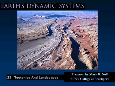
Title:
Prepared by Mark R' Noll
Description:
Landscape evolution influenced by tectonics, climate & differential weathering ... Paleozoic folding, covered by Cretaceous and Tertiary sediments ... – PowerPoint PPT presentation
Number of Views:54
Avg rating:3.0/5.0
Title: Prepared by Mark R' Noll
1
- Prepared by Mark R. Noll
- SUNY College at Brockport
2
Continental Landscapes
- Landscape evolution influenced by tectonics,
climate differential weathering - Most landforms developed within the last 2 my
- System moves toward an equilibrium condition
3
Continental Landscapes
- Continents are composed of 3 main tectonic
features - Large flat shield area of ancient igneous
metamorphic rocks - Stable platform where shield is covered by
sedimentary rocks - Folded mountains formed at convergent margins
4
Continental Landscapes
- Climate controls the action of the hydrologic
cycle - Weathering, erosion transport are results of
climate - Climate is controlled by latitude and topography
- Conversely, topography is influenced by climate
5
Continental Landscapes
- Differential erosion works at all scales
- Erosion is a selective process
- Impact of erosion on hard soft rock creates
variations in topography - Tectonic activity, folding faulting, may
exaggerate differences in erosion
6
Fig. 23.1
7
Evolution of Shields
- Shields are the eroded remnants of folded
mountain belts - Isostatic adjustment and erosion have nearly
reached equilibrium - Local relief is usually lt 100 m
8
Fig. 23.4. Evolution of a Shield
9
Rates of Uplift Erosion
- Uplift erosion are contemporaneous processes
- Uplift estimates average 6 mm/yr
- 6 km in 1 my
- 5 to 10 my to form a large mountain belt
- Erosion rates in mountain areas 1 to 1.5 mm/yr
- Uplift is 5x erosion
10
Rates of Uplift Erosion
- Erosion rate is dependent on uplift elevation
differences - Rates of erosion decrease with decreasing
elevation - New mountains deeply eroded by the time mountain
building is complete - Erosion continues at a progressively slower rate
11
Fig. 23.5. Rates of erosions of a mountain belt
12
Canadian Shield
- The Canadian Shield is typical of shields
worldwide - Covers 1/4 of NA, over 3 million km2
- Basic structural features well exposed
- Only relief is resistant rocks up to 100 m above
adjacent surface - Evidence shows the core of several different
mountain belts
13
Stable Platforms
- Areas of sedimentary rock covering a shield
- Landforms are the result of erosion of flat lying
sedimentary rocks - Dendritic drainage is common
- Small warps in crust influence pattern
14
Stable Platforms
- Dendritic drainage develops on flat lying
sedimentary rocks - Homogeneous surface covers large area
- Little or no structural control
- Streams develop equally in all directions
- Variations in landforms develop as streams downcut
15
Stable Platforms
- Differential erosion develops vertical variations
- cliffs and slopes - Resistant rock layers form cap rocks on plateau
- Steep cliffs may form in resistant layers
- Plateau may be cut into smaller mesa
16
Stable Platforms
- Differential erosion is most pronounced where
beds are tilted - Strike valleys form as weak layer is eroded away
- Resistant layers remain as asymmetrical ridges
- Cuestas - gently inclined
- Hogbacks - steeply inclined
17
Stable Platforms
- Major structural features are large domes and
basins - Form while area is covered by shallow seas
- Sedimentary layers may dip up to 30o along flanks
18
Stable Platforms in Arid Climates
- Differential erosion produces an array of
features easily seen - Buttes, pinnacles, pillars columns form by
erosion on receding cliffs - Joints play a role
- Natural arches form where groundwater causes
erosion in a cliff face
19
Fig.23.10. Differential erosion in horizontal
strata
20
Stable Platform of NA
- Three distinct regions
- Paleozoic strata in the east
- Great Plains underlain by Mesozoic Cenozoic
strata - Atlantic Gulf coastal plains
- Note areas north of the Ohio and Missouri Rivers
have been glaciated
21
Stable Platform of NA
- Major dome structures include
- Cincinnati arch
- Wisconsin dome
- Ozark dome
- Basins form between these domes
22
Stable Platform of NA
- Strata dip gently westward in the Great Plains
- Erosion forms cuestas and intervening lowlands
- The Black Hills (SD) are an exception
- Dome structure
- Surrounded by hogbacks strike valleys
23
Stable Platform of NA
- Coastal plains are characterized by alternating
layers of sandstone shale dipping gently
seaward - Topography is low cuestas and wide strike valleys
- Trellis stream patterns are common
24
Folded Mountain Belts
- Folded mountains have complex structures
including tight folds, thrust faults, accreted
terranes and igneous intrusions volcanics - Landforms are variable
- Depend on stage of development
- Differential erosion carves out weak zones
25
Appalachian Mountains
- Ridge valley province
- Classic example of landscapes on folded and
thrust faulted strata - Paleozoic folding, covered by Cretaceous and
Tertiary sediments - Renewed erosion removed sedimentary cover and
superposed east flowing streams - trellis patterns
26
Fig. 23.15. Differential erosion in folded rocks
27
Continental Rifts
- Dominant structure is normal faulting parallel to
rift - Large vertical displacements
- Horst graben structures develop
- Fault scarps form steep cliffs
- Stream erosion cuts into cliffs forming faceted
spurs
28
Continental Rifts
- Drainage feed isolated block faulted valleys
- Lakes form in central basins
- In arid regions playa lakes are temporary
- Weathering produces high sediment loads
alluvial fans develop - Bajada form as fans grow merge
- Pediment form as mountain front retreats
29
Basin Range Province
- Large region of uplift extension
- Block faulting produced alternating mountain
ranges basins - System is in early stages of development as
basins are large in north - Continued uplift is evident from complex faceted
spurs
30
Fig. 23.19. Basin Range model landscape
31
Fig. 23.18d. Faceted spurs in block faulted
mountains Wasatch Mountains, UT
32
Flood Basalts
- Basaltic plains form from flood basalts
- Lava flows disrupt stream patterns
- Streams follow margins of basalt flows
- Cinder cones are eroded leaving volcanic necks
- Inverted valleys form where lava filled old
stream valley - erode into mesas
33
Basaltic Plains of NA
- The Columbia Plateau and Snake River Plain are
one of the largest basalt plains in the world - Fluid basalt covered wide areas, filling valleys
and covering mountains - Created new surface, currently eroding
- Columbia Plateau is older, more eroded
34
Fig. 23.21. Landscape development in basalt
plains
35
Magmatic Arcs
- Dominated by volcanic landforms
- Erosion removes volcanoes, leaving deeper igneous
intrusions metamorphic rocks - Circular landforms are common
- Drainage patterns are complex and difficult to
establish
36
Cascade Volcanic Chain
- Magmatic arc built on continental crust
- String of large composite volcanoes 80 km wide by
500 km long - Smaller volcanoes fill in gaps
- Volcanic activity has been persistent since the
middle Tertiary - Wide range of landforms present
37
End of Chapter 23
Recommended
CrystalGraphics Presentations


