
The Profile of the new world oceanography - PowerPoint PPT Presentation
Title:
The Profile of the new world oceanography
Description:
Informal association founded in 1999 under the auspices of ... Benthic Model. Circulation. Model. T (x, y, z, t) S (x, y, z, t) KH (x, y, z, t) A (x, y, z, t) ... – PowerPoint PPT presentation
Number of Views:21
Avg rating:3.0/5.0
Title: The Profile of the new world oceanography
1
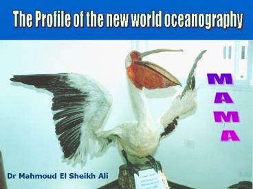
The Profile of the new world oceanography
MAMA
Dr Mahmoud El Sheikh Ali
2
World GOOS REGIONS
Euro GOOS
Euro GOOS
Black Sea GOOS
US GOOS
NEAR-GOOS
MedGOOS
AF
GOOS-AFRICA
IOCARIB GOOS
SEA GOOS
PI-GOOS
GRASP
IO GOOS
WA GOOS
3
MedGOOS Mediterranean Global Ocean Observing
System A regional initiative for operational
oceanography
- What is MedGOOS ?
- Brief history of MedGOOS The first MedGOOS
project RTD Projects Related to MedGOOSThe
strength of a regional partnership The expected
long-term results Benefits of MedGOOS
4
MedGOOS Mediterranean Global Ocean Observing
System
- History
- Informal association founded in 1999 under the
auspices of the UNESCO Intergovernmental
Oceanographic Commission (IOC) to provide a
concerted approach to the development of an
operational ocean observing and forecasting
system at a regional and coastal scale to the
benefit of a wide group of users in the region. - Founded in 1999 and the joined membership already
covers most of the riparian countries with a
total of 19 members from 16 countries. - MedGOOS members play a leading role as a
competent entity for the promotion of GOOS in
their country. - Each member acts as a national focal point,
establishing links with the scientific - community and the public authorities,
developing awareness activities to enable the
implementation of MedGOOS and the future
projection into long term commitments. - Created the first project MAMA (Mediterranean
network to Assess and upgrade - Monitoring and forecasting Activity in the
region.
5
MedGOOS Benefit
- Capability to make informed decisions based on
the knowledge of - the causes and consequences of changes
- Effective and sustainable management of the
marine environment - in favour of fisheries, safe and
efficient transportation, coastal - recreation and other marine-related
industries that contribute - a large part of the total GNP for the
bordering countries - Support of economies and for improving standards
of living on the - basis of enhanced marine services
- Mitigation of marine hazards, with improved
search and rescue - operations, and in ensuring public
health - Detection and forecasting of the oceanic
components of climate - variability due to human activity
- Quest to preserve and restore healthy marine
ecosystems.
6
MAMA is the first MedGOOS project
- MAMA Objectives
- Build the basin-wide network for ocean monitoring
and forecasting - linking all the Mediterranean
countries - Identify the gaps in the monitoring systems in
the region and in the - capability to measure, model and
forecast the ecosystem - Integrate the knowledge base derived by relevant
national and - international RTD projects and
programmes - Build capacities in ocean monitoring and
forecasting - Design the initial observing and forecasting
system, on the basis of - a coordinated upgrading of
capabilities in all Mediterranean countries - Raise awareness on the benefits of MedGOOS at
local, regional and - global scales for operational
oceanography at the service of - sustainable development.
7
Principal Novelties
MAMA
- Broadening the existing network by the experience
of EuroGOOS and MedGOOS - Setting up the logistics for the future ocean and
coastal monitoring, modeling and forecasting
operational system - Establishing the first network of all
Mediterranean countries - Integrating the knowledge base derived by
national and EU RTD projects - Providing the framework for full geographical
coverage of observation in the basin - Producing a web-based demonstration application
of the benefits of ocean observations and
forecasting, coastal erosion protection
8
- MAMA
- Mediterranean network to Assess and upgrade the
Monitoring and forecasting Activity in the region - WP1 MAMA NOW
- WP2 MAMA OBSERVING SYSTEM
- WP3 MAMA CAPACITY BUILDING
- WP4 MAMA MODEL
- WP5 MAMA-NET
- WP6 MAMA WWW
- WP7 MAMA AWARENESS
- WP8 MAMA DISSEMINATION PRODUCTS
9
MAMA WPs
- WP1 MAMA NOW Inventorying and assessment of
current national operational oceanographic
activities, infrastructures and resources in the
Mediterranaen.
- WP2 MAMA OBSERVING SYSTEM Design of the
real-time coastal data acquisition systems,
fully integrated to the basin scale observing
system. - WP3 MAMA CAPACITY BUILDING - Enhance in each
country the basic technical and scientific
expertise required to participate in MedGOOS. - WP4 MAMA MODEL Transfer of know-how and
modelling experiences to - partners by dedicated model
implementations in new shelf areas. - WP5 MAMA-NET Design and test elements for
inter-agency networking - and for the exchange of data and
information. Provide guidelines for a regional - marine information system.
- WP6 MAMA WWW - Establish the MAMA WWW as a
reference point and - showcase for operational
oceanography in the Mediterranean. - WP7 MAMA AWARENESS Undertake an awareness
campaign on - MedGOOS addressing governmental
agencies and authorities, policy-makers, - the marine scientific community,
marine industries, the services sector, and the - public at large.
- WP8 MAMA DISSEMINATION PRODUCTS Promote the
use and potential of added- value applications of
routine data for the management of marine
resources.
10
Expected Long Term Results
- Strengthen the co-operation of all the Med
countries for the interest of development - Upgrade the technical and scientific skills, and
quantity of human resources - Enhance the basin wide monitoring and forecasting
capabilities for coastal and shelf area
management, based on the successful experience of
the EU projects as MFSPP - Establish the platform for the Med operational
interagency exchange, merging data and
information, to produce added value oceanographic
information, and the delivery of user-oriented
products in an operational and interacted mode - Maximize the use of products and exploit
opportunities deriving from operational ocean
forecasting, by marine and environment
authorities, policy makers, and stakeholders in
general
11
MAMA Benefits
- Gain knowledge and understand oceans system.
- Improve navigaton system to exploit oceans.
- Observe the sea from space.
- Improve the global progress in Operational
Oceanography, O O by long-term routine
systematic measurements. - Use the technology for rapid information,
interpretation and dissemination. - Providing continuous forecasting status to the
sea. - Keep recorded DB for the status of the sea.
- Provide warnings system. eg. coastal floods,
storm impacts, earthquake. - Watching ocean climate variability, etc.
12
MAMA Priorities
- Network Institution in all Med countries
- Define the present capabilities
- Raise awareness
- Capacity building of technical and scientific
capabilities - Pilot exercise to network existing monitoring
systems - Design of the initial observing system
- Design the initial forecasting system downscaled
to the coastyal area - Disseminate products and results
13
MAMA in Palestine Discussion
Combined map of depth and sea bed
14
Ocean ecosystem dynamics strongly coupled with
Ocean dynamics Factors limiting
predictability Data Predictability of the
atmospheric forcing (coastal areas). Predictabilit
y of external inputs (River runoff and nutrient
load) Model Open boundary condition (Limited
area nested models) Definition of initial
conditions for forecast simulations Initial
adjustment problem for nested models. To
overcome (or reduce) such problems, the
forecasting System must encompass both the open
and the coastal Ocean scales
15
The pelagic physical-biological interactions in
the ocean
2
B
light limitation
Nutrient limitation
1
A
C
1
2
New production
Regenerated production
Stratification
Mixing
F
Coastal Ecosystems
Oceanic Ecosystems
3
3
5
D
E
Flagellates and bacteria
Large phytoplankton
Microbial food web
Herbivorous food web
5
4
4
Legendre and Rassoulzadegan, 1995
16
The components of an interdisciplinary
forecasting system
17
Buoy stations
Adricosm in situ Observing System Currently Runn
ing
18
Adricosm remote Observing System
SeaWifs AVHRR
TOPEX ERS-2
19
The coupled physica-ecological modelling
system Need - Water column and sediment
prognostic equations for Physical state
variables Macro-scale T, S, ?, p, u, v, w
(equation of motion
equation of state
equations for
scalar properties
conservation) Sub-grid scale
Kv, KH, Iz (turbulence closure equations
radiative
transfer equations) Air-sea fluxestw, Q, (E-P)
(bulk formulae) Water sediment interactions tb,
(bulk formulae)
20
The Standard Organism (Functional group
approach)
CO2
Nutr.
Nutrient excretion
Basal activity Stress respiration
Organism (CNP)organism
Predation
Uptake
Food components (CNP)food
Predators (CNP)food
Mortality Excretion Defaecation
Detritus fractions
21
- Thus, the fundamental structure ofthe marine
ecosystem - Model Is
- Physical environment description (macro and
micro-scales) - Chemical currencies
- Functional groups (Different species in a single
group) - Closure hypothesis(or individual based modelling)
for - Higher trophic levels.
All components interacting in a deterministic way
with bulk parameterizations
22
THE GENERAL STRUCTURE OF THE MODELS FORCING AND
COUPLING
?w
Particulate Inorganic Matter
Qs
QbQeQh
(E-P-R)
Nutrient input
PAR
KH (x, y, z, t)
T (x, y, z, t)
A (x, y, z, t)
S (x, y, z, t)
Ecology Pelagic Model
Circulation Model
Transport Model
u, v, w (x, y, z, t)
Cp (x, y, z, t)
Sedimentary and Water-Sediment diffusive processes
Numerical Driver (Time Integration)
Ecology Benthic Model
23
- Implementation towards operational use of
ecological models - MFS strategy
- Implementation of 1D models in data rich areas to
- validate/calibrate models and check the
physical/ - biological coupling (MFSPP task
accomplished) - Extend the implementation to 3D with
climatological - forcing and nesting approach (MFSTEP task
underway) - Explore the use of data assimilation schemes for
- biogechemical state variables (MFSTEP task
underway)
24
1D implementations Validation under high
frequency forcing Bacterial biomass 48 h
simulation with 6hr atmospheric forcing
Observations Model
25
1DImplementation improving biological processes
Comparison with observedBacterial Carbon
Production (BCP) rates
BCP -bf(T)B (1-BGE)U(substrate) BGE
0.3 (standard) BGE c aT(Rivkin and
Legendre, 2001)
26
3D implementations Nested approach based on
MFSPP Circulation modelling
OGCM Coupled Model
The MFSTEP Coupled Models Domain
Regional Coupled Models
27
Preliminary results forthe Adriatic
Chlorophyll-a
28
Thank You and See you in Next Workshop