
Using Remote Sensing to Detect Wetlands - PowerPoint PPT Presentation
1 / 14
Title:
Using Remote Sensing to Detect Wetlands
Description:
Digital Imaging. Why are wetlands important? Have several important functions to our ecosystem: ... Airborne multispectral and hyperspectral cameras. Airborne cameras ... – PowerPoint PPT presentation
Number of Views:272
Avg rating:3.0/5.0
Title: Using Remote Sensing to Detect Wetlands
1
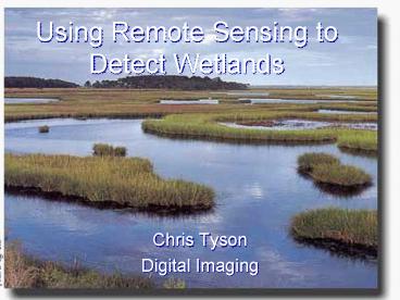
Using Remote Sensing to Detect Wetlands
- Chris Tyson
- Digital Imaging
2
Why are wetlands important?
- Have several important functions to our
ecosystem - Biological diversity
- Wildlife Habitat
- kidneys of ecosystem filter for pollutants
3
Wetlands in the U.S.
- More than half of total area of wetlands has
been destroyed because of - Agricultural
- Urban
- Industrial
- The USFWS has completed a National Wetlands
Inventory using aerial photography
4
Types of Wetlands
- Marshes
- Swamps
- Bogs
- Fens
5
Why use remote sensing for wetlands?
- Birds eye view
- Can see parts beyond visible spectrum
- Frequently revisit certain areas
- Multi-stage observations
6
How can remote sensing be used to benefit
wetlands?
- -Mapping -Vegetative Biomass
- -Monitor Pollution -Changes in Water
-
Levels
7
What kinds of equipment are used in wetland
detection?
- Airborne cameras
- Satellite sensor systems
- Airborne multispectral and hyperspectral cameras.
8
Airborne cameras
- Mounted to the belly of a plane
- Flown over area take pictures
- Effective for mapping
- High spatial resolution pictures
- Shown is an example of an aerial mounted camera
9
Picture of wetlands using aircraft mounted camera
10
Satellite Systems
- Can monitor large areas of wetlands
- Can measure waves beyond visible spectrum ( IR,
UV) as well as pictures of visible spectrum - Shown is ERS-1 SAR satellite
- Can produce pictures of medium spatial resolution
11
Satellite Image of Mississippi River Delta
12
Conclusion
- Remote Sensing has helped to successfully map and
monitor wetlands - Aircraft mounted and satellite type sensors are
best for monitoring and detecting wetlands - In the future, remote sensing will be an
important part of protecting and preserving our
wetlands.
13
References
- Balser, Andrew W. Remote Sensing of Wetlands
Within the Tanana
- Flats.Accessed April 12, 2005.
- http//www.cgc.uaf.edu/Newsletter/gg5_1/wetlan
ds.html - Coastal Remote Sensing Science. NCCOS Center
for Sponsored
- Coastal Ocean
- Research. Accessed Apr. 12 2005.
- http//www.cop.noaa.gov/ecoforecasting/pas
t/ef-crs.htmll - Evaluation of Multidate ERS-1 and Multispectral
Landsat Imagery
- for WetlandDetection in Southern
Ontario. Remote Sensing
- Abstracts, Vol. 24, no 1. Accessed April
14, 2005.
- http//www.casi.ca/98rsabs1.htm
- Goldberg, Jason. Remote Sensing of Wetlands
Procedures and
- Considerations.
14
References
- Accessed April 12, 2005. http//www.vims.edu/rmap
.cers/tutorial/rsecol.htm - Mackey, H.E., and J.R. Jensen. Remote Sensing of
Wetlands Applications and - Overview. Energy Citations Database.
Accessed April 12, 2005. - http//www.osti.gov/energycitations/product.bibli
o.jsp?osti_id7156554 - Prigent, Catherine. Remote Sensing of Global
Wetland Dynamics with Multiple Satellite - Data Sets. Geophysical Research
Letters, vol. 28, No. 24, pgs. 4361-4364. - December 15, 2001.
- Wetlands. U.S. Environmental Protection
Agency. - Accessed April 12, 2005. http//www.epa.gov/owow/
wetlands/vital.html
Recommended
CrystalGraphics Presentations


