
An Introduction to Climate Modeling - PowerPoint PPT Presentation
1 / 39
Title:
An Introduction to Climate Modeling
Description:
A model is a simplified representation of a system designed to provide insight ... representation of the climate system integrated on a computer, numerical errors ... – PowerPoint PPT presentation
Number of Views:34
Avg rating:3.0/5.0
Title: An Introduction to Climate Modeling
1
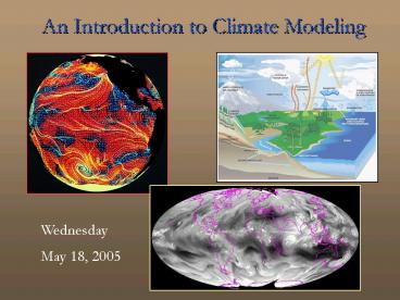
An Introduction to Climate Modeling
Wednesday May 18, 2005
2
Overview
- What are climate models and why use them?
- Limitations of climate models
- Types of climate models and climate model
- components
- Sensitivity experiments with climate models
- Last Glacial Maximum simulations
3
What are climate models?
- First, what is a model ?
- A model is a simplified representation of a
system designed to provide insight into how that
system responds to change.
4
What types of systems?
- Can be traffic flow, fluid flow, factory
- productivity, economic trends, climate, etc.
- Some systems are inherently complex
- (e.g., atmosphere, climate), for instance
- - the atmosphere is a large (but thin!)
compressible fluid on a non-uniformly heated,
rotating sphere with varying surface
characteristics (terrain and vegetation) and
processes occurring on a wide range of temporal
and spatial scales.
5
- Yet, atmospheric processes, like many others, can
be described mathematically. - Hence, climate models are mathematical
descriptions of the climate system (atmosphere,
ocean, sea ice, land surface, glacier).
6
Why use climate models?
- To make climate predictions.
7
Why use climate models?
- Much of the impetus comes from concern over
- rising greenhouse gas concentrations.
- Climate models provide predictions on how the
- climate system will respond to (for instance)
- increases in CO2 concentrations over time.
- Such investigations provide the basis for the
- Intergovernmental Project on Climate Change
- (IPCC) reports on the effects of increased
- greenhouse gases.
8
Limitations of climate models(How do we know
whether theyre right?)
- Since a climate model is a numerical
- representation of the climate system integrated
on a computer, numerical errors (e.g.,
truncation) will affect the solution.
9
- Since a climate model is a simplification of the
- climate system, it cant explicitly represent all
- processes that take place in the real system.
- We make some assumptions about processes that we
dont yet understand. We parameterize some
processes that are too complex (require too much
computer time) or operate on relatively small
time/space scales (e.g., thunderstorms).
10
- Parameterization - a simplified representation of
an unresolved process as a function of other
(resolved) variables. For instance, clouds are
typically represented in terms of temperature and
humidity. - Other processes may be completely omitted from
the model representation of the climate system. - These and other factors contribute to error in
the - model solution.
11
- Confidence in a model prediction of future
- climate is largely built on the models ability
to - accurately simulate past climate. Hence, the
- importance of paleoclimate modeling.
- The interaction between those who make climate
- proxy observations (e.g., ice cores, tree rings)
and those who make climate predictions (modelers)
is - mutually beneficial.
12
Types of climate models and climate model
components
- Climate models vary in complexity from very
- simple to highly complex. The choice of which
- climate model to use depends on multiple factors.
13
- From simple to most complex
- Energy Balance Models consider only surface
- temperature as a function of energy exchange.
- These can be zero-dimensional (energy balance of
- the whole earth), one-dimensional (consider the
- earth in terms of zonal bands), to
two-dimensional - (latitude vs. height, land vs. ocean). EBMs are
- computationally efficient, so long simulations
can - be run in a short time span.
14
- Statistical/dynamical use equations that
describe - changes in the climate system over a long period
- of time instead of explicitly resolving all of
the - processes that occur on shorter time scales.
- One example would be a simple atmosphere-land-ocea
n model with dynamics, heat and moisture - transport, etc., parameterized.
- SD models are also computationally efficient and
could be coupled to an ice sheet model (for
instance) for long simulations.
15
- Radiative Convective Models examine radiation
- processes in a vertical column of the model
- atmosphere. Temperature profile of the atmosphere
is maintained by convective adjustments (air
moving - vertically).
- RCMs have been used to study the effects of
aerosols, clouds, and changing greenhouse gases
on temperature.
16
- General Circulation Models (atmosphere and
- ocean) most complex type of climate model.
- Explicitly represents many processes using
- dynamical (mathematical) equations for
conservation - of mass, energy, and momentum (motion).
- Earth is divided into grid boxes that extend
- vertically into the atmosphere, which is divided
- into multiple levels. Computations take place at
- each grid box.
17
(No Transcript)
18
- GCM resolution varies greatly, hence, so does
- computation time.
- Early GCMs had 8ox10o lat/lon resolution too
- coarse to represent Great Britain!
- Current GCMs are commonly 2.8o lat by 2.8o lon
horizontal resolution (one grid box in Ohio) with
18 to 26 vertical levels.
19
- Earth Simulator (Japan) -- global 10 km
resolution, 96 vertical levels
20
- NCAR CCM3 (147456 grid points) coupled to a
- Land Surface Model running on the Cray SV1
supercomputer takes 4 wall clock hours to
complete one model year - Regional climate model (788800 grid points) with
- North American domain running on a Linux
- cluster 50 days to complete one model year
- Higher resolution means higher computational
- cost!
21
- Even fine scale GCMs are too coarse to represent
small scale processes like thunderstorms (10 km
diameter), which are critical in the tropics for
atmospheric circulation. Instead, these are
parameterized. - Climate model components of varying complexity
can include atmosphere, ocean, biosphere,
cryosphere (sea ice, snow, land ice). These
simulate processes that - work on different time scales. Often, the
components are coupled asynchronously.
22
Coupling atmosphere and ocean multiple options
23
- Coupled models have been used to trace pathways
- of materials within the climate system (dust,
- isotopes, moisture) to determine the locations of
- source regions and how these change over time.
24
Sensitivity experiments with climate models
- Climate models are very useful for conducting
- sensitivity experiments (how does a change in one
element of the system boundary condition affect
the rest of the system?) - Run a control for some number of years to
- equilibrium. Then change a boundary condition,
- re-run the model, and compare the experiment
- with the control.
25
- Boundary conditions for paleoclimate simulations
include orbital forcing, trace gases, ice sheets,
sea level, sea surface temperature, vegetation,
and aerosols.
26
- Orbital variations since the last glacial period
27
- Orbital forcing and glaciation
- Proxy data indicate that sea level fell by 50 m
- from 115-105 kyr BP, consistent with the presence
- of continental ice sheets.
- Orbital configuration at 115 kBP leads to a 7
- reduction in summertime incoming solar radiation
- in the Northern Hemisphere - necessary to
preserve snow cover and grow ice sheets.
28
- Rind et al. (1987) used a low resolution GCM.
Results show that orbital forcing alone is
insufficient to grow ice sheets. Only by
specifying a 10 m thick ice sheet (higher
albedo), lowering CO2, and cooling tropical SSTs
could an ice sheet be maintained.
29
- Dong and Valdes (1995) -- able to get permanent
snow cover only by lowering CO2 and predicting
SSTs. The model predicted ice growth in northeast
N. America and Fennoscandia, but also in Tibet,
Siberia, and Alaska.
30
- Gallimore and Kutzbach (1996) -- Changes to
orbital forcing, CO2, and albedo due to expanding
tundra led to permanent snow cover at high
latitudes. Their study demonstrates the
importance of nonlinear feedbacks of
vegetation/snow cover albedo on the climate
system.
31
- Orbital forcing and monsoon
- Orbital changes in the early Holocene (9 kBP)
- led to increased seasonality and higher summer
- insolation in the NH relative to present day.
32
- Mitchell et al. (1988) -- simulated modern and 9
- kBP climates.
- Increased summer insolation in the
- Northern Hemisphere heats the continents
generating low pressure and enhanced monsoon
flow. - The changes in monsoon precipitation are
consistent with proxy evidence of elevated lake
levels at low latitudes.
33
Note the warming over midlatitude North America
with largest values over land. Increased land/sea
temperature contrast enhances monsoon flow.
34
- Kutzbach et al. (1996) showed that orbital
- changes and vegetation/soil changes (run RVS
below) produce more precipitation in tropical
monsoon regions than orbital changes alone.
35
- Influence of continental ice sheets
- Elevated terrain, such as the Rockies and the
Tibetan Plateau, alters atmospheric flow.
Mid-tropospheric trough downstream of elevated
terrain
Associated with lower-tropospheric temperature
anomalies (e.g. downstream cooling)
36
- Similarly, large ice sheets (e.g. the Laurentide
Ice Sheet) at the LGM impacted the planetary
albedo and atmospheric circulation patterns. - Manabe and Broccoli (1985 a,b) -- used a low
- resolution GCM coupled to a mixed layer ocean
- model. Results show substantial atmospheric
- cooling downstream of the ice sheets. There is no
- SH cooling in the model until CO2 levels are
- lowered to appropriate values.
37
Note the coarse representation of land masses in
this early GCM.
38
Northern Hemisphere midlatitude jet stream
splits around the continental ice sheets.
39
- Rind (1987) -- presence of the ice sheets lowers
- the atmospheric temperature/moisture content.
- Topographic influence of the ice sheets results
in - a split midlatitude jet stream.
- Hall et al. (1996) -- show a uniform jet stream
- with the storm tracks along the ice sheet
southern - margins. Dramatic cooling occurs in the NH in
- the vicinity of the ice sheets resulting in
positive - mass balance.