
Coastal Ocean Observation Lab - PowerPoint PPT Presentation
1 / 79
Title:
Coastal Ocean Observation Lab
Description:
Coastal Ocean Observation Lab – PowerPoint PPT presentation
Number of Views:44
Avg rating:3.0/5.0
Title: Coastal Ocean Observation Lab
1
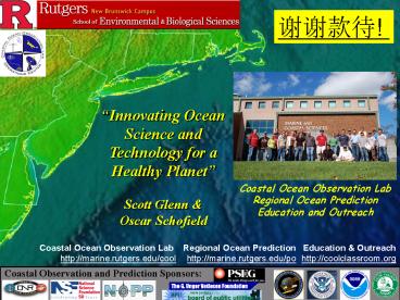
????!
Innovating Ocean Science and Technology for a
Healthy Planet Scott Glenn Oscar Schofield
Coastal Ocean Observation Lab Regional Ocean
Prediction Education and Outreach
Coastal Ocean Observation Lab http//marine.rutger
s.edu/cool
Regional Ocean Prediction http//marine.rutgers.e
du/po
Education Outreach http//coolclassroom.org
Coastal Observation and Prediction Sponsors
2
???????
Western Antarctic Peninsula
-Most rapid recent regional winter warming on
Earth -Major loss of perennial sea ice -87 of
Glaciers are in retreat
3
???????
ARCTIC IS ALSO CHANGING!!
2090
Our grand children
Polar Amplification of Global Warming
2005
1979
2060
Our children
2030
Us
1980
2000
YEAR
4
WHERE WILL THE MELTING WATER GO? IT WILL CHANGE
OUR HOME
5
???????????
Coastlines importance will increase due to human
associated economic growth
China All 14 economic free zones and 5
special economic zones are coastal provinces
and over 65 of Chinas cities that have
municipal status are coastal Latin American and
the Caribbean 57 out of 77 cities are coastal and
current projections have 75 of the populations
living in urban centers in the next 10
years Mediterranean basin has current population
of 380 million (146 at coasts) with projections
of 555 million within years (176 living at the
coast itself)
Human population distribution
Night-time radiance of the United States
Elvidge et al. 1997
6
???????????
Coasts are important to my home New Jersey
PEOPLE NJ has 8.6 million people, 60 are
located in coastal counties MONEY Coasts
critical to the state economy (16 billion
tourism industry, 50 billion maritime industry,
100 million commercial fishing
industry) ENVIRONMENT Diverse habitats that
include bays, estuaries, wetlands, and dunes. It
is a global stopover point 1.5 million migratory
shorebirds, and many of the fisheries are
migratory.
Commercial movement
Ecosystem movement
Cooper, Beevers, and Oppenheimer 2005
7
???????
HUMANS NOW CAPABLE OF CHANGING THE EARTH
EUTROPHICATION
ATMOSPHERE
HUMAN CHEMICALS DOWN TO 1000 m DEEP IN OCEAN
IPC TAR
OVERFISHING
Sabine et al. 2002
Myers and Worm 2003
8
DESPITE THAT THE OCEANS ARE CHANGING AND ARE
CENTRAL TO HUMAN SOCIETY
OUR UNDERSTANDING IS POOR BECAUSE THE
EARTH SYSTEM IS COMPLEX
Thanks to the NEPTUNE team
9
UNDERSTANDING IS DIFFICULT ESPECIALLY SINCE WE DO
NOT SAMPLE THE OCEAN WELL!
10
A Look Back
If I were to choose a single phrase to
characterize the first century of modern
oceanography, it would be a century of
under-sampling.
Walter Munk, 2000
11
A Global View from Space Imagers and Altimeters
Passive Imagers for SST Ocean Color
Active Radars for Altimetry
12
A Global Array of 3,000 Argo Profiling Floats
13
?????????
Rutgers University Coastal Ocean Observation
Lab Operations Center
Ship-to-Shore Communications
CODAR Network
Cable
Glider Fleet
X-Band
L-Band
Mission Sustained Operations of Key Observing
Technologies for Scientific Research, Technology
Development, Education and Outreach
14
An International Constellation
L-Band (installed 1992)
X-Band (installed 2003)
MODIS RGB USA
15
CNN Live The Situation Room June 12, 2006
CBS Philadelphia Evening News All Summer
16
Sea surface temp.
Dec 24
Jan 06
Data downloaded at the airport prior to departure
to Beijing
Jan 02
Chlorophyll a
Jan 03
17
CODAR surface current mappers (standard and
long-range)
25 MHz and 13 MHz
5 MHz
18
Long Range HF Radar Networks
19
10/16/2002 1500 GMT
991 mb
Contour resolution 1 mb
20
10/16/2002 1800 GMT
989 mb
Contour resolution 1 mb
21
Data from January 6, 2007 downloaded at the
airport prior to departure to Beijing
22
Real-time data will save lives and property
23
Ensuring public health Search and Rescue, United
States Coast Guard, Office of Search and Rescue
Long Range (2004)
Standard Range (2002)
NOAA Coastal Site CODAR Currents SLDMB Drifter
24
Lost Glider Recovery Rutgers, USCG, Civil Air
Patrol
Civil Air Patrol
Glider ru02 as seen from Search Plane
Communication Plane
Search Plane
25
Slocum Coastal Glider
Science Bay Specs. Length 30 cm Diameter 21.3
cm Max. Payload Weight 4 kg
Glider Specs. Length 1.5 m Hull Diameter 21.3
cm Weight 52 kg
26
Command and Control 94 Missions Around the World
RU-COOL Glider Fleet Stats (as of 10 October,
2006) 26,181 km flown 208,664 casts 1312 days at
sea
27
05/2005
03/2004
10/2003
06/2004
10/2005
10/2005
06/2005
11/2003
07/2004
03/2004
11/2003
04/2004
11/2005
07/2005
07/2004
07/2005
01/2005
08/2004
12/2003
04/2004
01/2006
02/2005
01/2004
08/2004
05/2004
01/2004
05/2004
02/2005
04/2006
09/2004
05/2004
09/2004
04/2006
03/2005
03/2005
06/2004
10/2004
05/2006
28
RIDER IN THE STORM
16-Sep-2004 150053 - 23-Sep-2004 115727
Temperature
Depth-Averaged Currents Surface Currents
bb532
bb(532)/c(532)
7410
7400
7350
7340
7330
7320
7310
29
YOU CAN FLY MANY GLIDERS AT THE SAME TIME!
NJ SUMMER 2006 Glider Statistics - Deployments
17 - Km Flown gt6,500 - CTD Profiles gt51,000 -
Calendar Days 93 - Glider Days 360
30
This leads to unique science culture, where
several experiments, training and education
efforts are conducted at the same time.
MORNING ON EAST COAST OF UNITED STATES
Coordinated Swarms of Gliders Sweep Across the
Shelf Slope Front 3-D Evolution of Slope Water
Salinity Intrusions is Captured
Salinity
Temperature
31
This leads to unique science culture, where
several experiments, training and education
efforts are conducted at the same time.
MORNING ON WEST COAST UNITED STATES Morning hours
on the west coast of United States - Adaptive
Sampling of the California Coast
Temperature
Backscatter (660 nm)
32
RIMPAC June 2006
This leads to unique science culture, where
several experiments, training and education
efforts are conducted at the same time.
MORNING HOURS OF HAWAII TIME ZONE Map the
condition of nearshore waters off the Hawaiian
islands
33
This leads to unique science culture, where
several experiments, training and education
efforts are conducted at the same time.
AFTERNOON ON EAST COAST OF UNITED STATES Late
afternoon on the East Coast of United States,
student interns test ocean robot sensors
Summer 2006 Glider Training Projects
Glider Jane OSU/RU Engineer Exchange
Bioprobe Student Team Kristy (URI) Christi
(RU)
Glider Cameras John Roberts
RIOS Students Rosa Leon (PR) John Roberts
(GA) Christi Welter (CO)
34
WHERE IS THE GLIDER TODAY? JAN. 8, 2007
DATA
35
A Distributed Cyber-Ocean Network Enabling
Process Science, Discovery and Education
36
Facilitated by a fixed Operations Center, the
Observatory can be sustained and accessed from
anywhere!
Summer 2006 REAL-TIME DATA COLLECTED, AND
SYNTHESIZED BY LEAD SCIENTIST AND THEN
DISTRIBUTED TO THE COMMUNITY BY 10 AM Morning
Reports 78 Storm Alerts 10 Locations Wayport
WiFi 94 Hrs
37
(No Transcript)
38
River Plumes
39
LaTTE Principal Investigators Physics Bob
Chant (Rutgers) Bernie Gardner (U. Mass) Scott
Glenn (Rutgers) Bob Houghton (Lamont) John Wilkin
(Rutgers) Chemistry John Reinfelder
(Rutgers) Bob Chen (U. Mass) Biology Paul
Bissett (FERI) Tom Frazer (U. Florida) Mark
Moline (Cal-Poly) Oscar Schofield (Rutgers) Meng
Zhou (U. Mass) Plus Many Others
An Interdisciplinary Process Study of the
Hudson River Plume in a Sustained Coastal
Observatory
Dye Release Studies May 2004 Pilot 1/3,
2/3 Split April 2005 High Flow 2
Injections May 2006 Follow-up 1 Injection
Coastal Observatory Sponsors
40
Specific LaTTE Goals and Objectives
To quantify mixing and the rates that biological
and chemical processes transform material in
a Buoyant Urban Coastal Plume
- Biological production rates
- and community composition
- Zooplankton community
- response
- Bioavailability and bio-
- accumulation of metals
- CDOM photobleaching rates
New York City
Downwelling Wind
Upwelling Wind
Link these rates to wind forced changes in the
structure of the plume.
Geyer and Fong
41
Modeling Tools for the LaTTE Process Study
Atmospheric Model WRF
Ocean Physics ROMS
Biogeochemical NENA, EcoSim
Bowers, Dunk
Choi, Wilkin
Fennel, Bissett
42
Observational Tools for the LaTTE Process Study
Mooring Arrays Physics Coastal Current
R/V Cape Hatteras Physics Chemistry Undulating
Towbody
R/V Connecticut or Oceanus Biology Optics Water
Sampling
43
Tidal Pulsing of Hudson River Outflow Layers of
Freshwater
CODAR
CODAR Ocean Color
North
Tidal Pulse
Shipboard Surface Salinity
South
Alongshore CODAR Currents
44
CODAR Current Maps of Hudson River Plume -
Positioning the Cape Hatteras to inject dye in an
ebb tidal pulse
0400
0600
1000
0800
45
CODAR Current Maps of Hudson River Plume
Following the First 2005 Dye Release
46
CODAR Current Maps of Hudson River Plume
Following the First 2005 Dye Release
1400
1200
47
Virtual Dye Release in CODAR Current Fields
Most Drifters Recirculate with the Sea
Breeze. Some exit to the South, some exit to the
Southeast.
Morning Synoptic Winds
Ambrose Light Winds
Afternoon Sea Breeze
48
The Nearshore Recirculation An Incubator for
Phytoplankton
Drifters Recirculate
Observatory Finds The Frazer Eddy!
Hudson River
Oxygen Drops
Large Phytoplankton Dominate
49
Freshwater Plume moves Cross-Shelf, down the
Hudson Shelf Valley
Satellite SST
50
LaTTE 2005 -- After Luring the Cape Hatteras
Offshore.
Shipboard Salinity Section Across the NJ Coastal
Current and the HSV Highway
The survey began on the Highway. We were near
the glider when it surfaced. We saw currents
ripping southward in a 10 m thick layer of
freshwater along the highway -- perhaps the most
significant freshwater transport we saw all
week. Perhaps the most perplexing to me
is the Highway and why there has been a lack of
a strong coastally trapped flow this week.
--- Bob Chant aboard the Cape Hatteras, April
21, 2005
51
River carries out biological material
52
River carries out bad chemicals metals
gt20 ?m particulate trace metals and phosphorus -
Ag, Al, Cr, Cu, Fe, P, Pb
50 ng L-1 (Al, Fe, P ?g L-1 Ag x 10, Al x 5, P x
10)
salinity
53
Before After NE to S wind shift
Eddy
Highway
54
Virtual Dye Study Results
Virtual Dye Paths History
- 5 transport pathways out of NY Bight apex (LI, NJ
coastal jet, inner shelf, midshelf outer shelf) - transport pathways depend strongly on wind
history - virtual dye study result consistent with remote
sensing, glider and ship observations - results insensitive to the magnitude of velocity
dispersion - surface circulation wind driven, but also
affected by interaction with topography
55
Hudson River Discharge for LaTTE Summer 2006
- Top 5 Discharge Events
- Since 1918
- 3/21/1936 3955
- 3/16/1977 3438
- 1/22/1996 3201
- 9/20/1938 3171
- 6/29/2006 3167
Summer Rain
LaTTE Spring Freshet
5 Albanys Wettest June on Record since 1795
Hudson River Watershed
2006
56
Historical Mean Fields
Weak Wind
Strong S Wind (stratified)
Strong NE Wind (stratified)
57
Upwelling Winds Dominate Summer 2006
July
Strong Winds
58
US Coast Guard SAROPS Testbed
- On July 26
- 10 Drifters Deployed
- 3 Clusters
- Cross-Shelf Line
- Hudson Shelf Valley
59
Deploy the Glider Fleet
USCG Drifters
RU10
RU01
RU11
RU12
RU09
OSU Jane
60
Check the Salinities
61
Tropical Storm Ernesto
62
RU-WRF Forecast of Tropical Storm Ernesto
63
MODIS Imagery of Tropical Storm Ernesto
060902.1819.aqua.rgb
64
Tropical Storm Ernesto September 1, 2006 1900
GMT
WRF Forecast Surface Winds
CODAR Observations Surface Currents
65
Tropical Storm Ernesto September 2, 2006 0700
GMT
WRF Forecast Surface Winds
CODAR Observations Surface Currents
66
Tropical Storm Ernesto September 2, 2006 1300
GMT
WRF Forecast Surface Winds
CODAR Observations Surface Currents
67
Tropical Storm Ernesto September 2, 2006 1300
GMT
WRF Forecast Surface Winds
CODAR Observations Surface Currents
68
Tropical Storm Ernesto September 2, 2006 1900
GMT
WRF Forecast Surface Winds
CODAR Observations Surface Currents
69
Tropical Storm Ernesto September 3, 2006 0100
GMT
WRF Forecast Surface Winds
CODAR Observations Surface Currents
70
Tropical Storm Ernesto Surface Impacts
After
Before
71
Tropical Storm Ernesto Sub-Surface Impacts
Before
June 14, 2006 - Present
72
Tropical Storm Ernesto Sub-Surface Impacts
During
June 14, 2006 - Present
73
Tropical Storm Ernesto Sub-Surface Impacts
After
74
Tropical Storm Ernesto
75
Tropical Storm Ernesto Track Sensitivity
Old Physics
New Physics
76
Tropical Storm Ernesto Feedback to the State
Accumulated Rainfall
Predicted Observed
77
NOAA PORTS Enhancements Data Assimilation
- Real-time current observations
- (ADCPs, CODAR) for nowcasting
- and forecasting
- 1) Water Level
- 2) Currents
- 3) Salinity
Evaluation - Codar based tidal prediction
- Surface current and salinity
prediction
78
??????????????
ICOOL
THE ECOSYSTEMS OF THE OCEANS
How do we start? Find collaborators -US, EUROPE
(England, France, Germany, Spain, Norway),
Pacific (Australia and ???) - Link
efforts to create a global perspective -
Participate in international field programs
- Train a new global workforce
79
??!
Recommended
CrystalGraphics Presentations


