
Step 1: Valley Segment Classification - PowerPoint PPT Presentation
1 / 1
Title:
Step 1: Valley Segment Classification
Description:
The valley segment data layer will be based on the National Hydrography Dataset (NHD) ... DEVELOPMENT OF AQUATIC GAP IN KANSAS, USA ... – PowerPoint PPT presentation
Number of Views:16
Avg rating:3.0/5.0
Title: Step 1: Valley Segment Classification
1
DEVELOPMENT OF AQUATIC GAP IN KANSAS,
USA Jessica Kemp1, Bob Oakes1, Keith Gido1,
Walter Dodds1, Chris Guy1,2 1Divison of Biology,
Kansas State Univ., Manhattan, KS 2U.S.
Geological Survey, Biological Resources Division,
Kansas Cooperative Fish and Wildlife Research
Unit
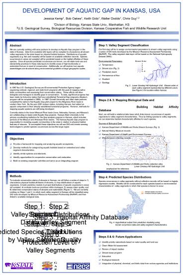
- Step 1 Valley Segment Classification
- Our first step will be to assign environmental
parameters to stream valley segments using a
series of GIS tools developed by the Missouri
Resource Assessment Partnership (MoRAP). The
valley segment data layer will be based on the
National Hydrography Dataset (NHD). - Environmental Parameters
- Temperature
- Stream size (Fig. 2)
- Floodplain reach
- Permanence of flow
- Gradient
- Geology
Abstract We are currently working with area
partners to develop an Aquatic Gap program in the
state of Kansas. Data from available GIS layers
will be compiled to characterize all stream
valley segments in the state based on physical
habitat features. Distributions of aquatic
organisms (e.g. fish and mussels) will be based
on available collection records. Species
occurrences in areas not sampled will be
predicted based on the habitat affinities of
these species. Once all species predicted
occurrences are known, we will relate land-use
and stewardship practices to these data layers to
identify areas of high biodiversity or endemism
that are in need of conservation. Additionally,
we will explore how aquatic assemblages are
structured along environmental gradients at large
geographic scales.
Introduction In 1987 the U.S. Geological Survey
and Environmental Protection Agency began
organizing national, regional, and state level
programs with the goal of mapping native biotic
communities and assessing their conservation
status. These efforts will allow biologists and
managers to identify gaps in conservation. To
date, significant progress has been made by
forty-nine states that have established
Terrestrial Gap programs (Alaskas program will
be completed in 2005). In 1997 Cornell
University and other state partners completed the
nations first Aquatic Gap pilot project for the
Allegheny River basin in western New York. By
the year 2001 sixteen states, including Kansas,
had added an aquatic component to their already
established terrestrial programs. However,
methods for mapping aquatic systems are still
being developed. Currently states in the lower
Missouri River basin (Iowa, Nebraska, Kansas, and
Missouri) are collaborating on basin-wide Aquatic
Gap projects. Kansas State University is the
primary coordinating institution for the Gap
analysis program in Kansas, which includes
portions of the Missouri and Arkansas River
basins. The Kansas Aquatic Gap program is
responsible for modeling aquatic communities in
the state in relation to physical habitat
features of streams. To accomplish these
objectives we will use GIS and remote sensing
technologies to predict species occurrences
across this large region.
Fig. 2 Lower Smokey Hill Hydrologic Unit.
Stream order of each valley segment
represented by different colors.
See Figure 3 for location within Kansas.
- Steps 2 3 Mapping Biological Data and
Building Habitat Affinity Database - Next, we will build a relational data base which
links known occurrences of aquatic organisms to
valley segment characteristics. Thus by linking
species to valley segments, we can determine
habitat characteristic affinities for each
species. - Sources of Biological Data
- Kansas Department of Wildlife and Parks Stream
Surveys (Fig. 3) - Natural History Museum records
- Kansas Department of Health and Environment
Surveys - Miscellaneous collecting records
Fig. 3 Kansas Department of Wildlife and Parks
collection sites. Lower Smokey Hill
Hydrologic Unit emphasized for reference.
- Step 4 Predicted Species Distributions
- Species occurrences in valley segments without
collection records will be based on logistic
regression models. Models will be constructed
for each species based on environmental
characteristics of valley segments in which that
species is known to occur.
Notropis topeka occurrence Predicted Notropis
topeka occurrence
Fig. 4 Hypothetical output from predictive
modeling using known occurrence data
and valley segment characteristics.
Recommended
CrystalGraphics Presentations


